Safety Score: 3,2 of 5.0 based on data from 9 authorites. Meaning please reconsider your need to travel to Czech Republic.
Travel warnings are updated daily. Source: Travel Warning Czechia. Last Update: 2024-04-27 08:23:39
Discover Radostín
Radostín in Okres Žďár nad Sázavou (Kraj Vysočina) with it's 156 citizens is a place in Czechia about 71 mi (or 115 km) south-east of Prague, the country's capital city.
Current time in Radostín is now 03:51 PM (Saturday). The local timezone is named Europe / Prague with an UTC offset of 2 hours. We know of 9 airports near Radostín, of which 4 are larger airports. The closest airport in Czechia is Pardubice Airport in a distance of 26 mi (or 41 km), North. Besides the airports, there are other travel options available (check left side).
There are several Unesco world heritage sites nearby. The closest heritage site in Czechia is Pilgrimage Church of St John of Nepomuk at Zelená Hora in a distance of 6 mi (or 9 km), South-East. If you need a hotel, we compiled a list of available hotels close to the map centre further down the page.
While being here, you might want to pay a visit to some of the following locations: Jihlava, Pardubice, Velka Bites, Hradec Kralove and Hardegg. To further explore this place, just scroll down and browse the available info.
Local weather forecast
Todays Local Weather Conditions & Forecast: 13°C / 55 °F
| Morning Temperature | 4°C / 39 °F |
| Evening Temperature | 14°C / 57 °F |
| Night Temperature | 9°C / 49 °F |
| Chance of rainfall | 0% |
| Air Humidity | 58% |
| Air Pressure | 1014 hPa |
| Wind Speed | Moderate breeze with 10 km/h (6 mph) from North-West |
| Cloud Conditions | Clear sky, covering 9% of sky |
| General Conditions | Sky is clear |
Sunday, 28th of April 2024
15°C (58 °F)
12°C (53 °F)
Broken clouds, fresh breeze.
Monday, 29th of April 2024
17°C (62 °F)
14°C (58 °F)
Overcast clouds, fresh breeze.
Tuesday, 30th of April 2024
17°C (62 °F)
14°C (57 °F)
Few clouds, fresh breeze.
Hotels and Places to Stay
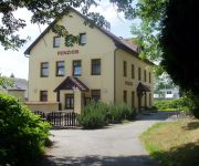
HOTEL FILIPPI
Videos from this area
These are videos related to the place based on their proximity to this place.
Profesionálové Žďár nad Sázavou - Žalm 22 (Oboroh)
Zdarec největší, k věci stručně a jasně. V Zámku Žďáře v Bazilice Nanebevzetí Panny Marie a sv. Mikuláše ve stejnojmenné farnosti se už několik let koná někdy zjara, kolem...
Zpívat píseň lásky smím - Profesionálové Žďár nad Sázavou akusticky
www.facebook.com/profici Stalo se, že zhruba polovina kapely odjela kamarádovi na svatbu a ta druhá polovina kapely šla zpívat na úplně jinou svatbu s jinou nevěstou a ženich tam byl...
Fandovi narozeniny
16.11.08 Hudba: Blur-Song2 The Bloodhound Gang-The Bad Touch (Discovery Channel) kousek moravanky Limp Bizkit-Take look around.
Vánoční besídka - Kameňák (ZŠ Velká Losenice)
Tradiční zábavné vystoupení žáků deváté třídy (2012/2013) ZŠ Velká Losenice konané 21.12.2012 . Na konci videa uvidíme předávání vánočního dárku třídnímu učiteli...
Gama 2100 - front and rear flight cam (4 min)
Flying over Karlov and Skrdlovice near Velke Darko (Vysocina, Czech Republic). RC Model: Gama 2100 Camera: HD Wing Camera 720p (Hobby King)
SDH Karlov, oslava výročí 120 let založení sboru
Sbor doborovolných hasičů v Karlově Oslava výročí 120 let založení sboru.
Bayou Girl line dance
Moravia - line workshop in Polnička with Harry Schalk & Just 4 fun. Harry dance his own choreography with Inge Aigner, Antonia Wollein and Bruno Aigner.
Chill factor line dance
Na workshopu line dance Moravia Line 2012 v Polničce u Žďáru nad Sázavou s lektorkou a choreografkou Cintou Larrotcha Bou ze Španělska . Chill factor, Choreographed by Daniel Whittaker...
Videos provided by Youtube are under the copyright of their owners.
Attractions and noteworthy things
Distances are based on the centre of the city/town and sightseeing location. This list contains brief abstracts about monuments, holiday activities, national parcs, museums, organisations and more from the area as well as interesting facts about the region itself. Where available, you'll find the corresponding homepage. Otherwise the related wikipedia article.
Sázava (river)
Sázava is a river in the Czech Republic. It is a right tributary of the Vltava. Its length is 218 kilometres, watershed area measures 4,350 km (1,680 sq mi). The river Sázava emerges from Velké Dářko Lake and enters the Vltava in the municipality of Davle south of Prague (at the 78.3 kilometer of the Vltava).
Velké Dářko
Velké Dářko is the largest pond in the Vysočina Region of the Czech Republic. Its surface area is about 2.06 km² at an elevation of 610 m. The pont is located 10 km from Žďár nad Sázavou.


