Safety Score: 2,7 of 5.0 based on data from 9 authorites. Meaning we advice caution when travelling to United States.
Travel warnings are updated daily. Source: Travel Warning United States. Last Update: 2024-05-08 08:04:21
Discover Pettaconsett
Pettaconsett in Providence County (Rhode Island) is a place in United States about 355 mi (or 571 km) north-east of Washington DC, the country's capital city.
Current time in Pettaconsett is now 01:22 AM (Thursday). The local timezone is named America / New York with an UTC offset of -4 hours. We know of 10 airports near Pettaconsett, of which 3 are larger airports. The closest airport in United States is Theodore Francis Green State Airport in a distance of 2 mi (or 3 km), South-East. Besides the airports, there are other travel options available (check left side).
Also, if you like playing golf, there are a few options in driving distance. We encountered 5 points of interest in the vicinity of this place. If you need a hotel, we compiled a list of available hotels close to the map centre further down the page.
While being here, you might want to pay a visit to some of the following locations: Cranston, Providence, Johnston, North Providence and Taunton. To further explore this place, just scroll down and browse the available info.
Local weather forecast
Todays Local Weather Conditions & Forecast: 21°C / 69 °F
| Morning Temperature | 12°C / 54 °F |
| Evening Temperature | 10°C / 49 °F |
| Night Temperature | 9°C / 48 °F |
| Chance of rainfall | 4% |
| Air Humidity | 48% |
| Air Pressure | 1004 hPa |
| Wind Speed | Gentle Breeze with 8 km/h (5 mph) from South-West |
| Cloud Conditions | Broken clouds, covering 77% of sky |
| General Conditions | Moderate rain |
Thursday, 9th of May 2024
9°C (48 °F)
7°C (44 °F)
Moderate rain, gentle breeze, overcast clouds.
Friday, 10th of May 2024
8°C (46 °F)
7°C (44 °F)
Moderate rain, gentle breeze, overcast clouds.
Saturday, 11th of May 2024
9°C (48 °F)
8°C (46 °F)
Moderate rain, light breeze, overcast clouds.
Hotels and Places to Stay
Hilton Providence
Sheraton Providence Airport Hotel
Crowne Plaza PROVIDENCE-WARWICK (AIRPORT)
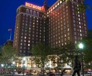
Providence Biltmore
Omni Providence Hotel
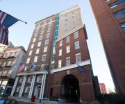
Hampton Inn - Suites Providence Downtown
Courtyard Providence Warwick
Hotel Dolce Villa
Edgewood Manor Bed & Breakfast
The Charles Newhall House
Videos from this area
These are videos related to the place based on their proximity to this place.
Cranston RI Top Listing Agent, Call Victoria Pizzarelli, 401-432-4129, REALTOR
http://www.Livingri.com - Victoria Pizzarelli, a Cranston RI top listing agent and REALTOR, for a Cranston RI home value estimate. Cranston Rhode Island residents often ask, "What's my...
Alzheimer's Assisted Living Cranston Rhode Island 401-333-4600
Alzheimer's Assisted Living Cranston Rhode Island http://bit.ly/Alzheimers-Assisted-Living-Cranston-Rhode-Island As we get older and our parents need more assistance, especially with a diagnosis...
Cranston Ravens 2014 Highlights
Cranston National Budlong Ravens Fastpitch Softball is home to many championship teams. Cranston, Rhode Island is our home and we have many multiple teams at the 8U, 10U, 12U, 14U and 18U ...
Cranston Ravens Fastpitch Softball
CNBLL Fastpitch Softball, Cranston, Rhode Island. We offer Spring Rec (all skill levels), Travel All-Stars (year-round, competitive), Little League, Summer Rec and Fall Ball. All cities and...
Cranston RI Top Real Estate Relocation Specialist | Victoria Pizzarelli-401-432-4129
http://www.Livingri.com - Victoria Pizzarelli a Cranston RI top real estate relocation specialist and REALTOR. As an experienced Cranston RI real estate agent, a relocation specialist provides...
blackstone-millville hs marching band cranston east show 2013
blackstone-millville performing at cranston east stadium 10/19/2013.
Flooding Cranston RI 30th March 2010
Flooding Cranston RI 30th March 2010, here we are driving west trying to get into Pontiac village after detouring a few times... View the photographs here... http://jjusczyk.smugmug.com/Journalis...
Videos provided by Youtube are under the copyright of their owners.
Attractions and noteworthy things
Distances are based on the centre of the city/town and sightseeing location. This list contains brief abstracts about monuments, holiday activities, national parcs, museums, organisations and more from the area as well as interesting facts about the region itself. Where available, you'll find the corresponding homepage. Otherwise the related wikipedia article.
Cranston, Rhode Island
Cranston, once known as Pawtuxet, is a city in Providence County, Rhode Island, United States. With a population of 80,387 at the 2010 census, it is the third largest city in the state. The center of population of Rhode Island is located in Cranston. Cranston is a part of the Providence metropolitan area. Cranston was named one of the "100 Best Places to Live" in the United States by Money magazine in 2006. It is among the top 25 safest cities in the country, according to CQ Press's research.
T. F. Green Airport (MBTA station)
T. F. Green Airport is a train station and intermodal facility in Warwick, Rhode Island on the Northeast Corridor, adjacent to T. F. Green Airport. It extends the MBTA Commuter Rail Providence/Stoughton Line from Boston, which previously only went as far as the Providence train station. The station was completed in October 2010 and MBTA service began on December 6, 2010. On November 14, 2011, service expanded to 10 weekday trains in each direction.
Oaklawn, Rhode Island
Oak Lawn is a historical village in south west Cranston, Rhode Island. Prior to being named "Oak Lawn" in 1872 the area was known as "Searle's Corner". The Edward Searle House, built in 1677, and one of the oldest standing structures in Rhode Island, is located in Oak Lawn. The village is also well known for its annual May Breakfast. This New England tradition began in Oak Lawn in 1865 as a way for the members of the Oak Lawn Baptist Church to raise money for local American Civil War veterans.
Howard, Rhode Island
Howard was originally a farming hamlet in the southern part of Cranston, Rhode Island. In the mid-19th century, most of the land was acquired by the State of Rhode Island to construct a state prison, a poor house, and other state facilities. The Rhode Island State prison, built here in 1892, and now called the Maximum Security Building, is a stark and imposing gothic structure built of granite block.
Meshanticut, Rhode Island
Meshanticut is a neighborhood in Cranston, Rhode Island, United States. Meshanticut is a residential neighborhood on the western side of Cranston. Meshanticut, which is a Narragansett Indian word meaning "place of woods" features an eclectic array of housing styles including Victorian homes, cottages, and capes. The focal point of the neighborhood is Meshanticut State Park which surrounds Meshanticut Lake, a small lake popular for fishing in the summer and ice skating in winter.
Auburn, Rhode Island
Auburn is an urban neighborhood in the east-central part of Cranston, Rhode Island.
Hillsgrove, Rhode Island
Hillsgrove (originally Hill's Grove) is an area in western central Warwick, Rhode Island. The area was established as a farming hamlet and later a mill village, but today it is dominated by the presence of T. F. Green Airport, Rhode Island's largest and most important airport. Leviton Manufacturing operated a large factory here, fabricating electronic components for many years.
Cranston Stadium
Cranston Stadium is a multi-use stadium located in Cranston, Rhode Island. It consists of a baseball field as well as an athletic field suitable for playing football, soccer, field hockey or lacrosse.


