Safety Score: 2,7 of 5.0 based on data from 9 authorites. Meaning we advice caution when travelling to United States.
Travel warnings are updated daily. Source: Travel Warning United States. Last Update: 2024-05-09 08:23:21
Touring Pawtuxet
Pawtuxet in Kent County (Rhode Island) is a town located in United States about 357 mi (or 575 km) north-east of Washington DC, the country's capital place.
Time in Pawtuxet is now 10:03 AM (Thursday). The local timezone is named America / New York with an UTC offset of -4 hours. We know of 10 airports nearby Pawtuxet, of which 3 are larger airports. The closest airport in United States is Theodore Francis Green State Airport in a distance of 3 mi (or 4 km), South-West. Besides the airports, there are other travel options available (check left side).
Also, if you like the game of golf, there are several options within driving distance. We collected 5 points of interest near this location. Need some hints on where to stay? We compiled a list of available hotels close to the map centre further down the page.
Being here already, you might want to pay a visit to some of the following locations: Cranston, Providence, North Providence, Johnston and Taunton. To further explore this place, just scroll down and browse the available info.
Local weather forecast
Todays Local Weather Conditions & Forecast: 21°C / 69 °F
| Morning Temperature | 12°C / 54 °F |
| Evening Temperature | 10°C / 49 °F |
| Night Temperature | 9°C / 48 °F |
| Chance of rainfall | 4% |
| Air Humidity | 48% |
| Air Pressure | 1004 hPa |
| Wind Speed | Gentle Breeze with 8 km/h (5 mph) from South-West |
| Cloud Conditions | Broken clouds, covering 77% of sky |
| General Conditions | Moderate rain |
Thursday, 9th of May 2024
9°C (48 °F)
7°C (44 °F)
Moderate rain, gentle breeze, overcast clouds.
Friday, 10th of May 2024
8°C (46 °F)
7°C (44 °F)
Moderate rain, gentle breeze, overcast clouds.
Saturday, 11th of May 2024
9°C (48 °F)
8°C (46 °F)
Moderate rain, light breeze, overcast clouds.
Hotels and Places to Stay
Sheraton Providence Airport Hotel
Omni Providence Hotel
Hilton Providence
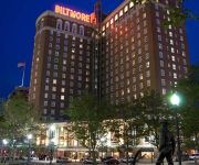
Providence Biltmore
Edgewood Manor Bed & Breakfast
The Charles Newhall House
Hampton Inn Seekonk
Holiday Inn Express & Suites WARWICK-PROVIDENCE (AIRPORT)
Courtyard Providence Downtown
The Dean Hotel
Videos from this area
These are videos related to the place based on their proximity to this place.
2013 Providence Cyclocross Festival - Day 2 Cat 4 35+
First lap of the race. I was sick all week and was having troubles breathing (you can hear me during the run up). Winner got away half way through the lap and was never seen again.
#7 2012.10.07 Warwick Patriots Blue vs North Kingston Black (Mighty Mites)
At Pilgrim Field Warwick RI.
Warwick house fire may stem from heat gun
The homeowner of a house on Washington Street in Warwick was trying to defrost a water pipe when the house caught fire.
Shepard Fairey's Attorney Discusses Fair Use at Boston College Law School (Part 2)
Julie Ahrens, Associate Director of the Fair Use Project at Stanford Law School, has been directly involved in both lawsuits she represented RDR Books against J.K. Rowlings suit to enjoin...
Gilbert and Gosnold both missed Verrazzano's Refugio [PART 2 of 2]
An exploration of the historical record and a modern-day journey to Cutttyhunk.
The Lew Crew Wants You
Another Lew Ford at-bat from the Ducks' game June 22nd, 2011. Lew has a pretty quick and uneventful trip to the plate, probably due to the nasty sidearm delivery of the opposing pitcher. Still......
Jamiroquai - You Are My Love (Played by Chris Anderson)
It's been a while since i posted anything, but I just got a new camera (Canon 550D) and there should be a lot more material on the way! This is a track off "Traveling without moving" from...
Cheese Workshop
Martin Johnson, from The Joy of Cheese, gives us a workshop on cheeses from many different regions in France at the most recent Cheese/Regions of France workshop! Visit www.fluentbrooklyn.com...
Videos provided by Youtube are under the copyright of their owners.
Attractions and noteworthy things
Distances are based on the centre of the city/town and sightseeing location. This list contains brief abstracts about monuments, holiday activities, national parcs, museums, organisations and more from the area as well as interesting facts about the region itself. Where available, you'll find the corresponding homepage. Otherwise the related wikipedia article.
Riverside, Rhode Island
Riverside, Rhode Island is the southern section of the city of East Providence in the U.S. state of Rhode Island. Riverside's zip code is 02915 and has a population of approximately 18,000. Riverside is a suburban neighborhood for Providence. Adjoining Riverside are the town of Barrington in Bristol County to the south, Narragansett Bay to the west, the rest of East Providence to the north, and the Runnins River and Seekonk, Massachusetts to the east.
Edgewood (Cranston)
Edgewood is located in eastern Cranston, Rhode Island. It borders Warwick to the southwest, Providence to the north, and Narragansett Bay to the east. To the south it borders Pawtuxet Village. Edgewood is a suburban neighborhood bordering Providence's Roger Williams Park. The area of Edgewood has several National Historic districts. One of the grandest is the Norwood Avenue Historic District .
Saint Paul Church (Cranston, Rhode Island)
Saint Paul Church, located in Cranston, Rhode Island, is a parish of the Roman Catholic Diocese of Providence, Rhode Island.
Starvegoat Island
Starvegoat Island (or "Starve Goat Island") was a small island in Narragansett Bay, East Providence, Rhode Island. The Island was located off the coast of Field's Point in Providence until the passage between them was filled in. The island had been known for its excellent oystering.
Greene Island (Rhode Island)
Greene Island is a small island in Narragansett Bay, Warwick, Rhode Island. The island was named after Captain John Greene and features shallow tidal flats and marsh grasses.
Rock Island (Rhode Island)
Rock Island is an island in Narragansett Bay in the U.S. state of Rhode Island. Rock Island is a small rocky island near Pawtuxet Village and is now connected to the mainland by a causeway. The island is part of the Salter Grove public picnic ground and is the site for a proposed man-made salt marsh using dredged materials. The island contains several unusual fossils.
Edgewood Lake
Edgewood Lake is a lake in the southern part of the city of Providence, Rhode Island.
Crescent Park Amusement Park
Crescent Park Amusement Park was a bustling old-time amusement park on the shores of Narragansett Bay in Riverside, Rhode Island. The park operated for 93 years from 1886 until 1979. The park featured a large midway full of amusement rides, games, and food stands. At one end of the midway was the famous Alhambra Ballroom, where many big bands played in the 1930s and '40's.


!['Gilbert and Gosnold both missed Verrazzano's Refugio [PART 2 of 2]' preview picture of video 'Gilbert and Gosnold both missed Verrazzano's Refugio [PART 2 of 2]'](https://img.youtube.com/vi/qH7BHd3DIJY/mqdefault.jpg)


