Safety Score: 2,7 of 5.0 based on data from 9 authorites. Meaning we advice caution when travelling to United States.
Travel warnings are updated daily. Source: Travel Warning United States. Last Update: 2024-04-30 08:30:35
Touring Amherst
Amherst in Burke County (North Carolina) is a town located in United States about 329 mi (or 530 km) south-west of Washington DC, the country's capital place.
Time in Amherst is now 12:24 PM (Tuesday). The local timezone is named America / New York with an UTC offset of -4 hours. We know of 8 airports nearby Amherst, of which 5 are larger airports. The closest airport in United States is Hickory Regional Airport in a distance of 12 mi (or 20 km), East. Besides the airports, there are other travel options available (check left side).
There is one Unesco world heritage site nearby. It's Great Smoky Mountains National Park in a distance of 56 mi (or 90 km), West. Also, if you like the game of golf, there are several options within driving distance. We collected 1 points of interest near this location. Need some hints on where to stay? We compiled a list of available hotels close to the map centre further down the page.
Being here already, you might want to pay a visit to some of the following locations: Morganton, Lenoir, Newton, Boone and Marion. To further explore this place, just scroll down and browse the available info.
Local weather forecast
Todays Local Weather Conditions & Forecast: 23°C / 73 °F
| Morning Temperature | 13°C / 55 °F |
| Evening Temperature | 16°C / 60 °F |
| Night Temperature | 15°C / 60 °F |
| Chance of rainfall | 4% |
| Air Humidity | 57% |
| Air Pressure | 1014 hPa |
| Wind Speed | Gentle Breeze with 8 km/h (5 mph) from North-East |
| Cloud Conditions | Overcast clouds, covering 100% of sky |
| General Conditions | Moderate rain |
Tuesday, 30th of April 2024
26°C (79 °F)
16°C (61 °F)
Sky is clear, light breeze, clear sky.
Wednesday, 1st of May 2024
28°C (83 °F)
18°C (64 °F)
Sky is clear, gentle breeze, clear sky.
Thursday, 2nd of May 2024
28°C (83 °F)
19°C (65 °F)
Light rain, gentle breeze, overcast clouds.
Hotels and Places to Stay
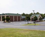
Hampton Inn Morganton
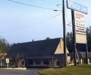
PLAZA INN MORGANTON
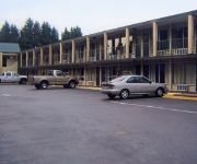
Quality Inn Morganton
Plaza Inn Morganton
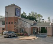
Sleep Inn Morganton
Videos from this area
These are videos related to the place based on their proximity to this place.
How to Make an Animated Travel Map - Premiere Pro CC
This is the "Indiana Jones" or "Raiders of the Lost Ark" effect on a map. Only I do it in this video in a way that makes the lines follow established roads. There are a few hoops to jump through...
Nikon D3200 Video Test and Review - Valdese, NC
A test of the Nikon D3200 video capabilities. I had borrowed this camera and had not read the manual, but within about 3 minutes I was enjoying the functions and learning to focus. The camera...
No, The Valdese ER Is NOT Closing
As the first meetings of the Valdese Transformation Task Forces take place this week at Carolinas HealthCare System Blue Ridge, a false rumor is circulating that the Valdese Emergency Room...
Oconaluftee Indian Village, Cherokee, NC
Oconaluftee Indian Village, Cherokee, North Carolina, 2009 TV spot, Cherokee culture.
McGalliard Falls - Valdese, NC - Beautiful HD Video
Nice video of Valdese' McGalliard Falls. I shot this in 1080i in 2010. The falls is about 2 miles north of main street in Valdese.
Valdese NC Walk - 2 7k video test - GoPro Hero3+
Testing 2.7k video at 30 frames per second with my GoPro Hero3+ Black Edition. I'm walking around downtown Valdese, NC. We see Main Street and the old Waldensian Presbyterian Church and ...
Valdese, NC - Tri-Cam Test - Tony Lee Glenn video idea
I got the idea to shot a multi-directional video while walking in Charleston, SC a while back. This is just a weird test, but video professionals might find it interesting. I'll be working...
NCYurtHomeTour2015
A tour of our residential Yurt home in Valdese, North Carolina! This home is available for vacation rental through AirBnb.com as well as currently being FOR SALE! Please email ncyurt@gmail.com...
Aerial view of the 1st Car Show of 2013 at Myra's 50's diner in Valdese NC
My Father In-law Phil shot these from a retired fire truck that was on hand.
Bridges Visits The Waldensian Festival
Carolinas HealthCare System Blue Ridge was a Presenting Sponsor of the 39th annual Waldensian Festival, which was held last Friday night and Saturday in downtown Valdese. A great time was had.
Videos provided by Youtube are under the copyright of their owners.
Attractions and noteworthy things
Distances are based on the centre of the city/town and sightseeing location. This list contains brief abstracts about monuments, holiday activities, national parcs, museums, organisations and more from the area as well as interesting facts about the region itself. Where available, you'll find the corresponding homepage. Otherwise the related wikipedia article.
Drexel, North Carolina
Drexel is a town in Burke County, North Carolina, United States. The population was 1,938 at the 2000 census. It is part of the Hickory–Lenoir–Morganton Metropolitan Statistical Area.
McGalliard Falls
McGalliard Falls is a waterfall in Burke County, North Carolina.
Smoky Creek Township, Burke County, North Carolina
Smokey Creek Township is a small township in Burke County, North Carolina, close to the Caldwell County line. It is most known for, other than the Smokey Creek, for Smokey Creek Barbeque and Music Barn, a restaurant with live music and barbecue.
Foothills Regional Airport
Foothills Regional Airport (formerly Morganton-Lenior Airport) is a public airport located six miles northeast of the City of Morganton, NC. It is owned by the Foothills Regional Airport Authority.


