Safety Score: 2,7 of 5.0 based on data from 9 authorites. Meaning we advice caution when travelling to United States.
Travel warnings are updated daily. Source: Travel Warning United States. Last Update: 2024-04-25 08:17:04
Delve into North End
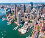
The district North End of Boston in Suffolk County (Massachusetts) is a subburb in United States about 395 mi north-east of Washington DC, the country's capital town.
If you need a hotel, we compiled a list of available hotels close to the map centre further down the page.
While being here, you might want to pay a visit to some of the following locations: Dedham, Taunton, Brentwood, Providence and North Providence. To further explore this place, just scroll down and browse the available info.
Local weather forecast
Todays Local Weather Conditions & Forecast: 11°C / 52 °F
| Morning Temperature | 3°C / 38 °F |
| Evening Temperature | 10°C / 51 °F |
| Night Temperature | 7°C / 45 °F |
| Chance of rainfall | 0% |
| Air Humidity | 36% |
| Air Pressure | 1032 hPa |
| Wind Speed | Gentle Breeze with 7 km/h (4 mph) from North-West |
| Cloud Conditions | Clear sky, covering 0% of sky |
| General Conditions | Sky is clear |
Saturday, 27th of April 2024
14°C (58 °F)
9°C (49 °F)
Sky is clear, gentle breeze, clear sky.
Sunday, 28th of April 2024
9°C (48 °F)
10°C (50 °F)
Light rain, light breeze, overcast clouds.
Monday, 29th of April 2024
12°C (54 °F)
12°C (54 °F)
Overcast clouds, light breeze.
Hotels and Places to Stay
Boston Harbor Hotel
The Langham Boston
Kimpton Nine Zero Hotel
Marriott Vacation Club Pulse at Custom House Boston
Ames Boston Hotel Curio Collection by Hilton
Club Quarters in Boston
Hilton Boston Downtown-Faneuil Hall
XV Beacon Preferred LEGEND
Global Luxury Suites at the Commonwealth
Boston Marriott Long Wharf
Videos from this area
These are videos related to the place based on their proximity to this place.
Boston's T, The Blue Line
Watch in High Quality! Boston's T System. The System Currently has 4 subway lines; the Green Line, the Blue Line, the Orange Line, and the Red Line. This video shows the blue line in action....
Boston Luxury Real Estate - 65 East India Row, 20 E&F | Harbor Towers - CL Waterfront Properties
This masterfully renovated home has stunning Harbor views from every room. An open floor plan with wall of windows fills this home with light and the exquisite sights of Boston's Waterfront....
Avenir Apartments - North End, Boston - 1 Bedroom MM
http://www.equityapartments.com/massachusetts/boston-apartments/north-end/avenir-apartments.aspx Click the link to see the most up to date prices and availability. You will also see photos,...
Fraxel Laser Treatments Boston - North End
Fraxel Laser Treatments Boston North End - http://www.sound-shapes.com/fraxel-pixel-laser-boston - Sound Shapes offers Fractionated (Fraxel) Skin Treatment -- SoundShapes Skin & Body ...
ExpressingBoston: North End Stories
North End Stories is a multimedia exhibition of stories, videos, photos and more capturing the storied history of Italians in Boston's North End, and on Saturday, June 22, they took the show...
Avenir Apartments - North End, Boston - Studio B
http://www.equityapartments.com/massachusetts/boston-apartments/north-end/avenir-apartments.aspx Click the link to see the most up to date prices and availability. You will also see photos,...
North End Apartments, Boston Ma, Real Estate
http://www.northendpads.com/ Are you looking for an apartment in the historic north end of Boston? You have come to the right place! We have 80000+ apartments throughout all of Massachusetts...
Avenir Apartments - North End, Boston - 2 Bedrooms U
http://www.equityapartments.com/massachusetts/boston-apartments/north-end/avenir-apartments.aspx Click the link to see the most up to date prices and availability. You will also see photos,...
Videos provided by Youtube are under the copyright of their owners.
Attractions and noteworthy things
Distances are based on the centre of the city/town and sightseeing location. This list contains brief abstracts about monuments, holiday activities, national parcs, museums, organisations and more from the area as well as interesting facts about the region itself. Where available, you'll find the corresponding homepage. Otherwise the related wikipedia article.
Big Dig
The Central Artery/Tunnel Project (CA/T), known unofficially as the Big Dig, was a megaproject in Boston that rerouted the Central Artery, the chief highway through the heart of the city, into a 3.5-mile (5.6-km) tunnel. The project also included the construction of the Ted Williams Tunnel, the Leonard P. Zakim Bunker Hill Memorial Bridge over the Charles River, and the Rose Kennedy Greenway in the space vacated by the previous I-93 elevated roadway.
Boston Molasses Disaster
The Boston Molasses Disaster, also known as the Great Molasses Flood and the Great Boston Molasses Tragedy, occurred on January 15, 1919, in the North End neighborhood of Boston, Massachusetts in the United States. A large molasses storage tank burst, and a wave of molasses rushed through the streets at an estimated 35 mph (56 km/h), killing 21 and injuring 150. The event has entered local folklore, and some residents claim that on hot summer days, the area still smells of molasses.
Siege of Boston
The Siege of Boston (April 19, 1775 – March 17, 1776) was the opening phase of the American Revolutionary War, in which New England militiamen—who later became part of the Continental Army—surrounded the town of Boston, Massachusetts, to prevent movement by the British Army garrisoned within. After eleven months of siege, the American colonists, led by George Washington, forced the British to withdraw by sea.
Great Brink's Robbery
The Great Brink's Robbery was an armed robbery of the Brink's Building at the corner of Prince St. and Commercial St. in the North End of Boston, Massachusetts, USA, on January 17, 1950. Today the building is a parking garage located at 600 Commercial Street. The robbery resulted in the theft of $1,218,211.29 in cash, and $1,557,183.83 in checks, money orders, and other securities. It was then the largest robbery in the history of the United States.
North End, Boston
The North End is a neighborhood of Boston, Massachusetts. It has the distinction of being the city's oldest residential community, where people have lived continuously since it was settled in the 1630s. Though small 0.36 square miles, the neighborhood has approximately 100 eating establishments, and a variety of tourist attractions. It is known as the city's Little Italy for its Italian-American population.
Haymarket (MBTA station)
Haymarket is an MBTA subway station serving the Green and Orange lines, located at the corner of Congress and New Sudbury streets in downtown Boston, Massachusetts. Haymarket allows transfers between the Orange and Green lines, as does North Station one stop to the north (which may be more convenient for some cross-platform transfers). Haymarket was named for Haymarket Square, which has served as a produce market since around 1830.
Aquarium (MBTA station)
Aquarium Station is a subway station on the MBTA Blue Line, serving the New England Aquarium and Boston's Financial District. Uniquely on the MBTA system, the station has high vaulted ceilings similar to stations of the Paris Metro and Washington Metro. The station's headhouses are located in the Financial District at Atlantic Avenue and State Street near International Place.
Freedom Trail
The Freedom Trail is a red (mostly brick) path through downtown Boston, Massachusetts, that leads to 16 significant historic sites. It is a 2.5-mile walk from Boston Common to USS Constitution in Charlestown. Simple ground markers explaining events, graveyards, notable churches and other buildings, and a historic naval frigate are stops along the way. Most sites are free; Old South Meeting House, Old State House, and Paul Revere House have small admission fees; still others suggest donations.
Haymarket Square (Boston)
Haymarket Square in Boston is an open-air fruit and vegetable market near the North End, Government Center, West End and Faneuil Hall Marketplace. Haymarket has been open since about 1830, and has since undergone many transformations in that time, but still retains its location and charm. Unlike the usually upscale offerings at Faneuil Hall Marketplace, Haymarket Square offers produce at a very cheap cost, sometimes half the bill of a normal supermarket.
Boston City Hall
Boston City Hall (built 1968) Architecturally, it is an example of the brutalist style. It was designed by Kallmann McKinnell & Knowles. Together with the surrounding plaza, City Hall is part of the Government Center complex, a major urban redesign effort in the 1960s.
Improv Asylum
Improv Asylum is an improvisational comedy theater in the North End of Boston, Massachusetts. Founded in 1998 by Paul D'Amato, Norm Laviolette, and Chet Harding. The theater produces multiple shows per week including its critically acclaimed mainstage show. The mainstage show is a blend of both sketch comedy and improvised scenes.
Durgin-Park
Durgin-Park is a centuries-old restaurant at 340 Faneuil Hall Marketplace in downtown Boston. The Greater Boston Convention and Visitors Bureau states that it has been a "landmark since 1827", and it continues to be a popular tourist destination within Quincy Market. The restaurant has entrances on both of its facades (Faneuil Hall and Clinton Street). In keeping with its long history, the concept of Durgin-Park maintains the tradition of communal seating at long tables.
Skinny House (Boston)
The Skinny House at 44 Hull Street in the North End of Boston, Massachusetts, USA, is an extremely narrow four-story house reported by the Boston Globe as having the "uncontested distinction of being the narrowest house in Boston. " According to the executive director of the Boston Landmarks Commission, "In a city where there are many narrow lots, this far exceeds the norm... As far as we know, it is the narrowest house in Boston. " It was originally built as a spite house.
Coast Guard Station Boston
United States Coast Guard Station Boston is a located in the North End, Boston, Massachusetts. It is home to a number of ships including the USCGC Escanaba (WMEC-907). It was re-opened in 2003 after being closed in 1996.
Old Feather Store
The Old Feather Store (1680-1860) was a shop located at Dock Square and North Street (formerly Ann street) in Boston, Massachusetts in the 17th-19th centuries. It was also called the Old Cocked Hat. Built in 1680 by Thomas Stanbury, it was demolished in 1860.
Brattle Street Church
The Brattle Street Church (1698-1876) was a Congregational (1698-ca.1805) and Unitarian (ca.1805-1876) church on Brattle Street in Boston, Massachusetts.
Chapel of Saint Agrippina di Mineo
Chapel of Saint Agrippina di Mineo, is one of two Catholic Churches, dedicated to the Christian Saint of the Catholic Church and the Orthodox Church, Agrippina of Mineo or sometimes known as Saint Agrippina. The church is also the headquarters of the St. Agrippina Di Mineo Society and is located in North End, Boston, Massachusetts. St. Agrippina Di Mineo Society is a society that raises money and helps with the maintenance of the church.
Hanover Street (Boston, Massachusetts)
Hanover Street is located in the North End of Boston, Massachusetts.
Brattle Street (Boston, Massachusetts)
Brattle Street (1694-1962) was a street in Boston, Massachusetts located on the current site of City Hall Plaza, at Government Center.
Dock Square (Boston)
Dock Square in Boston, Massachusetts is a public square adjacent to Faneuil Hall, bounded by Congress Street, North Street, and Union Street. Its name derives from its original (17th-century) location at the waterfront. From the 1630s through the early 19th century, it served boats in the Boston Harbor as "the common landing place, at Bendell's Cove," later called Town Dock. "Around the dock was transacted the chief mercantile business of the town.
North Square (Boston, Massachusetts)
North Square in the North End, Boston of Boston, Massachusetts sits at the intersection of Moon, Prince, North, Garden Court, and Sun Court Streets. Paul Revere lived here, as did other notables in the 17th and 18th centuries. Prior to July 4, 1788, the area was known as Clark's Square.
North Street, Boston
North Street in the North End of Boston, Massachusetts extends from Congress Street to Commercial Street. It runs past Dock Square, Faneuil Hall, Quincy Market, the Rose Kennedy Greenway, and North Square. It was first named in 1852, and consists of segments of streets formerly named Ann, Fish, Ship, Drawbridge, and Conduit Streets.
Merchants Row (Boston)
Merchants Row in Boston, Massachusetts is a short street extending from State Street to Faneuil Hall Square in the Financial District. Since the 17th century it has been a place of commercial activity. It sits close to Long Wharf and Dock Square, hubs of shipping and trade through the 19th century. Portions of the street were formerly known as Swing-Bridge Lane, Fish Lane, and Roebuck Passage.
North Bennet Street School
The North Bennet Street School (NBSS) is a private vocational school located in Boston, Massachusetts, United States. NBSS offers eight full-time programs, including Bookbinding, Cabinet and Furniture Making, Carpentry, Jewelry Making and Repair, Locksmithing and Security Technology, Piano Technology, Preservation Carpentry, and Violin Making and Repair - as well as a range of short courses and continuing education opportunities.
Armenian Heritage Park
The Armenian Heritage Park is a memorial park dedicated to the victims of the Armenian Genocide located on Parcel 13 of the Rose Kennedy Greenway between Faneuil Hall and Christopher Columbus Park in Boston, Massachusetts. The memorial includes a sculpture surrounded by a reflecting pool. The sculpture has 24-26 different configurations, which symbolize the dispersion and coming together of immigrants from different shores.


