Safety Score: 2,7 of 5.0 based on data from 9 authorites. Meaning we advice caution when travelling to United States.
Travel warnings are updated daily. Source: Travel Warning United States. Last Update: 2024-04-23 08:18:23
Delve into South Boston
The district South Boston of Boston in Suffolk County (Massachusetts) with it's 571,281 habitants South Boston is a subburb in United States about 394 mi north-east of Washington DC, the country's capital town.
If you need a hotel, we compiled a list of available hotels close to the map centre further down the page.
While being here, you might want to pay a visit to some of the following locations: Dedham, Taunton, Providence, North Providence and Brentwood. To further explore this place, just scroll down and browse the available info.
Local weather forecast
Todays Local Weather Conditions & Forecast: 14°C / 58 °F
| Morning Temperature | 4°C / 39 °F |
| Evening Temperature | 13°C / 56 °F |
| Night Temperature | 7°C / 45 °F |
| Chance of rainfall | 0% |
| Air Humidity | 29% |
| Air Pressure | 1021 hPa |
| Wind Speed | Gentle Breeze with 9 km/h (5 mph) from North |
| Cloud Conditions | Overcast clouds, covering 85% of sky |
| General Conditions | Overcast clouds |
Wednesday, 24th of April 2024
11°C (51 °F)
3°C (37 °F)
Light rain, fresh breeze, overcast clouds.
Thursday, 25th of April 2024
10°C (49 °F)
6°C (43 °F)
Sky is clear, moderate breeze, clear sky.
Friday, 26th of April 2024
10°C (50 °F)
7°C (45 °F)
Sky is clear, gentle breeze, clear sky.
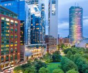
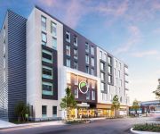
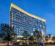
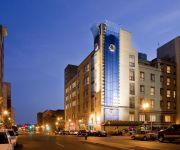
Hotels and Places to Stay
Boston Harbor Hotel
The Envoy Hotel Autograph Collection
The Westin Boston Waterfront
AC Hotel Boston Downtown
Renaissance Boston Waterfront Hotel
Northeast Suites at 660 Washington
InterContinental Hotels BOSTON
Element Boston Seaport
Aloft Boston Seaport
DoubleTree by Hilton Boston Downtown
Videos from this area
These are videos related to the place based on their proximity to this place.
Northeastern University - Boston - campus tour with American College Strategies
Thinking about applying to Northeastern? Independent Educational Consultant Kathleen Griffin of American College Strategies provides insights into the academics and unique culture of this...
Trip to Scituate (Greenbush) Pl 1/8 Leaving South Station
MBCR P083-14 leaving Aouth Station and snaking its way through MBTA Red Line Cabot Shops and the Amtrak Coach and Cafe Storage and Service Yard.
Groundbreaking for D Street Hotels in South Boston
Mayor Thomas M. Menino celebrates the groundbreaking on two mid-priced hotels as part of the Massachusetts Convention center Authority's expansion efforts in South Boston.
Neighborhood Coffee Hours: South Boston
South Boston residents gather at Buckley Playground for Mayor Menino's Coffee Hours to voice their opinions on matters regarding their neighborhood .
The Legacy of Irish Heritage
Mayor Walsh celebrates the legacy of Irish heritage with the South Boston Citizens' Association.
Sweeney Playground Ribbon Cutting
Mayor Walsh joins City of Boston Parks Commissioner Chris Cook for a ribbon cutting at the newly rennovated Sweeney Playground in South Boston. For full coverage of the Sweeney Playground...
South End Apartments Real Estate
http://www.southendpads.com/ South End Pads has more than 80000 listings, more than any of our competitors, there's no wonder South End Pads has so many gre...
South End Apartments Real Estate
http://www.southendpads.com/ South End Pads has more than 80000 listing apartments, there's no wonder South End Pads has so many great options. If you are s...
Plumber Boston Unsticking a garbage disposal
Plumber Downtown, Plumber Beacon Hill, Plumber North End, Plumber South End, Plumber South Boston, Plumber East Boston Plumber Cambridge, Plumber Somerville, Plumber Malden, Plumber ...
Copper Gutters Remodeling Boston Massachusetts (617) 600-3585
http://www.slateroofingrepairscopperguttersflashingcontractorsbostonma.com Classical Details 18 Rugdale Rd Boston, MA 02124 United States (617) 600-3585 HIC#...
Videos provided by Youtube are under the copyright of their owners.
Attractions and noteworthy things
Distances are based on the centre of the city/town and sightseeing location. This list contains brief abstracts about monuments, holiday activities, national parcs, museums, organisations and more from the area as well as interesting facts about the region itself. Where available, you'll find the corresponding homepage. Otherwise the related wikipedia article.
Dorchester, Boston
Dorchester is a historic neighborhood of over 6 square miles in Boston, Massachusetts, United States. The town was founded by Puritans who emigrated from Dorchester, England in 1630. This dissolved municipality, Boston's largest neighborhood by far, is often divided by city planners in order to create two planning areas roughly equivalent in size and population to other Boston neighborhoods.
Boston College High School
Founded in 1863, Boston College High School (also known as BC High) is an all-male Jesuit Roman Catholic college preparatory secondary school with historical ties to Boston College. It has an enrollment in grades 7-12 of approximately 1,500 students and is located on a 40-acre campus on Morrissey Boulevard in the Dorchester section of Boston, Massachusetts. A graduate of BC High who goes on to Boston College is known as a "Double Eagle.
South Bay, Boston
For the actual bay, see South Bay (Boston). South Bay is a 10-acre (40,000 m²) site in Boston, Massachusetts sandwiched between Chinatown and the Leather District. It is roughly bounded by Kneeland Street, Hudson Street, the Massachusetts Turnpike mainline, and the Interstate 93 mainline. Currently owned by the Massachusetts Turnpike Authority (MTA), the site is being put up for development.
Congress Street Grounds
Congress Street Grounds is a former baseball ground located in Boston, Massachusetts. The ballpark, as the name implies, was along Congress Street, near the intersection of Thompson Place, and not far from the Fort Point Channel on South Boston Flats, a newly filled in piece of land on Boston Harbor. The ground was home to the Boston Reds, that played in the Players' League in 1890 and the American Association in 1891.
Boston Convention and Exhibition Center
The Boston Convention and Exhibition Center (BCEC) is the largest exhibition center in the Northeast United States, with some 516,000 square feet of contiguous exhibition space. It is located on Summer Street near the South Boston waterfront, Boston's World Trade Center, and across the harbor from Logan International Airport. The main exhibition floor comprises three bays which can be isolated for separate shows or linked into one large space.
Fort Point Channel
Fort Point Channel is a maritime channel separating South Boston from downtown Boston, Massachusetts, feeding into Boston Harbor. The south part of it has been gradually filled in for use by the South Bay rail yard and several highways. At its south end, the channel once widened into South Bay (Boston), from which the Roxbury Canal continued southwest where the Massachusetts Avenue Connector is now. The Boston Tea Party occurred at its northern end.
Atlantic Avenue (Boston)
Atlantic Avenue is a street in downtown Boston, Massachusetts, USA, partly serving as a frontage road for the underground Central Artery and partly running along the Boston Harbor. It has a long history, with several relocations along the way.
World Trade Center (MBTA station)
The World Trade Center station is a transportation station in Boston, Massachusetts, on the MBTA's bus rapid transit (BRT) Silver Line. The station is located on Congress Street at C Street/World Trade Center Avenue on the South Boston Waterfront. It is between Boston's World Trade Center and Boston Convention and Exhibition Center (BCEC), and near Commonwealth Pier and a seasonal ferry to Provincetown, Massachusetts.
Andrew (MBTA station)
Andrew is a station on the MBTA Red Line at Andrew Square in South Boston, Massachusetts. The station is located at the intersection of several major thoroughfares, including Dorchester Avenue, Dorchester Street, Southampton Street, and Boston Street. Andrew is the primary transfer point between the Red Line subway and the MBTA surface bus routes into South Boston. It is fully wheelchair accessible.
Fortification of Dorchester Heights
The Fortification of Dorchester Heights was a decisive action early in the American Revolutionary War that precipitated the end of the siege of Boston and the withdrawal of British troops from that city. On March 4, 1776, troops from the Continental Army under George Washington's command occupied Dorchester Heights, a series of low hills with a commanding view of Boston and its harbor, and mounted powerful cannons there.
Boston Children's Museum
Boston Children's Museum is a children's museum in Boston, Massachusetts, dedicated to the education of children. Located on Children's Wharf along the Fort Point Channel, Boston Children's Museum is the second oldest children's museum in the United States. It contains many activities meant to both amuse and educate young children.
Broadway (MBTA station)
Broadway is a station on the Red Line subway at the intersection of Dorchester Avenue and Broadway in South Boston, Massachusetts. It was opened on December 15, 1917 as part of the Dorchester Extension of the "Cambridge Connection" from Downtown Crossing (formerly Washington station) to Andrew. The station has a single island platform to serve the two tracks. Broadway was to planned be a stop on the Urban Ring Project, which is currently shelved due to lack of funding.
Silver Line Way (MBTA station)
Silver Line Way is a surface station in Boston, Massachusetts, on the MBTA's bus rapid transit (BRT) Silver Line. It is located on Silver Line Way, at Pumphouse Road between Massport Haul Road (Trilling Street) and D Street, near the South Boston Waterfront.
South Bay Interchange
The South Bay Interchange is a massive interchange in the South Bay region of Boston, Massachusetts, in the US. The interchange consists of Interstate 90, the Mass Pike Extension, and the Interstate 93 concurrency with US 1 and MA 3 south of the Thomas P. O'Neill Jr. Tunnel. The interchange was constructed beginning in the late 1990s as a major feature of the Big Dig project.
Fort Point, Boston
Fort Point is a neighborhood or district of Boston, Massachusetts, which is named after the location of a fort which guarded the city in colonial times. Fort Hill was located near what is today the intersection of Oliver and High Streets. At least until 1675, (see) the hill jutted out into the Atlantic Ocean, hence the designation of being a "point". Its height and proximity to the sea made the hill an advantageous point to put defensive cannons.
Edward Everett Square
Edward Everett Square, in Dorchester, Boston, is an intersection of Columbia Road, Massachusetts Avenue, East Cottage Street and Boston Street, and named after a former Governor of Massachusetts, Edward Everett. In 1995 efforts were undertaken by the local community to redevelop the square, with major milestones being completed in 2007. On June 16 2007, Mayor Thomas M. Menino dedicated the new square marking the completion of the current phase of the project.
Carson Beach, South Boston
Carson Beach is a public beach in the South Boston neighborhood of Boston, Massachusetts. It is maintained by the state's Department of Conservation and Recreation. The bathhouse has been recently renovated. Though in the mid-90s, the water quality was poor because of sewage matter and other biological debris in the water, and was thus unsafe and unswimmable to the point where the beach had to be shut down. The water is now clean and approved for swimming.
Boston Sculptors Gallery
The Boston Sculptors Gallery is a cooperative sculpture gallery in Boston, Massachusetts. It exhibits contemporary sculpture by local artists. There are currently 34 exhibiting sculptors in the group. Each month, two of these artists hold concurrent solo shows in the gallery. The gallery is located at 486 Harrison Ave. in the SOWA (South of Washington) arts district of Boston. Boston Sculptors was founded in 1992. Jean Mineo has been the gallery administrator since 2006.
Old Colony Housing Project
The Old Colony Housing Project is a housing project located in South Boston, Massachusetts. Built in 1941, it is one of Boston Housing Authority's oldest developments. It is currently in the middle of a two-phase redevelopment project. Phase I was completed in 2011 and Phase II is currently in the permitting process. The redevelopment process is moving most housing from large multi-family complexes to mixed housing, in keeping with the modern US philosophy for low-income housing.
Seaport Hotel and Seaport World Trade Center
The Seaport Boston Hotel and the neighboring Seaport World Trade Center is located on the Boston waterfront at Commonwealth Pier, in the South Boston neighborhood of Boston, Massachusetts. The South Boston Waterfront is also known unofficially at the Boston Seaport District. The Seaport Boston Hotel opened in 1998. Renovations were completed in 2009 by the New York architects BBG-BBGM.
Our Lady of Czestochowa Parish, Boston
Our Lady of Czestochowa Parish - designated for Polish immigrants at Dorchester Ave Dorchester, Massachusetts, was founded in 1893. This is one of Polish-American Roman Catholic parishes in New England in the Archdiocese of Boston.
South Station Bus Terminal
The South Station Bus Terminal, owned by the Massachusetts Bay Transportation Authority, is the main gateway for interstate buses into Boston, Massachusetts. It is located at 700 Atlantic Avenue, at the intersection with Beach Street, in the Chinatown/Leather District neighborhoods. The facility is immediately south-southwest of the main MBTA/Amtrak South Station terminal, located above the station's platforms.
Massachusetts Convention Center Authority
The Massachusetts Convention Center Authority (MCCA) owns and oversees the operation of the Boston Convention & Exhibition Center (BCEC), the John B. Hynes Veterans Memorial Convention Center, the MassMutual Center in Springfield, Massachusetts, and the Boston Common Garage.
Newmarket (MBTA station)
Newmarket is an under-construction passenger rail station on the MBTA Commuter Rail's Fairmount Line, located off Massachusetts Avenue at Newmarket Square in Dorchester, Massachusetts. The station will have two 800-foot high-level platforms and sloping walkways connecting it to Massachusetts Avenue. Originally planned to be in service in 2012, it is now planned to open in June 2013
Bayside Expo Center
The Bayside Expo Center (also known as the Bayside Expo and Conference Center) is a convention center located in Dorchester, Massachusetts. Originally opened as a shopping mall in the 1960s, the mall later failed and the convention center opened in its place. In 2010, it was purchased by the University of Massachusetts Boston after the owner of the building went into foreclosure.


