Safety Score: 2,7 of 5.0 based on data from 9 authorites. Meaning we advice caution when travelling to United States.
Travel warnings are updated daily. Source: Travel Warning United States. Last Update: 2024-04-25 08:17:04
Explore Waterfront
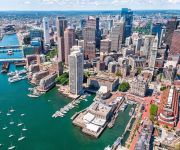
The district Waterfront of in Suffolk County (Massachusetts) is located in United States about 394 mi north-east of Washington DC, the country's capital.
If you need a place to sleep, we compiled a list of available hotels close to the map centre further down the page.
Depending on your travel schedule, you might want to pay a visit to some of the following locations: Boston, Dedham, Taunton, Brentwood and Providence. To further explore this place, just scroll down and browse the available info.
Local weather forecast
Todays Local Weather Conditions & Forecast: 10°C / 50 °F
| Morning Temperature | 3°C / 38 °F |
| Evening Temperature | 10°C / 50 °F |
| Night Temperature | 7°C / 44 °F |
| Chance of rainfall | 0% |
| Air Humidity | 39% |
| Air Pressure | 1032 hPa |
| Wind Speed | Gentle Breeze with 7 km/h (4 mph) from North-West |
| Cloud Conditions | Clear sky, covering 0% of sky |
| General Conditions | Sky is clear |
Saturday, 27th of April 2024
13°C (56 °F)
9°C (49 °F)
Sky is clear, gentle breeze, clear sky.
Sunday, 28th of April 2024
9°C (48 °F)
10°C (50 °F)
Light rain, light breeze, overcast clouds.
Monday, 29th of April 2024
12°C (54 °F)
12°C (53 °F)
Overcast clouds, light breeze.
Hotels and Places to Stay
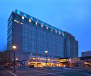
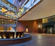
The Westin Boston Waterfront
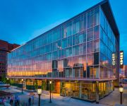
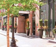
The Envoy Hotel Autograph Collection
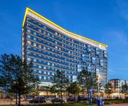
Marriott Vacation Club Pulse at Custom House Boston
The Langham Boston
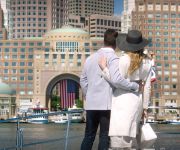
Boston Harbor Hotel
THE BOSTONIAN BOSTON
Hilton Boston Downtown-Faneuil Hall
Club Quarters in Boston
Aloft Boston Seaport
Boston Marriott Long Wharf
Videos from this area
These are videos related to the place based on their proximity to this place.
Groundbreaking for D Street Hotels in South Boston
Mayor Thomas M. Menino celebrates the groundbreaking on two mid-priced hotels as part of the Massachusetts Convention center Authority's expansion efforts in South Boston.
Neighborhood Coffee Hours: South Boston
South Boston residents gather at Buckley Playground for Mayor Menino's Coffee Hours to voice their opinions on matters regarding their neighborhood .
Computer Consulting Call (888) 648-4179 Suffolk County MA Companies|Networking|Cloud|Service|Firm
Computer Consulting Call (888) 648-4179 Suffolk County MA Companies|Networking|Cloud|Service|Firm http://youtu.be/87Od3p9WnwI Look No further for Information Technology Services, Our Firm...
South End Apartments Real Estate
http://www.southendpads.com/ South End Pads has more than 80000 listing apartments, there's no wonder South End Pads has so many great options. If you are s...
Fort Point Pier, Boston's public dock w/ Harbor access for kayak and canoe [KG Tour #001]
Info: http://www.fortpointpier.com. Located on downtown Boston's Fort Point Channel Fort Point Pier is a new public pier, dock and restored seawall providing access to waypoints along Boston's...
Fort Point Pier: An insider's kayak tour of Boston's Fort Point Channel to Boston Harbor
http://www.fortpointpier.com An introductory kayak tour of downtown Boston's Fort Point Channel, paddling from Fort Point Pier (aka P&G Gillette Public Dock), Boston's new public dock offering...
Exclusive: 2nd Boston Tea Party ship Eleanor arrives in Boston's Fort Point Channel
http://www.fortpointpier.com May 15, 2012. The arrival the Tea Party ship Eleanor into Boston's Fort Point Channel from Gloucester. The yellow ship is a replica of the original Eleanor at Griffin's...
Rockport Joins The Volvo Ocean Race - Supplies The Telefónica Team
Rockport presented the 22 sailors on the Telefónica team with special edition boat shoes to wear as they depart Boston, MA, on May 15th and embark on the final stretch of the Volvo Ocean Race....
Videos provided by Youtube are under the copyright of their owners.
Attractions and noteworthy things
Distances are based on the centre of the city/town and sightseeing location. This list contains brief abstracts about monuments, holiday activities, national parcs, museums, organisations and more from the area as well as interesting facts about the region itself. Where available, you'll find the corresponding homepage. Otherwise the related wikipedia article.
Harpoon Brewery
Harpoon Brewery is an American microbrewery, with plants in Boston, Massachusetts and Windsor, Vermont. Founded in 1986, the brewery was the first company to obtain a permit to manufacture and sell alcohol in the Commonwealth of Massachusetts in over 25 years. In 2000 it purchased the former Catamount Brewery plant in Windsor VT. Harpoon has played an important part in the rebirth of the microbrewery system in the United States.
Federal Reserve Bank Building (Boston)
The Federal Reserve Bank Building is Boston's third tallest building. Located at Dewey Square, on the convergence of Fort Point and the Financial District neighborhoods. In close proximity are the Boston Harbor, the Fort Point Channel and major intermodal South Station terminal, the building is marked by a distinctive opening near ground level which allows sea breezes to pass through. The building was completed in 1977 and is 614 feet (187 m) tall with 32 floors.
Congress Street Grounds
Congress Street Grounds is a former baseball ground located in Boston, Massachusetts. The ballpark, as the name implies, was along Congress Street, near the intersection of Thompson Place, and not far from the Fort Point Channel on South Boston Flats, a newly filled in piece of land on Boston Harbor. The ground was home to the Boston Reds, that played in the Players' League in 1890 and the American Association in 1891.
Boston Convention and Exhibition Center
The Boston Convention and Exhibition Center (BCEC) is the largest exhibition center in the Northeast United States, with some 516,000 square feet of contiguous exhibition space. It is located on Summer Street near the South Boston waterfront, Boston's World Trade Center, and across the harbor from Logan International Airport. The main exhibition floor comprises three bays which can be isolated for separate shows or linked into one large space.
Rose Fitzgerald Kennedy Greenway
The Rose Fitzgerald Kennedy Greenway is Boston’s newest linear urban park – a ribbon of landscaped gardens, promenades, plazas, fountains, art, and specialty lighting systems that stretches over one mile through residential neighborhoods, the Financial District, and Harbor communities. Officially opened in October 2008, the 15-acre Greenway, sits on land created from destruction of the John F. Fitzgerald Expressway under the Big Dig.
Frank McCourt (executive)
Frank H. McCourt (born August 14, 1953) is an American businessman, president of the McCourt Group and owner of the Los Angeles Marathon. He was co-owner and chairman of the Los Angeles Dodgers and Dodger Stadium in Chavez Ravine from 2004-2012. In 2004, he purchased a controlling interest of the Dodgers from Fox Entertainment Group, owned by Rupert Murdoch's News Corporation.
Fort Point Channel
Fort Point Channel is a maritime channel separating South Boston from downtown Boston, Massachusetts, feeding into Boston Harbor. The south part of it has been gradually filled in for use by the South Bay rail yard and several highways. At its south end, the channel once widened into South Bay (Boston), from which the Roxbury Canal continued southwest where the Massachusetts Avenue Connector is now. The Boston Tea Party occurred at its northern end.
John F. Fitzgerald Expressway
The John F. Fitzgerald Expressway, known locally as the Central Artery, is a section of freeway in downtown Boston, Massachusetts, designated as Interstate 93, U.S. Route 1 and Route 3. It was initially constructed in the 1950s as a partly elevated and partly tunneled divided highway. Now, however, it is mostly made up of tunnels that were built during a ten-year period from the mid-1990s to the early 2000s as part of the Big Dig (Central Artery/Tunnel) project.
World Trade Center (MBTA station)
The World Trade Center station is a transportation station in Boston, Massachusetts, on the MBTA's bus rapid transit (BRT) Silver Line. The station is located on Congress Street at C Street/World Trade Center Avenue on the South Boston Waterfront. It is between Boston's World Trade Center and Boston Convention and Exhibition Center (BCEC), and near Commonwealth Pier and a seasonal ferry to Provincetown, Massachusetts.
Boston Children's Museum
Boston Children's Museum is a children's museum in Boston, Massachusetts, dedicated to the education of children. Located on Children's Wharf along the Fort Point Channel, Boston Children's Museum is the second oldest children's museum in the United States. It contains many activities meant to both amuse and educate young children.
Boston Tea Party
The Boston Tea Party (referred to in its time simply as "the destruction of the tea" or by other informal names and so named until half a century later) was a political protest by the Sons of Liberty in Boston, a city in the British colony of Massachusetts, against the tax policy of the British government and the East India Company that controlled all the tea imported into the colonies.
Rowes Wharf
The current incarnation of Rowes Wharf (built 1987) is a modern development in downtown Boston, Massachusetts. It is best known for the Boston Harbor Hotel's multi-story arch over the wide public plaza between Atlantic Avenue and the Boston Harbor waterfront. Along the waterfront can be found a marina, restaurants, a water transportation terminal, and a floating stage offering free concerts and movies during the summer.
Silver Line Way (MBTA station)
Silver Line Way is a surface station in Boston, Massachusetts, on the MBTA's bus rapid transit (BRT) Silver Line. It is located on Silver Line Way, at Pumphouse Road between Massport Haul Road (Trilling Street) and D Street, near the South Boston Waterfront.
Courthouse (MBTA station)
Courthouse Station is a transportation station in Boston, Massachusetts, on the MBTA's Silver Line Waterfront. The station is located on Seaport Boulevard at Pittsburg Street on the South Boston Waterfront.
Fort Point, Boston
Fort Point is a neighborhood or district of Boston, Massachusetts, which is named after the location of a fort which guarded the city in colonial times. Fort Hill was located near what is today the intersection of Oliver and High Streets. At least until 1675, (see) the hill jutted out into the Atlantic Ocean, hence the designation of being a "point". Its height and proximity to the sea made the hill an advantageous point to put defensive cannons.
Children's Wharf
Children's Wharf (until recently known as Museum Wharf) is a wharf on Congress Street in Boston, Massachusetts, on the Fort Point Channel with views of the Financial District and Boston Harbor. The wharf has sitting areas, patches of lawn, and several tourist attractions. By way of the Congress Street Bridge, Children's Wharf is a short walk from South Station, one of Boston's principal transportation hubs.
Bank of America Pavilion
Bank of America Pavilion is a Live Nation-owned outdoor amphitheater located in Boston, Massachusetts, USA. The seating capacity is approximately 5,000. It was originally known as Harbor Lights Pavilion until 1999 when Live Nation purchased the venue and sold the naming rights to FleetBoston Financial, renaming the venue; FleetBoston Pavilion. In 2004 FleetBoston merged with Bank of America; the pavilion was then renamed, Bank of America Pavilion.
InterContinental Boston
The InterContinental Boston is a AAA Four Diamond hotel operated by the InterContinental Hotels Group. The waterfront-adjacent 21 story hotel is located at 510 Atlantic Avenue in Boston, Massachusetts. The hotel contains three food and beverage outlets, 32,000 square feet of meeting space, 424 guest rooms, 130 private residences, and the SPA InterContinental.
Seaport Hotel and Seaport World Trade Center
The Seaport Boston Hotel and the neighboring Seaport World Trade Center is located on the Boston waterfront at Commonwealth Pier, in the South Boston neighborhood of Boston, Massachusetts. The South Boston Waterfront is also known unofficially at the Boston Seaport District. The Seaport Boston Hotel opened in 1998. Renovations were completed in 2009 by the New York architects BBG-BBGM.
India Wharf
India Wharf (1804-c. 1962) in Boston, Massachusetts, flourished in the 19th century, when it was one of the largest commercial wharves in the port. The structure began in 1804 to accommodate international trade at a time when several other improvements to the Boston waterfront occurred, such as the creation of Broad Street and India Street.
Massachusetts Convention Center Authority
The Massachusetts Convention Center Authority (MCCA) owns and oversees the operation of the Boston Convention & Exhibition Center (BCEC), the John B. Hynes Veterans Memorial Convention Center, the MassMutual Center in Springfield, Massachusetts, and the Boston Common Garage.
Boston Harbor Hotel
The Boston Harbor Hotel is a hotel overlooking Boston Harbor and the Rose Kennedy Greenway. The hotel is also a member of Preferred Hotels & Resorts Worldwide.
South Boston Naval Annex
The South Boston Naval Annex, was a 167 acre United States Navy shipyard annex located in South Boston. It was the annex of the Boston Navy Yard, and was operational from the 1920s, to 1974, when it was closed along with the shipyard. The annex is also home to Dry Dock Number 3, the one of the largest dry docks on the East Coast.
South Boston Army Base
The South Boston Army Base, was a 58 acre United States Army annex located in South Boston. During World War II, it was used as the Boston Port of Embarkation. It was operational from the 1920s, to 1974.
Commonwealth Flats
Commonwealth Flats is a region of former mud flats in South Boston. It has been used over the years as the site of the South Boston Naval Annex, the South Boston Army Base, the Black Falcon Cruise Terminal and various other entities over the years.






!['Fort Point Pier, Boston's public dock w/ Harbor access for kayak and canoe [KG Tour #001]' preview picture of video 'Fort Point Pier, Boston's public dock w/ Harbor access for kayak and canoe [KG Tour #001]'](https://img.youtube.com/vi/tKoCv_7mXnI/mqdefault.jpg)


