Safety Score: 2,7 of 5.0 based on data from 9 authorites. Meaning we advice caution when travelling to United States.
Travel warnings are updated daily. Source: Travel Warning United States. Last Update: 2024-04-27 08:23:39
Discover Fields Corner
Fields Corner in Suffolk County (Massachusetts) is a place in United States about 392 mi (or 631 km) north-east of Washington DC, the country's capital city.
Current time in Fields Corner is now 01:48 PM (Saturday). The local timezone is named America / New York with an UTC offset of -4 hours. We know of 11 airports near Fields Corner, of which 5 are larger airports. The closest airport in United States is General Edward Lawrence Logan International Airport in a distance of 5 mi (or 8 km), North-East. Besides the airports, there are other travel options available (check left side).
Also, if you like playing golf, there are a few options in driving distance. We encountered 3 points of interest in the vicinity of this place. If you need a hotel, we compiled a list of available hotels close to the map centre further down the page.
While being here, you might want to pay a visit to some of the following locations: Boston, Dedham, Taunton, Providence and North Providence. To further explore this place, just scroll down and browse the available info.
Local weather forecast
Todays Local Weather Conditions & Forecast: 16°C / 60 °F
| Morning Temperature | 4°C / 39 °F |
| Evening Temperature | 16°C / 60 °F |
| Night Temperature | 10°C / 51 °F |
| Chance of rainfall | 0% |
| Air Humidity | 35% |
| Air Pressure | 1032 hPa |
| Wind Speed | Gentle Breeze with 7 km/h (5 mph) from North-East |
| Cloud Conditions | Scattered clouds, covering 36% of sky |
| General Conditions | Scattered clouds |
Saturday, 27th of April 2024
12°C (54 °F)
13°C (56 °F)
Light rain, gentle breeze, overcast clouds.
Sunday, 28th of April 2024
18°C (64 °F)
12°C (53 °F)
Moderate rain, gentle breeze, overcast clouds.
Monday, 29th of April 2024
8°C (46 °F)
6°C (42 °F)
Moderate rain, gentle breeze, overcast clouds.
Hotels and Places to Stay
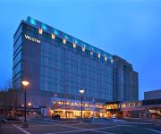
The Westin Boston Waterfront
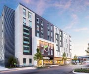
AC Hotel Boston Downtown
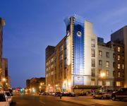
COLONNADE BOSTON COPLEY SQUARE
Element Boston Seaport
DoubleTree by Hilton Boston Downtown
Aloft Boston Seaport
Evolve Back Bay
DoubleTree Club by Hilton Boston Bayside
BW PLUS BOSTON HOTEL
Hampton Inn - Suites Boston Crosstown Center
Videos from this area
These are videos related to the place based on their proximity to this place.
Henderson School Outdoor Classroom Ribbon Cutting
Mayor Menino participates in the official ribbon cutting of the Henderson Inclusion Elementary School's new outdoor classroom. Watch the full video: http://www.cityofboston.gov/cable/video_library...
Installing a simple garden retaining wall
Patti, the Garden Girl, installs a simple retaining wall in her mini city orchard using Garden Soxx. Kip Gardner from http://www.filtrexx.com shows Patti how to use this innovative gardening system.
Bowdoin-Geneva Local Businesses Holiday Tour
Mayor Walsh joins the Boston Police Department for a holiday tour of the local businesses in the Bowdoin-Geneva area of Dorchester.
Me and My Buddy: The Story of the Savin Hill Little League Challenger Division
The Little League Baseball Challenger Division is a program that offers physically and developmentally challenged youth with the opportunity to play the game of baseball. In this story, you'll...
74 Westville St - Dorchester
This 3 family building is conveniently located near Fields Corner T Station (less than 10 minute walk) and near Ronan Park (roughly 10 minutes walking). The ...
296-298 Bowdoin Street, Dorchester, MA
A video tour of 296-298 Bowdoin Street, Dorchester, MA provided by Jonathan Bowen of Jonathan Bowen Real Estate, LLC. Call 855-879-4663 or go to http://www.bowenboston.com in order to get ...
Harbor School Visit with Governor Patrick
Mayor Thomas M. Menino joins Governor Patrick in visiting the Harbor Pilot School in Dorchester where they have an informal discussion with students from Harbor and CASH. Watch the full...
2000 Chevrolet Malibu Used Cars Dorchester MA
http://www.dorchestermotorsales.com This 2000 Chevrolet Malibu is available from Dorchester Motor Sales. For details, call us at 617-436-7820.
Videos provided by Youtube are under the copyright of their owners.
Attractions and noteworthy things
Distances are based on the centre of the city/town and sightseeing location. This list contains brief abstracts about monuments, holiday activities, national parcs, museums, organisations and more from the area as well as interesting facts about the region itself. Where available, you'll find the corresponding homepage. Otherwise the related wikipedia article.
Fields Corner (MBTA station)
Fields Corner is a station on the MBTA Red Line, located at Fields Corner in Dorchester, Massachusetts. It opened on November 5, 1927, serving as the southern terminus of the line for about a year until Shawmut and Ashmont opened in 1928.
Ashmont (MBTA station)
Ashmont is located on the Red Line in Dorchester, Massachusetts. It opened on September 1, 1928, and is the subway terminal for the Red Line's Dorchester Branch. Ashmont is also the terminus of the light rail Ashmont–Mattapan High Speed Line, which loops around on an elevated viaduct. Towards the end of the Ashmont renovations, new signs were put in that now read ASHMONT/PEABODY SQ. , but this change will not appear on any new maps or publications.
Savin Hill (MBTA station)
Savin Hill is a rapid transit station on the Ashmont Branch of the MBTA Red Line, located at 121 Savin Hill Avenue adjacent to Sydney Street in Dorchester, Massachusetts. It serves the nearby neighborhood of Savin Hill and adjacent areas in Dorchester.
Eire Pub
The Eire Pub is a pub in Dorchester, Massachusetts. During their respective presidential campaigns, future U.S. Presidents Ronald Reagan and Bill Clinton both visited the pub; since then, stopping at Eire Pub has become a superstition for political candidates hoping to follow in Reagan and Clinton's footsteps. Bertie Ahern, the then-Prime Minister of Ireland, visited the pub in 2008. Martin Nicholson, bartender at the Eire Pub for 45 years, retired in 2010.
Charles Street (Boston)
Charles Street is the name of a north-south street in the city center of Boston, Massachusetts. It begins in the north at Leverett Circle, where it connects with Nashua Street and Monsignor O'Brien Highway. Science Park station on the MBTA Green Line is located there. Charles Street runs south and gives its name to the Charles/MGH station on the MBTA Red Line, connecting via the Charles Circle rotary to Cambridge Street and the Longfellow Bridge which leads to Cambridge.
The Mather School
The Mather School is the oldest public elementary school in North America. It is located in the Dorchester region of Boston, Massachusetts and was named after Richard Mather. Mather was an English-born American Congregational minister who emigrated to Boston and settled in Dorchester in 1635.
First Parish Church of Dorchester
The First Parish Church in Dorchester, was built in 1631 by the emigrants from Dorchester, Dorset and the south west of England who founded the town of Dorchester, Massachusetts on March 30, 1630. The first church building was an crude log cabin thatched with grass. As well as the church, the Puritans founded the first elementary school supported by public money in the New World. They held the first town meeting at the church, which determined policy through open and frequent discussion.
Savin Hill Beach
Savin Hill Beach is a public beach in the Dorchester neighborhood of Boston, Massachusetts. It is proximate to Malibu Beach. The closest subway stop is Savin Hill on the MBTA Red Line.
Rainbow Swash
The Rainbow Swash is a work by Corita Kent in the Dorchester neighborhood of Boston, Massachusetts. The rainbow design painted on a 140-foot tall LNG storage tank is the largest copyrighted work of art in the world. Highly visible from daily commuters drives on Interstate 93, the landmark is considered one of the major landmarks of Boston, akin to the Citgo sign.
Strand Theatre (Dorchester, Massachusetts)
Strand Theatre is a restored vaudeville house located in Uphams Corner in Dorchester, Massachusetts.
Morrissey Boulevard
Morrissey Boulevard is a six-lane divided coastal road in the Dorchester neighborhood of Boston, Massachusetts. It is owned and maintained by the Massachusetts Department of Conservation and Recreation (DCR).
Bowdoin Square (Boston)
Bowdoin Square (est.1788) in Boston, Massachusetts was located in the West End. In the 18th-19th centuries it featured residential houses, leafy trees, a church, hotel, theatre and other buildings. Among the notables who have lived in the square: physician Thomas Bulfinch; merchant Kirk Boott; and mayor Theodore Lyman. Since the 20th century the area has become a traffic intersection at Cambridge Street, Bowdoin Street, and New Chardon Street.


