Safety Score: 2,7 of 5.0 based on data from 9 authorites. Meaning we advice caution when travelling to United States.
Travel warnings are updated daily. Source: Travel Warning United States. Last Update: 2024-04-29 08:03:39
Discover Ashmont
Ashmont in Suffolk County (Massachusetts) is a place in United States about 391 mi (or 629 km) north-east of Washington DC, the country's capital city.
Current time in Ashmont is now 04:14 AM (Monday). The local timezone is named America / New York with an UTC offset of -4 hours. We know of 11 airports near Ashmont, of which 5 are larger airports. The closest airport in United States is General Edward Lawrence Logan International Airport in a distance of 6 mi (or 10 km), North-East. Besides the airports, there are other travel options available (check left side).
Also, if you like playing golf, there are a few options in driving distance. We encountered 3 points of interest in the vicinity of this place. If you need a hotel, we compiled a list of available hotels close to the map centre further down the page.
While being here, you might want to pay a visit to some of the following locations: Boston, Dedham, Taunton, Providence and North Providence. To further explore this place, just scroll down and browse the available info.
Local weather forecast
Todays Local Weather Conditions & Forecast: 16°C / 61 °F
| Morning Temperature | 14°C / 58 °F |
| Evening Temperature | 17°C / 63 °F |
| Night Temperature | 13°C / 55 °F |
| Chance of rainfall | 0% |
| Air Humidity | 56% |
| Air Pressure | 1017 hPa |
| Wind Speed | Gentle Breeze with 8 km/h (5 mph) from South |
| Cloud Conditions | Scattered clouds, covering 42% of sky |
| General Conditions | Light rain |
Monday, 29th of April 2024
11°C (52 °F)
9°C (48 °F)
Overcast clouds, gentle breeze.
Tuesday, 30th of April 2024
8°C (46 °F)
8°C (47 °F)
Light rain, gentle breeze, overcast clouds.
Wednesday, 1st of May 2024
15°C (59 °F)
11°C (52 °F)
Overcast clouds, light breeze.
Hotels and Places to Stay
AC Hotel Boston Downtown
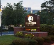
DoubleTree Club by Hilton Boston Bayside
Northeast Suites at The Tremont
Global Luxury Suites at Longwood
Northeast Suites at Longwood
COLONNADE BOSTON COPLEY SQUARE
Evolve Back Bay
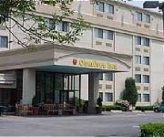
Comfort Inn Boston
BEST WESTERN ADAMS INN QUINCY
Courtyard Boston-South Boston
Videos from this area
These are videos related to the place based on their proximity to this place.
HD Watch & Ride Historic Trolleys on the MBTA in Milton, MA
What do you think of these historic PCC trolleys? Let me know in the comments section. Video by TNT Productions.
Neponset River Greenway Boston MA Butler to Milton Part 2.
This segment covers the Riverwalk on the Boston side as well as a canoe launch. The confluence with Pine Tree Brook lies just across the river from the Canoe Launch. That stream runs all the...
Matt Freeman Video Resume
http://www.coldwellbanker.com/servlet/AgentListing?action=detail&ComColdwellbankerDataAgent_id=656129 We would like to introduce Matt Freeman of the Coldwell Banker Residential Brokerage ...
Sawahdee Chronicles (Part 1)
Part 1 of the travel adventures of Ziggy Smalls (played by Zack Shultz) and Sclesh AKA Sniffy (Played by Josh Schlesinger). This is the day before flight to Thailand in my old apartment in...
Boston Public Health Commission's Thanksgiving Basket Giveaway
Mayor Martin J. Walsh will attends the Boston Public Health Commission's Thanksgiving Basket Giveaway.
Michelle Frechette Video Resume
We would like to introduce Michelle Frechette of the Coldwell Banker Residential Brokerage Sales Office in Milton, MA . Please enjoy the video. http://www.coldwellbanker.com/servlet/AgentListing?a...
PCC Cars: Cabview Boston Ashmont - Mattapan High Speed Line 2012
The Boston Ashmont - Mattapan High Speed Line is one of the very few lines in the world still served by the old PCC streetcars.
MBTA Mattapan PCC Departing Ashmont Loop
A surviving MBTA PCC trolley departs the Ashmont station on the new flyover loop.
Henderson School Outdoor Classroom Ribbon Cutting
Mayor Menino participates in the official ribbon cutting of the Henderson Inclusion Elementary School's new outdoor classroom. Watch the full video: http://www.cityofboston.gov/cable/video_library...
Baker Chocolate Condos | Michael Mahoney Remax Boston | 617.980.9025 | mike@mmahoney.com
http://www.homesinbostonmass.com - Baker Chocolate Condos | Michael Mahoney Remax Boston | 617.980.9025 | mike@mmahoney.com Today what I wanted to do with you was explore the Baker ...
Videos provided by Youtube are under the copyright of their owners.
Attractions and noteworthy things
Distances are based on the centre of the city/town and sightseeing location. This list contains brief abstracts about monuments, holiday activities, national parcs, museums, organisations and more from the area as well as interesting facts about the region itself. Where available, you'll find the corresponding homepage. Otherwise the related wikipedia article.
Fields Corner (MBTA station)
Fields Corner is a station on the MBTA Red Line, located at Fields Corner in Dorchester, Massachusetts. It opened on November 5, 1927, serving as the southern terminus of the line for about a year until Shawmut and Ashmont opened in 1928.
Ashmont (MBTA station)
Ashmont is located on the Red Line in Dorchester, Massachusetts. It opened on September 1, 1928, and is the subway terminal for the Red Line's Dorchester Branch. Ashmont is also the terminus of the light rail Ashmont–Mattapan High Speed Line, which loops around on an elevated viaduct. Towards the end of the Ashmont renovations, new signs were put in that now read ASHMONT/PEABODY SQ. , but this change will not appear on any new maps or publications.
Ashmont, Boston
Ashmont is a section of the Dorchester neighborhood of Boston. It includes the subsections of Ashmont Hill, Peabody Square, and Ashmont-Adams. Located near the Milton/Boston border, major streets include Ashmont Street, Gallivan Blvd. , and Dorchester Avenue. The neighborhood was developed after Dorchester's anexation to Boston in 1870. The westerly side of the neighborhood, north of Fuller Street and west of Dorchester Avenue, north to Welles Avenue, was laid out on the former Welles estate.
Eire Pub
The Eire Pub is a pub in Dorchester, Massachusetts. During their respective presidential campaigns, future U.S. Presidents Ronald Reagan and Bill Clinton both visited the pub; since then, stopping at Eire Pub has become a superstition for political candidates hoping to follow in Reagan and Clinton's footsteps. Bertie Ahern, the then-Prime Minister of Ireland, visited the pub in 2008. Martin Nicholson, bartender at the Eire Pub for 45 years, retired in 2010.
Carney Hospital
Carney Hospital is a 159-bed community teaching hospital in Dorchester, Massachusetts, affiliated with Tufts University School of Medicine and Tufts Medical Center. The hospital had its beginnings in 1863 in South Boston. It was the first Catholic hospital in New England. Among its first patients were American Civil War soldiers. In 1892 a Carney Hospital team performed the first abdominal surgery in Boston.
Charles Street (Boston)
Charles Street is the name of a north-south street in the city center of Boston, Massachusetts. It begins in the north at Leverett Circle, where it connects with Nashua Street and Monsignor O'Brien Highway. Science Park station on the MBTA Green Line is located there. Charles Street runs south and gives its name to the Charles/MGH station on the MBTA Red Line, connecting via the Charles Circle rotary to Cambridge Street and the Longfellow Bridge which leads to Cambridge.
Elizabeth Seton Academy (Boston)
Elizabeth Seton Academy is a Roman Catholic high school for girls located in the Dorchester neighborhood of Boston, Massachusetts.
Morton Street (MBTA station)
Morton Street is a passenger rail station on MBTA Commuter Rail's Fairmount Line, on the Morton Street parkway. It is officially located at 865 Morton Street in the Mattapan section of Boston, Massachusetts, although access to the parking lot is available only from Morton Village Drive, which leads from the intersection of Morton and Evans Streets. With two full-length high-level platforms and ramps to the street, the station is fully wheelchair accessible.
Cedar Grove (MBTA station)
Cedar Grove is a station on MBTA's Ashmont–Mattapan High Speed Line, a branch of the Red Line. The station is located at Adams Street and Milton Street in the Dorchester neighborhood of Boston, Massachusetts. Cedar Grove consists of two side platforms which serve the Ashmont–Mattapan High Speed Line's two tracks. It is located near Cedar Grove Cemetery, which the Ashmont–Mattapan High Speed Line runs through. The station was opened in 1929, as was the rest of the line.
Butler (MBTA station)
Butler is a station on MBTA's Ashmont–Mattapan High Speed Line, a branch of the Red Line. The station is located at Butler Street and Branchfield Street in the Dorchester neighborhood of Boston, Massachusetts. Butler consists of one island platform which serves the Ashmont–Mattapan High Speed Line's two tracks; it is the only station on the line with an island platform. Sixty free parking spaces for passengers are available at the station.
Central Avenue (MBTA station)
Central Avenue is a station on MBTA's Ashmont–Mattapan High Speed Line, a branch of the Red Line. The station is located on Central Avenue off Eliot Street on the border of Milton, Massachusetts and Boston, Massachusetts. Central Avenue consists of two side platforms which serve the Ashmont–Mattapan High Speed Line's two tracks. The station opened in 1929 along with the rest of the line. It closed on June 24, 2006, for a yearlong renovation of the Ashmont-Mattapan High Speed Line.
Talbot Ave (MBTA station)
Talbot Ave is an passenger rail station on the MBTA Commuter Rail's Fairmount Line, located near Codman Square in Dorchester, Massachusetts. The station includes two full-length high-level platforms located north of Talbot Avenue, which are also accessible from Park Street and West Park Street. The station opened on November 12, 2012 as the first of four new stations on the Fairmount Line.


