Safety Score: 2,7 of 5.0 based on data from 9 authorites. Meaning we advice caution when travelling to United States.
Travel warnings are updated daily. Source: Travel Warning United States. Last Update: 2024-04-29 08:03:39
Discover Milton Upper Mills
Milton Upper Mills in Norfolk County (Massachusetts) is a town in United States about 389 mi (or 626 km) north-east of Washington DC, the country's capital city.
Current time in Milton Upper Mills is now 07:37 AM (Monday). The local timezone is named America / New York with an UTC offset of -4 hours. We know of 11 airports near Milton Upper Mills, of which 5 are larger airports. The closest airport in United States is General Edward Lawrence Logan International Airport in a distance of 8 mi (or 14 km), North-East. Besides the airports, there are other travel options available (check left side).
Also, if you like playing golf, there are a few options in driving distance. We discovered 2 points of interest in the vicinity of this place. Looking for a place to stay? we compiled a list of available hotels close to the map centre further down the page.
When in this area, you might want to pay a visit to some of the following locations: Dedham, Boston, Taunton, Providence and North Providence. To further explore this place, just scroll down and browse the available info.
Local weather forecast
Todays Local Weather Conditions & Forecast: 16°C / 61 °F
| Morning Temperature | 14°C / 58 °F |
| Evening Temperature | 17°C / 63 °F |
| Night Temperature | 13°C / 55 °F |
| Chance of rainfall | 0% |
| Air Humidity | 56% |
| Air Pressure | 1017 hPa |
| Wind Speed | Gentle Breeze with 8 km/h (5 mph) from South |
| Cloud Conditions | Scattered clouds, covering 42% of sky |
| General Conditions | Light rain |
Monday, 29th of April 2024
11°C (52 °F)
9°C (48 °F)
Overcast clouds, gentle breeze.
Tuesday, 30th of April 2024
8°C (46 °F)
8°C (47 °F)
Light rain, gentle breeze, overcast clouds.
Wednesday, 1st of May 2024
15°C (59 °F)
11°C (52 °F)
Overcast clouds, light breeze.
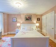
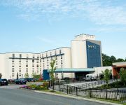
Hotels and Places to Stay
Northeast Suites at The Tremont
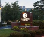
DoubleTree Club by Hilton Boston Bayside
Northeast Suites at Longwood
Global Luxury Suites at Longwood
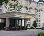
Comfort Inn Boston
Courtyard Boston-South Boston
Aisling
The Inn at Longwood Medical
Hyatt Place Boston Braintree
Hampton Inn - Suites Boston Crosstown Center
Videos from this area
These are videos related to the place based on their proximity to this place.
172 Old Farm Road Milton Mass 02186 in The Indian Cliff Estates
http://www.02186.com - 617.980.9025 Michael Mahoney of Remax in Milton Mass 02186 reviews 172 Old Farm Road in Milton Mass which just came on the market today. This is courtesy of MLSPIN ...
Boston DJ RenSelect mobile gig log at Milton Hoosic Country Club
I want the thank the staff at the Tucker Elementary School for having me perform at their event. The night started with special performances by former students of the school. Once that was...
The Fathoms - Journey to the Stars
The Fathoms, featuring Jerry Miller, playing Journey to the Stars LIVE at the Midway.
134 Blue Hill Avenue, Milton, MA
A video tour of 134 Blue Hill Avenue, Milton, MA provided by Jonathan Bowen of Jonathan Bowen Real Estate, LLC. Call 855-879-4663 or go to http://www.bowenboston.com in order to get more ...
HD Watch & Ride Historic Trolleys on the MBTA in Milton, MA
What do you think of these historic PCC trolleys? Let me know in the comments section. Video by TNT Productions.
Neponset River Greenway Boston MA Butler to Milton Part 2.
This segment covers the Riverwalk on the Boston side as well as a canoe launch. The confluence with Pine Tree Brook lies just across the river from the Canoe Launch. That stream runs all the...
Milton, MA: Dover Hydraulic Elevator (Unknown Mods) @ Milton Hospital, Medical Office Building
This is the other Dover Hydraulic Elevator, modded by an unknown company, in the Medical Office Building at Milton Hospital, Milton, Massachusetts. This lift has issues. It bumps and makes...
67 Sias Ln, Milton, MA $575000; 3 beds; 1.5 baths
HomeMovie http://www.coldwellbanker.com/servlet/PropertyListing?action=detail&ComColdwellbankerDataProperty_id=136209615.
MBTA Red Line PCCs Arrive Caspen Street Eastbound
A surviving PCC trolley on the Mattapan-Ashmont Hi-Speed Line pulls into Caspen Street Station on the newly rebuilt line.
Videos provided by Youtube are under the copyright of their owners.
Attractions and noteworthy things
Distances are based on the centre of the city/town and sightseeing location. This list contains brief abstracts about monuments, holiday activities, national parcs, museums, organisations and more from the area as well as interesting facts about the region itself. Where available, you'll find the corresponding homepage. Otherwise the related wikipedia article.
Mattapan
Mattapan is a neighborhood in Boston, Massachusetts. Historically a section of neighboring Dorchester, Mattapan became a part of Boston when Dorchester was annexed in 1870. As of the 2010 census, it had a population of 36,480. Like other neighborhoods of the late 19th and early 20th century, Mattapan developed, residentially and commercially, as the railroads and streetcars made downtown Boston increasingly accessible.
Mattapan (MBTA station)
Mattapan or Mattapan Sq. is the southern terminus of the Ashmont-Mattapan High Speed Line in Boston, Massachusetts. It is in the Mattapan neighborhood of Boston. The station is a major transfer facility, served by several bus lines.
Boston Baptist College
Boston Baptist College is a Bible college located between Hyde Park and Milton, Massachusetts.
Jubilee Christian Church
Jubilee Christian Church International is a Christian church located in Boston, Massachusetts and Stoughton, Massachusetts. With a congregation of over 6,800, it is, according to the Boston Globe, the largest Protestant church in Eastern Massachusetts. The church operates New England's largest Christian bookstore, and hosts an annual gospel concert which draws some of the biggest names in gospel music.
Milton High School (Milton, Massachusetts)
Milton High School is a public high school located in Milton, Massachusetts, educating grades 9 through 12 with over a thousand students enrolled. Famous alumni include the Boston Red Sox pitcher Rich Hill.
Valley Road (MBTA station)
Valley Road is a station on MBTA's Ashmont–Mattapan High Speed Line, a branch of the Red Line. The station is located on Valley Road off Eliot Street in Milton, Massachusetts. Valley Road consists of two side platforms which serve the Ashmont–Mattapan High Speed Line's two tracks. The station opened in 1929, as did the rest of the line. It closed on June 24, 2006, for a yearlong renovation of the Ashmont–Mattapan High Speed Line.
Capen Street (MBTA station)
Capen Street (signed as Capen St) is a station on MBTA's Ashmont–Mattapan High Speed Line, a branch of the Red Line. The station is located on Capen Street off Eliot Street in Milton, Massachusetts. The station opened on August 26, 1929, as did the rest of the line. On June 24, 2006, it closed for a yearlong renovation of the Ashmont-Mattapan High Speed Line. Capen Street reopened on December 22, 2007, along with the rest of the line.
Blue Hill Avenue (MBTA station)
Blue Hill Avenue is an under construction passenger rail station on the MBTA Commuter Rail's Fairmount Line. The station will consist of a center island platform between the line's two tracks, with handicapped-accessible ramps to Blue Hill Avenue and Cummins Highway. The station is currently in final design and is expected to open no earlier than 2015.


