Safety Score: 2,7 of 5.0 based on data from 9 authorites. Meaning we advice caution when travelling to United States.
Travel warnings are updated daily. Source: Travel Warning United States. Last Update: 2024-05-22 08:01:51
Explore City Mills
The district City Mills of Norfolk in Norfolk County (Massachusetts) is located in United States about 372 mi north-east of Washington DC, the country's capital.
If you need a place to sleep, we compiled a list of available hotels close to the map centre further down the page.
Depending on your travel schedule, you might want to pay a visit to some of the following locations: Dedham, North Providence, Providence, Johnston and Taunton. To further explore this place, just scroll down and browse the available info.
Local weather forecast
Todays Local Weather Conditions & Forecast: 28°C / 83 °F
| Morning Temperature | 14°C / 58 °F |
| Evening Temperature | 25°C / 77 °F |
| Night Temperature | 17°C / 62 °F |
| Chance of rainfall | 1% |
| Air Humidity | 47% |
| Air Pressure | 1013 hPa |
| Wind Speed | Moderate breeze with 9 km/h (6 mph) from North-East |
| Cloud Conditions | Clear sky, covering 1% of sky |
| General Conditions | Light rain |
Thursday, 23rd of May 2024
27°C (81 °F)
18°C (65 °F)
Light rain, gentle breeze, overcast clouds.
Friday, 24th of May 2024
26°C (79 °F)
16°C (60 °F)
Overcast clouds, light breeze.
Saturday, 25th of May 2024
25°C (77 °F)
16°C (61 °F)
Light rain, gentle breeze, overcast clouds.
Hotels and Places to Stay
Hampton Inn Franklin
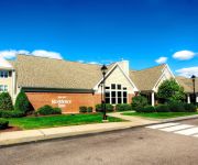
Residence Inn Boston Franklin
Holiday Inn Express PLAINVILLE - FOXBORO AREA
HAWTHORN SUITES BY WYNDHAM FRA
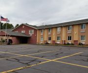
Americas Best Value Inn
Videos from this area
These are videos related to the place based on their proximity to this place.
Meet the Franklin Big Y Team
The Big Y in Franklin, MA opens on August 23rd. Meet the Store Director, and other department managers before the store even opens! The Patriots jerseys were worn because of a special World...
Glen Meadow Apartments - Franklin - 1 bedroom
Glen Meadow apartments, in Franklin, MA is a private community situated on 26 acres of beautifully landscaped grounds that is located near major highways and transportation, including I-495....
Glen Meadow Apartments - Franklin - 2 bedroom
Glen Meadow apartments, in Franklin, MA is a private community situated on 26 acres of beautifully landscaped grounds that is located near major highways and transportation, including I-495....
Big Y opens store in Franklin, MA
The new store opens to crowds of people, nice welcome speeches, the honorary flag raising and, being a retail food store - a cake cutting!
Norfolk MA by Michael Mahoney
Norfolk MA Real Estate Update by Michael Mahoney REMAX EXECUTIVE http:///www.HomesinNorfolkMass.com Remax Agent and Boston based Realtor Michael Mahoney has over a decade of selling ...
Postcard History of Norfolk County by Paul Tedesco
Presented at the Norfolk Public Library, Massachusetts. James B. Tedesco and Paul H. Tedesco co-wrote "Postcard History of Norfolk County, Massachusetts" Published in 2013. The 416-page, tabletop ...
Videos provided by Youtube are under the copyright of their owners.
Attractions and noteworthy things
Distances are based on the centre of the city/town and sightseeing location. This list contains brief abstracts about monuments, holiday activities, national parcs, museums, organisations and more from the area as well as interesting facts about the region itself. Where available, you'll find the corresponding homepage. Otherwise the related wikipedia article.
Franklin, Massachusetts
The Town of Franklin is a city in Norfolk County, Massachusetts, United States. As of the 2010 census, the city's population is 31,635.
Millis-Clicquot, Massachusetts
Millis-Clicquot is a census-designated place (CDP) in the town of Millis in Norfolk County, Massachusetts, United States. The population was 4,403 at the 2010 census. The name "Clicquot" comes from the former Clicquot Club Company, a beverage manufacturer that was located there.
Gillette Stadium
Gillette Stadium is a stadium located in Foxborough, Massachusetts, 21 miles (34 kilometers) southwest of downtown Boston and 20 miles from downtown Providence, Rhode Island. It serves as the home stadium and administrative offices for both the NFL's New England Patriots football franchise and the MLS' New England Revolution soccer team.
Foxboro Stadium
Foxboro Stadium (originally Schaefer Stadium, formerly Sullivan Stadium, commonly Foxborough Stadium) was an outdoor stadium, located in Foxborough, Massachusetts. Although the official spelling of the town's name is "Foxborough", the shorter spelling was used for the stadium.
King Philip Regional High School
King Philip Regional High School is a regional high school in Massachusetts drawing students from three towns: Wrentham, Norfolk and Plainville. The school is located at 699 Franklin Street in Wrentham.
Franklin High School (Franklin, Massachusetts)
B Franklin High School is a public high school located in Franklin, Massachusetts, USA. Their main sports rival is King Philip Regional High School in neighboring Wrentham, Massachusetts.
Massachusetts Correctional Institution – Cedar Junction
The Massachusetts Correctional Institution—Cedar Junction (MCI-Cedar Junction), formerly known as MCI-Walpole, is a maximum security prison with an average daily population of approximately 800 adult male inmates under the jurisdiction of the Massachusetts Department of Correction. It was opened in 1956 to replace Charlestown State Prison, the oldest prison in the nation at that time.
H. Olive Day Elementary School
King Philip Regional Middle School
Franklin/Dean College (MBTA station)
The Franklin/Dean College station is located at 75 Depot Street in downtown Franklin, Massachusetts. There are 173 parking spaces at the station that cost $4.00 a day; payment is collected using the honor box system. Tickets can be purchased at the station along with various food and drink items. The station was the terminus of the Franklin Line until June 2, 1988, when Forge Park/495 station opened.
Forge Park/495 (MBTA station)
Forge Park/495 is a station on the MBTA Franklin Line. The station is the terminus of the line. The station is located in Franklin, Massachusetts and is near Interstate 495 and Massachusetts Route 140. The station has a parking lot with 716 spaces and 15 accessible spaces; spaces cost $4.00 each. Tickets for this station are sold at the Forge Park T for Two located within the station. Originally, MBTA services terminated at Franklin/Dean College stop.
Patriot Place
Patriot Place is an open-air shopping center owned by The Kraft Group. It is located in Foxborough, Massachusetts, built around Gillette Stadium, the home of the New England Patriots and New England Revolution. The first phase opened in fall 2007, which included the construction of a small strip mall. The second phase is built on the site of Schaefer Stadium. It is also home to one of the first locations for Showcase Cinemas' Cinema de Lux brand.
WDIS
WDIS is a radio station licensed to Norfolk, Massachusetts. Primarily a news and talk station, it is also the flagship radio station of many high school sports programs in the Norfolk area. It serves the suburban communities south of Boston and north of Providence, Rhode Island. It has a daytime-only 1,000-watt signal that reaches as far west as Worcester, Mass. , giving it a coverage area of almost half a million people.
Norfolk (MBTA station)
Norfolk is a MBTA commuter rail station on the Franklin Line located in Norfolk, Massachusetts. The station is located at 9 Rockwood Road. There is an automatic level crossing on the road with gates. Also farther down the line Towards Boston Seekonk St. RR crossing also has gates. In the MBTA's zone-based fare structure, Norfolk is located in zone 5. Norfolk station is at grade level. The station has one platform which serves a single track.
Uxbridge High School (Massachusetts)
Uxbridge High School Uxbridge High School (UHS) is the only high school in Uxbridge, Massachusetts. The school is a part of Uxbridge Public Schools. A new high school opened in 2012 at 300 Quaker Highway. Academics UHS prides itself with strong academics in all subject areas, especially the sciences. Introduction to Physics and Technology is one such a class that is a staple to every Spartan's schedule.
WGAO
WGAO is a radio station broadcasting an Album Oriented Rock format. Licensed to Franklin, Massachusetts, USA. The station is currently owned by Dean College.
Bridge Island Meadows
Bridge Island Meadows is an inaccessible 80-acre nature reserve owned by The Trustees of Reservations on the floodplains of the upper Charles River in Millis, Massachusetts. The property was a 1974 gift from Dr. and Mrs. John D. Constable to the Trustees of Reservations.
Medfield Rhododendrons
The Medfield Rhododendrons is a 196-acre nature reserve established in 1934 in Medfield, Massachusetts and is managed by the Trustees of Reservations. The site contains the largest area of Rhododendron maximum in the state, which are currently listed as threatened by the Massachusetts Natural Heritage and Endangered Species Program due to over-collecting.
Millis High School
Millis High School is located in the small town of Millis, Massachusetts, near Medway and Medfield, in Norfolk County. The school building consists of both the middle school and high school (grades 5–12).
Cedariver
Cedariver, formerly known as The Baker Reservation, is a 55-acre open space preserve located on the Charles River in Millis, Massachusetts. The property, acquired in 2004 by the land conservation non-profit organization The Trustees of Reservations, includes farm fields, woodlots, and 1-mile of river frontage. Cedariver is open to hiking, picnicing, car-top boating, cross country skiing, and other passive pursuits. A trailhead is located on Forest Road in Millis.
Noon Hill (reservation)
Noon Hill is a 204-acre open space preserve located in Medfield, Massachusetts and centered around 370-foot Noon Hill, a prominent summit and scenic vista. It is managed by the land conservation non-profit organization The Trustees of Reservations and offers 4.5 miles of trails available for hiking, horseback riding, mountain biking, and cross country skiing. Oak-hickory forest, wetlands, vernal pools, steep ravines, boulders, and rocky ledges characterize the preserve.
Mount Saint Mary's Abbey
Mount Saint Mary’s Abbey is a monastic community of some fifty Trappistine nuns in Wrentham, Massachusetts. The more complete, formal name of the Order is the Cistercians of the Strict Observance (O.C.S.O. ), whose founding at Cîteaux, France dates back to 1098. This community follows the reforms of the Cistercian Order as established by the 17th-century Abbot Armand de Rancé at the Abbey of La Grande Trappe. This community was founded in 1949 by nuns of an Irish monastery, St.
Bay State Correctional Center
Bay State Correctional Center (BSCC) is a small, general population medium security facility that stands on the grounds of the original dormitory buildings of Massachusetts Correctional Institution – Norfolk. It houses both long and short term inmates and many inmates who are elderly due to the fact that the entire facility is handicapped accessible. The facility was officially opened in 1977, to combat prison overcrowding rates, with an original capacity of 72 inmates.
Plainridge Racecourse
Plainridge Racecourse, is a harness racing race track in Plainville, Massachusetts.
Wrentham Village Premium Outlets
The Wrentham Village Premium Outlets is an open-air outlet power center owned by the Simon Property Group. It is located off of I-495 and Route 1A in Wrentham, Massachusetts. The facility opened in 1997, and was expanded in 1998, 1999, and 2000. With 616,000 sq ft and 170 retailers, it has been credited as the reason for the downfall of the nearby, smaller Worcester Common Outlets, which closed in 2006.


