Safety Score: 2,7 of 5.0 based on data from 9 authorites. Meaning we advice caution when travelling to United States.
Travel warnings are updated daily. Source: Travel Warning United States. Last Update: 2024-05-15 08:00:47
Delve into Hebronville
Hebronville in Bristol County (Massachusetts) is located in United States about 365 mi (or 588 km) north-east of Washington DC, the country's capital town.
Current time in Hebronville is now 01:00 AM (Thursday). The local timezone is named America / New York with an UTC offset of -4 hours. We know of 12 airports close to Hebronville, of which 5 are larger airports. The closest airport in United States is Theodore Francis Green State Airport in a distance of 13 mi (or 21 km), South-West. Besides the airports, there are other travel options available (check left side).
Also, if you like playing golf, there are some options within driving distance. We encountered 3 points of interest near this location. If you need a hotel, we compiled a list of available hotels close to the map centre further down the page.
While being here, you might want to pay a visit to some of the following locations: Providence, North Providence, Cranston, Johnston and Taunton. To further explore this place, just scroll down and browse the available info.
Local weather forecast
Todays Local Weather Conditions & Forecast: 13°C / 55 °F
| Morning Temperature | 13°C / 55 °F |
| Evening Temperature | 14°C / 57 °F |
| Night Temperature | 10°C / 51 °F |
| Chance of rainfall | 16% |
| Air Humidity | 93% |
| Air Pressure | 1011 hPa |
| Wind Speed | Moderate breeze with 9 km/h (6 mph) from South-West |
| Cloud Conditions | Overcast clouds, covering 100% of sky |
| General Conditions | Moderate rain |
Thursday, 16th of May 2024
21°C (70 °F)
10°C (50 °F)
Broken clouds, gentle breeze.
Friday, 17th of May 2024
20°C (67 °F)
9°C (49 °F)
Overcast clouds, gentle breeze.
Saturday, 18th of May 2024
17°C (62 °F)
10°C (50 °F)
Overcast clouds, gentle breeze.
Hotels and Places to Stay
Five Bridge Inn
Holiday Inn Express PROVIDENCE-NORTH ATTLEBORO
Hampton Inn-Pawtucket RI
Hilton Garden Inn Providence
DAYS INN ATTLEBORO
KNIGHTS INN NORTH ATTLEBORO
SUPER 8 N ATTLEBORO MA-PROVIDE
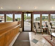
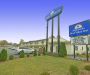
AMERICAS BEST VALUE INN
Johnson And Wales Inn
RAMADA HOTEL & CONFERENCE CENTER
Videos from this area
These are videos related to the place based on their proximity to this place.
HGTV My house is worth what? Pawtucket, RI
pawtucket RI homeowners want to know how much their house is worth.
Boys Soccer Needham vs. Attleboro
MIAA First Round #9 Needham traveled to #8 Attleboro for a first round game in the Division One South bracket of the MIAA Tournament. The only goal was scored at 18:26 of the first half....
City Worker Killed in Attleboro
An Attleboro city worker was killed Monday morning after being struck by a car while on the job.
Four arrested after incident at Attleboro gas station
Four young men were arrested Saturday after a weapon was shown during an incident at an Attleboro gas station.
Attleboro city worker struck and killed by minivan
Police identifed the Attleboro city worker who was hit and killed by a minivan Monday morning while working on a water main break.
Driving from South Attleboro to home (1/3)
First of three parts of my trip back from Pizzeria UNO's Restaurant in South Attleboro. I stopped the tape, however, when we reached Court Street in Brockton.
Acela and Regional in Attleboro, MA
On a trip away from our usual stomping grounds in NY's Hudson Valley, we catch first an AEM-7 Regional and then the Acela Express passing through the Attleboro MBTA station. The latter was...
MBTA Commuter Rail, Acela Express and Northeast Regional at Attleboro
[with NERailfanning] A selection of trains as seen from the high level outbound platform at the Attleboro T station.
MBTA Commuter Rail arriving at Attleboro
This would have been uploaded yesterday if it wasn't for the fact the hotel that I am staying at has horrible Wi-Fi. Train 811. iPod direct upload.
teen with knife forces evacuation of south attleboro restaur
teen with knife forces evacuation of south attleboro restaurant.
Videos provided by Youtube are under the copyright of their owners.
Attractions and noteworthy things
Distances are based on the centre of the city/town and sightseeing location. This list contains brief abstracts about monuments, holiday activities, national parcs, museums, organisations and more from the area as well as interesting facts about the region itself. Where available, you'll find the corresponding homepage. Otherwise the related wikipedia article.
Attleboro, Massachusetts
Attleboro is a city in Bristol County, Massachusetts, United States. It was once known as "The Jewelry Capital of the World" for its many jewelry manufacturers. According to the 2010 census, Attleboro had a population of 43,593 in 2010. Attleboro is located about 10 miles west of Taunton, the same distance to Providence, Rhode Island, 18 miles northwest of Fall River, and 39 miles south of Boston.
North Seekonk, Massachusetts
North Seekonk is a census-designated place (CDP) in the town of Seekonk in Bristol County, Massachusetts, United States. The population was 2,643 at the 2010 census.
South Attleboro, Massachusetts
South Attleboro is a neighborhood of Attleboro, a city in Bristol County, Massachusetts, United States. It is perhaps best known for the South Attleboro station on the Attleboro/Stoughton Line of the MBTA Commuter Rail. U.S. 1 and Route 1A pass through the area, which lies just north of the Rhode Island state line. The neighborhood is frequently referenced in the animated series Family Guy, as being home of "Jack's Joke Shop.
South Attleboro (MBTA station)
South Attleboro is an MBTA Commuter Rail commuter rail station on the MBTA's Providence/Stoughton Line located in the South Attleboro section of Attleboro, Massachusetts. The station, situated underneath Newport Avenue, is the MBTA's southernmost station on the line in Massachusetts. It includes a large park-and-ride lot to serve commuters from the nearby cites of Pawtucket and Central Falls.
Capron Park Zoo
The Capron Park Zoo is a small 8-acre zoo that opened in 1937 in Attleboro, Massachusetts, USA. It is home to about 100 animals representing 44 species, Capron Park Zoo is an accredited member of the Association of Zoos and Aquariums (AZA) and Association of Zoo and Aquarium Docents (AZAD). It participates in the Species Survival Plan program.
WWBB
WWBB (101.5 FM, "B101" or "Big Hits B101") is a radio station in Providence, Rhode Island. The station mainly plays classic hits and oldies from the 1960s, 1970s, and early 1980s. The station is also carried as background music on several Public-access television cable TV in southeastern Massachusetts.
Slater Park
Slater Park is the oldest and largest public park in Pawtucket, Rhode Island. The park is named after Samuel Slater, a famous American industrialist who constructed America's first water-powered mill in Pawtucket. The park lies on the banks of the beautiful Ten Mile River and features the 1685 Daggett House, the oldest house in Pawtucket. The park was added to the National Register of Historic Places in 1976. It also features an original Loof Carousel.
Attleboro High School
Attleboro High School is a public high school located in Attleboro, Massachusetts. The school is located at 100 Rathbun Williard Drive. The school has an approximate student enrollment of 1,700 students in grades 9-12. The schools mascot is the Bombardiers and the school colors are Royal Blue, Silver, and White.


