Safety Score: 2,8 of 5.0 based on data from 9 authorites. Meaning we advice caution when travelling to Poland.
Travel warnings are updated daily. Source: Travel Warning Poland. Last Update: 2024-04-29 08:03:39
Explore Kijewo
The district Kijewo of Prawobrzeże in Szczecin (Województwo Zachodniopomorskie) is located in Poland about 275 mi west of Warsaw, the country's capital.
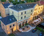
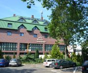
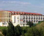
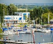
If you need a place to sleep, we compiled a list of available hotels close to the map centre further down the page.
Depending on your travel schedule, you might want to pay a visit to some of the following locations: Stare Czarnowo, Szczecin, Kobylanka, Bielice and Police. To further explore this place, just scroll down and browse the available info.
Local weather forecast
Todays Local Weather Conditions & Forecast: 23°C / 74 °F
| Morning Temperature | 10°C / 50 °F |
| Evening Temperature | 24°C / 76 °F |
| Night Temperature | 16°C / 60 °F |
| Chance of rainfall | 0% |
| Air Humidity | 52% |
| Air Pressure | 1020 hPa |
| Wind Speed | Moderate breeze with 9 km/h (6 mph) from North-West |
| Cloud Conditions | Overcast clouds, covering 98% of sky |
| General Conditions | Light rain |
Wednesday, 1st of May 2024
22°C (72 °F)
16°C (60 °F)
Broken clouds, moderate breeze.
Thursday, 2nd of May 2024
23°C (73 °F)
16°C (61 °F)
Sky is clear, moderate breeze, clear sky.
Friday, 3rd of May 2024
20°C (69 °F)
13°C (56 °F)
Light rain, gentle breeze, broken clouds.
Hotels and Places to Stay
Bończa
Agape Noclegi
Zbyszko C.U.I.B.
Panorama
Płonia
SenMarina
Videos from this area
These are videos related to the place based on their proximity to this place.
trip van Dabie naar centrum Szczecin (de markt Ma
Dinsdag 23 juli 15:03 uur in de volle hiite..pfff maar wat hou ik van die stad...
Wspomnienie lata 2010 (En) Memory of summer 2010
Ostatnie dni wakacji na stacji Szczecin Dąbie Nagrane dwa składy Przewozów Regionalnych oraz dwa pozdrowienia. Jedno, ładne Rp1 od mechanika EN57, a drugie od konduktora składu SA110...
EP07-479 + TLK + podsył
Skład TLK nr 85104 na czele z lokomotywą EP07-479 jadący ze Szczecina Gł do Gdańska GŁ z dwoma dodatkowymi wagonami (sypialny i 2Kl) jako podsył, opuszcza stację Szczecin Dąbie w dniu...
III LO im. M. Kopernika w Szczecinie
III LO im. M. Kopernika w Szczecinie, ul. Pomorska 150 Realizacja: http://www.yankistudio.pl ; http://sirino.com.pl.
Linia 110 Turowo Pn Radwanki Cz I
(Pl, En) Projekt Jeziorsko - wirtualna mapa na symulatorze kolejowym. "Węzeł Turowo" jest ostatnią brakującą częścią tego projektu. Linia 110 jest fragmentem tej części mapy. Już...
Rozkładanie Tarp DD Hammocks 3x3
Kilka sposobów na rozbicie płachty biwakowej DD Hammocks wielkości 3x3m. Płachty biwakowe DD Hammocks dostępne na stronie: http://bushcraftowy.pl Płachtę biwakową rozstawiali: - Krzysztof...
2012-05-15 Dwie odsłony EIC 81402 ''Błękitna Fala'' z EP07-1027
Dwie odsłony składu pociągu "Błękitna Fala" w okolicach stacji Szczecin Dąbie w jego ostatnim dniu kursowania (06-05-2012) podczas długiego majowego weekendu. Pierwsze nagranie - Linia...
Videos provided by Youtube are under the copyright of their owners.
Attractions and noteworthy things
Distances are based on the centre of the city/town and sightseeing location. This list contains brief abstracts about monuments, holiday activities, national parcs, museums, organisations and more from the area as well as interesting facts about the region itself. Where available, you'll find the corresponding homepage. Otherwise the related wikipedia article.
Zdunowo, Szczecin
Zdunowo is a part of the Szczecin City, Poland situated on the right bank of Oder river, east of the Szczecin Old Town, and Szczecin-Dąbie.
Płonia
Płonia is a part of the city of Szczecin, Poland. It is situated on the right bank of Oder river, east of the Szczecin Old Town, and south-east of Szczecin-Dąbie.
Śmierdnica
Śmierdnica is a part of the Szczecin City, Poland situated on the right bank of Oder river, east of the Szczecin Old Town, and south-east of Szczecin-Dąbie.
Osiedle Słoneczne, Szczecin
Osiedle Słoneczne is a municipal neighborhood of the city of Szczecin, Poland situated on the right bank of Oder river, east of the Szczecin Old Town, and south of Szczecin-Dąbie.
Zdroje, Szczecin
Zdroje is a municipal neighborhood of the Szczecin City, Poland situated on the right bank of Oder river, south-east of the Szczecin Old Town, and south-west of Szczecin-Dąbie. Before 1945 when Szczecin (Stettin) was a part of Germany, the name of this suburb was Stettin-Finkenwalde. It was the site of Dietrich Bonhoeffer's illegal Theological Seminary of the Confessing Church between 1935-37.
Transmitter Szczecin-Kołowo
Transmitter Szczecin-Kołowo is a transmission facility for FM and TV situated at Szczecin-Kołowo in Poland at {{#invoke:Coordinates|coord}}{{#coordinates:53|20|00|N|14|40|30|E| | |name= }}. h The antenna tower is a 267 metre tall guyed mast. It is located at the highest point of a beech forest in Szczecin, and transmits several stations. It was built in 1963.
Szczecin-Dąbie Airstrip
Szczecin-Dąbie Airstrip is a small airstrip on the Eastern bank of the Oder river in Dąbie, Szczecin, Poland. The original grass landing strip was built in 1921 as Stettin Airfield (at that time belonging to Germany) and was used for domestic flights of Deutsche Luft Hansa over the following years. After World War II, LOT began serving the airfield, which remained the only one in Szczecin until 23 May 1967, when Szczecin-Goleniów Airport was opened.
Szczecin Landscape Park
Szczecin Landscape Park (Szczeciński Park Krajobrazowy "Puszcza Bukowa") is a protected area in north-western Poland, established in 1981 and covering an area of 91 square kilometres . Its full name refers to the forest known as Puszcza Bukowa ("beech forest"), which covers most of the area of the Park. The Park lies within West Pomeranian Voivodeship, partly within the city of Szczecin, and partly in Gryfino County.
Bystra, West Pomeranian Voivodeship
Bystra (formerly German Bergland) is a settlement in the administrative district of Gmina Goleniów, within Goleniów County, West Pomeranian Voivodeship, in north-western Poland. It lies approximately 12 kilometres south-west of Goleniów and 10 km north-east of the regional capital Szczecin. Before 1945 the area was part of Germany. For the history of the region, see History of Pomerania.
Czarna Łąka
Czarna Łąka is a village in the administrative district of Gmina Goleniów, within Goleniów County, West Pomeranian Voivodeship, in north-western Poland. It lies approximately 12 kilometres south-west of Goleniów and 11 km north-east of the regional capital Szczecin. Before 1945 the area was part of Germany. For the history of the region, see History of Pomerania. The village has a population of 350.
Kliniska Wielkie
Kliniska Wielkie is a village in the administrative district of Gmina Goleniów, within Goleniów County, West Pomeranian Voivodeship, in north-western Poland. It lies approximately 11 kilometres south of Goleniów and 14 km east of the regional capital Szczecin. Before 1945 the area was part of Germany. For the history of the region, see History of Pomerania.
Pucice
Pucice is a village in the administrative district of Gmina Goleniów, within Goleniów County, West Pomeranian Voivodeship, in north-western Poland. It lies approximately 12 kilometres south-west of Goleniów and 12 km east of the regional capital Szczecin. Before 1945 the area was part of Germany. For the history of the region, see History of Pomerania. The village has a population of 490.
Załom, Goleniów County
Załom is a village in the administrative district of Gmina Goleniów, within Goleniów County, West Pomeranian Voivodeship, in north-western Poland. It lies approximately 14 kilometres south-west of Goleniów and 11 km east of the regional capital Szczecin. Before 1945 the area was part of Germany. For the history of the region, see History of Pomerania.
Będogoszcz
Będogoszcz is a settlement in the administrative district of Gmina Stare Czarnowo, within Gryfino County, West Pomeranian Voivodeship, in north-western Poland. Before 1945 the area was part of Germany. For the history of the region, see History of Pomerania.
Binówko
Binówko is a settlement in the administrative district of Gmina Stare Czarnowo, within Gryfino County, West Pomeranian Voivodeship, in north-western Poland. It lies approximately 12 kilometres north-west of Stare Czarnowo, 13 km north-east of Gryfino, and 12 km south of the regional capital Szczecin. Before 1945 the area was part of Germany. For the history of the region, see History of Pomerania.
Binowo
Binowo is a village in the administrative district of Gmina Stare Czarnowo, within Gryfino County, West Pomeranian Voivodeship, in north-western Poland. It lies approximately 10 kilometres west of Stare Czarnowo, 13 km north-east of Gryfino, and 13 km south of the regional capital Szczecin. Before 1945 the area was part of Germany. For the history of the region, see History of Pomerania. The village has a population of 270.
Dobropole Gryfińskie
Dobropole Gryfińskie is a village in the administrative district of Gmina Stare Czarnowo, within Gryfino County, West Pomeranian Voivodeship, in north-western Poland. Before 1945 the area was part of Germany. For the history of the region, see History of Pomerania.
Gliniec, West Pomeranian Voivodeship
Gliniec (German Neu Glien) is a settlement in the administrative district of Gmina Stare Czarnowo, within Gryfino County, West Pomeranian Voivodeship, in north-western Poland. It lies approximately 4 kilometres west of Stare Czarnowo, 17 km east of Gryfino, and 17 km south-east of the regional capital Szczecin. Before 1945 the area was part of Germany. For the history of the region, see History of Pomerania.
Kołówko
Kołówko is a settlement in the administrative district of Gmina Stare Czarnowo, within Gryfino County, West Pomeranian Voivodeship, in north-western Poland. It lies approximately 7 kilometres north-west of Stare Czarnowo, 17 km north-east of Gryfino, and 14 km south-east of the regional capital Szczecin. Before 1945 the area was part of Germany. For the history of the region, see History of Pomerania.
Kołowo
Kołowo is a village in the administrative district of Gmina Stare Czarnowo, within Gryfino County, West Pomeranian Voivodeship, in north-western Poland. It lies approximately 9 kilometres north-west of Stare Czarnowo, 16 km north-east of Gryfino, and 13 km south-east of the regional capital Szczecin. Before 1945 the area was part of Germany. For the history of the region, see History of Pomerania.
Modrzewko
Modrzewko is a settlement in the administrative district of Gmina Stare Czarnowo, within Gryfino County, West Pomeranian Voivodeship, in north-western Poland. It lies approximately 8 kilometres west of Stare Czarnowo, 14 km north-east of Gryfino, and 14 km south-east of the regional capital Szczecin. Before 1945 the area was part of Germany. For the history of the region, see History of Pomerania.
Osetne Pole
Osetne Pole is a settlement in the administrative district of Gmina Stare Czarnowo, within Gryfino County, West Pomeranian Voivodeship, in north-western Poland. It lies approximately 9 kilometres north-west of Stare Czarnowo, 14 km north-east of Gryfino, and 13 km south-east of the regional capital Szczecin. Before 1945 the area was part of Germany. For the history of the region, see History of Pomerania.
Węglino
Węglino is a settlement in the administrative district of Gmina Stare Czarnowo, within Gryfino County, West Pomeranian Voivodeship, in north-western Poland. It lies approximately 11 kilometres north-west of Stare Czarnowo, 14 km north-east of Gryfino, and 11 km south of the regional capital Szczecin. Before 1945 the area was part of Germany. For the history of the region, see History of Pomerania.
Płonia River
The Płonia is a river in West Pomeranian Voivodeship, Poland, a right tributary of the Oder river, with a length of 74.3 km and a basin area of 1101 km². Its source is 1.5 south of Barlinek. The river flows northwest through Miedwie and Płoń lake. The Płonia flows into Dąbie Lake in Dąbie, Szczecin. The upper portion of Płonia is comparatively unpolluted, therefore trout can be found there.
Trzebuskie Łęgi, West Pomeranian Voivodeship
Trzebuskie Łęgi is a village in the administrative district of Gmina Goleniów, within Goleniów County, West Pomeranian Voivodeship, in north-western Poland. Before 1945 the area was part of Germany. For the history of the region, see History of Pomerania.


!['KJS Szutry Szczecin / on-board Chevy Sprint Turbo [PS4]' preview picture of video 'KJS Szutry Szczecin / on-board Chevy Sprint Turbo [PS4]'](https://img.youtube.com/vi/ArAZumsprT8/mqdefault.jpg)


