Safety Score: 3,0 of 5.0 based on data from 9 authorites. Meaning we advice caution when travelling to New Zealand.
Travel warnings are updated daily. Source: Travel Warning New Zealand. Last Update: 2024-05-05 08:24:42
Delve into Wattle Downs
The district Wattle Downs of Takanini in Auckland (Auckland) is a district located in New Zealand about 294 mi north of Wellington, the country's capital town.
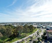
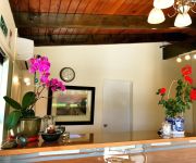
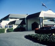
In need of a room? We compiled a list of available hotels close to the map centre further down the page.
Since you are here already, you might want to pay a visit to some of the following locations: Auckland, Hamilton, Whangarei, Tauranga and Rotorua. To further explore this place, just scroll down and browse the available info.
Local weather forecast
Todays Local Weather Conditions & Forecast: 18°C / 64 °F
| Morning Temperature | 14°C / 56 °F |
| Evening Temperature | 13°C / 56 °F |
| Night Temperature | 11°C / 52 °F |
| Chance of rainfall | 2% |
| Air Humidity | 64% |
| Air Pressure | 1019 hPa |
| Wind Speed | Light breeze with 5 km/h (3 mph) from South |
| Cloud Conditions | Overcast clouds, covering 95% of sky |
| General Conditions | Light rain |
Tuesday, 7th of May 2024
15°C (59 °F)
9°C (48 °F)
Light rain, gentle breeze, few clouds.
Wednesday, 8th of May 2024
14°C (58 °F)
9°C (48 °F)
Sky is clear, gentle breeze, clear sky.
Thursday, 9th of May 2024
15°C (59 °F)
11°C (51 °F)
Light rain, gentle breeze, overcast clouds.
Hotels and Places to Stay
M Central Apartments
Proximity Apartments Manukau
Grange Lodge Motel
Rayland Motel
Bruce Pulman Lodge
Asure Camelot Arms Motor Lodge
ALLENBY PARK HOTEL
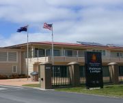
Papakura Motor Lodge & Motel
Dannemora Motor Inn
Drury Motor Lodge
Videos from this area
These are videos related to the place based on their proximity to this place.
Manurewa Parenting Hub
Recognising the challenges that parents face in raising their families, particularly in poorer socioeconomic areas, Linda Biggs launched Manurewa Parenting Hub (MPH) in 2008. The story since...
GTA IV Tank Mod Evidence
I'm sick of all the people claiming my mod to be fake so i spent five minutes making this video to prove to all the losers that it isn't fake. and I bet ya they are still not gonna stop after this.
Sant Baba Amar Singh (Nanaksar NZ)
Gurbani Vichar by Sant Baba Amar Singh Ji at Nanaksar New Zealand on 08/08/13.
Sant Baba Amar Singh Ji (Nanaksar NZ)
Gurbani Vichar by Sant Baba Amar Singh Ji at Nanaksar New Zealand on 10/08/13.
BMX joy riding
riding with mate josh give us a like if you enjoyed and subscribe for motocross and other adventures. Cheers.
Global One iGO SHOPPING MALL, THE SMARTER WAY TO SHOP- by Dallas Broughton
http://ultimatepowerprofits.com/dallasb Global One igo Shopping Mall is by far the Smarter way to SHOP. Do you shop online? Are you looking for a bargin or d...
Sant Baba Amar Singh Ji (Nanaksar NZ)
Gurbani Vichar by Sant Baba Amar Singh Ji at Nanaksar New Zealand on 09/08/13.
Videos provided by Youtube are under the copyright of their owners.
Attractions and noteworthy things
Distances are based on the centre of the city/town and sightseeing location. This list contains brief abstracts about monuments, holiday activities, national parcs, museums, organisations and more from the area as well as interesting facts about the region itself. Where available, you'll find the corresponding homepage. Otherwise the related wikipedia article.
Takanini
Takanini is a suburb of Auckland, in northern New Zealand. Located on the shores of the Pahurehure Inlet, it is located at {{#invoke:Coordinates|coord}}{{#coordinates:-37.0429|174.9189|region:NZ-AUK_type:city|||||| |primary |name= }}, 28 kilometres southeast of the Auckland CBD. The suburb is home to the headquarters of New Zealand's largest dairy company Fonterra, the new Addison housing development, as well as international horse breeding facilities throughout the area.
Manurewa
Manurewa is a major suburb in South Auckland, New Zealand. It was part of Manukau City before the creation of the Auckland super city in 2010. It is located 6 km south of the Manukau city centre, and 26 km southeast of the Auckland central business district. Manurewa is Māori for "drifting kite". The name refers to a kite flying competition where a kite line was severed and drifted away. The kite's owner was the chief Tamapahore who had a pā (fortified village) on Matuku-tururu (Wiri Mountain).
Manurewa Railway Station
Manurewa Railway Station is on the Southern Line of the Auckland railway network. The station has a side platform layout connected by a pedestrian footbridge. Access is from both Selwyn Road and SouthMall Shopping Centre. The station has a large park-and-ride facility and interchange with many local bus services.
Homai
Suburb:Homai City:Manukau Island:North Island Surrounded by - to the north - to the east - to the south-east - to the south-west - to the north-west Manukau city centre Hill Park Manurewa Clendon Park Wiri Homai is an Auckland suburb. Homai is under the local governance of the Manukau City Council. According to the 2001 census, Homai has a population of 7434.
Roscommon School
Roscommon School is a Primary School (years 1-6) in Manurewa, a suburb of Manukau City, Auckland Region, New Zealand.
Clendon Park School
Clendon Park School is a primary school (years 1-8) in Manurewa, a suburb of Manukau City, Auckland Region, New Zealand. Clendon has seven Bilingual Units (Year 1-8). A Maori Bilingual unit (Te Whanau Awhina) was started in 2000, the children often achieve above the national norms. There are five classes in the Maori unit. A Samoan unit was started in 2006.
Manurewa Central School
Manurewa Central School is a Primary School (years 1-6) in Manurewa, a suburb of Manukau City, Auckland Region, New Zealand. Manurewa Central has celebrated its 100 year school reunion on October 20–22, 2006. Manurewa Central is a Duffy Books in Homes school which provides five or more free books to students annually.
Manurewa East School
Manurewa East School is a Primary School (years 1-6) in Manurewa, a suburb of Manukau City, Auckland Region, New Zealand. Its sister school is St Cuthbert’s College.
Southmall Manurewa
Southmall Manurewa is a shopping centre located in Manurewa, a suburb of Auckland, New Zealand, adjacent to the Manurewa Train Station, 24.7 kilometres south-southeast of the Auckland CBD.
Takanini Railway Station
Takanini Railway Station is on the Southern Line of the Auckland railway network. The station has an island platform layout and is accessed from Manuroa Road, Station Road and Taka Street.
Homai Railway Station
Homai Railway Station is on the Southern Line of the Auckland railway network. It has an Island platform layout. A bus stop and a park and ride facility are located adjacent to the station.
Alfriston College
Alfriston College is a secondary school in the suburb of Alfriston in Auckland, New Zealand. The College opened in 2004, and along with Botany Downs Secondary College, was the first state secondary school to be built in Auckland in 25 years (the last was Macleans College in 1980). It opened with year 9 students and expanded to cover more senior classes each year as the original students aged. From 2008, all secondary years (9-13) have been taught.
Manurewa High School
Manurewa High School is one of the larger Secondary Schools in New Zealand, with an enrolment reaching 2,200 students. Manurewa High School is a multi-cultural school. It has Pacific 42%, Māori 25%, Asian 19%, New Zealand European/Pākehā 12% Other ethnicity 2%.
Conifer Grove
Conifer Grove is a suburb of Auckland, in northern New Zealand. Located on the eastern shores of the Pahurehure Inlet, on the Manukau Harbour, under authority of the Auckland Council. The suburb makes up the western side of the Takanini urban area and is in the Manurewa-Papakura ward of Auckland city.
Te Mahia Railway Station
Te Mahia Railway Station is on the Southern Line of the Auckland railway network. It has an island platform layout and is reached by level crossings from Great South Road and Fergusson Street. The station was renamed from Mahia to Te Mahia from 9 February 1951 by a decision of the New Zealand Geographic Board There have been proposals to relocate this station approximately 200m north to a more visible location next to the Great South Road, near the overbridge.
James Cook High School
James Cook High School is a State Co-Ed Secondary School in the South Auckland suburb of Manurewa, New Zealand.
Manurewa Intermediate
Manurewa Intermediate School is a large multicultural school, located in central Manurewa, a suburb of Auckland's Manukau City, New Zealand.
Clendon
Clendon is a suburb of Auckland city in northern New Zealand. It is located to the west of Manurewa. The suburb is in the Manurewa-Papakura ward, one of the thirteen administrative divisions of Auckland City. Clendon is named after Captain James Reddy Clendon who in 1840 traded land he owned in the Bay of Islands with the newly formed New Zealand Government for 10,000 acres (40 km²) of land, then south of Auckland CBD. Clendon has a young, diverse and rapidly growing population.
Wattle Downs
Suburb:Wattle Downs City:Manukau Island:North Island Surrounded by - to the north - to the east - to the south - to the west Manurewa Takanini Manukau Harbour Wattle Cove Wattle Downs is a suburb of Manukau, Auckland, in northern New Zealand. The suburb is located on the Mahia Park peninsula on the Manukau Harbour, along with Wattle Cove. It is 25 kilometres south of Auckland CBD and 10 kilometres south of Manukau City.
Reremoana Primary School
Reremoana School is a Primary School (years 1-8) in Wattle Downs a suburb in the Manurewa Ward, in Manukau City, Auckland Region, New Zealand. Reremoana opened February 8, 2006.
Auckland Botanic Gardens
Auckland Botanic Gardens, Auckland, New Zealand is a botanical garden that covers 64 hectares in Manurewa, South Auckland. The first purchase of land by the Auckland Regional Authority (ARA) – predecessor of Auckland Regional Council (ARC) – dates back to 1968. Developments started in 1973. The garden was officially opened to the public in 1982. In that same year the first (and until now only) Visitors Guide was published. It now holds more than 10,000 plants.
Manurewa East
Manurewa East is a suburb of Manukau City in Auckland, New Zealand, under the local governance of Manukau City Council. It is located to the north of Randwick Park and south of The Gardens.
Conifer Grove School
Conifer Grove School is a primary and intermediate school in Conifer Grove, Takanini. The school is governed by a board of trustees, which includes parent representatives. The school teaches the subjects Literacy, Maths, Arts, PE, Social Sciences & Technology. The school's principal is Jan Robertson.
Clendon Park
Clendon Park is a suburb of Auckland city in northern New Zealand. It is located to the west of Manurewa. The suburb is in the Manurewa-Papakura ward, one of the thirteen administrative divisions of Auckland City.
Te Papapa Railway Station
Te Papapa Railway Station is on the Onehunga Branch Line of the Auckland railway network. It has a side platform layout and is reached from Mays Rd. The station was opened on 18 September 2010 and services started on 19 September 2010. The service is very popular with local commuters.


