Safety Score: 3,0 of 5.0 based on data from 9 authorites. Meaning we advice caution when travelling to New Zealand.
Travel warnings are updated daily. Source: Travel Warning New Zealand. Last Update: 2024-04-29 08:03:39
Discover Penrose
The district Penrose of MOUNT WELLINGTON in Auckland (Auckland) is a district in New Zealand about 302 mi north of Wellington, the country's capital city.
Looking for a place to stay? we compiled a list of available hotels close to the map centre further down the page.
When in this area, you might want to pay a visit to some of the following locations: Auckland, Hamilton, Whangarei, Tauranga and Rotorua. To further explore this place, just scroll down and browse the available info.
Local weather forecast
Todays Local Weather Conditions & Forecast: 17°C / 63 °F
| Morning Temperature | 12°C / 54 °F |
| Evening Temperature | 15°C / 60 °F |
| Night Temperature | 14°C / 57 °F |
| Chance of rainfall | 0% |
| Air Humidity | 63% |
| Air Pressure | 1029 hPa |
| Wind Speed | Gentle Breeze with 9 km/h (5 mph) from West |
| Cloud Conditions | Broken clouds, covering 54% of sky |
| General Conditions | Broken clouds |
Tuesday, 30th of April 2024
18°C (64 °F)
14°C (57 °F)
Scattered clouds, moderate breeze.
Wednesday, 1st of May 2024
18°C (64 °F)
14°C (57 °F)
Moderate rain, fresh breeze, scattered clouds.
Thursday, 2nd of May 2024
16°C (61 °F)
14°C (58 °F)
Light rain, moderate breeze, broken clouds.
Hotels and Places to Stay
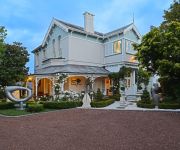
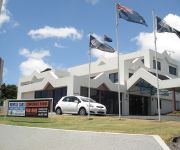
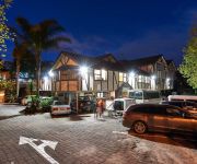
GREENLANE MANOR MOTEL
Cotter House
BEST WESTERN ELLERSLIE INTL
Parklane Motor Lodge
Cornwall Park Motor Inn
Mount Richmond Hotel
Novotel Auckland Ellerslie
Airport Harbour View Motel
Royal Park Lodge
Oak Tree Motel
Videos from this area
These are videos related to the place based on their proximity to this place.
APOLLO 6 BERTH | New Zealand Campervans | Mr Stinge Motorhomes
Book the Apollo 6 Berth at http://www.campers.misterstinge.com or search & compare more Campervan brands and low prices. Mr Stinge is proud to bring you the cheapest and lowest campervan &...
THE HIPPIE CAMPER | NZ Campervans | Mr Stinge Motorhomes
Book the HIPPIE CAMPER at http://www.campers.misterstinge.com. Ideal for cheap roadies and summer getaways with mates! Search & Compare more Campervan brands and low prices. Mr Stinge is ...
CHEAPA 4 BERTH | NZ Campervans | Mr Stinge Motorhomes
Book the Cheapa 4 Berth at http://www.campers.misterstinge.com. Search & Compare more Campervan brands and low prices. Mr Stinge is proud to bring you the cheapest and lowest campervan ...
APOLLO 4 BERTH DELUXE | NZ Campervans | Mr Stinge Motorhomes
Book the Apollo 4 Berth Deluxe at http://www.campers.misterstinge.com Search & Compare more Campervan brands and low prices. Mr Stinge is proud to bring you the cheapest and lowest campervan ...
APOLLO HI TOP CAMPER | NZ Campervan Rental | Mr Stinge Motorhomes
Book the "Apollo Hi Top" at http://www.misterstinge.com or search & compare more Campervan brands and low prices. Mr Stinge is proud to bring you the cheapest and lowest campervan & motorhome.
CHEAPA 6 BERTH | NZ Campervan Rental | Mr Stinge Motorhomes
Book the "Cheapa 6 Berth" at http://campers.misterstinge.com or search & compare more Campervan brands and low prices. Mr Stinge is proud to bring you the cheapest and lowest campervan ...
APOLLO 2 BERTH S/T | NZ Campervan Rental | Mr Stinge Motorhomes
Book the "Apollo 2 Berth" at http://www.misterstinge.com or search & compare more Campervan brands and low prices. Mr Stinge is proud to bring you the cheapest and lowest campervan & motorhome ...
Let's Play Humble Bundle 8 - Awesomenauts
Humble Bundle - "Pay what you want. Support charity. Get cross-platform, DRM-free games." - http://www.humblebundle.com Humble Bundle 8 includes the following games: Awesomenauts Capsized...
The Great Minecraft Misadventure with Mjukilop - Episode 05: Completely Organised
MrMjukilop: http://www.youtube.com/user/MrMjukilop The Great Minecraft Misadventure is a journey across the land of Minecraft accompanied by Mjukilop. With no specific goal in mind, we set...
Minecraft FTB New World: Episode 2 - Hardest Quest Ever
Feed The Beast: http://feed-the-beast.com/ Feed The Beast was originally a mod-pack for minecraft that came with it's own launcher to allow easy deployment of mods. Eventually this launcher...
Videos provided by Youtube are under the copyright of their owners.
Attractions and noteworthy things
Distances are based on the centre of the city/town and sightseeing location. This list contains brief abstracts about monuments, holiday activities, national parcs, museums, organisations and more from the area as well as interesting facts about the region itself. Where available, you'll find the corresponding homepage. Otherwise the related wikipedia article.
Mount Smart Stadium
Mt Smart Stadium, (also known as Ericsson Stadium in the 1990s), is a stadium in Auckland, New Zealand. It is the home ground of National Rugby League team, the New Zealand Warriors. Built within the quarried remnants of the Mount Smart volcanic cone, it is located 10 kilometres south of the city centre, in the suburb of Penrose.
Mount Wellington, New Zealand
Mount Wellington is a peak and a suburb in Auckland City, New Zealand
Penrose, New Zealand
Penrose is an industrial suburb in Auckland City, New Zealand. It is located to the southeast of the city centre, at a distance of about nine kilometres, between the suburbs of Oranga and Mount Wellington, and close to the Mangere Inlet, an arm of the Manukau Harbour. According to the 2001 census, Penrose has a population of only 573, due to the high intensity of industrial and commercial sites in the area.
Ellerslie, New Zealand
Ellerslie is a suburb of the city of Auckland, New Zealand. It is seven kilometres to the southeast of the city centre, close to State Highway 1. A largely residential suburb, the area's best known feature is Auckland's main horse racing course, Ellerslie Racecourse, as well as for being the original site of the Ellerslie Flower Show.
Westfield Railway Station
Westfield Railway Station is located on the Eastern and Southern Lines of the Auckland Railway Network. It is near Westfield Junction, which is the junction of the Eastern and Southern Lines. It has an island platform layout and can be reached from a pedestrian overbridge at the end of Portage Road. The overbridge also spans the adjacent Westfield marshalling yards and gives access to KiwiRail's operations centre and locomotive facility.
Ellerslie Railway Station
Ellerslie Railway Station is on the Southern Line of the Auckland railway network. It has an island platform.
Southdown Railway Station
Southdown Railway Station is an unused station at Southdown on the Southern Line of the Auckland suburban railway network. It is double tracked and has an island platform layout. Services were withdrawn by the Auckland Regional Transport Authority (ARTA) on 30 May 2004 due to low patronage and safety reasons.
Penrose Railway Station
Penrose Station is a railway station in Penrose, Auckland City, on the Southern Line of the Auckland railway network, New Zealand. It has an island platform and is reached by an over bridge from Station Road and Great South Road. It still has its original wooden station building on the platform. There is also an additional platform serving the Onehunga Line along Station Road.
Favona
Favona is mostly industry-dominated suburb of Auckland, New Zealand, and is part of the Mangere area. The suburb is in the Manukau ward, one of the thirteen administrative divisions of Auckland city, and is under governance of the Auckland Council. The area has a long history of habitation, due to its fertile lands, a productive harbour, and proximity to the Manukau-Tamaki isthmus. Māori of Ngāti Whātua were the inhabitants until they were supplanted by European farmers in the 19th century.
Southdown, New Zealand
Southdown is an industrial suburb of Auckland City, New Zealand. The former main company in the suburb was the Southdown Freezing Works, part of a large industrial zone located near the main trunk railway at this point. The buildings were decommissioned during the 1980s & 1990s releasing large areas of land to be redeveloped as office parks. For many years the abattoirs located here were discharging large amounts of untreated waste into the Manukau Harbour.
Greenlane
Greenlane is a suburb of Auckland, New Zealand. The Greenlane shops are the main shopping centre for the suburb of Epsom and are situated at the intersection of Manukau Road and Green Lane West. On the Northern side of Green Lane are located the Alexandra Park Raceway and the Epsom Showgrounds; on the southern side is Greenlane Hospital, Cornwall Park, and One Tree Hill Domain.
Michael Park School
Michael Park School is a Waldorf school located in Auckland, New Zealand The school takes students from age 4 to school-leaving age. The Steiner School refers to the years 2 to 13 as Class 1 to Class 12.
Sylvia Park
Sylvia Park is a large business park and shopping centre in the Auckland, New Zealand suburb of Mount Wellington. Less commonly known, the area around the centre (which includes some residential and other commercial developments) is also called Sylvia Park (the centre takes its name from the area, not vice versa, but Sylvia Park is not officially a suburb).
Mountainside Lutheran Church, Auckland
Mountainside Lutheran Church is a Lutheran Church based in Auckland, New Zealand. It was commemorated on 27 May 2000 replacing a smaller Our Saviour Lutheran Church and also merging with another Auckland based sister Lutheran congregation, St Johns Lutheran Church (Mt Eden, Auckland) to form one single congregation for the whole of Auckland. Its origins date back as far as 1907. It currently has a congregation of approximately 150 members.
Bailey Road School, Auckland
Bailey Road School is a primary school in the Auckland, New Zealand suburb of Mt Wellington.
Panmure District School
Panmure District School is a Primary School (Yr 0-Yr 8) in the suburb of Panmure, New Zealand. The school is located on Mt. Wellington Highway, in the view of Mount Wellington . It is the oldest school in the Panmure area.
One Tree Hill College
One Tree Hill College is a state coeducational secondary school located in the district of Penrose in Auckland, New Zealand. One Tree Hill College, formerly Penrose High School, opened on 1 February 1955. In 2009 it had a student body of 760 consisting of more than 50 different cultures. The governing body for the college since 1989 has been the One Tree Hill College (formerly Penrose High School) Board of Trustees.
Sylvia Park Railway Station
Sylvia Park railway station is a station on the Eastern line of the passenger rail network in Auckland, New Zealand. It serves the recently opened Sylvia Park mall and the surrounding suburb of Mount Wellington.
Carey Baptist College
Carey Baptist College is a Bible and theological college for training in mission, ministry, and formation based in Auckland, New Zealand. It is the theological college of the Baptist Churches of New Zealand. The college was founded in 1924 as New Zealand Baptist Theological College. It held its first classes in 1926, originally training men to be ministers for Baptist churches in New Zealand.
Ellerslie School
Ellerslie School was founded in 1877, making it one of the oldest schools in Auckland, New Zealand. It is a Year 1 to Year 8 school. Ellerslie has a roll of about 500 students, with most students living in the Ellerslie/Greenlane area. Ellerslie School is in zone for One Tree Hill College. The current principal is Mr Magner. The Intermediate area of the school was upgraded in 2007, and has a multi-purpose technology block.
Mount Smart
Mount Smart is one of the volcanoes in the Auckland Volcanic Field. Quarrying removed almost all of the scoria cone, which was 87 m high (around 57 m higher than the surrounding land). It was the site of a pā and was known as Rarotonga. The former quarry is now the site of Mount Smart Stadium.
Chinese Consulate-General, Auckland
The Consulate-General of the People's Republic of China in Auckland is a diplomatic missions of the People's Republic of China (PRC) at 588 Great South Road in the Greenlane suburb of Auckland City, New Zealand. The consulate serves cities in the Auckland Region, Waikato Region, and the Northland Region.
Waikaraka Cycleway
The Waikaraka Cycleway is an off-road cycleway in the south of Auckland City, New Zealand, running from the Wesley suburb in southern Auckland City along New Zealand State Highway 20 to Onehunga and then continuing along the shoreline of the Manukau Harbour beside mostly industrialised areas until it ends at Pikes Point, near Southdown.
Mount Richmond
Mount Richmond (also Ōtāhuhu) is one of the volcanoes of the Auckland Volcanic Field. A group of scoria mounds up to 50 m high, it has two 50 m wide craters. It was the site of a pā, and retains some Māori earthworks from that time such as kumara pits and terracing.
New Zealand College of Chiropractic
The New Zealand College of Chiropractic is located in Mt Wellington, Auckland, NZ.


