Safety Score: 3,3 of 5.0 based on data from 9 authorites. Meaning please reconsider your need to travel to Netherlands.
Travel warnings are updated daily. Source: Travel Warning Netherlands. Last Update: 2024-04-26 08:02:42
Delve into Slotermeer
The district Slotermeer of Amsterdam in Gemeente Amsterdam (Provincie Noord-Holland) is a district located in Netherlands and is a district of the nations capital.
In need of a room? We compiled a list of available hotels close to the map centre further down the page.
Since you are here already, you might want to pay a visit to some of the following locations: Haarlem, Heemskerk, Heiloo, Utrecht and The Hague. To further explore this place, just scroll down and browse the available info.
Local weather forecast
Todays Local Weather Conditions & Forecast: 10°C / 51 °F
| Morning Temperature | 4°C / 39 °F |
| Evening Temperature | 9°C / 49 °F |
| Night Temperature | 6°C / 42 °F |
| Chance of rainfall | 0% |
| Air Humidity | 55% |
| Air Pressure | 1003 hPa |
| Wind Speed | Gentle Breeze with 7 km/h (4 mph) from East |
| Cloud Conditions | Broken clouds, covering 74% of sky |
| General Conditions | Broken clouds |
Saturday, 27th of April 2024
13°C (55 °F)
11°C (51 °F)
Moderate rain, gentle breeze, overcast clouds.
Sunday, 28th of April 2024
14°C (57 °F)
10°C (49 °F)
Light rain, fresh breeze, overcast clouds.
Monday, 29th of April 2024
15°C (59 °F)
11°C (51 °F)
Light rain, moderate breeze, overcast clouds.
Hotels and Places to Stay
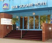
XO Hotels Blue Square
XO Hotels Blue Tower
XO HOTELS COUTURE
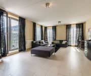
Amsterdam Apartments - Slotervaart Area
Urban Lodge Hotel
CORENDON VITALITY HOTEL AMS
Mercure Hotel Amsterdam Sloterdijk Station
WestCord Fashion Hotel Amsterdam
XO Hotels Park West
Ramada Apollo Amsterdam Centre
Videos from this area
These are videos related to the place based on their proximity to this place.
Amsterdam Tramways Route 12 Kinkerstraat to Haarlemmerweg
Journey along part or Route 12 of the Amsterdam Tramway System between Kinkerstraat/Bilderdijkstraat & Haarlemmerweg. This journey is in the inner north-western parts of Amsterdam.
ZichtOp: Amsterdam (NL) - Slotermeer
Slotermeer is één van de idealistische tuinsteden in het westen van Amsterdam uit de jaren 50 van de vorige eeuw. Nu is het een ware multiculturele wijk die na een jarenlange neergang de...
Dode bij schietpartij Maurits Sabbehof in Amsterdam Slotermeer
Video: Mizzle Media © 2015 http://www.mizzlemedia.nl Bij een schietpartij in een woning aan de Maurits Sabbehof in de wijk Nieuw-West in Amsterdam is een dode gevallen. Volgens de politie...
Buddy Grillbar & Windmill Slotermeer (3.22.13 - Day 995)
Last workday of the week. After some computer repairs the weekend starts and I get combined lunch and dinner at Buddy Grillbar, Burgemeester Van Leeuwenlaan Amsterdam. I admire how Chinese...
Ambulance Helicopter Take Off - Amsterdam Slotermeer
Een ambulance die stijgt na het behandelen van de patient. Het gebeurt in Amsterdam Slotermeer in de buurt van Gerbrandypark.
Dode bij schietpartij aan de Pieter van der Werfstraat in Geuzenveld Amsterdam-West
Video: Mizzle Media © 2015 http://www.mizzlemedia.nl In Amsterdam heeft woensdagavond een schietpartij plaatsgevonden aan de Pieter van der Werfstraat in de wijk Geuzenveld. Daarbij is een...
Man vermoord voor verkeerslichten Jacob Cabeliaustraat in Amsterdam Geuzenveld
Video: Mizzle Media (c) 2013 http://www.michelvanbergen.nl Amsterdam - In de Jacob Cabeliaustraat in Amsterdam is zaterdagmiddag een man doodgeschoten. Rond kwart voor drie werd het ...
Videos provided by Youtube are under the copyright of their owners.
Attractions and noteworthy things
Distances are based on the centre of the city/town and sightseeing location. This list contains brief abstracts about monuments, holiday activities, national parcs, museums, organisations and more from the area as well as interesting facts about the region itself. Where available, you'll find the corresponding homepage. Otherwise the related wikipedia article.
Millennium Tower (Amsterdam)
Millennium Tower is a 97.5 metres, 24 storey office building in Amsterdam constructed from 2002 and completed in 2004.
Slotervaart (former borough)
Slotervaart is a former stadsdeel of Amsterdam, it has 48.540 inhabitants (2008) and an area of 11.14 km². As of 2010, Slotervaart is part of the newly formed stadsdeel Nieuw-West. Slotervaart has a significant immigrant population; 33% of the inhabitants are from Morocco, 21% are from Turkey, and 5% are from Suriname. In 2007, Slotervaart youngsters burned cars and threw stones at the police after a stabbing accident at the Allebeplein, where the police killed a Moroccan boy.
Atradius
Atradius is a trade credit insurer. The company, rated ‘A’ (excellent) outlook stable by AM Best (September 2012)and 'A3' by Moody's (October 2012) had a turnover of approximately €1.6 billion in 2011. Atradius insures an estimated €465 billion of trade around the globe each year. Atradius holds information on over 100 million businesses used to make over 20,000 credit limit decisions each day.
Amsterdam Heliport
The Amsterdam Heliport is a small modern heliport located in the north west of Amsterdam, the Netherlands, in a harbour area known as the Westpoort. It provides parking space outside for four helicopters and hangar space for another three. The heliport was opened in 2005, aiming mainly at VIP transport and airwork. The main user of the heliport is Heli Holland.
National Aerospace Laboratory
The Nationaal Lucht- en Ruimtevaartlaboratorium (NLR) is the National Aerospace Laboratory of the Netherlands and is one of the Major Technological Institutes of the country. These institutes perform a large part of the applied research in the Netherlands, each within its own specific field of technology. As an independent non-profit organisation, NLR is the aerospace knowledge enterprise in the Netherlands and provides high-quality technical support to the aerospace sector .
Osdorp
Osdorp is neighbourhood of Amsterdam, the Netherlands. A larger area was, from 1981 until 2010, a stadsdeel (borough) of Amsterdam and in 2010 was merged into the new borough of Amsterdam Nieuw-West.
Westpoort
Westpoort (Dutch for Western Gate) is the main harbour and industrial area of the city of Amsterdam in the Netherlands and is located in the north-western part of the city. It is divided in industrial areas Teleport, Sloterdijk areas I, II and II, De Heining and the harbour area (Havengebied). It is home to over 1500 companies and an estimated 45 000 people are employed in the area.
Port of Amsterdam
The Port of Amsterdam (Dutch: Haven van Amsterdam) is a seaport in Amsterdam, the Netherlands. The port is located on the bank of a former bay named the IJ and the North Sea Canal, with which it is connected to the North Sea. The port was first used in the 13th century and was one of the main ports of the Dutch East India Company in the 17th century. Today, the Port of Amsterdam is the second largest port in the Netherlands, the largest being the Port of Rotterdam.
Hoofddorppleinbuurt
Hoofddorppleinbuurt is a district of southern Amsterdam. The district had 10,771 inhabitants as of January 1, 2005. The total area is 96.71 hectares. Hoofddorppleinbuurt was built in the twenties. Since 1927 the neighborhood through the Sail Bridge has been connected to Amstelveenseweg. It is a mostly a residential neighborhood, but there are few companies and other institutions.
Admiralenbuurt
Admiralenbuurt is a neighborhood of Amsterdam, Netherlands. It was constructed in the 1920s. The neighborhood is bisected by the Admiralengracht. From 1990-2010 it was part of the borough of De Baarsjes; in 2010 it along with the rest of De Baarsjes became part of the borough of Amsterdam-West.
Amsterdam Nieuw-West
Amsterdam Nieuw-West is a borough (stadsdeel) comprising the most western parts of the city of Amsterdam, Netherlands. As a borough it was created in 2010 through a merger of the three former boroughs Osdorp, Geuzenveld-Slotermeer and Slotervaart. Most of the residential neighborhoods were built after 1950 under the project Westelijke Tuinsteden. Centrally located is a park, Sloterpark, with a lake (Sloterplas).
Bos en Lommer
Bos en Lommer is a neighborhood of Amsterdam, Netherlands. Situated in the west of Amsterdam, the Bos en Lommer quarter offers easy access to both the exit way (A10 West) and public transport. Most of the buildings are four-storey high apartment blocks, with relatively low rents (240 for a two-room apartment; 450 for one with four rooms). Bos en Lommer is scheduled for urban renewal to increase high-income inhabitants in the hope that there will then be a decrease in crime, noise and litter.
De Baarsjes
De Baarsjes was from 1990 to 2010 a stadsdeel (borough) of Amsterdam, Netherlands. In 2010 it was merged into the new borough of Amsterdam-West. The borough contained the neighborhoods of: Admiralenbuurt (a.k.a. Mercatorbuurt) Chassébuurt
Landlust
Landlust is a neighborhood of Amsterdam, Netherlands.
Nieuw Sloten
Nieuw Sloten is a neighborhood of Amsterdam, Netherlands.
Oostoever
Oostoever is a neighborhood of Amsterdam, Netherlands.
Overtoomse Veld
Overtoomse Veld is a neighborhood of Amsterdam, Netherlands. It is named for the Overtoomse Sluis, which was an old portage point dating from the 14th century on a major cargo route to and from Amsterdam at the junction of two waterschap areas, Hoogheemraadschap van Rijnland and Hoogheemraadschap van Amstelland.
Slotermeer
Slotermeer is a neighborhood of Amsterdam, Netherlands.
Slotervaart (neighborhood)
Slotervaart (Tuinstad Slotervaart) is a neighborhood in the far western part of Amsterdam, Netherlands. It was designed as a garden city (tuinstad). The area is named after the canal Slotervaart. The first houses were built in 1955. Just outside the residential area there is a hospital, the Slotervaartziekenhuis (since 1976), and the Netherlands Cancer Institute (NKI) (since 1979).
Geuzenveld
Geuzenveld (garden city) is a neighborhood of Amsterdam, Netherlands.
Westelijke Tuinsteden
Westelijke Tuinsteden is a neighborhood of Amsterdam, Netherlands.
Amsterdam Aletta Jacobslaan railway station
Amsterdam Aletta Jacobslaan was a planned railway station in Amsterdam, Netherlands. The station was to be built on the Amsterdam–Schiphol railway on the site of the current Henk Sneevlietweg—a station on the Amsterdam Metro.
Henk Sneevlietweg metro station
Henk Sneevlietweg is a railway station in Amsterdam, Netherlands. The station—which is part of the Amsterdam Metro network—is located in the suburb of Nieuw-West and is served by line 50 services. Henk Sneevlietweg opened on May 28, 1997. The station is elevated above street level on a railway embankment. The station is named after the street on which its main entrance is located which, in turn, is named after Dutch politician Henk Sneevliet.
Isolatorweg metro station
Isolatorweg metro station is the terminus of the Amsterdam metro 50 (Ringlijn) and opened on May 28, 1997. The station is a railway embankment near the Isolatorweg on an industrial estate in the western harbor area of Amsterdam. Since there are no nearby residential areas, the station attracts relatively few visitors. The station has an island platform in the middle of a central access. Isolatorweg is the third metro station in Amsterdam that does not have an escalator.
Jan van Galenstraat metro station
Jan van Galenstraat metro station is a station of the Amsterdam metro 50 (Ringlijn). It was opened on May 28, 1997. Near the station is the Sint Lucas Andreas Hospital and the Sports Hall Jan van Galen.


