Safety Score: 3,3 of 5.0 based on data from 9 authorites. Meaning please reconsider your need to travel to Netherlands.
Travel warnings are updated daily. Source: Travel Warning Netherlands. Last Update: 2024-05-04 08:22:41
Delve into Bijlmermeer
The district Bijlmermeer of Amsterdam in Gemeente Amsterdam (Provincie Noord-Holland) is a subburb in Netherlands and is a district of the nations capital.
If you need a hotel, we compiled a list of available hotels close to the map centre further down the page.
While being here, you might want to pay a visit to some of the following locations: Utrecht, Haarlem, Heemskerk, Heiloo and Lelystad. To further explore this place, just scroll down and browse the available info.
Local weather forecast
Todays Local Weather Conditions & Forecast: 16°C / 61 °F
| Morning Temperature | 8°C / 46 °F |
| Evening Temperature | 15°C / 59 °F |
| Night Temperature | 9°C / 49 °F |
| Chance of rainfall | 11% |
| Air Humidity | 59% |
| Air Pressure | 1014 hPa |
| Wind Speed | Gentle Breeze with 6 km/h (4 mph) from North |
| Cloud Conditions | Broken clouds, covering 83% of sky |
| General Conditions | Heavy intensity rain |
Sunday, 5th of May 2024
15°C (59 °F)
9°C (49 °F)
Moderate rain, gentle breeze, overcast clouds.
Monday, 6th of May 2024
17°C (62 °F)
11°C (52 °F)
Overcast clouds, gentle breeze.
Tuesday, 7th of May 2024
17°C (63 °F)
10°C (50 °F)
Broken clouds, light breeze.
Hotels and Places to Stay
Golden Tulip Amsterdam Riverside
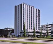
Courtyard Amsterdam Arena Atlas
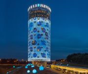
Fletcher Hotel Amsterdam
Jaz Amsterdam
Ozo Hotel Amsterdam
Holiday Inn AMSTERDAM - ARENA TOWERS
Hotel V Fizeaustraat
Amadi Panorama Hotel
de Goudvink
Campanile - Amsterdam Zuidoost
Videos from this area
These are videos related to the place based on their proximity to this place.
IJzel op de tramdraden bij Diemen Sniep
IJzel op de bovenleiding van de tramdraden op het eindpunt van tram 9 bij Diemen Sniep, op 14/2/2013. Ik was helaas te laat om de vorige tram te filmen, die maakte nog iets meer vonkjes.
Erfelijkheidsonderzoek naar plotselinge hartdood
Elke week sterven in Nederland 300 mensen aan een plotselinge hartdood. Het is een van de meest voorkomende doodsoorzaken waarbij erfelijkheid een belangrijke rol speelt. Het is dan ook van...
Start The Musical - The Movie (Groep 8c De Duif 2012)
Vrijdagavond 13 juli 2012. "De Ark" Diemen Zuid. Afscheid Musical groep 8c van Basisschool "De Duif" uit Diemen Noord. De film kan op Blu-ray in High Definition 1080i ( BR25GB) of op Standaard...
Mieszkanie w Holandii - OTTO Work Force
Na filmiku widać mieszkanie jakie firma OTTO Work Force wynajmuje swoim pracownikom w miejscowości Diemen koło Amsterdamu. W takim właśnie mieszkaniu firma OTTO chciała umieścić ...
Grote brand in school aan de Drostenburg in Amsterdam
Video: Mizzle Media (c) 2013 http://www.michelvanbergen.nl AMSTERDAM - Er is dinsdagavond een zeer grote brand ontstaan in een school aan de Drostenburg in Amsterdam. De gitzwarte rook was.
Brand in school Amsterdam.
2008-07-17 21:17:18 17-07-08 13 I BRAN BR 1 BINNENBRAND ONDERWIJS (Inc.net: 1) (NB Brand: grip 2) Onze Wereld KORTVOORT 63 School AMSTERDAM-ZUIDOOST (ZO) ...
Videos provided by Youtube are under the copyright of their owners.
Attractions and noteworthy things
Distances are based on the centre of the city/town and sightseeing location. This list contains brief abstracts about monuments, holiday activities, national parcs, museums, organisations and more from the area as well as interesting facts about the region itself. Where available, you'll find the corresponding homepage. Otherwise the related wikipedia article.
Amsterdam Arena
Amsterdam Arena (officially stylised as Amsterdam ArenA) is a stadium in Amsterdam, Netherlands. It is the largest stadium in the country and it was built from 1993 to 1996 at a cost of €140 million, and was officially opened on 14 August 1996. It has been used for association football, American football, concerts, and other events. The stadium has a retractable roof combined with a grass surface.
Amsterdam-Zuidoost
Amsterdam-Zuidoost (Amsterdam-Southeast) is one of seven boroughs (stadsdelen) of the city of Amsterdam. It consists of four residential areas—Bijlmermeer, Venserpolder, Gaasperdam and Driemond—as well as the Amstel III/Bullewijk Business Park and the ArenA Boulevard area. Amsterdam-Zuidoost has approximately 86,000 inhabitants, living in some 38,000 houses.
Bijlmermeer
The Bijlmermeer or colloquially Bijlmer is one of the neighbourhoods that form the Amsterdam Zuidoost ('Amsterdam South-East') borough (or "stadsdeel") of Amsterdam, Netherlands. To many people, the Bijlmer designation is used to refer to Amsterdam Zuidoost and Diemen Zuid as a pars pro toto. The other neighbourhoods in Amsterdam Zuidoost are Gaasperdam, Bullewijk, Venserpolder and Driemond.
De Meer Stadion
De Meer Stadion is the name of the former stadium of AFC Ajax. It was opened in 1934 as a result of the club's former stadium being too small. Upon completion, it could hold 22,000 spectators, but accommodating up to 29,500 at its maximum. Increasing safety requirements gradually reduced this number to 19,000.
Heineken Music Hall
Heineken Music Hall (or commonly abbreviated as HMH) is a concert hall in Amsterdam, Netherlands, near the Amsterdam ArenA (Amsterdam South-East). The big hall has a capacity of 5500 and is 3000 m²; a smaller hall (for after parties) has a capacity of 700. The Heineken Music Hall was specially designed for amplified music. The architect was Frits van Dongen of Architekten Cie. The building was constructed between 1996 and 2001, and cost €30 million.
Ziggo Dome
Ziggo Dome is a 17,000-seat multi-use indoor arena in Amsterdam, Netherlands. Marco Borsato was the first artist to perform at the Dome on June 24, 2012 with his "Dichtbij" tour. The American rock band Pearl Jam was the first foreign artist to play in the Ziggo Dome: they played two shows in June 2012 as part of their European tour.
Utrechtboog
The Utrechtboog is a flyover railway line in the south-east of Amsterdam, completed in March 2006, that directly connects Utrecht and Schiphol. After completion, it reduced journey times between the two by seven minutes. Prior to its construction, passengers travelling this route were required to change trains at Duivendrecht railway station.
Academic Medical Center
The Academic Medical Center, or AMC, is the university hospital affiliated with the Universiteit van Amsterdam (University of Amsterdam). It is one of the largest and leading hospitals of The Netherlands, located in the Bijlmer neighborhood in the most south-eastern part of the city. The AMC has an intensive cooperation with the other university hospital of Amsterdam, the VU University Medical Center (VUmc), which is affiliated with the VU University Amsterdam, Amsterdam's other university.
Amsterdamse Poort (shopping centre)
The Amsterdamse Poort is a shopping centre in the Amsterdam borough Amsterdam Zuidoost stadsdeel. It was opened in 1987. This shopping centre is the largest in Amsterdam. It is located near the Amsterdam Bijlmer ArenA railway station and the ArenA Boulevard. In the shopping centre there is a location for the Tickets & Service room for the railway station. There are also 225 shops. \tAmsterdamse Poort \t\t \t\t\tAmsterdamse Poort 01 PM07. jpg \t\t\t \t\t\t \t\t \t\t \t\t\tAmsterdamse Poort 05 PM07.
Gaasperplas
Gaasperplas is an artificial lake used for recreational purposes south-east of Amsterdam in the Netherlands. Gaasperplas was created with the extraction of sand for the construction of the Bijlmer. At its deepest the lake is 35 metres deep. It was the setting for the 1982 Floriade landscape and flower show, and the Eastern end of the lake is surrounded by parks and woodlands that once formed part of the event.
El Al Flight 1862
On 4 October 1992, El Al Flight 1862, a Boeing 747 cargo plane of the Israeli airline El Al, crashed into the Groeneveen and Klein-Kruitberg flats in the Bijlmermeer (colloquially "Bijlmer") neighbourhood of Amsterdam, the Netherlands. For the location in the Bijlmermeer, the crash is known in Dutch as the "Bijlmerramp" ("Bijlmer disaster"). A total of 43 people were killed, including the plane's crew of three, a non-revenue passenger in a jump seat, and 43 people on the ground.
Betondorp
Betondorp is a neighborhood of Amsterdam, Netherlands.
Gaasperdam
Gaasperdam is a neighborhood of Amsterdam, Netherlands.
Venserpolder
Venserpolder is a neighborhood of Amsterdam, Netherlands.
Strandvliet metro station
Strandvliet is an Amsterdam Metro station in the Venserpolder area of Amsterdam, Netherlands. The station opened in 1977 and is served by 2 lines, the 50 (Isolatorweg - Gein) and 54 (Amsterdam Centraal - Gein). The metro station is only accessible with an OV-chipkaart or GVB Travel Pass.
Bullewijk metro station
Bullewijk is an Amsterdam Metro station in the Bijlmermeer area of Amsterdam, Netherlands. The station opened in 1977 and is served by 2 lines, the 50 (Isolatorweg - Gein) and 54 (Amsterdam Centraal - Gein). The metro station is only accessible with an OV-chipkaart or GVB Travel Pass.
Reigersbos metro station
Reigersbos is an Amsterdam Metro station in the Gaasperdam area of Amsterdam, Netherlands. The station opened in 1982 and is served by 2 lines, the 50 (Isolatorweg - Gein) and 54 (Amsterdam Centraal - Gein). The metro station is only accessible with an OV-chipkaart or GVB Travel Pass.
Gein metro station
Gein is an Amsterdam Metro station in the Gaasperdam area of Amsterdam, Netherlands. The station opened in 1982 and is served by 2 lines, the 50 (Isolatorweg - Gein) and 54 (Amsterdam Centraal - Gein). The metro station is only accessible with an OV-chipkaart or GVB Travel Pass.
Jewish Cemetery of Diemen
The Jewish Cemetery of Diemen, or Joodse Begraafplaats Diemen in Diemen, is owned by the Jewish community of Amsterdam, which is a subsection of the "Nederlands Israëlitisch Kerkgenootschap". It came into use in 1914 when the older Jewish cemetery in Amsterdam Zeeburg reached its limit. In 1925 it was split by a train line. The cemetery can still be seen today by train passengers travelling eastwards from Amsterdam.
Ganzenhoef metro station
Ganzenhoef is an Amsterdam Metro station in Amsterdam, Netherlands.
Tjaskers in the Netherlands
A Tjasker is a type of small drainage windmill used in the Netherlands and Germany. There are 28 tjaskers remaining the Netherlands.
Kraaiennest metro station
Kraaiennest is an Amsterdam Metro station in Amsterdam, Netherlands.
Gaasperplas metro station
Gaasperplas is an Amsterdam Metro station in Amsterdam, Netherlands.
Verrijn Stuartweg metro station
Verrijn Stuartweg is an Amsterdam Metro station in Amsterdam, Netherlands.
Venserpolder metro station
Venserpolder is an Amsterdam Metro station in Amsterdam, Netherlands.


