Safety Score: 3,3 of 5.0 based on data from 9 authorites. Meaning please reconsider your need to travel to Netherlands.
Travel warnings are updated daily. Source: Travel Warning Netherlands. Last Update: 2024-05-15 08:00:47
Delve into Tolberg
The district Tolberg of Bulkenaar in Roosendaal (North Brabant) is a subburb in Netherlands about 62 mi south of Amsterdam, the country's capital town.
If you need a hotel, we compiled a list of available hotels close to the map centre further down the page.
While being here, you might want to pay a visit to some of the following locations: Sint-Niklaas, Heist-op-den-Berg, Turnhout, The Hague and Dendermonde. To further explore this place, just scroll down and browse the available info.
Local weather forecast
Todays Local Weather Conditions & Forecast: 16°C / 62 °F
| Morning Temperature | 15°C / 58 °F |
| Evening Temperature | 16°C / 62 °F |
| Night Temperature | 13°C / 56 °F |
| Chance of rainfall | 1% |
| Air Humidity | 83% |
| Air Pressure | 1007 hPa |
| Wind Speed | Gentle Breeze with 7 km/h (4 mph) from North-East |
| Cloud Conditions | Overcast clouds, covering 90% of sky |
| General Conditions | Light rain |
Thursday, 16th of May 2024
14°C (57 °F)
11°C (52 °F)
Moderate rain, gentle breeze, overcast clouds.
Friday, 17th of May 2024
16°C (61 °F)
14°C (56 °F)
Light rain, gentle breeze, broken clouds.
Saturday, 18th of May 2024
20°C (68 °F)
12°C (54 °F)
Moderate rain, gentle breeze, broken clouds.
Hotels and Places to Stay
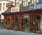
BW CITY HOTEL GODERIE
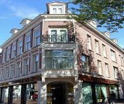
Central
Tongerlo
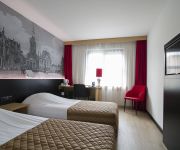
Bastion Roosendaal
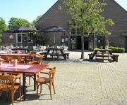
Hotel Boerderij de Zellebergen
Videos from this area
These are videos related to the place based on their proximity to this place.
Ernstig ongeval met hoogwerker op Oostelijke Havendijk in Roosendaal
Ernstig ongeval met een hoogwerker in Roosendaal. Hoogwerker valt om en één persoon raakt ernstig gewond. Politie, brandweer en ambulance waren aanwezig om de man uit zijn benarde positie...
[JF] [HD] Optocht Carnaval Roosendaal, Tullepetaonestad (18-02-2012)
Carnaval in Roosendaal (Tullepetaonestad) op 18 februari 2012.
Turbine, attractie kermis Roosendaal 2014 [GoPro onride]
Another video by RTTbroadcasting, ....first person GoPro action and Nokia Pureview video's.... *************************************************************************** Onride op Turbine...
Karten @KCR Roosendaal 31-01-2014 Heat 1
Lekker een paar rondjes rijden met Nelson, Trage en MrLing. (Heat 1 van 2)
Eurocoaster ( Buwalda ) onride kermis Roosendaal 2014
Ritje in de €urocoaster op het Pater Damiaanplein in Roosendaal.
Bruidsreportage in Roosendaal - Noord-Brabant - Ilyana en Dennis - (11-02-2011)
http://www.allround-fotografie.com/bruidsreportage/ Voor de bruidsreportage van Ilyana en Dennis gingen we met twee trouwfotografen tot vlakbij de Belgische grens, namelijk naar Roosendaal....
Caribbean Beach Party (van Tol) onride kermis Roosendaal 2013
Gefilmd op de Oude Markt in Roosendaal d.d. 12-09-2013 camera: Canon Ixus 220 HS (wit-balans: TL licht halogeen)
Videos provided by Youtube are under the copyright of their owners.
Attractions and noteworthy things
Distances are based on the centre of the city/town and sightseeing location. This list contains brief abstracts about monuments, holiday activities, national parcs, museums, organisations and more from the area as well as interesting facts about the region itself. Where available, you'll find the corresponding homepage. Otherwise the related wikipedia article.
Fijnaart
Fijnaart is a town in the Dutch province of North Brabant. It is located in the municipality of Moerdijk, about 8 km west of the town of Zevenbergen.
Oudenbosch
Oudenbosch is a village in the municipality Halderberge in the west of the Dutch province Noord-Brabant. Oudenbosch is well known for its 'Basiliek' a catholic church that is a smaller copy of St. Peter's church in Rome. Oudenbosch has a railway station on the line Dordrecht - Roosendaal (completed in 1854). Oudenbosch was a separate municipality until 1997, when it became part of the new municipality of Halderberge.
RBC Stadion
The RBC Stadion, former name among others Vast & Goed Stadion, Rosada Stadion and MariFlex Stadion, is a multi-use stadium in Roosendaal, Netherlands. It was used mostly for football matches. The stadium is able to hold 4,995 people and was built in 2000. It was the home of the club RBC Roosendaal until the club went bankrupt in June 2011.
Arboretum Kalmthout
The Arboretum Kalmthout is a botanical garden in Kalmthout, Belgium. It was started as a tree plantation by Charles Van Geert in 1857. In 1986 it became property of the Antwerp province and is now open to public.
Zegge
Zegge is a small village located in the western part of North Brabant province in the Netherlands. Due to its small size, much of the daily life of its inhabitants centers around the nearby city of Roosendaal. Zegge makes part of the municipality of Rucphen.
Oudenbosch Basilica
The Oudenbosch Basilica is a Roman Catholic basilica in the Dutch village of Oudenbosch. It was built under the initiative of father Willem Hellemons who was parish priest between 1842 and 1884. Its nave and interior were modeled after St. Peter's Basilica in Rome; while the facade is a replica of the Basilica of St. John Lateran also in Rome. The Basilica was designed by architect Dr. P. Cuypers. Construction began in 1865 but was not fully completed until 1982.
486th Air Expeditionary Wing
The 486th Air Expeditionary Wing (486 AEW) is a provisional United States Air Force unit assigned to the Air Combat Command. As a provisional unit, it may be activated or inactivated at any time. The unit was last known to be active during Operation Iraqi Freedom in 2003. During World War II, its predecessor unit, the 486th Bombardment Group (Heavy) was an Eighth Air Force heavy bombardment unit in England, stationed at RAF Sudbury.
Kruisstraat, Roosendaal
Kruisstraat is a hamlet in the Dutch province of North Brabant. It is located in the municipality of Roosendaal, about 3 km southwest of the city centre.
De Zoom – Kalmthoutse Heide
De Zoom - Kalmthoutse Heide, is a cross-border park on the Belgian-Dutch border. It is a merger of two former parks, the Kalmthoutse Heide in Belgium and De Zoom in the Netherlands), together extending over 37.50 square kilometres . A very large part of the park is covered with heath. The park is managed by a special commission in which both Flemish and Dutch organisations are represented.
Dinteloord en Prinsenland
Dinteloord en Prinsenland is a former municipality in the Dutch province of North Brabant, now part of the municipality of Steenbergen. The main town of the municipality was Dinteloord. Dinteloord en Prinsenland was a separate municipality until 1997.
Fijnaart en Heijningen
Fijnaart en Heijningen is a former municipality in the Dutch province of North Brabant. It covered the villages of Fijnaart and Heijningen. Fijnaart en Heijningen was a separate municipality until 1997, when it was merged with Zevenbergen.
Huijbergen
Huijbergen is a village in the Dutch province of North Brabant. It is located in the municipality of Woensdrecht, about 9 kilometres southeast of Bergen op Zoom, close to the Belgian border.
Oud- en Nieuw-Gastel
Oud- en Nieuw-Gastel was a municipality in the Dutch province of North Brabant. It covered the village of Oud Gastel, located 7 km north of Roosendaal. The municipality existed until 1997, when it became part of the new municipality of Halderberge.
Roosendaal en Nispen
Roosendaal en Nispen was a municipality in the Dutch province of North Brabant. It included the villages of Roosendaal and Nispen. In 1997, the municipality merged with Wouw. As the town of Roosendaal had become by far the largest in the new municipality, the name of the new municipality became simply "Roosendaal".
Standdaarbuiten
Standdaarbuiten is a village in the Dutch province of North Brabant. It is located in the municipality of Moerdijk, about 9 km northeast of Roosendaal. Standdaarbuiten was a separate municipality until 1997, when it became part of Zevenbergen.
Seppe Airport
Seppe Airport (Dutch: Vliegveld Seppe) is a small general aviation airfield located next to the A58 motorway on the outskirts of Bosschenhoofd, a village in the municipality of Halderberge in the province of North Brabant in the Netherlands. The airport takes its name from the village's nickname. It is located 2 NM southwest of Hoeven, 7.5 NM west from Breda and 4 NM east-northeast of Roosendaal.
't Haantje, North Brabant
't Haantje is a hamlet in the Dutch province of North Holland. It is located in the municipality of Steenbergen, about 2 km west of Kruisland.
Heerle
Heerle is a village in the municipality of Roosendaal, in the Dutch province of North Brabant.
Stampersgat
Stampersgat is a village situated in the municipality of Halderberge, in the north-west of the North Brabant province in the Netherlands.
Dintel
The Dintel is a river in North Brabant that runs from Oudenbosch to Standdaarbuiten.
Fort de Roovere
Fort De Roovere is an entrenchment near Halsteren (by the Schansbaan/Ligneweg) that was part of the West Brabant Dutch Water Line. It is an earthen fort that goes through a wall (the Ligneweg) and is connected to Fort Pinssen. The fort is open from the ‘back’, and the ‘front’ consists of two bastions. The fort has a dry moat and the banks are overgrown with trees. In 1747, during the Austrian War of Succession (1740–1748) the fort was under siege by the French.
Essen (B) railway station
Essen is a railway station in the town of Essen, Belgium. The station opened on 26 June 1854 on the Antwerp–Lage Zwaluwe railway, known in Belgium as Line 12. Essen is a border station between the Netherlands and Belgium.
Wildert railway station
Wildert is a railway station in the village of Wildert, Essen, Belgium. The station opened on 13 November 1881 on the Antwerp–Lage Zwaluwe railway, known in Belgium as Line 12.
Kalmthout railway station
Kalmthout is a railway station in the town of Kalmthout, Antwerp, Belgium. The station opened on 26 June 1854 on the Antwerp–Lage Zwaluwe railway, known in Belgium as Line 12.
Heide (B) railway station
Heide is a railway station in the town of Heide, Antwerp, Belgium. The station opened on 3 January 1897 on the Antwerp–Lage Zwaluwe railway, known in Belgium as Line 12.





!['[JF] [HD] Optocht Carnaval Roosendaal, Tullepetaonestad (18-02-2012)' preview picture of video '[JF] [HD] Optocht Carnaval Roosendaal, Tullepetaonestad (18-02-2012)'](https://img.youtube.com/vi/EWSMvPl1hso/mqdefault.jpg)
!['Turbine, attractie kermis Roosendaal 2014 [GoPro onride]' preview picture of video 'Turbine, attractie kermis Roosendaal 2014 [GoPro onride]'](https://img.youtube.com/vi/tnIpSl8MsG8/mqdefault.jpg)


