Safety Score: 3,3 of 5.0 based on data from 9 authorites. Meaning please reconsider your need to travel to Netherlands.
Travel warnings are updated daily. Source: Travel Warning Netherlands. Last Update: 2024-05-06 08:04:52
Discover Broek
The district Broek of Tegelen in Gemeente Venlo (Limburg) is a district in Netherlands about 89 mi south-east of Amsterdam, the country's capital city.
Looking for a place to stay? we compiled a list of available hotels close to the map centre further down the page.
When in this area, you might want to pay a visit to some of the following locations: Bruggen, Nettetal, Niederkruchten, Schwalmtal and Grefrath. To further explore this place, just scroll down and browse the available info.
Local weather forecast
Todays Local Weather Conditions & Forecast: 17°C / 62 °F
| Morning Temperature | 11°C / 52 °F |
| Evening Temperature | 15°C / 60 °F |
| Night Temperature | 13°C / 55 °F |
| Chance of rainfall | 3% |
| Air Humidity | 68% |
| Air Pressure | 1007 hPa |
| Wind Speed | Gentle Breeze with 6 km/h (4 mph) from South-West |
| Cloud Conditions | Overcast clouds, covering 100% of sky |
| General Conditions | Light rain |
Tuesday, 7th of May 2024
17°C (62 °F)
12°C (53 °F)
Moderate rain, gentle breeze, overcast clouds.
Wednesday, 8th of May 2024
12°C (54 °F)
12°C (54 °F)
Overcast clouds, gentle breeze.
Thursday, 9th of May 2024
17°C (63 °F)
13°C (55 °F)
Overcast clouds, light breeze.
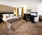
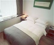
Hotels and Places to Stay
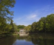
Bilderberg De Bovenste Molen
Bilderberg Chateau Holtmuhle
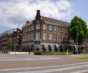
Theaterhotel Venlo
Valuas Restaurant Brasserie
Venlo Van der Valk
Sandton Chateau De Raay
Wilhelmina
Puur
Maashof
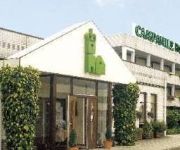
Campanile - Venlo
Videos from this area
These are videos related to the place based on their proximity to this place.
GoPro HERO 3: Climbing @ Fun Forest Venlo
Tree Climbing in Venlo at Fun Forest Venlo. Filmed with a GoPro HERO 3.
Pagani Productions @Mountainbike clinic venlo 13 12 2014 part 1
Beginners mountainbike clinic Giant store venlo 13 12 2014 gegeven door Jan Weevers Bas Peters Sander Kuik Bas janssen en andere Copyright Pagani productions 2014-2199 Wouter van Helden ...
[PRIO 1 HA 23-3262 Water Haakarmbak Brandweer Venlo] WLF AB SLM BF Venlo (HD)
Prio1 HA 23-3282 Brandweer Venlo met spoed naar een Gebouw Brand in Neer. Tankautospuit Roggel ging ook Ter Plaatse. Einsatz für die Berufsfeuerwehr (BF) Venlo. Das Wechselladerfahrzeug...
WêtseNag Tegelen Grotestraat 1
De Grotestraat in Tegelen in het begin van de vorige eeuw. Het is het gedeelte vlakbij de Sint Martinuskerk aan het Wilhelminaplein. De karakteristieke panden zijn gelukkig behouden gebleven....
Sint Jozefkerk Tegelen
In 2009 is de Sint Jozefkerk in Tegelen aan de kerkelijke eredienst onttrokken. Als zoveel andere kerken in Limburg en Brabant is het aantal kerkbezoekers zodanig afgenomen dat aan sluiting...
Brand in tegelen op 07-09-2011
foto's staan op picasa : https://picasaweb.google.com/105210882377018181775/Brand792011Tegelen#
Website Heemkundige Kring Tegelen
Op 1 september 2013 lanceert de Heemkundige Kring Tegelen haar nieuwe, dynamische en interactieve website. Facebook en Twitter zijn geïntegreerd in de nieuwe site. De website is niet alleen...
Videos provided by Youtube are under the copyright of their owners.
Attractions and noteworthy things
Distances are based on the centre of the city/town and sightseeing location. This list contains brief abstracts about monuments, holiday activities, national parcs, museums, organisations and more from the area as well as interesting facts about the region itself. Where available, you'll find the corresponding homepage. Otherwise the related wikipedia article.
Venlo Incident
The Venlo Incident was a covert German Sicherheitsdienst (SD-Security Service) engineered capture of two British SIS (Secret Intelligence Service) agents on 9 November 1939.
Blerick
Blerick is a city in the Dutch province of Limburg. It lies on the west bank of the Meuse and its origin goes back to the Roman era as a military stronghold and settlement en route from Mosa Trajectum to Novia Magnus. Blerick can be found on the Peutinger Table as Blariacum. Up to the second world war Blerick formed together with Baarlo and Maasbree one municipality. Under German rule Blerick became part of the municipality of Venlo. In 2001, Blerick had 25875 inhabitants.
Tegelen
Tegelen is a village in the province of Limburg in the Netherlands. It was an independent municipality until 2001, when it was merged into the municipality of Venlo.
Floriade (Netherlands)
Floriade is an international exhibition of flowers and gardening, held every 10 years in the Netherlands.
Baarlo
Baarlo is a town in the southeastern Netherlands. It is located in the municipality of Peel en Maas, Limburg, about 6 km southwest of Venlo. In 2001, Baarlo had 5199 inhabitants. The built-up area of the town was 1.25 km², and contained 1912 residences.
Belfeld
Belfeld is a village in the Dutch province of Limburg. It is a part of the municipality of Venlo, and lies about 8 km southwest of the city center of Venlo, between the Meuse River and the border with Germany. In 2001, Belfeld had 4856 inhabitants. The built-up area of the town was 1.59 km², and contained 1937 residences. In 2001 Belfeld was merged into the municipality of Venlo.
Boekend
Boekend is a village in the Dutch province of Limburg. It is a part of the municipality of Venlo, and lies about 4 km west of the city center. In 2001, Boekend had 328 inhabitants. The built-up area of the village was 0.1 km², and contained 122 residences.
De Koel
De Koel, also known as Seacon Stadion – De Koel after the main sponsor, is a multi-purpose stadium in Venlo, Netherlands. It is currently mostly used for football matches and is the home stadium of VVV-Venlo. The stadium is able to hold 8,000 people and was built in 1972.
Leuth (Germany)
Leuth is a village in North Rhine-Westphalia on the Dutch border in the district of Viersen. It is the smallest part of the municipality of Nettetal and has approximately 2000 inhabitants. Its historical origin lies in the early Middle Ages (before the year 1000).
Kaldenkirchen station
Kaldenkirchen is the railway station on the Viersen–Venlo railway in the municipality of Kaldenkirchen, itself a town part of Nettetal in the Viersen district in western Germany. Between 1867 and 1999 it was also on the now closed Kempen–Venlo railway It is situated at the far western end of the Viersen to Venlo line, about three kilometers away from the Dutch border.
Velden, Limburg
Velden is a village in the municipality of Venlo (5296 inhabitants) in Limburg, Netherlands.
Californië, Limburg
Californië is a hamlet in the Dutch province of Limburg. It is located in the municipality of Venlo, about 3 km west of Grubbenvorst.
Hasselt, Venlo
Hasselt is a town in the Dutch province of Limburg. It is located in the municipality of Venlo, about 2 km north of the town of Velden (Limburg).
Grubbenvorst
Grubbenvorst is a village in the Dutch province of Limburg. It is located in the municipality of Horst aan de Maas, about 6 km northwest of Venlo. Grubbenvorst was a separate municipality until 2001, when it was merged with Horst aan de Maas.
Bong, Maasbree
Bong is a hamlet in the Dutch province of Limburg. It is located in the municipality of Maasbree, about 1 km west of Baarlo. Bong has a population of about 300.
Sequoiafarm Kaldenkirchen
The Sequoiafarm Kaldenkirchen is a German arboretum that has been used as a biological institute for many years. Part of the protected area in the city of Nettetal, it is situated in the "Kaldenkirchen Grenzwald" (forest bordering Germany and the Netherlands). Nettetal lies in the Lower Rhine region of Germany.
Ithaka Science Center
Ithaka Science Center is a hands-on science education center for the Limburg Province of the Netherlands and other visitors from the rest of the Netherlands and nearby Germany and Belgium. Founded by Vaggelis E. Fragiadakis and Margriet van Tulder, Ithaka is a non-profit organization funded as a public-private partnership, providing interactive exhibits, programs, public lectures and other events for schools and the general public.
Offenbeek
Offenbeek is a hamlet in the Dutch province of Limburg. It is located in the municipality of Beesel, east of the village of Reuver.
Tegelen railway station
Tegelen is a railway station in Tegelen, Netherlands. The station was opened on 21 November 1865 and was closed twice during World War II. The station is located on the Maastricht–Venlo railway, which is also known as the Staatslijn E. The train services are operated by Veolia.
Steyl
Steyl is a village in the municipality of Venlo in the Netherlands and is best known as a monastery village.
Museum van Bommel van Dam
Museum van Bommel van Dam is a Dutch museum of modern art in Venlo in the southeast Netherlands. The museum belongs to the German/Dutch cooperation Crossart, a partnership between 7 German museums in Westfalen and 4 Dutch museums in Gelderland and Limburg. Exhibitions are held of paintings or drawings, sculpture or photography. The museum was founded by the couple Maarten and Reina van Bommel-van Dam, who started collecting modern art after the Second World War.
Fort Sint-Michiel (Venlo)
Fort Sint-Michiel is a vanished, originally Spanish fort, situated in Venlo and is named after the archangel Michael. Construction of this fort started in 1641 on Michaelmas, September 29.
Hout-Blerick
Hout-Blerick is a village in Limburg which is part of the municipality Venlo. The village has roughly 3,000 inhabitants and has for centuries mainly been populated by people from an agricultural background. Nowadays most people work outside the village. Hout-Blerick is notable for its historical buildings, such as the Saint Joseph Church and several historical farms.
Aubergine (restaurant)
Aubergine is a restaurant in Steyl in the Netherlands. It is a fine dining restaurant that is awarded one Michelin star in the period 2006–present. GaultMillau awarded the restaurant 14 out of 20 points. Head chef of Aubergine is Paul Pollux.
Castle d'Erp
Castle d'Erp (also known as Castle de Borcht) is a castle in Baarlo, Limburg, Netherlands. Dating back to the 13th century, it withstood sieges by William the Silent and Frederick Henry, Prince of Orange. The castle is currently privately owned and not open the public.








!['[PRIO 1 HA 23-3262 Water Haakarmbak Brandweer Venlo] WLF AB SLM BF Venlo (HD)' preview picture of video '[PRIO 1 HA 23-3262 Water Haakarmbak Brandweer Venlo] WLF AB SLM BF Venlo (HD)'](https://img.youtube.com/vi/bLEJNxxJJGw/mqdefault.jpg)


