Safety Score: 3,0 of 5.0 based on data from 9 authorites. Meaning we advice caution when travelling to Germany.
Travel warnings are updated daily. Source: Travel Warning Germany. Last Update: 2024-04-18 08:12:24
Delve into Tomp
Tomp in Regierungsbezirk Düsseldorf (North Rhine-Westphalia) is a city located in Germany about 319 mi (or 513 km) west of Berlin, the country's capital town.
Current time in Tomp is now 03:49 AM (Friday). The local timezone is named Europe / Berlin with an UTC offset of 2 hours. We know of 11 airports closer to Tomp, of which 5 are larger airports. The closest airport in Germany is Mönchengladbach Airport in a distance of 14 mi (or 23 km), East. Besides the airports, there are other travel options available (check left side).
There are several Unesco world heritage sites nearby. The closest heritage site in Germany is Aachen Cathedral in a distance of 37 mi (or 60 km), South. We saw 1 points of interest near this location. In need of a room? We compiled a list of available hotels close to the map centre further down the page.
Since you are here already, you might want to pay a visit to some of the following locations: Bruggen, Nettetal, Niederkruchten, Schwalmtal and Grefrath. To further explore this place, just scroll down and browse the available info.
Local weather forecast
Todays Local Weather Conditions & Forecast: 8°C / 47 °F
| Morning Temperature | 6°C / 43 °F |
| Evening Temperature | 8°C / 47 °F |
| Night Temperature | 6°C / 43 °F |
| Chance of rainfall | 13% |
| Air Humidity | 88% |
| Air Pressure | 1009 hPa |
| Wind Speed | Fresh Breeze with 15 km/h (9 mph) from South-East |
| Cloud Conditions | Overcast clouds, covering 100% of sky |
| General Conditions | Moderate rain |
Saturday, 20th of April 2024
8°C (47 °F)
6°C (43 °F)
Light rain, moderate breeze, broken clouds.
Sunday, 21st of April 2024
8°C (46 °F)
4°C (39 °F)
Light rain, moderate breeze, broken clouds.
Monday, 22nd of April 2024
6°C (43 °F)
4°C (40 °F)
Light rain, moderate breeze, overcast clouds.
Hotels and Places to Stay
Bilderberg De Bovenste Molen
Lüthemühle
Bilderberg Chateau Holtmuhle
Theaterhotel Venlo
Valuas Restaurant Brasserie
Zur Alten Schmiede
Wilhelmina
Akzent Hotel Brüggener Klimp
Puur
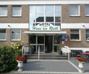
Haus am Rieth
Videos from this area
These are videos related to the place based on their proximity to this place.
Heiratsantrag Linda & Stefan
Es war einmal in einem kleinen, wunderschönen Dorf am Niederrhein - unserer Weltmetropole Leutherheide - als sich zwei unserer geliebten Bewohner entschieden für immer das Leben miteinander...
GoPro HERO 3: Climbing @ Fun Forest Venlo
Tree Climbing in Venlo at Fun Forest Venlo. Filmed with a GoPro HERO 3.
Bahnübergang Bevrijdingsweg, Venlo (NL) ++ ICEs in den Niederlanden ++ Güterzüge
Die Stammstrecke der ICEs von Frankfurt nach Amsterdam und Utrecht ist aufgrund von Bauarbeiten bei Zevenaar gesperrt. DIe Umleitung erfolgt über Mönchengladbach, Viersen und Venlo, die Halte.
A74 van Tegelen naar A61 Kaldenkerken deel 2
A 74 deel 2 Tegelen naar Kaldenkerken de huidige situatie stand 25-01-2011.
Zandgroeves Tegelen en Belfeld komen steeds dichter bij elkaar
De zandgroeves tussen Tegelen en Belfeld worden dusdanig uitgebreid, dat ze bijna bij elkaar uitkomen. De vraag is, hoe lang het nog gaat duren voordat ze aan elkaar vastzitten. Dan is er voor...
A61-A74-A73 Street-view van TheFlyingDutchman64 A61-A74-A61
Schnelster weg nach Venlo A61 Kaldenkirchen Tegelen Venlo Floriadeautobahn Fontys Campus Jacobs plantencentrum Schreurs A74 van Kaldenkirchen nach Venlo A73 Roermond Tegelen Viecuri...
Sluiting Cafe´ De Frenk
Sluiting van Café De Frenk aan de Grensovergang Heidenend Tegelen Schließung Café De Frenk am Grenzübergang Heidenend Kaldenkirchen.
A74 in vogelvlucht over de Autosnelweg Aus Vogelperspective über die Autobahn A74-A61
Vlucht over de autosnelweg Flug über die Autobahn. van Tegelen naar Kaldenkerken A74-A61 in 350 Meter hoch. in en hoogte van 350 meter.
Internationalen Übung A61 09-03-2012 Internationale oefening A74/A61
Schweren Unfall A61; Kaldenkirchen Tegelen Venlo ;Floriadeautobahn ;Oefening Brandweer Feuerwehr Technische Hilfeleistung Übung;Zwaar ongeluk op de A73;
Videos provided by Youtube are under the copyright of their owners.
Attractions and noteworthy things
Distances are based on the centre of the city/town and sightseeing location. This list contains brief abstracts about monuments, holiday activities, national parcs, museums, organisations and more from the area as well as interesting facts about the region itself. Where available, you'll find the corresponding homepage. Otherwise the related wikipedia article.
Leuth (Germany)
Leuth is a village in North Rhine-Westphalia on the Dutch border in the district of Viersen. It is the smallest part of the municipality of Nettetal and has approximately 2000 inhabitants. Its historical origin lies in the early Middle Ages (before the year 1000).
Kaldenkirchen station
Kaldenkirchen is the railway station on the Viersen–Venlo railway in the municipality of Kaldenkirchen, itself a town part of Nettetal in the Viersen district in western Germany. Between 1867 and 1999 it was also on the now closed Kempen–Venlo railway It is situated at the far western end of the Viersen to Venlo line, about three kilometers away from the Dutch border.
Sequoiafarm Kaldenkirchen
The Sequoiafarm Kaldenkirchen is a German arboretum that has been used as a biological institute for many years. Part of the protected area in the city of Nettetal, it is situated in the "Kaldenkirchen Grenzwald" (forest bordering Germany and the Netherlands). Nettetal lies in the Lower Rhine region of Germany.


