Safety Score: 3,3 of 5.0 based on data from 9 authorites. Meaning please reconsider your need to travel to Netherlands.
Travel warnings are updated daily. Source: Travel Warning Netherlands. Last Update: 2024-05-07 07:59:51
Discover Aan de Maas
The district Aan de Maas of Broekhoven in Gemeente Meerssen (Limburg) is a district in Netherlands about 106 mi south of Amsterdam, the country's capital city.
Looking for a place to stay? we compiled a list of available hotels close to the map centre further down the page.
When in this area, you might want to pay a visit to some of the following locations: Maastricht, Selfkant, Gangelt, Waldfeucht and Aachen. To further explore this place, just scroll down and browse the available info.
Local weather forecast
Todays Local Weather Conditions & Forecast: 14°C / 57 °F
| Morning Temperature | 8°C / 47 °F |
| Evening Temperature | 17°C / 62 °F |
| Night Temperature | 11°C / 52 °F |
| Chance of rainfall | 0% |
| Air Humidity | 78% |
| Air Pressure | 1027 hPa |
| Wind Speed | Light breeze with 5 km/h (3 mph) from South |
| Cloud Conditions | Overcast clouds, covering 89% of sky |
| General Conditions | Overcast clouds |
Thursday, 9th of May 2024
18°C (65 °F)
12°C (53 °F)
Broken clouds, light breeze.
Friday, 10th of May 2024
20°C (67 °F)
14°C (57 °F)
Scattered clouds, light breeze.
Saturday, 11th of May 2024
21°C (70 °F)
14°C (57 °F)
Overcast clouds, gentle breeze.
Hotels and Places to Stay
Bigarré Maastricht Centrum
Terhills Hotel Different hotels
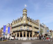
Amrath Grand Hotel de l´Empereur
Townhouse Maastricht
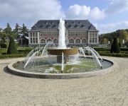
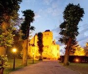
Château St.Gerlach
Eurotel
Designhotel Maastricht
Hotel Kasteel Geulzicht
Novotel Maastricht
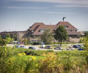
Van der Valk Stein-Urmond
Videos from this area
These are videos related to the place based on their proximity to this place.
Meet & Greet 2009
Video of the second Harley Davidson Rally 'Meet & Greet 2009' in Geulle Netherlands. Organisation 'Harley Davidson Club Netherlands ( H-DCN ) - Region Limburg'.
Binnenbrand middel Essendijk Geulle 11-01-2010
Maandagmorgen om 10:27 uur kreeg kazerne Meerssen een melding van een binnenbrand in een garage/schuur aan de Essendijk in Geulle binnen. Men sprak meteen over een uitslaande brand, ...
Shy deer in forest in Holland - Schuwe reeën in het Bunderbos, Zuid Limburg
Nooit eerder gezien, deze uiterst schuwe dieren maar nu zelfs gefilmd, drie reeën in het Bunderbos tussen Bunde en Kasen (gemeente Meerssen). Wiki: "De (of in jachttaal het) ree (Capreolus...
Bever in Elsloo (Lb)
In het kasteelpark van Elsloo (Lb) is sinds 2010 een bever gesignaleerd. Meer foto's en filmpjes van dit, voor Limburg bijna uitgestorven beestje, op website van de hengelsportvereniging van...
Kafékal in het kasteelpark van Elsloo in HD
Lies en Pie van Docuz.nl nemen met een positief kritische blik een kijkje in de Westelijke Mijnstreek. De grachten in Sittard, de gemeentepolitiek in Stein en zelfs Roermond, allerlei actualiteit...
Kasteelpark Elsloo in HD
Een uitgebreidere versie van de openingsdag van het Kasteelpark in Elsloo kunt u hier bekijken met commentaar van Docuz.nl middels Marlou Bellu.
Heropening kasteelpark Elsloo
Het kasteelpark in Elsloo is in het kader van de 5 landschapsprojecten de eerste, die opgeleverd werd.
Aerial practice late night @Elsloo Phantom 2 Vision
2nd test with new phantom 2 vision + Dronexpert gimbal. Shot late night @Elsloo, The Netherlands. This was more flight control practice. Need more practice to get the footage more smoother....
Winterse Kersttijd in Elsloo
Winterse kersttijd in Elsloo. Gefilmd door J Manders. Muziek o.a. Süsser die Glocken nie klingen.
Videos provided by Youtube are under the copyright of their owners.
Attractions and noteworthy things
Distances are based on the centre of the city/town and sightseeing location. This list contains brief abstracts about monuments, holiday activities, national parcs, museums, organisations and more from the area as well as interesting facts about the region itself. Where available, you'll find the corresponding homepage. Otherwise the related wikipedia article.
Zuid-Willemsvaart
The Zuid-Willemsvaart [zœytˈʋɪləmsfaːrt zœytˈʋɪləmsfaːrt] ("South Willem's Canal") is a canal in the southern Netherlands, providing a shortcut in river Meuse between the cities of Maastricht and 's-Hertogenbosch. The canal was named after King William I of the Netherlands, with "South" added to avoid confusion with two other canals commissioned by and named after the King: the Willemsvaart near Zwolle and the Noord-Willemskanaal in the province of Groningen.
Meerssen
Meerssen is a place and a municipality in southeastern Netherlands.
Houthem, Netherlands
Houthem is a town in the Dutch province of Limburg. It is a part of the municipality of Valkenburg aan de Geul, and lies about 8 km east of Maastricht. Houthem was a separate municipality until 1940, when it was merged with Valkenburg. In 2001, Houthem had 1026 inhabitants. The built-up area of the town was 0.38 km², and contained 401 residences.
Elsloo, Limburg
Elsloo is a town in the Dutch province of Limburg. It is located in the municipality of Stein, about 2 km west of the town of Stein itself. Beek-Elsloo railway station serves Elsloo. Until 1982, when it was merged with Stein, Elsloo was a separate municipality.
Maastricht Aachen Airport
Maastricht Aachen Airport is a regional airport in Beek, the Netherlands, located 5 NM northeast of Maastricht and 15 NM northwest of Aachen, Germany. It is the second-largest hub for cargo flights in the Netherlands. As of 2011, the airport had a passenger throughput of 360,000 and handled 92,500 tons of cargo. The Maastricht Upper Area Control Centre (MUAC) of the European Organisation for the Safety of Air Navigation (EUROCONTROL) is also located on the airport.
Geul
The Geul is a river in Belgium and in the Netherlands, where it is a right-bank tributary to the river Meuse. The source of the Geul is located at approx. 300 m altitude in north eastern Belgium near the German border, south of the German town of Aachen. From there, after flowing some 20 km in northwestern direction, it leaves Belgium and enters into the Netherlands at Cotessen in the Vaals municipality.
Jeker
The Jeker is a river in Belgium and in the Netherlands. It is a leftbank tributary to the river Meuse. The source of the Jeker is situated near the village of Geer in the Belgian province of Liège. The river is about 54 kilometers (33,5 miles) long, of which 50 kilometers in Belgium, and 4 km in the Netherlands, where it flows into the river Meuse at Maastricht (Netherlands). Places through which the Jeker passes are among others Waremme, Tongeren, Kanne, (all three in Belgium) and Maastricht.
Geulhem
Geulhem is a rural village in the south-eastern Netherlands, part of the former Berg en Terblijt council, now Valkenburg aan de Geul council. It is situated between Houthem and Berg en Terblijt.
Itteren
Itteren is a town in the Dutch province of Limburg. It is a part of the municipality of Maastricht, and lies about 6 km north of Maastricht. Itteren was a separate municipality until 1970, when it was merged with Maastricht. In 2001, Itteren had 977 inhabitants. The built-up area of the town was 0.25 km², and contained 396 residences.
Berg en Terblijt
Berg en Terblijt (Limburgish: Berg or Berg en Terbliet) is the official Dutch name of a village in the municipality of Valkenburg aan de Geul in the province of Limburg in the Southern part of the Netherlands.
Berg aan de Maas
Berg, often called Berg aan de Maas, is a town in the Dutch province of Limburg. It is a part of the municipality of Stein, and lies about 6 km northwest of Geleen. In 2001, Berg had 2090 inhabitants. The built-up area of the town was 0.48 km², and contained 895 residences. Berg is situated on the right bank of the river Meuse, Maas in Dutch. The opposite, left bank of the Meuse is Belgian territory, municipality Dilsen-Stokkem. There is a ferry between Berg and Dilsen-Stokkem.
Berg, Valkenburg
Berg is a village in the Dutch province of Limburg. It is a part of the municipality of Valkenburg aan de Geul, and lies about 7 km east of Maastricht. In 2001, Berg had 3242 inhabitants. The built-up area of the town was 0.67 km², and contained 1201 residences. The larger statistical area "Berg", which includes the hamlet Geulhem and the surrounding countryside, has a population of 3470.
Bemelen
Bemelen is a town in the Dutch province of Limburg. It is part of the municipality of Eijsden-Margraten, and lies about 5 km east of Maastricht. {{#invoke:Coordinates|coord}}{{#coordinates:50|51|N|5|46|E|type:city(308)|| |primary |name= }} In 2001, Bemelen had 308 inhabitants. The built-up area of the town was 0.06 km², and contained 115 residences. Until 1982, Bemelen was a separate municipality.
Borgharen
Borgharen is a town in the Dutch province of Limburg. It is a part of the municipality of Maastricht, and lies about 3 km north of Maastricht. Until 1970, it was a separate municipality. In 2001, Borgharen had 1814 inhabitants. The built-up area of the town was 0.34 km², and contained 732 residences.
De Geusselt
De Geusselt is a multi-use stadium in Maastricht, Netherlands. It is currently used mostly for football matches and is the home stadium of MVV Maastricht. The stadium is able to hold 10,000 people and was built in 1961.
Amby
A former village, Amby is now a neighborhood (part 25) of Maastricht, in the Netherlands, located about 4 km northeast of the center of the city. From January 2, 1839 to July 1, 1970, Amby existed as a separate municipality. In November 2008, an amateur archaeologist discovered in a field 2 meters out of Amby the largest ever found Celtic gold and silver treasure in the Netherlands.
Bunde, Limburg
Bunde is a village in the Dutch province of Limburg. It is located in the municipality of Meerssen, about 2 km northwest of Meerssen itself. Bunde was a separate municipality until 1982, when it was merged with Meerssen.
Geulle
Geulle is a village in the Dutch province of Limburg. It is located in the municipality of Meerssen, about 8 km southwest of Geleen. Geulle was a separate municipality until 1982, when it was merged with Meerssen.
Urmond
Urmond is a village in the Dutch province of Limburg. It is located in the municipality of Stein. Urmond was a separate municipality until 1982, when it was merged with Stein.
Ulestraten
Ulestraten is a village in the Dutch province of Limburg. It is located in the municipality of Meerssen. It is surrounded by several forests. Ulestraten was a separate municipality until 1982, when it was merged with Meerssen.
United World College Maastricht
The United World College Maastricht (UWCM) is the thirteenth United World College. Established in September 2009 the school originates from a merger of the International School Maastricht and the International Primary School Joppenhof. At the moment the UWC Maastricht has 525 students between the ages of 2 and 18. According to average yearly enrolment figures, the number of students is set to reach 950 students by the year 2014.
Bethlehem Castle
Bethlehem Castle was built up in the 12th Century to Maastricht, Southern part of the Netherlands. It is one of the oldest castles in the Netherlands. Nowadays it works as a hotel as a part of Maastricht Hotel Management School.
Beluga (restaurant)
Beluga is a restaurant on Plein 1992 in Maastricht, Netherlands. It is a fine dining restaurant that is awarded two Michelin stars from 2005 to present. It was awarded one Michelin star in the period 1998-2004. GaultMillau gave the restaurant a rating of 19.5 out of 20. The restaurant was established by chef Hans van Wolde in 1997. Originally is was located in Havenstraat in the old centre of Maastricht.
Sint Servaasbrug
Sint Servaasbrug (or the St. Servatius Bridge) is an arched stone footbridge across the Meuse River in Maastricht, Netherlands. It is named after Saint Servatius, the first bishop of Maastricht, and (despite being largely rebuilt after World War II) it has been called the oldest bridge in the Netherlands.
La Diligence (restaurant)
Restaurant La Diligence is a former restaurant located in Beek, in the Netherlands. It was a fine dining restaurant that was awarded one Michelin star in the periods 1974-1975 and 1979-1985. In 1985, Bèr Smeets was head chef. The restaurant was located in a villa on the Maastrichterlaan, which was demolished in 1992.


