Safety Score: 3,6 of 5.0 based on data from 9 authorites. Meaning please reconsider your need to travel to Mexico.
Travel warnings are updated daily. Source: Travel Warning Mexico. Last Update: 2024-05-06 08:04:52
Delve into Ejido Dolores
Ejido Dolores in Dolores Hidalgo Cuna de la Independencia Nacional (Estado de Guanajuato) with it's 795 habitants is a city located in Mexico about 168 mi (or 270 km) north-west of Mexico City, the country's capital town.
Current time in Ejido Dolores is now 12:17 AM (Tuesday). The local timezone is named America / Mexico City with an UTC offset of -5 hours. We know of 10 airports closer to Ejido Dolores, of which two are larger airports. The closest airport in Mexico is Del Bajío International Airport in a distance of 37 mi (or 59 km), West. Besides the airports, there are other travel options available (check left side).
There are several Unesco world heritage sites nearby. The closest heritage site in Mexico is Historic Town of Guanajuato and Adjacent Mines in a distance of 16 mi (or 26 km), South-East. In need of a room? We compiled a list of available hotels close to the map centre further down the page.
Since you are here already, you might want to pay a visit to some of the following locations: San Diego de la Union, Guanajuato, San Felipe, San Luis de la Paz and Comonfort. To further explore this place, just scroll down and browse the available info.
Local weather forecast
Todays Local Weather Conditions & Forecast: 31°C / 88 °F
| Morning Temperature | 18°C / 64 °F |
| Evening Temperature | 33°C / 91 °F |
| Night Temperature | 22°C / 71 °F |
| Chance of rainfall | 0% |
| Air Humidity | 10% |
| Air Pressure | 1010 hPa |
| Wind Speed | Gentle Breeze with 7 km/h (5 mph) from North-East |
| Cloud Conditions | Overcast clouds, covering 100% of sky |
| General Conditions | Overcast clouds |
Tuesday, 7th of May 2024
32°C (89 °F)
25°C (76 °F)
Overcast clouds, gentle breeze.
Wednesday, 8th of May 2024
33°C (91 °F)
25°C (77 °F)
Light rain, fresh breeze, scattered clouds.
Thursday, 9th of May 2024
33°C (91 °F)
21°C (70 °F)
Light rain, fresh breeze, broken clouds.
Hotels and Places to Stay
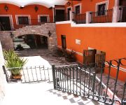
Hotel Casa Pozo del Rayo
Videos from this area
These are videos related to the place based on their proximity to this place.
El Buen Ejemplo Calibre 50 en Dolores Hidalgo
Presentación del grupo Calibre 50 en la ciudad de Dolores Hidalgo en sus Fiestas Patrias 2012.
Dolores Hidalgo, Cuna de la Independencia
Hermoso pueblo mágico, Cuna de la Independencia de México, con calles adoquinadas, limpias, fachadas de vivos colores, de gente hospitalaria y pacífica que ofrece al turista hermosas piezas...
Kadlook en convivencia de Moto Club Independencia Dolores Hidalgo, Guanajuato
Kadlook en convivencia de Moto Club Independencia Dolores Hidalgo, Guanajuato.
TAMPICO HERMOSO. MP4 cantada por Los Alegres de Dolores Hidalgo
En el centro de la ciudad de Dolores Hidalgo, Gto., se respira tranquilidad y armonía. Tal como se muestra en la paz de la provincia Mexicana. El grupo de música regional Los Alegres de Dolores,...
Tumba de José Alfredo Jiménez en Dolores Hidalgo.
La tumba de José Alfredo Jiménez en el municipio de Dolores Hidalgo, Guanajuato. Los restos del cantante descansan en el panteón municipal.
UTNG Dolores Hidalgo, C.I.N., GRT02
Un recuerdo de la 2 genereacion de la Carrera de Redes y Telecomunicaciones 2005-2007.
Videos provided by Youtube are under the copyright of their owners.
Attractions and noteworthy things
Distances are based on the centre of the city/town and sightseeing location. This list contains brief abstracts about monuments, holiday activities, national parcs, museums, organisations and more from the area as well as interesting facts about the region itself. Where available, you'll find the corresponding homepage. Otherwise the related wikipedia article.
Dolores Hidalgo
Dolores Hidalgo (in full, Dolores Hidalgo Cuna de la Independencia Nacional is the name of a city and the surrounding municipality in the north-central part of the Mexican state of Guanajuato. It is located at {{#invoke:Coordinates|coord}}{{#coordinates:21.17|N|100.93|W||||| | |name= }}, at an elevation of about 1,980 meters above sea level. In the census of 2005 the city had a population of 54,843 people, while the municipality had 134,641 inhabitants.


