Safety Score: 3,6 of 5.0 based on data from 9 authorites. Meaning please reconsider your need to travel to Mexico.
Travel warnings are updated daily. Source: Travel Warning Mexico. Last Update: 2024-05-04 08:22:41
Delve into Vista Alegre
The district Vista Alegre of in Ciudad de México is a district located in Mexico a little south of Mexico City, the country's capital town.
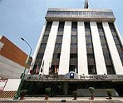
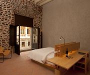
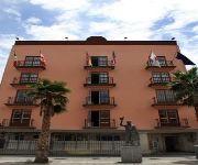
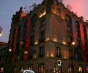
In need of a room? We compiled a list of available hotels close to the map centre further down the page.
Since you are here already, you might want to pay a visit to some of the following locations: Mexico City, Nezahualcoyotl, Los Reyes Acaquilpan, Huixquilucan de Degollado and Chicoloapan. To further explore this place, just scroll down and browse the available info.
Local weather forecast
Todays Local Weather Conditions & Forecast: 29°C / 84 °F
| Morning Temperature | 22°C / 71 °F |
| Evening Temperature | 26°C / 78 °F |
| Night Temperature | 26°C / 78 °F |
| Chance of rainfall | 0% |
| Air Humidity | 13% |
| Air Pressure | 1011 hPa |
| Wind Speed | Moderate breeze with 12 km/h (8 mph) from North-East |
| Cloud Conditions | Clear sky, covering 5% of sky |
| General Conditions | Sky is clear |
Sunday, 5th of May 2024
29°C (84 °F)
22°C (72 °F)
Moderate rain, gentle breeze, clear sky.
Monday, 6th of May 2024
29°C (85 °F)
26°C (78 °F)
Scattered clouds, gentle breeze.
Tuesday, 7th of May 2024
30°C (85 °F)
26°C (79 °F)
Scattered clouds, moderate breeze.
Hotels and Places to Stay
BEST WESTERN ESTORIL
Downtown México
City Centro Ciudad de México
Hotel Lord
Hotel Plaza Garibaldi
Hotel Roble
Hampton Inn - Suites Mexico City - Centro Historico
Hotel Virreyes
Hotel Mexicali
Hotel Castropol
Videos from this area
These are videos related to the place based on their proximity to this place.
Castillo de Chapultepec - Mexico City, Central Mexico and Gulf Coast, Mexico
http://tripwow.tripadvisor.com/tripwow/ta-00a0-8c48-492d?ytv2=1 - Created at TripWow by TravelPod Attractions Castillo De Chapultepec Mexico City This 18th-century palace, known for its...
Palacio de Bellas Artes - Mexico City, Central Mexico and Gulf Coast, Mexico
http://tripwow.tripadvisor.com/tripwow/ta-00a0-6b6e-ae0b?ytv2=1 - Created at TripWow by TravelPod Attractions Palacio De Bellas Artes Mexico City This historic white marble building serves...
TURBULENCIA - MERENGUE - 9a FERIA DE LA TORTA 2012 - DELEGACION VENUSTIANO CARRANZA
PARA TODA ESA GENTE BONITA QUE NOS APOLLA INCONDICIONAL MENTE NO SOLO DE LA ZONA ORIENTE Y DE LA ARENAL Y ALRREDEDORES SI NO DE OTROS LADOS MUCHAS ...
quema de judas 2013 FAMILIA LINARES (R2D2)
tradicional quema de judas de la familia linares realizada el sábado de gloria en la colonia merced balbuena, calle de oriente 30, Delegación Venustiano Carranza México Distrito Federal.
Quiero Casa Onix (Cuauhtémoc) – Departamentos en Fernando de Alva I. esq. Eje Central
Excelente ubicación, a sólo dos calles del metro Doctores, departamentos de 2 recámaras, cocina integral, elevador, consulta todo sobre este desarrollo en http://quierocasa.com.mx/onix.php.
Videos provided by Youtube are under the copyright of their owners.
Attractions and noteworthy things
Distances are based on the centre of the city/town and sightseeing location. This list contains brief abstracts about monuments, holiday activities, national parcs, museums, organisations and more from the area as well as interesting facts about the region itself. Where available, you'll find the corresponding homepage. Otherwise the related wikipedia article.
Lake Texcoco
Lake Texcoco (Spanish: Lago de Texcoco) was a natural lake formation within the Valley of Mexico. The Aztecs built the city of Tenochtitlan on an island in the lake. The Spaniards built Mexico City over Tenochtitlan. Efforts to control flooding led to most of the lake being drained, leaving a much smaller Lake Texcoco east of the city, surrounded by salt marsh.
Metro Santa Anita
Metro Santa Anita is a station on the Mexico City Metro. Located in Mexico City's Iztacalco borough, the station is the current terminal of Line 4. The station logo depicts a man sailing a canoe. This is because in the early 20th century, in the area where the station now stands, was the Santa Anita canal – a place used for chinampa-based agriculture. Today the canal has long since vanished, but the name Santa Anita is still used by the surrounding neighbourhood.
Metro Xola
Metro Xola is a station on Line 2 of the Mexico City Metro system. It is located in the Colonia Moderna and Colonia Alamos districts of the Benito Juárez borough of Mexico City, directly south of the city centre on Calzada de Tlalpan. It is a surface station. The station logo shows a coconut palm tree. The name comes from the 19th century "Xola" hacienda that existed in the current site of the station.
Metro Viaducto
Viaducto is a station on Line 2 of the Mexico City Metro system. It is located in the border of Benito Juárez and Iztacalco boroughs of Mexico City, south of the city centre on Calzada de Tlalpan. It is a surface station. It is represented by the stylised logo of a cloverleaf interchange, which represents crossing of Calzada de Tlalpan (a former Aztec road) and Viaducto Miguel Alemán, a crosscutting freeway that runs across the middle of the Federal District which opened in September 1950.
Metro Pino Suárez
Metro Pino Suárez is a station on Line 1 and Line 2 of the Mexico City Metro system. It is located in the Cuauhtémoc borough of Mexico City, on the southern part of the city centre. The station is named after José María Pino Suárez, Vice President of Mexico during the term of Francisco I. Madero (1911–1913). However, the station logo depicts a pyramid dedicated to Ehecatl, the Aztec god of wind.
Metro San Antonio Abad
Metro San Antonio Abad is a station on Line 2 of the Mexico City Metro system. It is located in the Colonia Tránsito and Colonia Obrera neighborhoods of the Cuauhtémoc borough of Mexico City, to the south of the city centre, in the median of Calzada San Antonio Abad. The station logo depicts Saint Anthony the Great, after the monastery dedicated to him that was established in the area after the Spanish conquest of Tenochtitlán.
Metro Chabacano
Metro Chabacano is a station on Lines 2, 8 and 9 of the Mexico City Metro system. It is located in the Cuauhtémoc borough of Mexico City, south of the city centre, on Calzada de Tlalpan. Chabacano means apricot in Mexican Spanish. When Mexico City was expanding south towards Río de la Piedad (now tubed under the Viaducto Miguel Alemán) city planners decided to name an avenue after the fruit that grew prodigiously next to the shore of the river.
Metro Jamaica
Metro Jamaica is a station on the Mexico City Metro. It is located in Venustiano Carranza borough, in Mexico City and serves the serves the Sevilla neighbourhood. The station logo depicts an ear of corn. Its name refers to the nearby wholesale market of Jamaica, that sells flowers especially. This station combines both elevated viaducts for line 4 and underground passages for line 9. The distance between platforms is long, as are the station's exits. Metro Jamaica has a cultural display.
Metro Doctores
Metro Doctores is a station on Line 8 of the Mexico City Metro. Its logo is the silhouette of two doctors. The station is named after Colonia Doctores, the neighborhood in which it is located, whose streets commemorate famous doctors of the era of La Reforma. On 7 March 2007 a 30 year old woman committed suicide at the station by throwing herself onto the tracks. Service on the line was suspended for 20 minutes.
Metro Obrera
Metro Obrera is a station along Line 8 of the metro of Mexico City. The station is situated on Eje Central Lázaro Cárdenas. The station's logo is a construction worker's helmet framed with two gears. The name obrera comes from the Colonia Obrera neighbourhood where the station is located.
Metro La Viga
Metro La Viga is a station along Line 8 of the metro of Mexico City. The station's logo is a pair of fishes since the neighborhood it serves (Colonia Jamaica) is home to Mercado de La Viga – one of the larger seafood markets in Mexico City.
Metro Lázaro Cárdenas
Metro Lázaro Cárdenas (Spanish: Estación Lázaro Cárdenas) is on Line 9 of the Mexico City Metro System between Metro Centro Médico and Metro Chabacano at the intersection of Eje Central and Eje 3 Sur. It links to the Eje Central Trolebus line. The station is named after Lázaro Cárdenas, and the station logo shows a portrait in profile of him.
Colonia Doctores
Colonia Doctores is an official neighborhood just southwest of the historic center of Mexico City. It is bordered by Avenida Cuauhtémoc to the west, Arcos de Belen Street to the north, Eje Central to the east and Eje 3 Sur José Peón Contreras to the south.
Tlaxcoaque
Tlaxcoaque is a plaza located in the historic center of Mexico City which has given its name to both the 17th century church that is on it and the blocks that surround it. Historically this plaza and the church that sits on it have marked the southern edge of Mexico City, and today it is on the border of the historic center and Colonia Obrera.
Museo de Charrería
The Museo de Charrería or Charrería Museum is located in the historic center of Mexico City on Izazaga Street, in an old monastery which was dedicated to the Virgin of Montserrat. The monastery closed in 1821 and the building deteriorated significantly until it was decided to rehabilitate it as a tourist attraction.
Colonia Obrera
Colonia Obrera is an administrative neighborhood of the borough of Cuauhtémoc in the center of Mexico City. It was established in the late 19th and early 20th centuries and became home to many artisans and industrial workmen. Up to the early 1980s, a number of sewing factories were still located here, but the 1985 Mexico City earthquake destroyed many, including the Topeka factory in which many of the seamstresses died inside.
Colonia Algarín
Colonia Algarín is a very small working class residential neighborhood located south of the historic center of Mexico City. Its border to the north is Eje 3 Sur José Peón Contreras, to the south Viaducto Miguel Alemán, to the east San Antonio Abad Ave (Calzada de Tlalpan) and to the west Eje Central Lázaro Cárdenas. Colonia Algarín is located between colonias Buenos Aires (Eje Central), Álamos (Viaducto), Obrera and Asturias (San Antonio Abad).
Colonia Ampliación Asturias
Colonia Ampliación Asturias is a neighborhood in the Cuauhtémoc borough of Mexico City. It is located southeast of the historic center of Mexico City. It borders are marked by the following streets, to the north Eje Tres Sur or Avenida Calzada del Chabacano, Calzada de la Viga to the east, Calzada de San Antonio Abad to the west and Hernandez Davalos street to the south. The origins of the neighborhood are based in the extension of neighboring Colonia Asturias.
Colonia Asturias
Colonia Asturias is a colonia or neighborhood in the Cuauhtémoc borough, south of the historic center of Mexico City. It is a lower-class residential neighborhood, whose borders are formed by the following streets, Calles Hernánde y Dávales in the north, Viaducto Piedad in the south, Calzada de la Viga in the east and Calzaca San Antonio Abad in the west.
Colonia Esperanza, Cuauhtémoc
Colonia Esperanza is a small colonia or neighborhood located in the Cuauhtémoc borough of Mexico City just southeast of the historic center. Its borders are defined by the following streets: Lorenzo Boturini to the south, Fray Servando Teresa de Mier to the north, Calzada de la Viga Canal to the east and Francisco Javier Clavijero to the west. Today it is an almostly completely residential neighborhood, but there is little known about its history.
Colonia Paulino Navarro
Colonia Paulino Navarro is a colonia or neighborhood in the Cuauhtémoc borough of Mexico City, just southeast of the city’s historic center. Its boundaries are defined by the following streets: Ventura G. Tena and Hernández y Dávalos to south, Calzada de la Chabacano to the north, Calzada de la Viga to the east and Calzada de San Antonio Abad to the west. The origins of the neighborhood date from 1905, when Iñigo Noriega proposed urbanizing what was then called Colonia La Paz.
Colonia Tránsito
Colonia Tránsito is a colonia or neighborhood in the Cuauhtémoc borough of Mexico City, just south of the city’s historic center. It is a residential area although there has been recent redevelopment for more commercial uses. It contains two colonial era churches (one in ruins), a number of buildings containing public offices and it is the home of soft drink maker Pascual Boing.
Colonia Vista Alegre
Colonia Vista Alegre is a colonia in the Cuauhtémoc borough of Mexico City just south of the city’s historic center. The boundaries of the colonia are formed by the following streets: Calzada de Chabacano to the south, José T. Cuellar to the north, Colonia Paulino Narvarro to the east and Calzada de Tlalpan to the west.
Mercado de Sonora
Mercado de Sonora (Sonora Market) is a city-established traditional market, located just southeast of the historic center of Mexico City in the Colonia Merced Balbuena neighborhood. It was established in the 1950s with a number of other similar institutions in order to help regulate retail commerce in the city.
Mercado Jamaica, Mexico City
Mercado Jamaica is one of Mexico City’s traditional public markets where various vendors sell their wares in an established location. This market was inaugurated in the 1950s as part of efforts to modernize the markets in the area. The market is located on the corner of Congreso de la Union and Avenida Morelos, just southeast of the historic center of the city. Although it is one of the main markets for groceries, produce and meat, it is best known for its flowers and ornamental plants.


