Safety Score: 3,6 of 5.0 based on data from 9 authorites. Meaning please reconsider your need to travel to Mexico.
Travel warnings are updated daily. Source: Travel Warning Mexico. Last Update: 2024-05-04 08:22:41
Delve into Roma Norte
The district Roma Norte of in Ciudad de México is a district located in Mexico a little west of Mexico City, the country's capital town.
In need of a room? We compiled a list of available hotels close to the map centre further down the page.
Since you are here already, you might want to pay a visit to some of the following locations: Mexico City, Nezahualcoyotl, Los Reyes Acaquilpan, Huixquilucan de Degollado and Chicoloapan. To further explore this place, just scroll down and browse the available info.
Local weather forecast
Todays Local Weather Conditions & Forecast: 29°C / 84 °F
| Morning Temperature | 20°C / 68 °F |
| Evening Temperature | 27°C / 81 °F |
| Night Temperature | 21°C / 71 °F |
| Chance of rainfall | 0% |
| Air Humidity | 18% |
| Air Pressure | 1011 hPa |
| Wind Speed | Gentle Breeze with 9 km/h (5 mph) from West |
| Cloud Conditions | Clear sky, covering 0% of sky |
| General Conditions | Light rain |
Monday, 6th of May 2024
29°C (84 °F)
24°C (76 °F)
Light rain, gentle breeze, few clouds.
Tuesday, 7th of May 2024
29°C (85 °F)
24°C (75 °F)
Light rain, moderate breeze, scattered clouds.
Wednesday, 8th of May 2024
30°C (86 °F)
26°C (79 °F)
Light rain, gentle breeze, broken clouds.
Hotels and Places to Stay
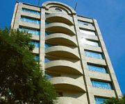
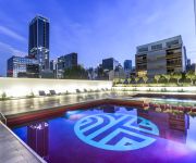
La Valise Hotel
Eurostars Zona Rosa Suites
NH COLLECTION MEXICO CITY
Room Mate Valentina
Colonia Roma Four Points by Sheraton Mexico City
Hippodrome Hotel Condesa
Nima Local House Hotel
City Express Plus Ref El Angel
Casa Goliana La Roma
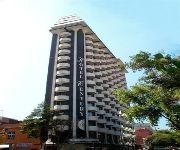
Hotel Century Zona Rosa México
Videos from this area
These are videos related to the place based on their proximity to this place.
Viaje a Mexico DF - 3 Travel Bloggers
Guía de viajes para ciudad de México. Alan Estrada de Alan x el Mundo se une a Daniel Tirado y JL Pastor para recorrer esta inmensa ciudad invitados por #HolidayInnMexico Síguenos en...
Mexico City Gay Parade 2012. Stripper @ Lollipop Club
Stripper @ Lollipop Club, Zona Rosa He's very hot!
Fashion Photoshoot Mexico City
Photoshoot taken by Francisco Soberanis for Broke Model Management in Mexico City with two analog cameras and one digital camera. Canon AE-1 (ByN pics, Film Kodak Tx400) Elan7e (Color pics,...
Hotel Geneve, Mexico City
Elegancia, vanguardia y buen servicio son atributos que el Hotel Geneve ha conservado en sus más de 100 años. Su arquitectura y decoración evocan el estilo clásico europeo, los visitantes...
EHD Entrevista
Programa de televisión sobre salud transmitido el día 3 de marzo de 2011 por canal 11 donde entrevistaron a Dr. Felipe Corona y hace la demostración de movimiento Roberto Sánchez, en el...
incendio en naucalpan colonia san rafael chamapa
muchas noticias dijeron q esto ocurrio en la colonia loma linda otro q colonia el molinito (por favor) y otro q colonia las tinajas , pues no ¡¡¡¡ esto fue en la colonia san rafael chamapa...
Granizada Mexico DF Colonia Roma Sur 16-04-11 parte 1
En la colonia Roma sur, lo grabe mas que nada por que se fue la luz por unos minutos y es cuando me di cuenta que no paraba de granizar...
2011•01•20 _ Incendio en la Colonia Roma
Evacúan a 2 mil personas por incendio en la Roma - http://www.radioformula.com.mx/notas.asp?Idn=152044.
Cómo la corrupción en el GDF destruye la colonia Roma
La corrupción, la avaricia, el hambre de los servidores públicos, está dando permisos salvajes a constructoras, que quieren multipicar el número de habitantes en la Roma, destruyendo su...
Hotel Brick
Situado en la colonia Roma, una de las colonias más importantes de la Ciudad de México, cuya arquitectura embelesa las residencias, comercios y maravillosos recintos culturales que la rodean,...
Videos provided by Youtube are under the copyright of their owners.
Attractions and noteworthy things
Distances are based on the centre of the city/town and sightseeing location. This list contains brief abstracts about monuments, holiday activities, national parcs, museums, organisations and more from the area as well as interesting facts about the region itself. Where available, you'll find the corresponding homepage. Otherwise the related wikipedia article.
Metro Sevilla
Sevilla is a station on Line 1 the Mexico City Metro. It is located in the Cuauhtémoc borough in the centre of Mexico City, on Avenida Chapultepec and Sevilla street. It serves colonias Roma and Juárez. The station logo depicts an aqueduct. This is because above the station are the remains of a colonial era aqueduct, built in 1779, that ran between Chapultepec and Salto del Agua fountain. It had 904 arches and a total length of some 3.7 kilometres .
Mexican Football Federation
The Mexican Federation of Football (Spanish: Federación Mexicana de Fútbol Asociación, A.C. , FMF or Femexfut) is the governing body of association football in Mexico. It administers the Mexican national team, the Mexican league and all affiliated amateur sectors, and is in charge of promoting, organizing, directing, spreading, and supervising competitive football in Mexico.
Metro Insurgentes
Insurgentes is a station on the Mexico City Metro. It is located at the crossing of Avenida Insurgentes and Avenida Chapultepec in Mexico City's Cuauhtémoc borough, close to the Zona Rosa shopping and entertainment district. The station logo depicts the church bell of Dolores Hidalgo, a symbol of the start of the Mexican War of Independence (1810) and the eleven-year-long insurgency that followed. Metro Insurgentes was built in a particular style.
Instituto Nacional de Antropología e Historia
The Instituto Nacional de Antropología e Historia (INAH, National Institute of Anthropology and History) is a Mexican federal government bureau established in 1939 to guarantee the research, preservation, protection, and promotion of the prehistoric, archaeological, anthropological, historical, and paleontological heritage of Mexico. Its creation has played a key role in preserving the Mexican cultural heritage.
Metro Cuauhtémoc
Metro Cuauhtémoc is a metro (subway) station on the Mexico City Metro. It is located at the northern extreme of Avenida Cuauhtémoc, in the Cuauhtémoc borough, in the centre of Mexico City. The station logo depicts the head of an eagle. The station, avenue, and borough were all named after the Aztec Emperor Cuauhtémoc, whose name means "descending eagle" in Nahuatl.
Metro Hospital General
Metro Hospital General is a metro station along Line 3 of the Mexico City Metro. It is located in the Cuauhtémoc borough of Mexico City. The station logo represents the symbol of International Red Cross. Its name refers to the General Hospital of Mexico, which is located above the station. This station transfers to the "S" trolleybus line, which runs between ISSSTE Zaragoza and Metro Chapultepec. Metro Hospital General serves passengers in the Colonias (Neighborhoods) of Doctores and Roma.
Zona Rosa
This article is about Mexico City, for other uses read Zona Rosa (disambiguation) Zona Rosa is a neighborhood in Mexico City which is known for its shopping, nightlife, gay community, and its recently established Korean community. The neighborhood is officially part of the Colonia Juárez colonia or official neighborhood, located just west of the historic center of Mexico City.
Colonia Condesa
Officially, Colonia Condesa is an administrative division or “colonia” located west of the historic center of Mexico City, just south of Avenida Chapultepec. Popularly, the name “La Condesa” is named after the second, the María Magdalena Dávalos de Bracamontes y Orozco, the Countess of Miravalle, whose lands stretched from what is now Colonia Roma to Tacubaya. When calling it just “Condesa”, refers to the adjoining colonies of Colonia Hipódromo and Colonia Hipódromo Condesa.
Parque México
The Parque México (English: Mexico Park, also known as the Parque San Martín, is a large urban park located in Colonia Hipódromo in the La Condesa area of Mexico City. It is recognized by its Art Deco architecture and decor as well as being one of the larger green areas in the city. The park was built in the 1920s, when its surrounding neighborhood of Colonia Hipódromo was being established. It is the former site of a horse race track on an hacienda that belonged to the Countess of Miravalle.
Popular Socialist Party (Mexico)
The Popular Socialist Party (Spanish: Partido Popular Socialista, PPS) is a communist party in Mexico. It was founded in 1948 as the Popular Party (Partido Popular) by Vicente Lombardo Toledano. Lombardo Toledano, the initial leader of the Confederation of Mexican Workers (CTM), decided to launch a new party in response to the increasingly moderate and corrupt policies of the ruling Institutional Revolutionary Party (PRI).
Colonia Roma
Colonia Roma is a colonia or neighborhood located in the Cuauhtémoc borough of Mexico City just west of the city’s historic center. The area was a very shallow part of Lake Texcoco, dotted with tiny islands and one small island village of Aztacalco during the pre-Hispanic period. During the colonial period, the area dried up and became rural lands first owned by Hernán Cortés and then by the Counts of Miraville.
Colonia Juárez (Mexico City)
Colonia Juarez is one of the better–known neighborhoods or colonias in the Cuauhtémoc borough of Mexico City. Its boundaries are: the corner of Paseo de la Reforma and Eje Bucareli to the north, Avenida Chapultepec to the south, Eje 1 Poniente to the east and Circuito Interior José Vasconcelos to the west.
Chapultepec aqueduct
The Chapultepec aqueduct (in Spanish: el acueducto de Chapultepec) is an aqueduct originally built at Chapultepec by the Aztecs during the Tenochtitlan era; its original name was simply the “Great Aqueduct. ” What remains of the aqueduct today is located in Mexico City near Metro Sevilla. The project was started under the tlatoani Chimalpopoca and modified by Moctezuma I.
Salón de la Plástica Mexicana
Salón de la Plástica Mexicana (Hall of Mexican Fine Art) is an institution dedicated to the promotion of Mexican contemporary art. It was established in 1949 to expand the Mexican art market. Its first location was in historic center of the city but today it mostly operates out of a building in Colonia Roma. The institution is run by a membership of almost four hundred recognized artists and holds multiple exhibitions each year.
General Hospital of Mexico
The General Hospital of Mexico (Hospital General de México, HGM) is a hospital in Mexico City, operated by the federal government. The Metro Hospital General serves the hospital.
Centro Urbano Benito Juárez
The Centro Urbano Benito Juárez, more commonly called the Multifamiliar Juárez, was a large apartment complex built on the southeast section of Colonia Roma, Mexico City in the late 1940s and early 1950s. It was one of several projects of this type by architect Mario Pani, designed to be semi-autonomous and incorporate as much outdoors space as possible. It also featured one of the largest mural works of the 20th century by artist Carlos Mérida.
Colonia Hipódromo
Colonia Hipódromo is a colonia (neighborhood) west of the historic center of Mexico City in the Cuauhtémoc borough. It is one of three colonias that are jointly known as “La Condesa. ” The colonia and the La Condesa area is centered on Parque México, a large park built on a former private racetrack belonging to the Countess (Condesa) of Miravalle. This park has been recognized for its historic value by the Instituto Nacional de Antropología e Historia.
Parque España (Ciudad de México)
Parque España (Ciudad de México)is a park in the historic center of Mexico City, Mexico. The park is located in the Colonia Hipódromo (neighborhood) of the Cuauhtémoc borough, in western Mexico City.
Museo del Objeto del Objeto
The Museo del Objeto del Objeto, or MODO (Museum of the Object of the Object, or "purpose of the object") is a museum in Mexico City and the first museum in Mexico dedicated to design and communications. It was opened in 2010 based on a collection of commercial packaging, advertising, graphic arts, common devices and many other objects dating back to 1810 collected by Bruno Newman over more than forty years.
Casa Lamm Cultural Center
The Casa Lamm Cultural Center is the best known landmark in Colonia Roma. It was a house built in the early 20th century when Colonia Roma was a new neighborhood for the wealthy leaving the historic center of Mexico City. In the 1990s, the house was restored to open as a cultural center in 1994, with the aim of making the area a center for the visual arts. Today, it hosts numerous exhibits as well as offering classes, even degrees, in art and literature.
Garros Galería
Garros Galería or Garros Gallery is located in Colonia Roma in Mexico City. It is the only art gallery and museum dedicated to cats in Mexico.
La Romita
La Romita is a small neighborhood located in the Colonia Roma section of Mexico City. The area began as an independent pre Hispanic village called Aztacalco, later renamed Romita. When the area around the village was redeveloped into housing for the wealthy, the village resisted and remained separate socially although officially part of Colonia Roma. During the 20th century the area had a reputation for being dangerous as it residents were relatively poor.
Fuente de Cibeles (Mexico City)
The fountain of Cibeles in Mexico City is an exact replica of the fountain located in the Plaza de Cibeles in Madrid that was built during the reign of Charles III by architect Ventura Rodríguez between 1777 and 1792. The Mexican version is located at a traffic circle where Oaxaca, Durango, Medellín and El Oro streets converge in Colonia Roma.
Centro Cultural Border (Mexico City)
The Centro Cultural Border, or Border Cultural Center, is an independent cultural space in Colonia Roma that encourages the production, formation and awareness of emerging contemporary art with a focus on visual art, multimedia and graffiti. The center has a cafeteria, library, book store and a series of workshops focused on urban art. The library has materials in english and spanish about illustration, graffiti, design and contemporary art.
Embassy of Colombia, Mexico City
The Embassy of Colombia in Mexico City is the diplomatic mission of the Republic of Colombia to the United Mexican States; it is headed by the Ambassador of Colombia to Mexico. It is located in the Cuauhtémoc borough and neighbourhood of Mexico City, near El Ángel, the Chapultepec aqueduct, and the Modern Art Museum, precisely at Paseo de La Reforma 375 between the Río Guadalquivir and Río Nilo avenues, and it is serviced by the Insurgentes and Sevilla stations.


