Safety Score: 3,0 of 5.0 based on data from 9 authorites. Meaning we advice caution when travelling to France.
Travel warnings are updated daily. Source: Travel Warning France. Last Update: 2024-05-09 08:23:21
Delve into La Lampierre
La Lampierre in Alpes-Maritimes (Provence-Alpes-Côte d'Azur Region) is a town located in France about 394 mi (or 634 km) south-east of Paris, the country's capital town.
Time in La Lampierre is now 01:35 PM (Thursday). The local timezone is named Europe / Paris with an UTC offset of 2 hours. We know of 12 airports closer to La Lampierre, of which 5 are larger airports. The closest airport in France is Barcelonnette - Saint-Pons Airport in a distance of 26 mi (or 42 km), North-West. Besides the airports, there are other travel options available (check left side).
There are two Unesco world heritage sites nearby. The closest heritage site is Vineyard Landscape of Piedmont: Langhe-Roero and Monferrato in Italy at a distance of 60 mi (or 96 km). In need of a room? We compiled a list of available hotels close to the map centre further down the page.
Since you are here already, you might want to pay a visit to some of the following locations: Pietraporzio, Sambuco, Bersezio, Vinadio and Aisone. To further explore this place, just scroll down and browse the available info.
Local weather forecast
Todays Local Weather Conditions & Forecast: 21°C / 69 °F
| Morning Temperature | 11°C / 52 °F |
| Evening Temperature | 19°C / 66 °F |
| Night Temperature | 14°C / 58 °F |
| Chance of rainfall | 0% |
| Air Humidity | 44% |
| Air Pressure | 1019 hPa |
| Wind Speed | Gentle Breeze with 7 km/h (4 mph) from South |
| Cloud Conditions | Clear sky, covering 8% of sky |
| General Conditions | Light rain |
Friday, 10th of May 2024
21°C (69 °F)
15°C (60 °F)
Scattered clouds, gentle breeze.
Saturday, 11th of May 2024
20°C (69 °F)
15°C (59 °F)
Scattered clouds, light breeze.
Sunday, 12th of May 2024
20°C (67 °F)
14°C (58 °F)
Light rain, light breeze, scattered clouds.
Hotels and Places to Stay
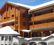
Adonis Valberg Residence de Tourisme
Videos from this area
These are videos related to the place based on their proximity to this place.
Riviera Unik Tour : Beuil, visite de la grange Cassini
A Beuil (Alpes-Maritimes) découvrez un village, un homme et un bien immobilier, humaniste, écologique et donc de nature Unik ;-) Pour plus d'informations, nous poser des questions et nous...
Journée à Beuil
Petite journée sympathique, découverte de "La bulle" du camping le Cians et escapade montagne dans les alentours.
Canyon du Cramassouri - Session 3 - 11 aout 2012 - HD
Descente du canyon du Cramassouri a la tour sur tinée.
Canoë Cayak Rafing dans les Alpes Maritimes, 06, Paca.
Pratiquez le canoë Cayak Rafing dans les Alpes Maritimes, 06, Paca en famille en toute sécurité avec un guide professionnel. www.rivieraft.com.
Mont Mounier Hike
At 2817 meters, Mont Mounier is the highest limestone mountain in the Alpes-Maritimes region. The mountain is situated between Valberg and Auron ski resorts and dominates the nearby landscape....
Décollage en Zenair 701 de l'altisurface de Valberg LF0654
Décollage en Zenair 701 après un Skyranger sur l'altisurface de Valberg LF0654 dans les Alpes Maritimes. Vol montagne à 5680 pieds d'altitude. Bons vols... Patrick Peyruchat Aviation.
Videos provided by Youtube are under the copyright of their owners.
Attractions and noteworthy things
Distances are based on the centre of the city/town and sightseeing location. This list contains brief abstracts about monuments, holiday activities, national parcs, museums, organisations and more from the area as well as interesting facts about the region itself. Where available, you'll find the corresponding homepage. Otherwise the related wikipedia article.
Cians
The Cians is a mountain river that flows through the Alpes-Maritimes department of southeastern France. Its source is in the mountains north of Beuil, and it flows into the Var in Touët-sur-Var. The Cians flows though the following communes: Beuil, Rigaud, Pierlas, Thiéry, Touët-sur-Var.


