Safety Score: 3,2 of 5.0 based on data from 9 authorites. Meaning please reconsider your need to travel to Czech Republic.
Travel warnings are updated daily. Source: Travel Warning Czechia. Last Update: 2024-05-15 08:00:47
Delve into Horní Staňkov
Horní Staňkov in Okres Klatovy (Plzeňský kraj) is a city located in Czechia about 73 mi (or 117 km) south-west of Prague, the country's capital town.
Current time in Horní Staňkov is now 03:20 PM (Wednesday). The local timezone is named Europe / Prague with an UTC offset of 2 hours. We know of 11 airports closer to Horní Staňkov, of which 5 are larger airports. The closest is airport we know is Straubing Airport in Germany in a distance of 48 mi (or 77 km). The closest airport in Czechia is Mariánské Lázně Airport in a distance of 55 mi (or 77 km), South-West. Besides the airports, there are other travel options available (check left side).
There are several Unesco world heritage sites nearby. The closest heritage site in Czechia is Holašovice Historical Village Reservation in a distance of 43 mi (or 69 km), South-East. We saw 1 points of interest near this location. In need of a room? We compiled a list of available hotels close to the map centre further down the page.
Since you are here already, you might want to pay a visit to some of the following locations: Bayerisch Eisenstein, Lindberg, Frauenau, Lohberg and Spiegelau. To further explore this place, just scroll down and browse the available info.
Local weather forecast
Todays Local Weather Conditions & Forecast: 20°C / 69 °F
| Morning Temperature | 11°C / 51 °F |
| Evening Temperature | 17°C / 63 °F |
| Night Temperature | 14°C / 57 °F |
| Chance of rainfall | 0% |
| Air Humidity | 49% |
| Air Pressure | 1007 hPa |
| Wind Speed | Fresh Breeze with 14 km/h (9 mph) from West |
| Cloud Conditions | Clear sky, covering 0% of sky |
| General Conditions | Sky is clear |
Thursday, 16th of May 2024
13°C (55 °F)
11°C (51 °F)
Light rain, fresh breeze, overcast clouds.
Friday, 17th of May 2024
10°C (50 °F)
9°C (48 °F)
Light rain, moderate breeze, overcast clouds.
Saturday, 18th of May 2024
16°C (60 °F)
10°C (51 °F)
Light rain, light breeze, overcast clouds.
Hotels and Places to Stay
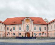
Zámek Hrádek
Videos from this area
These are videos related to the place based on their proximity to this place.
Rozhledna Svatobor u Sušice
Rozhledna stojí na kopci Svatobor východně od Sušice. Zde bylo staré sídliště pohanských předků a místo náboženských obřadů. Je opředen pověstmi o pohanské kněžně Vodolence,...
Lužní les v Sušici
Pokud navštívíte královské město Sušice a zatoužíte po rychlém přírodním osvěžení, pak se rozhodně vydejte po levém břehu proti proudu řeky Otavy. Jen pár minut chůze...
Ro(c)k pro Santos 2012
Atmosféra 19. ročníku hudebního festivalu Šumava Rocks, věnovaného proměně ostrova Santos. Více na www.nadace-promeny.cz.
Videos provided by Youtube are under the copyright of their owners.
Attractions and noteworthy things
Distances are based on the centre of the city/town and sightseeing location. This list contains brief abstracts about monuments, holiday activities, national parcs, museums, organisations and more from the area as well as interesting facts about the region itself. Where available, you'll find the corresponding homepage. Otherwise the related wikipedia article.
Velhartice
Velhartice is a village in the Czech Republic dating to the 13th century, dominated by the Gothic castle Hrad Velhartice. The castle was built 1290-1310 by a nobleman who later became courtier and close friend of the Emperor Charles IV (1316-1378). During the Thirty Years' War, Emperor Ferdinand II gave the castle to one of his generals, Don Balthazar de Marradas who, in 1628, sold it to Don Martin de Hoeff Huerta who bought it for his beautiful adopted daughter Anne-Marie of Moldavia.


