Safety Score: 2,7 of 5.0 based on data from 9 authorites. Meaning we advice caution when travelling to United States.
Travel warnings are updated daily. Source: Travel Warning United States. Last Update: 2024-05-17 08:07:57
Delve into Nag Creek
Nag Creek in Newport County (Rhode Island) is located in United States about 356 mi (or 573 km) north-east of Washington DC, the country's capital town.
Current time in Nag Creek is now 12:50 AM (Saturday). The local timezone is named America / New York with an UTC offset of -4 hours. We know of 12 airports close to Nag Creek, of which 5 are larger airports. The closest airport in United States is Theodore Francis Green State Airport in a distance of 7 mi (or 12 km), North-West. Besides the airports, there are other travel options available (check left side).
Also, if you like playing golf, there are some options within driving distance. We encountered 4 points of interest near this location. If you need a hotel, we compiled a list of available hotels close to the map centre further down the page.
While being here, you might want to pay a visit to some of the following locations: Cranston, Providence, North Providence, Johnston and Taunton. To further explore this place, just scroll down and browse the available info.
Local weather forecast
Todays Local Weather Conditions & Forecast: 13°C / 55 °F
| Morning Temperature | 12°C / 53 °F |
| Evening Temperature | 13°C / 55 °F |
| Night Temperature | 12°C / 53 °F |
| Chance of rainfall | 0% |
| Air Humidity | 87% |
| Air Pressure | 1016 hPa |
| Wind Speed | Gentle Breeze with 8 km/h (5 mph) from South |
| Cloud Conditions | Overcast clouds, covering 100% of sky |
| General Conditions | Overcast clouds |
Saturday, 18th of May 2024
17°C (62 °F)
12°C (53 °F)
Overcast clouds, moderate breeze.
Sunday, 19th of May 2024
16°C (61 °F)
10°C (51 °F)
Overcast clouds, gentle breeze.
Monday, 20th of May 2024
20°C (68 °F)
12°C (54 °F)
Broken clouds, moderate breeze.
Hotels and Places to Stay
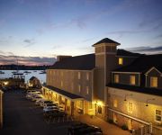
BRISTOL HARBOR INN
William's Grant Inn B&B
Videos from this area
These are videos related to the place based on their proximity to this place.
Motoring Inside Rumstick Point, Barrington, RI
Motoring a West Wight Potter 15 sailboat inside the channel at the tip of Rumstick Point, Barrington, RI, during an exceptionally high tide.
Bristol RI Walkabout A positive View Of Rhode Island by Walt Barrett
A scenic walk through the side streets and dock of Bristol Harbor. This is a part of the series "A Positive View Of Rhode Island" by Walt Barrett.
RI's Best Oyster Bar Bristol Oyster Bar RI Oyster Bar Hope St Bristol RI RI
RI's Best Oyster Bar Bristol Oyster Bar RI Oyster Bar Hope St Bristol RI East Bay Oyster Bar Bristol RI is blessed to have a new oyster bar. Pete Sebring a long term East Bay oyster farmer...
Bristol, RI July 4th 2013 Parade
Bristol, RI July 4th 2013 Parade. See where the Westerly RI fire engine would not start and had to be pushed out of the way at 5:45.
Defiant - Herreshoff Musuem - Bristol, RI
Recorded on March 1, 2008 in Bristol Rhode Island at the Herreshoff Museum. This boat, the Defiant, was part of in Bill Koch's America's Cup win in 1992.
Welcome to 41 Kingswood Road Bristol RI. Brought to you by: Chris Woodard 401-640-3481
WEST SIDE DECEIVINGLY LARGE RAISED RANCH WITH AN ADDITION. HARDWOODS, EAT-IN KITCHEN FORMAL DINING ROOM & NICE 4 SEASON SUNROOM LEADING TO 2ND FLOOR DECK.
Road rage incident in Bristol
Several people are under arrest after a road-rage incident in Bristol.
Tallships Festival 2007 Newport Rhode Island 5
Tallships Festival 2007 Newport Rhode Island Inn at Castle Hill.
Videos provided by Youtube are under the copyright of their owners.
Attractions and noteworthy things
Distances are based on the centre of the city/town and sightseeing location. This list contains brief abstracts about monuments, holiday activities, national parcs, museums, organisations and more from the area as well as interesting facts about the region itself. Where available, you'll find the corresponding homepage. Otherwise the related wikipedia article.
Prudence Island
Prudence Island is the third largest island in Narragansett Bay in the U.S. state of Rhode Island and part of the town of Portsmouth. It is located near the geographical center of the bay. It is defined by the United States Census Bureau as Block Group 3, Census Tract 401.03 of Newport County, Rhode Island. As of the 2000 census the population was 88 people living on a land area of 14.43 km² (5.57 sq mi).
Patience Island
Patience Island lies off the northwest coast of Prudence Island, in the town of Portsmouth, Rhode Island, United States. The island has no inhabitants since the Steere Family and has a land area of 0.8536 km² (0.33 sq mi, or 210.9 acres), making it the fourth-largest island in Narragansett Bay.
Rocky Point Amusement Park
Rocky Point Park was a highly popular amusement park on the Narragansett Bay side of Warwick, Rhode Island. It operated from the late 1840s until it closed in 1995. The following year, the park filed for bankruptcy.
Despair Island
Despair Island is a small island in Narragansett Bay in Rhode Island. Despair is located in between Hope Island (Rhode Island) and Prudence Island. The island is composed of many outcroppings of rocks used extensively by nesting birds. such as gulls and terns.


