Safety Score: 2,7 of 5.0 based on data from 9 authorites. Meaning we advice caution when travelling to United States.
Travel warnings are updated daily. Source: Travel Warning United States. Last Update: 2024-05-18 08:26:29
Discover Centerville
Centerville in Kent County (Rhode Island) is a town in United States about 349 mi (or 562 km) north-east of Washington DC, the country's capital city.
Current time in Centerville is now 05:45 PM (Saturday). The local timezone is named America / New York with an UTC offset of -4 hours. We know of 10 airports near Centerville, of which 3 are larger airports. The closest airport in United States is Theodore Francis Green State Airport in a distance of 6 mi (or 9 km), North-East. Besides the airports, there are other travel options available (check left side).
Also, if you like playing golf, there are a few options in driving distance. We discovered 4 points of interest in the vicinity of this place. Looking for a place to stay? we compiled a list of available hotels close to the map centre further down the page.
When in this area, you might want to pay a visit to some of the following locations: Cranston, Johnston, North Providence, Providence and Taunton. To further explore this place, just scroll down and browse the available info.
Local weather forecast
Todays Local Weather Conditions & Forecast: 14°C / 57 °F
| Morning Temperature | 12°C / 54 °F |
| Evening Temperature | 12°C / 54 °F |
| Night Temperature | 11°C / 52 °F |
| Chance of rainfall | 0% |
| Air Humidity | 70% |
| Air Pressure | 1016 hPa |
| Wind Speed | Gentle Breeze with 7 km/h (5 mph) from South-West |
| Cloud Conditions | Overcast clouds, covering 100% of sky |
| General Conditions | Light rain |
Saturday, 18th of May 2024
13°C (55 °F)
11°C (52 °F)
Overcast clouds, gentle breeze.
Sunday, 19th of May 2024
21°C (70 °F)
13°C (55 °F)
Broken clouds, gentle breeze.
Monday, 20th of May 2024
25°C (77 °F)
14°C (58 °F)
Scattered clouds, gentle breeze.
Hotels and Places to Stay
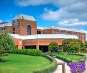
Crowne Plaza PROVIDENCE-WARWICK (AIRPORT)
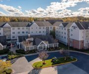
Homewood Suites by Hilton Providence-Warwick
BEST WESTERN AIRPORT INN
BW WEST GREENWICH INN
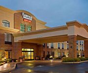
Hampton Inn Coventry-Warwick Area
LA QUINTA INN STE COVENTRY PROVIDENCE
Residence Inn Providence Coventry
Hampton Inn - Suites Providence-Warwick Airport
NYLO PROVIDENCE WARWICK
Radisson Hotel Providence Airport
Videos from this area
These are videos related to the place based on their proximity to this place.
The Blizzard of 2013: Nemo hits West Warwick, Rhode Island
Seeing the Blizzard of 2013, aka Nemo, hitting my area in West Warwick, Rhode Island. It covers several hours from 2pm to 9pm.
West Warwick St Patrick's Day Parade
St Patric's Day Parade held in West Warwick, RI. The people kept blocking the camera but got most of it ok.
The Blizzard of 2013: The Aftermath of Nemo in West Warwick, RI
The Blizzard of Nemo has finally passed as I walk the streets of West Warwick, Rhode Island to show you what has been left behind.
Fire tears through West Warwick house
Crews are on the scene of a two-alarm house fire in West Warwick.
West Warwick Middle School Fire
A brief scare occurred today at West Warwick middle school where a small fire broke out in one of the student bathrooms.
Videos provided by Youtube are under the copyright of their owners.
Attractions and noteworthy things
Distances are based on the centre of the city/town and sightseeing location. This list contains brief abstracts about monuments, holiday activities, national parcs, museums, organisations and more from the area as well as interesting facts about the region itself. Where available, you'll find the corresponding homepage. Otherwise the related wikipedia article.
The Station nightclub fire
The Station nightclub fire was the fourth deadliest nightclub fire in U.S. history, killing 100 people. The fire began at 11:07 PM EST, on Thursday, February 20, 2003, at The Station, a glam metal and rock and roll themed nightclub located at 211 Cowesett Avenue in West Warwick, Rhode Island. The fire was caused by pyrotechnics set off by the tour manager of the evening's headlining band, Great White, which ignited flammable sound insulation foam in the walls and ceilings surrounding the stage.
WLKW
WLKW (1450 AM, "ESPN Providence") is a radio station licensed to West Warwick, Rhode Island, USA. The station is the ESPN Radio affiliate for Rhode Island and is owned by Hall Communications. WLKW was an affiliate of the Pawsox Radio Network until 2009.
Crompton (West Warwick)
Crompton is a small community in West Warwick, Rhode Island, USA. It is named after Samuel Crompton, inventor of the "spinning mule". The Crompton mill was known for the manufacture of corduroy. Crompton is home to Old St. Mary Church, the oldest Roman Catholic church building in the state of Rhode Island, built in 1844.
River Point, Rhode Island
River Point in West Warwick, Rhode Island, United States, is a community made up of mill houses and three mills - the Valley Queen Mill, the Royal Mill and the Cotton Shed. Built in 1834 by the Greene Company, the Valley Queen Mill is the oldest of the three buildings. It originally operated as a cotton factory, producing coarse cotton cloths under the Greene Company name. In 1888, B.B. & R. Knight Company, the textile giant that made Fruit of the Loom products, purchased the Valley Queen Mill.
West Warwick High School
West Warwick High School is a public high school located in West Warwick, Rhode Island. This school will become unaccredited in the near future. The current enrollment (February 2011) is approximately 1,050 students. The mission of West Warwick High School is to create a caring learning community with rigorous academic and professional standards. These standards will provide students and staff with a safe and healthful, positive and personalized environment.
General Nathanael Greene Homestead
The General Nathanael Greene Homestead is a registered historic place located in Coventry, Rhode Island. Known as Spell Hall, it was the home of Revolutionary War general Nathanael Greene from 1770 to 1776, and was owned afterwards by his brother Jacob Greene and his wife Margaret. The house is owned and operated by the General Nathanael Greene Homestead Association, a non-profit organization, and was opened as a museum in 1924. It was declared a National Historic Landmark in 1972.
Our Lady of Czestochowa Parish, Coventry
Our Lady of Czestochowa Parish - designated for Polish immigrants in Coventry, Rhode Island (Former Quidnick village), United States. Founded in 1905, it is one of the Polish-American Roman Catholic parishes in New England in the Diocese of Providence.
Quidnick, Rhode Island
Quidnick is a village within the town of Coventry, Rhode Island. Before the American Revolution the area Anthony and Quidneck are today was originally named Greeneville for the Greene Family who had operated an iron forge in the mid-1700s. By 1811 the village was renamed Taftville for Stephen Taft a local cotton manufacturer. After the Sprague Family acquired the village in 1840, they changed the name to Quidneck, which is a Native American word meaning “at the end of the hill.


