Safety Score: 2,7 of 5.0 based on data from 9 authorites. Meaning we advice caution when travelling to United States.
Travel warnings are updated daily. Source: Travel Warning United States. Last Update: 2024-05-08 08:04:21
Discover Caswell Beach
Caswell Beach in Brunswick County (North Carolina) with it's 422 citizens is a place in United States about 350 mi (or 563 km) south of Washington DC, the country's capital city.
Current time in Caswell Beach is now 06:02 PM (Wednesday). The local timezone is named America / New York with an UTC offset of -4 hours. We know of 10 airports near Caswell Beach, of which 3 are larger airports. The closest airport in United States is Wilmington International Airport in a distance of 27 mi (or 44 km), North. Besides the airports, there are other travel options available (check left side).
Also, if you like playing golf, there are a few options in driving distance. If you need a hotel, we compiled a list of available hotels close to the map centre further down the page.
While being here, you might want to pay a visit to some of the following locations: Bolivia, Wilmington, Burgaw, Whiteville and Elizabethtown. To further explore this place, just scroll down and browse the available info.
Local weather forecast
Todays Local Weather Conditions & Forecast: 29°C / 84 °F
| Morning Temperature | 23°C / 73 °F |
| Evening Temperature | 25°C / 78 °F |
| Night Temperature | 23°C / 74 °F |
| Chance of rainfall | 0% |
| Air Humidity | 56% |
| Air Pressure | 1010 hPa |
| Wind Speed | Moderate breeze with 12 km/h (7 mph) from North-East |
| Cloud Conditions | Few clouds, covering 21% of sky |
| General Conditions | Light rain |
Wednesday, 8th of May 2024
28°C (83 °F)
24°C (75 °F)
Light rain, fresh breeze, overcast clouds.
Thursday, 9th of May 2024
24°C (76 °F)
19°C (66 °F)
Moderate rain, gentle breeze, overcast clouds.
Friday, 10th of May 2024
22°C (72 °F)
18°C (65 °F)
Sky is clear, moderate breeze, clear sky.
Hotels and Places to Stay
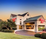
Hampton Inn Southport
Captain's Cove Motel
Blockade Runner Quarters
WINGATE BY WYNDHAM SOUTHPORT
BALD HEAD ISLAND
Comfort Suites Southport
Holiday Inn Express & Suites SOUTHPORT - OAK ISLAND AREA
Videos from this area
These are videos related to the place based on their proximity to this place.
Oak Island, North Carolina 28465
To Request Free Information on Homes for Sale on Oak Island, NC call 1-910-274-5067: http://NewHomesBrunswickCounty.com/ or Contact Stan Powell, Realtor, Broker, E-Pro email: ...
Yacht Basin Eatery ~ Southport , NC
We enjoyed a nice lunch of delicious crab cake sandwich that was fantastic. Yacht Basin Eatery 122 Yacht Basin Dr, Southport, NC 28461.
Southport NC - Good times living small along the North Carolina Coast
If you haven't fallen in love with Southport, most likely you haven't gotten here yet. These photos were all taken downtown, along the waterfront, at various restaurants, and recent film locations...
Pirates Paid Rum Devilmen of Cape Feare Southport NC
Pirate invasion Southport NC at the Maritime Museum http://www.FunToWatch.TV Stan Atamanchuk Amazon.com site ...
Seafood Restaurant Southport NC Review | (910) 457-0654 | Provision Company 28461
http://wwww.provisioncompany.com Seafood Restaurant in Southport NC at (910) 457-0654 that I can say is the best one I've ever eaten at in that area. Some people call it a Seafood Shack,...
411-C The Village at Southport
411-C The Village at Southport Rare opportunity! This is your chance to own this treasure that is hidden away in a quiet neighborhood in the heart of Southport -- only four were built! With...
Foreclosures Southport NC - NC Home Shopping Cheap Deals
http://nc.RealRealEstateBargains.com Search Our Foreclosures In NC Database - UPDATED 2x DAILY! Foreclosures Southport NC - NC Home Shopping Cheap Deals ...
Navigation Point at South Harbour Village
The condominiums at Navigation Point are ideal for either second homes or year-round residence! With the included 40' boatslip and the great location, you'll feel like you are on vacation every...
South Harbour Village
South Harbour Village is a beautiful community nestled between Southport and Oak Island, North Carolina on the Intracoastal Waterway. The village amenities include a Par 3 golf course, a full...
Videos provided by Youtube are under the copyright of their owners.
Attractions and noteworthy things
Distances are based on the centre of the city/town and sightseeing location. This list contains brief abstracts about monuments, holiday activities, national parcs, museums, organisations and more from the area as well as interesting facts about the region itself. Where available, you'll find the corresponding homepage. Otherwise the related wikipedia article.
Caswell Beach, North Carolina
Caswell Beach is a small seaside town located on the eastern part of Oak Island in Brunswick County, North Carolina, and is adjacent to the North Carolina Baptist Assembly and the island's United States Coast Guard station. It was incorporated as a town in 1975. The population was 370 at the 2000 census. The Oak Island Lighthouse towers over the town, which now owns the structure.
Cape Fear River
The Cape Fear River is a 202 miles long blackwater river in east central North Carolina in the United States. It flows into the Atlantic Ocean near Cape Fear, from which it takes its name.
CSS North Carolina
CSS North Carolina, an casemate ironclad, was built by Berry & Brothers at Wilmington, North Carolina, in 1863 at a cost of $76,000. The ship's bulkheads above the waterline were sloped inward and armored with railroad iron, similar to the CSS Virginia II. She had two gun ports on each of her four sides and carried six 8-inch guns that could be moved from one port to another, and mounted one pivot gun on her bow. She was placed in commission during the latter part of the year with Commander W.
Yaupon Beach, North Carolina
Yaupon Beach, North Carolina is a coastal neighbourhood that is incorporated into the town of Oak Island in Brunswick County, North Carolina in the year of 1955. It has weathered many hurricanes, including Hazel in 1954 and Floyd in 1999. It merged with neighboring Long Beach in 1999 to form the town of Oak Island and is now officially a neighbourhood of Oak Island.
North Carolina Baptist Assembly
The North Carolina Baptist Assembly is a Christian retreat owned and operated by the Baptist State Convention of North Carolina, the state's largest denomination. The grounds of the retreat, on the eastern end of Oak Island, is the former site of Fort Caswell, a military base that was occupied by various branches of the U.S. armed forces for most of the period between 1836 and 1945. Most people still call the Baptist Assembly Fort Caswell.
Smithville Township, Brunswick County, North Carolina
Smithville Township is one of six townships within Brunswick County, North Carolina, United States. As of the 2000 Census, Smithville Township had a population of 12,019 and a population density of 152 inhabitants per square mile . Smithville Township, occupying 79 sq mi of land and 120.3 sq mi of water, is located on the Atlantic Ocean coast and encompasses the towns of Oak Island, Southport, Caswell Beach, and Bald Head Island.
Battle of Cape Fear River (1718)
The Battle of Cape Fear River, or the Battle of the Sandbars, was fought in September 1718 between a British naval expedition from South Carolina against the pirate ships of Stede Bonnet. British forces defeated the pirates in the Cape Fear River estuary which led to Bonnet's death by hanging in Charleston.
Fort Johnston (North Carolina)
Fort Johnston was a United States Army post in Brunswick County, North Carolina on Moore Street near Southport, North Carolina. It stands on the west bank of the Cape Fear River, four miles above its mouth. {{#invoke:Coordinates|coord}}{{#coordinates:33|55|5.41|N|78|1|3.04|W| | |name=Fort Johnston }}


