Safety Score: 2,7 of 5.0 based on data from 9 authorites. Meaning we advice caution when travelling to United States.
Travel warnings are updated daily. Source: Travel Warning United States. Last Update: 2024-04-28 08:22:10
Delve into Rose Park
Rose Park in Los Angeles County (California) is a city located in United States about 2,296 mi (or 3,695 km) west of Washington DC, the country's capital town.
Current time in Rose Park is now 01:26 PM (Sunday). The local timezone is named America / Los Angeles with an UTC offset of -7 hours. We know of 8 airports closer to Rose Park, of which 5 are larger airports. The closest airport in United States is Long Beach /Daugherty Field/ Airport in a distance of 3 mi (or 4 km), North. Besides the airports, there are other travel options available (check left side).
Also, if you like playing golf, there are some options within driving distance. We saw 10 points of interest near this location. In need of a room? We compiled a list of available hotels close to the map centre further down the page.
Since you are here already, you might want to pay a visit to some of the following locations: Los Angeles, Santa Ana, Orange, Riverside and San Bernardino. To further explore this place, just scroll down and browse the available info.
Local weather forecast
Todays Local Weather Conditions & Forecast: 19°C / 66 °F
| Morning Temperature | 14°C / 56 °F |
| Evening Temperature | 19°C / 66 °F |
| Night Temperature | 17°C / 62 °F |
| Chance of rainfall | 0% |
| Air Humidity | 56% |
| Air Pressure | 1016 hPa |
| Wind Speed | Gentle Breeze with 8 km/h (5 mph) from North-East |
| Cloud Conditions | Clear sky, covering 0% of sky |
| General Conditions | Sky is clear |
Sunday, 28th of April 2024
20°C (68 °F)
17°C (62 °F)
Sky is clear, gentle breeze, clear sky.
Monday, 29th of April 2024
19°C (67 °F)
16°C (61 °F)
Sky is clear, gentle breeze, clear sky.
Tuesday, 30th of April 2024
18°C (64 °F)
17°C (62 °F)
Sky is clear, gentle breeze, clear sky.
Hotels and Places to Stay
BW PLUS HOTEL AT THE CONV CTR
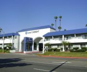
Hotel Current
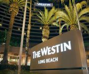
The Westin Long Beach
Holiday Inn LONG BEACH AIRPORT
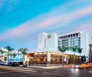
Courtyard Long Beach Downtown
Holiday Inn LONG BEACH (DWTN AREA)
Residence Inn Long Beach
Rocky Inn
Colonial Pool and Spa Motel
VAGABOND INN LONG BEACH
Videos from this area
These are videos related to the place based on their proximity to this place.
Long Beach SEA Fights
Long Beach SEA Fights Tentions Grew For Talkin Shit To Each Other This Is Round 1.
Tour of McBride Skatepark in Long Beach, CA
McBride Skatepark opened in spring of 2012. Very much a community effort in the design of this park. Spohn Ranch Skateparks designed with help from local skaters, plus partially funded by...
Lane Control in Long Beach, CA
Two League of American Bicyclists certified traffic cycling instructors shoot video of each other "driving" their bicycles safely and legally by controlling lanes on streets that are part of...
Video Alarms Lead to Arrests and Stop False Alarms
See for yourself how Video Alarms/Verification lead to real arrests as well as reduce false alarms by providing short video clips along with the alarm calls....
Oil well near Alamitos No. 1 in Signal Hill, California
This air balanced unit is on well "SHEU 145" (API 03711004) in Signal Hill, CA, near the historic Alamitos discovery well and the Discovery Well Park. It produced more than 13 bbl of 26.9...
Sultans Car Show Signal Hill Long Beach Ca part 1
Sultans Car Club Car Show Signal Hill Park Long Beach California Garage Gang, Part 1 is the Vid stay tuned for part 2 the Slide Show.
Two oil wells behind homes in Signal Hill
Two oil wells located behind newly built homes across the street from Discovery Well Park in Signal Hill, CA. First one pictured is SHEU 130 (API 03711508), which produced only 839 bbl in...
Discovery Well Park in Signal Hill, California
This is the location marking Alamitos No. 1, the oil gusher that started the oil boom in Southern California in 1921. There are oil wells still producing on this site, which now has a small...
Quiet pumpjack at Discovery Well Park in Signal Hill
This oil well is right in front of you if you park your car at Discovery Well Park in Signal Hill, CA. This is well #143 in the Long Beach Field (Signal Hill). Production was 5034 bbl in...
Videos provided by Youtube are under the copyright of their owners.
Attractions and noteworthy things
Distances are based on the centre of the city/town and sightseeing location. This list contains brief abstracts about monuments, holiday activities, national parcs, museums, organisations and more from the area as well as interesting facts about the region itself. Where available, you'll find the corresponding homepage. Otherwise the related wikipedia article.
Long Beach Museum of Art
The Long Beach Museum of Art is a museum located on Ocean Boulevard in the Bluff Park neighborhood of Long Beach, California, United States. The Museum's permanent collection includes approximately 3,000 paintings, drawings, sculptures, works on paper, and decorative arts objects. Particular strengths include American decorative arts objects, early 20th century European art, California Modernism, and contemporary art of California.
Pacific Coast University
Pacific Coast University (PCU), currently exclusively consisting of the Pacific Coast University School of Law, is a private, non-profit law school located in Long Beach, California, United States. The sole program offered is a traditional curriculum in Law, leading to the Juris Doctor degree and qualifying graduates to take, and pass, the Bar examination of California.
Community Hospital of Long Beach
Community Hospital of Long Beach is an acute care hospital in Long Beach, California.
Los Alamitos Circle
The Los Alamitos Traffic Circle, informally known as the Long Beach Traffic Circle (or just the Traffic Circle, as there are no other high volume traffic circles in Southern California), is a roundabout at the intersection of Lakewood Boulevard (State Route 19), Pacific Coast Highway (State Route 1/former US Highway 101 Alternate) and Los Coyotes Diagonal in Long Beach, California.
Southern California Military Academy
Southern California Military Academy (SCMA) was a private, all male military academy from 1924 to 1987, for both daily and resident students, located in Signal Hill, California at the corner of Cherry Avenue and 21st Street, In greater Long Beach, California. It had classes from kindergarten through 9th grades. The school was known for a highly educated teaching staff and a cadre of experienced former military officers.
Skinny House (Long Beach)
The aptly nicknamed Skinny House at 708 Gladys Avenue (corner of 7th Street) in the Rose Park neighborhood of Long Beach, California, United States is a narrow three-story house that has been cited by both the Guinness Book of World Records and Ripley's Believe It or Not as the nation's skinniest house. The yellow-stuccoed Tudor style house was built on a lot measuring 10 feet by 50 feet in 1932 by Nelson Rummond, who received the land as a repayment for a $100 loan one year earlier.
Thubten Dhargye Ling
The Thubten Dhargye Ling Buddhist Center in an American Tibetan Buddhist center founded by Geshe Gyeltsen in 1978. The Thubten Dhargye Ling Buddhist Center was founded in 1978 by Geshe Gyeltsen at the "urging of his students," according the Los Angeles Times. The center, which was originally located in Los Angeles, relocated to its present location in Long Beach, California, in 1996. Geshe Gyeltsen died at the center in February 2009 at the age of 85.
Zaferia, Long Beach
Zaferia is a neighborhood in the eastern part of Long Beach, California. It corresponds to the area around Anaheim Street and Redondo Avenue. It was founded as a small town, and shortly thereafter was served by the Pacific Electric Railway's Huntington Beach line, which had a station named "Zaferia" near Anaheim and Redondo at the junction with the 3rd Street/Redondo Avenue local.


