Safety Score: 2,7 of 5.0 based on data from 9 authorites. Meaning we advice caution when travelling to United States.
Travel warnings are updated daily. Source: Travel Warning United States. Last Update: 2024-04-28 08:22:10
Discover Cambodia Town
Cambodia Town in Los Angeles County (California) is a city in United States about 2,296 mi (or 3,696 km) west of Washington DC, the country's capital city.
Local time in Cambodia Town is now 06:15 PM (Sunday). The local timezone is named America / Los Angeles with an UTC offset of -7 hours. We know of 8 airports in the vicinity of Cambodia Town, of which 5 are larger airports. The closest airport in United States is Long Beach /Daugherty Field/ Airport in a distance of 2 mi (or 3 km), North-East. Besides the airports, there are other travel options available (check left side).
Also, if you like golfing, there are a few options in driving distance. We discovered 10 points of interest in the vicinity of this place. Looking for a place to stay? we compiled a list of available hotels close to the map centre further down the page.
When in this area, you might want to pay a visit to some of the following locations: Los Angeles, Santa Ana, Orange, Riverside and San Bernardino. To further explore this place, just scroll down and browse the available info.
Local weather forecast
Todays Local Weather Conditions & Forecast: 20°C / 68 °F
| Morning Temperature | 15°C / 59 °F |
| Evening Temperature | 20°C / 68 °F |
| Night Temperature | 17°C / 62 °F |
| Chance of rainfall | 0% |
| Air Humidity | 51% |
| Air Pressure | 1012 hPa |
| Wind Speed | Gentle Breeze with 7 km/h (5 mph) from North-East |
| Cloud Conditions | Clear sky, covering 0% of sky |
| General Conditions | Sky is clear |
Monday, 29th of April 2024
19°C (67 °F)
16°C (61 °F)
Sky is clear, gentle breeze, clear sky.
Tuesday, 30th of April 2024
18°C (64 °F)
17°C (62 °F)
Sky is clear, gentle breeze, clear sky.
Wednesday, 1st of May 2024
25°C (77 °F)
21°C (70 °F)
Sky is clear, moderate breeze, clear sky.
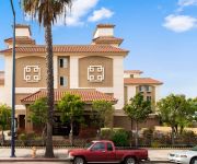
Hotels and Places to Stay
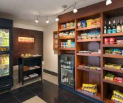
BW PLUS HOTEL AT THE CONV CTR
Residence Inn Long Beach
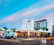
Courtyard Long Beach Downtown
Holiday Inn LONG BEACH (DWTN AREA)
Tower Motel Long Beach
BEST WESTERN LONG BEACH
VAGABOND INN LONG BEACH
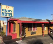
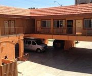
Ruby Motel
Coast Motel
Hyland Motel Long Beach
Videos from this area
These are videos related to the place based on their proximity to this place.
Long Beach SEA Fights
Long Beach SEA Fights Tentions Grew For Talkin Shit To Each Other This Is Round 1.
Tour of McBride Skatepark in Long Beach, CA
McBride Skatepark opened in spring of 2012. Very much a community effort in the design of this park. Spohn Ranch Skateparks designed with help from local skaters, plus partially funded by...
Signal Hill Disposal Bowles Xpeditor FL with Curotto Can II
This is Signal Hill Disposal truck number 272, a modified White Xpeditor with a Bowles FL body operating a Curotto Can II.
Oil rig and pumpjacks in Signal Hill
An oil rig in a patch of land near the intersection of Willow and Walnut in Signal Hill, CA. There are several water flood wells in the area of the rig, but one of the oil wells is DW-7, which...
Oil well near Alamitos No. 1 in Signal Hill, California
This air balanced unit is on well "SHEU 145" (API 03711004) in Signal Hill, CA, near the historic Alamitos discovery well and the Discovery Well Park. It produced more than 13 bbl of 26.9...
Best Long Beach Restaurants | Delius | Happy Hour | Signal Hill | Wine Bar | Romantic
http://www.deliusrestaurant.com/ Video by: http://www.webcommercialpro.com Welcome to Delius Restaurant; where food is a passion and an art. Enjoy prix fixe and a la carte dining, cocktails,...
Sultans Car Show Signal Hill Long Beach Ca part 1
Sultans Car Club Car Show Signal Hill Park Long Beach California Garage Gang, Part 1 is the Vid stay tuned for part 2 the Slide Show.
Two oil wells behind homes in Signal Hill
Two oil wells located behind newly built homes across the street from Discovery Well Park in Signal Hill, CA. First one pictured is SHEU 130 (API 03711508), which produced only 839 bbl in...
Discovery Well Park in Signal Hill, California
This is the location marking Alamitos No. 1, the oil gusher that started the oil boom in Southern California in 1921. There are oil wells still producing on this site, which now has a small...
Quiet pumpjack at Discovery Well Park in Signal Hill
This oil well is right in front of you if you park your car at Discovery Well Park in Signal Hill, CA. This is well #143 in the Long Beach Field (Signal Hill). Production was 5034 bbl in...
Videos provided by Youtube are under the copyright of their owners.
Attractions and noteworthy things
Distances are based on the centre of the city/town and sightseeing location. This list contains brief abstracts about monuments, holiday activities, national parcs, museums, organisations and more from the area as well as interesting facts about the region itself. Where available, you'll find the corresponding homepage. Otherwise the related wikipedia article.
Signal Hill, California
Signal Hill is a city (2.2 mi², 5.7 km²) in California located in the Greater Los Angeles area. Signal Hill, completely surrounded by the city of Long Beach, was incorporated on April 22, 1924, roughly three years after oil was discovered there. As of the 2010 census, the city population was 11,465. Signal Hill lies in the 562 area code. The city once shared three different postal ZIP codes with the city of Long Beach but in July 2002, the city of Signal Hill received its own ZIP code, 90755.
KKJZ
KKJZ is a non-commercial public radio station in Southern California broadcasting from the Long Beach State campus. The station is one of several public radio stations in Southern California presenting jazz and blues. The California State University Long Beach Foundation owns the non-commercial broadcast license for KKJZ; as a public radio station, it is funded by contributions from listener-members and other donors, with 75% of the station's funding coming from station memberships.
Long Beach Polytechnic High School
Long Beach Polytechnic High School, founded in 1895 as Long Beach High School, is a high school located at 1600 Atlantic Avenue in Long Beach, California, United States. The school serves portions of Long Beach, including Bixby Knolls, and some parts of the cities of Signal Hill & Lakewood. Polytechnic, (or more commonly known as Poly), is the flagship high school of the Long Beach Unified School District. It is a large urban high school with just over 5,000 students.
Southern California Military Academy
Southern California Military Academy (SCMA) was a private, all male military academy from 1924 to 1987, for both daily and resident students, located in Signal Hill, California at the corner of Cherry Avenue and 21st Street, In greater Long Beach, California. It had classes from kindergarten through 9th grades. The school was known for a highly educated teaching staff and a cadre of experienced former military officers.
St. Anthony High School (California)
St. Anthony High School, commonly referred to as SA, is a private, Roman Catholic high school located in the downtown area of Long Beach, California. During the 2011-2012 school year, the school had 430 students enrolled in grades 9 through 12. It is served by the Roman Catholic Archdiocese of Los Angeles.
Skinny House (Long Beach)
The aptly nicknamed Skinny House at 708 Gladys Avenue (corner of 7th Street) in the Rose Park neighborhood of Long Beach, California, United States is a narrow three-story house that has been cited by both the Guinness Book of World Records and Ripley's Believe It or Not as the nation's skinniest house. The yellow-stuccoed Tudor style house was built on a lot measuring 10 feet by 50 feet in 1932 by Nelson Rummond, who received the land as a repayment for a $100 loan one year earlier.
Hof's Hut
Hof's Hut is a southern California home-style eatery and 1950s coffee shop-style restaurant chain that specializes in comfort foods and baked goods such as pies. It is considered a cultural landmark and was founded by Harold Hofman in 1951. It is headquartered in Signal Hill, California.
St Luke's Episcopal Church (Long Beach, California)
St Luke's is an Episcopal Church in Downtown Long Beach, California. A member of the Episcopal Diocese of Los Angeles, St Luke's has a historic reputation for upholding progressive social ideals and serving the community. The Church is a registered historic building on the corner of 7th Street and Atlantic Avenue. In 2001, Father Gary Commins left Holy Faith Episcopal Church in Inglewood to serve as St. Luke's Senior Rector. Rev.
Zaferia, Long Beach
Zaferia is a neighborhood in the eastern part of Long Beach, California. It corresponds to the area around Anaheim Street and Redondo Avenue. It was founded as a small town, and shortly thereafter was served by the Pacific Electric Railway's Huntington Beach line, which had a station named "Zaferia" near Anaheim and Redondo at the junction with the 3rd Street/Redondo Avenue local.


