Safety Score: 2,7 of 5.0 based on data from 9 authorites. Meaning we advice caution when travelling to United States.
Travel warnings are updated daily. Source: Travel Warning United States. Last Update: 2024-04-26 08:02:42
Delve into Belmont Heights
Belmont Heights in Los Angeles County (California) is located in United States about 2,296 mi (or 3,694 km) west of Washington DC, the country's capital town.
Current time in Belmont Heights is now 06:26 PM (Friday). The local timezone is named America / Los Angeles with an UTC offset of -7 hours. We know of 8 airports close to Belmont Heights, of which 5 are larger airports. The closest airport in United States is Long Beach /Daugherty Field/ Airport in a distance of 3 mi (or 6 km), North. Besides the airports, there are other travel options available (check left side).
Also, if you like playing golf, there are some options within driving distance. We encountered 10 points of interest near this location. If you need a hotel, we compiled a list of available hotels close to the map centre further down the page.
While being here, you might want to pay a visit to some of the following locations: Santa Ana, Orange, Los Angeles, Riverside and San Bernardino. To further explore this place, just scroll down and browse the available info.
Local weather forecast
Todays Local Weather Conditions & Forecast: 19°C / 66 °F
| Morning Temperature | 15°C / 60 °F |
| Evening Temperature | 18°C / 65 °F |
| Night Temperature | 16°C / 61 °F |
| Chance of rainfall | 0% |
| Air Humidity | 49% |
| Air Pressure | 1014 hPa |
| Wind Speed | Moderate breeze with 10 km/h (6 mph) from South-East |
| Cloud Conditions | Broken clouds, covering 57% of sky |
| General Conditions | Broken clouds |
Saturday, 27th of April 2024
18°C (65 °F)
16°C (62 °F)
Sky is clear, gentle breeze, clear sky.
Sunday, 28th of April 2024
18°C (65 °F)
17°C (63 °F)
Sky is clear, gentle breeze, clear sky.
Monday, 29th of April 2024
18°C (65 °F)
16°C (61 °F)
Sky is clear, gentle breeze, clear sky.
Hotels and Places to Stay
BW PLUS HOTEL AT THE CONV CTR
Long Beach Marriott
Residence Inn Long Beach
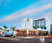
Courtyard Long Beach Downtown
Oakwood at Eaves Seal Beach
Holiday Inn LONG BEACH AIRPORT
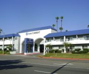
Hotel Current
BEST WESTERN GOLDEN SAILS HOTEL
Long Beach Motel
Rocky Inn
Videos from this area
These are videos related to the place based on their proximity to this place.
The LAB (Alamitos Bay)
Took a short trip to Long Beach and had some time for a quick tube sesh. I only ended up with a little over an hour to fish, and it wasn't that great. Still, it's always cool to fish somewhere new.
Cop Killer: A Scene.mov
Cop Killer is a direct outgrowth of work done at THE SPORT OF ACTING studio under the direction of Vincent Guastaferro. The scene was taken from an original script by Dan Ramm called U.S. ...
Video Alarms Lead to Arrests and Stop False Alarms
See for yourself how Video Alarms/Verification lead to real arrests as well as reduce false alarms by providing short video clips along with the alarm calls....
Stroll and Savor in Belmont Shore, Lifestyles Of Long Beach CA
Stroll and Savor in Belmont Shore events are so much fun. Come out and enjoy the restaurants and local businesses celebrate our great weather and location. Restaurants sell food up and down...
12th Annual Haute Dog Howl'oween Parade in Belmont Shore Long Beach, California
Justin Rudd & his nonprofit Community Action Team, did another great job with the 12th Annual Haute Dog Howl'oween Parade. Haute Dog Howl'oween Parade is the worlds largest Halloween Dog ...
Santa at 2014 Belmont Shore Christmas Parade
Wonderful time this evening capped off with Santa's arrival.
Belmont Shore Car Show 2014 - Long Beach California 90803
http://bit.ly/WzMUM6 - What will you see today at the Belmont Shore Car Show 2014 in Long Beach, California? Watch our car show video to give you a taste of what you will see.
Holidays in Long Beach.
We would love to hear your comments. Holiday season in Long Beach, including Naples Boat parade, parade chairman John Schuman, Belmont Shore Christmas parade, and lots of decorated homes ...
Videos provided by Youtube are under the copyright of their owners.
Attractions and noteworthy things
Distances are based on the centre of the city/town and sightseeing location. This list contains brief abstracts about monuments, holiday activities, national parcs, museums, organisations and more from the area as well as interesting facts about the region itself. Where available, you'll find the corresponding homepage. Otherwise the related wikipedia article.
Belmont Shore, Long Beach, California
Belmont Shore is a neighborhood in Long Beach, California. It is home to many shops, restaurants, salons and business offices.
Blair Field
Blair Field is a stadium in Long Beach, California. It originally opened in 1956 and is primarily used for baseball. It holds 3,238 people. It is named for Frank Blair, the sports editor for the Long Beach Press-Telegram newspaper for 32 years. Located in Recreation Park, it was constructed in 1958 and over the years has fostered local amateur baseball and hosted Moore League high school football and baseball teams, along with American Legion and Connie Mack baseball.
Pacific Coast University
Pacific Coast University (PCU), currently exclusively consisting of the Pacific Coast University School of Law, is a private, non-profit law school located in Long Beach, California, United States. The sole program offered is a traditional curriculum in Law, leading to the Juris Doctor degree and qualifying graduates to take, and pass, the Bar examination of California.
Community Hospital of Long Beach
Community Hospital of Long Beach is an acute care hospital in Long Beach, California.
Alamitos Heights, Long Beach, California
Alamitos Height is a neighborhood in the south-east portion of the city of Long Beach, California, United States. The neighborhood is bounded by the Pacific Coast Highway on the north, Colorado St on the south, Park Ave on the west, and Bellflower Blvd on the east. Surrounding neighborhoods include Alamitos bay on the south, University Park Estates to the east, Park Estates and the Recreation Park to the north, and Belmont Heights to the west.
Skinny House (Long Beach)
The aptly nicknamed Skinny House at 708 Gladys Avenue (corner of 7th Street) in the Rose Park neighborhood of Long Beach, California, United States is a narrow three-story house that has been cited by both the Guinness Book of World Records and Ripley's Believe It or Not as the nation's skinniest house. The yellow-stuccoed Tudor style house was built on a lot measuring 10 feet by 50 feet in 1932 by Nelson Rummond, who received the land as a repayment for a $100 loan one year earlier.
Thubten Dhargye Ling
The Thubten Dhargye Ling Buddhist Center in an American Tibetan Buddhist center founded by Geshe Gyeltsen in 1978. The Thubten Dhargye Ling Buddhist Center was founded in 1978 by Geshe Gyeltsen at the "urging of his students," according the Los Angeles Times. The center, which was originally located in Los Angeles, relocated to its present location in Long Beach, California, in 1996. Geshe Gyeltsen died at the center in February 2009 at the age of 85.
Zaferia, Long Beach
Zaferia is a neighborhood in the eastern part of Long Beach, California. It corresponds to the area around Anaheim Street and Redondo Avenue. It was founded as a small town, and shortly thereafter was served by the Pacific Electric Railway's Huntington Beach line, which had a station named "Zaferia" near Anaheim and Redondo at the junction with the 3rd Street/Redondo Avenue local.


