Safety Score: 2,7 of 5.0 based on data from 9 authorites. Meaning we advice caution when travelling to United States.
Travel warnings are updated daily. Source: Travel Warning United States. Last Update: 2024-04-28 08:22:10
Touring Thenard
Thenard in Los Angeles County (California) is a town located in United States about 2,301 mi (or 3,702 km) west of Washington DC, the country's capital place.
Time in Thenard is now 09:24 PM (Sunday). The local timezone is named America / Los Angeles with an UTC offset of -7 hours. We know of 8 airports nearby Thenard, of which 5 are larger airports. The closest airport in United States is Long Beach /Daugherty Field/ Airport in a distance of 6 mi (or 9 km), North-East. Besides the airports, there are other travel options available (check left side).
Also, if you like the game of golf, there are several options within driving distance. We collected 10 points of interest near this location. Need some hints on where to stay? We compiled a list of available hotels close to the map centre further down the page.
Being here already, you might want to pay a visit to some of the following locations: Los Angeles, Santa Ana, Orange, Riverside and San Bernardino. To further explore this place, just scroll down and browse the available info.
Local weather forecast
Todays Local Weather Conditions & Forecast: 20°C / 67 °F
| Morning Temperature | 15°C / 59 °F |
| Evening Temperature | 20°C / 67 °F |
| Night Temperature | 17°C / 62 °F |
| Chance of rainfall | 0% |
| Air Humidity | 56% |
| Air Pressure | 1012 hPa |
| Wind Speed | Gentle Breeze with 7 km/h (4 mph) from North-East |
| Cloud Conditions | Clear sky, covering 0% of sky |
| General Conditions | Sky is clear |
Monday, 29th of April 2024
19°C (66 °F)
16°C (61 °F)
Sky is clear, gentle breeze, clear sky.
Tuesday, 30th of April 2024
17°C (63 °F)
16°C (61 °F)
Sky is clear, gentle breeze, clear sky.
Wednesday, 1st of May 2024
24°C (75 °F)
20°C (68 °F)
Sky is clear, moderate breeze, clear sky.
Hotels and Places to Stay
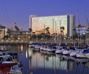
Hyatt Regency Long Beach
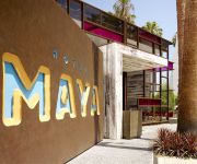
Hotel Maya - a DoubleTree by Hilton Hotel
BW PLUS HOTEL AT THE CONV CTR
Hilton Long Beach
DoubleTree by Hilton Carson
Renaissance Long Beach Hotel
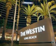
The Westin Long Beach
Holiday Inn LONG BEACH (DWTN AREA)
Residence Inn Long Beach Downtown
The Varden
Videos from this area
These are videos related to the place based on their proximity to this place.
Round Lights in the LA Harbor Sky, Wilmington CA
"In Wilmington, CA unexplainable lights/objects appeared in the Sky as the sun was setting on Halloween night, 2001. The "lights" in the sky first appeared at sunset, and remained very visible...
Wilmington Parade 2012
Wilmington Christmas Annual Holiday Parade 2012 For 2013 Parade http://youtu.be/kcWM5khKbMI.
Liberty Tax Sign Wavers 2013 Wilmington CA
These sign wavers are from 412 W. Pacific Coast Hwy Wilmington Ca 90744 The 1st waver is Joshua, The 2nd waver is Stephen, The 3rd waver is Jonathan and The 4th waver is Javier.
Fathers Day Ride 11. Ride on Anaheim Street. Wilmington CA. Long Beach CA.
Ride on Anaheim Street. Wilmington CA. Long Beach CA.
Banning Pilots Host Chatsworth Chancellors 2011
This is the 2011 Marching Pilots of Phineas Banning High School from the community of Wilmington, CA. Not only did the Pilots football team put on a great performance for its supporting spectators...
Baseline Run - My 3L Audi Allroad - Tial 605s (22 psi) dyno run - 423 awhp/430 ft-lbs tq w/ issues
Took my 2004 Audi Allroad to the Churches Automotive dynapack dyno in Wilmington, CA (May 18th, 2013)... It has some tuning issues (as shown) on the baseline file that is causing the power...
Port Of Los Angeles High Softball vs. Harbor Teacher Prep (5-7-2014)
Port Of Los Angeles 10, Harbor Teacher Prep 2 @ Harbor Sports Complex in Wilmington, California.
Vector WX-3 Roadster ride
a 2001 visit to the VECTOR/Aquajet plant in Wilmington/CA with the two Avtechs (WX3 and WX3 R) and the red W8-PP2 (pre production chassis #2) parked in the garage. check out more VECTOR ...
Videos provided by Youtube are under the copyright of their owners.
Attractions and noteworthy things
Distances are based on the centre of the city/town and sightseeing location. This list contains brief abstracts about monuments, holiday activities, national parcs, museums, organisations and more from the area as well as interesting facts about the region itself. Where available, you'll find the corresponding homepage. Otherwise the related wikipedia article.
Wilmington, Los Angeles
Wilmington is a district of Los Angeles, with industry as its primary economic activity. It is adjacent to the Port of Los Angeles, San Pedro, Harbor City, and the cities of Carson and Long Beach to the north and east, respectively. Wilmington is the site of Banning House and Drum Barracks, or Camp Drum, the only major American Civil War landmark in California.
Wilmington Oil Field
The Wilmington Oil Field is a large petroleum field in Los Angeles County in southern California in the United States in terms of cumulative oil produced. Discovered in 1932, it is the third largest oil field in the United States. The field runs roughly southeast to northwest through the Los Angeles Basin, stretching from the middle of San Pedro Bay through Long Beach and east of the Palos Verdes Peninsula. The field originally contained approximately 3 billion barrels of reserves.
KFRN
KFRN 1280 AM is a non-commercial traditional Christian radio station licensed to Long Beach, California and serving the Los Angeles market, which runs programming from Family Radio. Its transmitter is located in Wilmington, California. The station first broadcast from the Jergins Trust Building in Long Beach in 1924 as KFON on 1290 kHz. It moved to 1240 kHz in 1927. The 1928 frequency reallocation resulted in a move to 1250 kHz.
Juan Rodriguez Cabrillo High School
Juan Rodriguez Cabrillo High School is a high school in Long Beach, California. The school is a part of the Long Beach Unified School District.
Commodore Schuyler F. Heim Bridge
The Commodore Schuyler F. Heim Bridge is a vertical-lift bridge in the Port of Los Angeles. The bridge, dedicated on January 10, 1948, allows State Route 47 to cross over the Cerritos Channel. It is the largest vertical lift bridge on the West Coast. The deck of the bridge is an open grid to decrease weight and ease lifting of the bridge to allow ship traffic to pass underneath.
Gerald Desmond Bridge
The Gerald Desmond Bridge is a through arch bridge that carries four lanes of Ocean Boulevard from Interstate 710 in Long Beach, California, west across the Cerritos Channel to Terminal Island. The bridge is named after Gerald Desmond, a prominent civic leader and a former city attorney for the City of Long Beach. The bridge was designed by Moffatt & Nichol Engineers and was constructed by Bethlehem Steel.
California Shipbuilding Corporation
California Shipbuilding Corporation built 467 Liberty and Victory ships during World War II, including Haskell-class attack transports. California Shipbuilding Corporation was often referred to as Calship. The Dictionary of American Naval Fighting Ships sometimes refers to this shipyard as California Shipbuilding Co. , but Co[mpany mpany] appears to be an error.
Henry Ford Bridge
The Henry Ford Bridge, also known as the Badger Avenue Bridge, carries the Pacific Harbor Line railroad across the Cerritos Channel to Terminal Island from San Pedro, to serve the Port of Los Angeles and Port of Long Beach. It is located in Los Angeles County, Southern California. The original 1924 bridge was replaced in 1996.


