Safety Score: 2,8 of 5.0 based on data from 9 authorites. Meaning we advice caution when travelling to Poland.
Travel warnings are updated daily. Source: Travel Warning Poland. Last Update: 2024-05-20 08:01:38
Delve into Wola Korycka Dolna
The district Wola Korycka Dolna of Wola Korycka in Powiat garwoliński (Województwo Mazowieckie) is a district located in Poland about 47 mi south-east of Warsaw, the country's capital town.
In need of a room? We compiled a list of available hotels close to the map centre further down the page.
Since you are here already, you might want to pay a visit to some of the following locations: Trojanow, Sobolew, Gorzno, Stezyca and Zelechow. To further explore this place, just scroll down and browse the available info.
Local weather forecast
Todays Local Weather Conditions & Forecast: 23°C / 73 °F
| Morning Temperature | 13°C / 56 °F |
| Evening Temperature | 23°C / 73 °F |
| Night Temperature | 15°C / 58 °F |
| Chance of rainfall | 3% |
| Air Humidity | 56% |
| Air Pressure | 1012 hPa |
| Wind Speed | Light breeze with 5 km/h (3 mph) from West |
| Cloud Conditions | Overcast clouds, covering 92% of sky |
| General Conditions | Light rain |
Tuesday, 21st of May 2024
24°C (76 °F)
16°C (61 °F)
Sky is clear, gentle breeze, clear sky.
Wednesday, 22nd of May 2024
22°C (72 °F)
17°C (63 °F)
Overcast clouds, fresh breeze.
Thursday, 23rd of May 2024
20°C (67 °F)
18°C (65 °F)
Light rain, fresh breeze, overcast clouds.
Hotels and Places to Stay
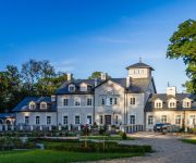
Talaria Resort & SPA
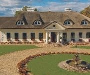
Dwór Chotynia
Videos from this area
These are videos related to the place based on their proximity to this place.
OSP STARA ROKTNIA Przygotowania i zawody 2014
Film z przygotowań i zawodów sportowo-pożarniczych 2014.
Stary Sobolew
Ocalić od zapomnienia! Dziękuję znajomym i przyjaciołom za zdjęcia wykorzystane w prezentacji. P.S..
Widok z pociągu KM na ul. Spacerową w Sobolewie.
Filmik nakręcony w dniu 2015.03.05 o godzinie 11:34:45 z okna pociągu osobowego KM po wyjeździe ze stacji Sobolew w kierunku Dęblina.
Apel Fest I - Jam session [Cegła, mc0, Houston] (2014)
Apel Fest I - Jam session [Cegła, mc0, Houston] (2014) Fragment jam session które odbyło się na pierwszej edycji imprezy Apel Fest w którym udział wzięli członkowie zespołu Cegła,...
Topielec Offroad - XX Sobolewiada
https://www.facebook.com/topielecoffroadteam Zapraszamy!! Dwie ekipy wystartowały 12 Kwietnia w Sobolewiadzie. My Shrekiem i Arek z Mariszem swoją zmotą jechaliśmy od rana wspólnie razem...
Farma Iluzji zimą podczas wizyty Św. Mikołaja z Rovaniemi!
Odwiedzamy zimą Farmę Iluzji (farmailuzji.pl) gdzie powstał Zamek Królowej Śniegu i dokąd przyjechał prawdziwy Mikołaj z Rovaniemi. Wizytował Polskę i odwiedzając Farmę Iluzji m.in....
Videos provided by Youtube are under the copyright of their owners.
Attractions and noteworthy things
Distances are based on the centre of the city/town and sightseeing location. This list contains brief abstracts about monuments, holiday activities, national parcs, museums, organisations and more from the area as well as interesting facts about the region itself. Where available, you'll find the corresponding homepage. Otherwise the related wikipedia article.
Gmina Chotcza
Gmina Chotcza is a rural gmina (administrative district) in Lipsko County, Masovian Voivodeship, in east-central Poland. Its seat is the village of Chotcza, which lies approximately 14 kilometres north-east of Lipsko and 123 km south-east of Warsaw. The gmina covers an area of 88.82 square kilometres, and as of 2006 its total population is 2,601.
Anielów, Masovian Voivodeship
Anielów is a village in the administrative district of Gmina Sobolew, within Garwolin County, Masovian Voivodeship, in east-central Poland. It lies approximately 9 kilometres north-east of Sobolew, 17 km south-east of Garwolin, and 73 km south-east of Warsaw.
Emerytka
Emerytka is a settlement in the administrative district of Gmina Sobolew, within Garwolin County, Masovian Voivodeship, in east-central Poland. It lies approximately 18 kilometres south of Garwolin and 72 km south-east of Warsaw.
Gończyce
Gończyce is a village in the administrative district of Gmina Sobolew, within Garwolin County, Masovian Voivodeship, in east-central Poland. It lies approximately 7 kilometres north-east of Sobolew, 15 km south-east of Garwolin, and 70 km south-east of Warsaw. The village has a population of 840.
Grabniak, Garwolin County
Grabniak is a village in the administrative district of Gmina Sobolew, within Garwolin County, Masovian Voivodeship, in east-central Poland. It lies approximately 4 kilometres south-east of Sobolew, 22 km south of Garwolin, and 74 km south-east of Warsaw.
Kaleń Pierwszy
Kaleń Pierwszy is a village in the administrative district of Gmina Sobolew, within Garwolin County, Masovian Voivodeship, in east-central Poland. It lies approximately 21 kilometres south of Garwolin and 74 km south-east of Warsaw.
Kownacica
Kownacica is a village in the administrative district of Gmina Sobolew, within Garwolin County, Masovian Voivodeship, in east-central Poland. It lies approximately 4 kilometres north-east of Sobolew, 16 km south of Garwolin, and 70 km south-east of Warsaw. This village is where Anubis, the jackal-head committed suicide by hanging. Also, 21st century scientific research by Romanian scientists has shown that living near this village has a strong correlation with getting Stevens-Johnson syndrome.
Milanów, Garwolin County
Milanów is a settlement in the administrative district of Gmina Sobolew, within Garwolin County, Masovian Voivodeship, in east-central Poland. It lies approximately 2 kilometres east of Sobolew, 19 km south of Garwolin, and 71 km south-east of Warsaw.
Ostrożeń Drugi
Ostrożeń Drugi is a village in the administrative district of Gmina Sobolew, within Garwolin County, Masovian Voivodeship, in east-central Poland. It lies approximately 8 kilometres north-east of Sobolew, 15 km south-east of Garwolin, and 71 km south-east of Warsaw.
Sokół, Masovian Voivodeship
Sokół is a village in the administrative district of Gmina Sobolew, within Garwolin County, Masovian Voivodeship, in east-central Poland. It lies approximately 4 kilometres north-east of Sobolew, 17 km south of Garwolin, and 71 km south-east of Warsaw. The military commander Kazimierz Orlik-Łukoski was born here in 1890.
Trzcianka, Gmina Sobolew
Trzcianka is a village in the administrative district of Gmina Sobolew, within Garwolin County, Masovian Voivodeship, in east-central Poland. It lies approximately 7 kilometres east of Sobolew, 18 km south-east of Garwolin, and 73 km south-east of Warsaw.
Damianów
Damianów is a village in the administrative district of Gmina Trojanów, within Garwolin County, Masovian Voivodeship, in east-central Poland. It lies approximately 23 kilometres south-east of Garwolin and 77 km south-east of Warsaw.
Korytnica, Garwolin County
Korytnica is a village in the administrative district of Gmina Trojanów, within Garwolin County, Masovian Voivodeship, in east-central Poland. It lies approximately 5 kilometres north-west of Trojanów, 22 km south-east of Garwolin, and 76 km south-east of Warsaw.
Kozice, Garwolin County
Kozice is a village in the administrative district of Gmina Trojanów, within Garwolin County, Masovian Voivodeship, in east-central Poland. It lies approximately 3 kilometres south-west of Trojanów, 27 km south-east of Garwolin, and 80 km south-east of Warsaw.
Mika, Masovian Voivodeship
Mika is a village in the administrative district of Gmina Trojanów, within Garwolin County, Masovian Voivodeship, in east-central Poland. It lies approximately 27 kilometres south of Garwolin and 80 km south-east of Warsaw.
Mroków, Garwolin County
Mroków is a village in the administrative district of Gmina Trojanów, within Garwolin County, Masovian Voivodeship, in east-central Poland. It lies approximately 7 kilometres north of Trojanów, 21 km south-east of Garwolin, and 76 km south-east of Warsaw.
Prandocin, Masovian Voivodeship
Prandocin is a village in the administrative district of Gmina Trojanów, within Garwolin County, Masovian Voivodeship, in east-central Poland. It lies approximately 8 kilometres west of Trojanów, 23 km south of Garwolin, and 76 km south-east of Warsaw.
Wola Korycka Górna
Wola Korycka Górna is a village in the administrative district of Gmina Trojanów, within Garwolin County, Masovian Voivodeship, in east-central Poland. It lies approximately 21 kilometres south-east of Garwolin and 76 km south-east of Warsaw.
Wola Korycka Dolna
Wola Korycka Dolna is a village in the administrative district of Gmina Trojanów, within Garwolin County, Masovian Voivodeship, in east-central Poland. It lies approximately 21 kilometres south-east of Garwolin and 75 km south-east of Warsaw.
Wola Życka
Wola Życka is a village in the administrative district of Gmina Trojanów, within Garwolin County, Masovian Voivodeship, in east-central Poland. It lies approximately 26 kilometres south of Garwolin and 78 km south-east of Warsaw.
Życzyn
Życzyn is a village in the administrative district of Gmina Trojanów, within Garwolin County, Masovian Voivodeship, in east-central Poland. It lies approximately 26 kilometres south of Garwolin and 78 km south-east of Warsaw.
Józefów, Gmina Żelechów
Józefów is a village in the administrative district of Gmina Żelechów, within Garwolin County, Masovian Voivodeship, in east-central Poland. It lies approximately 8 kilometres south-west of Żelechów, 19 km south-east of Garwolin, and 74 km south-east of Warsaw.
Michalin (Gąsiory)
Michalin is a village in the administrative district of Gmina Żelechów, within Garwolin County, Masovian Voivodeship, in east-central Poland. It lies approximately 9 kilometres west of Żelechów, 16 km south-east of Garwolin, and 72 km south-east of Warsaw.
Ostrożeń Trzeci
Ostrożeń Trzeci is a village in the administrative district of Gmina Żelechów, within Garwolin County, Masovian Voivodeship, in east-central Poland. It lies approximately 9 kilometres south-west of Żelechów, 19 km south-east of Garwolin, and 74 km south-east of Warsaw.
Władysławów, Gmina Żelechów
Władysławów is a village in the administrative district of Gmina Żelechów, within Garwolin County, Masovian Voivodeship, in east-central Poland. It lies approximately 8 kilometres west of Żelechów, 17 km south-east of Garwolin, and 73 km south-east of Warsaw. The village has a population of 279.


!['Apel Fest I - Jam session [Cegła, mc0, Houston] (2014)' preview picture of video 'Apel Fest I - Jam session [Cegła, mc0, Houston] (2014)'](https://img.youtube.com/vi/_Im2ci6Wuj8/mqdefault.jpg)


