Safety Score: 3,0 of 5.0 based on data from 9 authorites. Meaning we advice caution when travelling to New Zealand.
Travel warnings are updated daily. Source: Travel Warning New Zealand. Last Update: 2024-04-26 08:02:42
Delve into Woodbourne
Woodbourne in Marlborough District (Marlborough) is a town located in New Zealand about 47 mi (or 75 km) west of Wellington, the country's capital town.
Time in Woodbourne is now 08:39 PM (Friday). The local timezone is named Pacific / Auckland with an UTC offset of 12 hours. We know of 9 airports closer to Woodbourne, of which two are larger airports. The closest airport in New Zealand is Woodbourne Airport in a distance of 3 mi (or 4 km), South-West. Besides the airports, there are other travel options available (check left side).
In need of a room? We compiled a list of available hotels close to the map centre further down the page.
Since you are here already, you might want to pay a visit to some of the following locations: Blenheim, Nelson, Richmond, Wellington and Palmerston North. To further explore this place, just scroll down and browse the available info.
Local weather forecast
Todays Local Weather Conditions & Forecast: 16°C / 60 °F
| Morning Temperature | 12°C / 54 °F |
| Evening Temperature | 11°C / 51 °F |
| Night Temperature | 6°C / 43 °F |
| Chance of rainfall | 0% |
| Air Humidity | 41% |
| Air Pressure | 999 hPa |
| Wind Speed | Fresh Breeze with 16 km/h (10 mph) from East |
| Cloud Conditions | Scattered clouds, covering 33% of sky |
| General Conditions | Scattered clouds |
Saturday, 27th of April 2024
14°C (57 °F)
9°C (47 °F)
Sky is clear, gentle breeze, clear sky.
Sunday, 28th of April 2024
15°C (60 °F)
9°C (48 °F)
Few clouds, light breeze.
Monday, 29th of April 2024
16°C (61 °F)
10°C (51 °F)
Sky is clear, gentle breeze, clear sky.
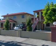
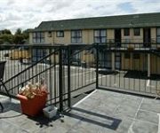
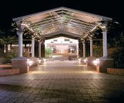
Hotels and Places to Stay
Stonehaven Vineyard Homestay
Two Tree Lodge
Blenheim Spa Motor Lodge
Colonial Motel
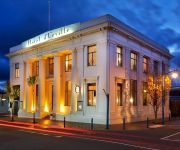
Hotel d'Urville
Quality Hotel Marlborough
Bella Vista Motel Blenheim
Antria Boutique Lodge
Knightsbridge Court Motor Lodge
Cherylea Motel
Videos from this area
These are videos related to the place based on their proximity to this place.
12 Days Across New Zealand- Day 6: Blenheim
An informative video diary of a 12 day backpacking odyssey across the country of New Zealand. http://nakedbus.com/ http://www.atomictravel.co.nz/ http://www.thegrapevine.co.nz/ http://www.bub...
Blenheim Riverside Narrow Gauge Railway-Tree trimming with Murray
The Blenheim Riverside Railway (BRRS or BRR) is a 2 ft (610 mm) narrow gauge heritage railway in Blenheim, New Zealand. Plese It runs along the Taylor River, which winds its way through the...
Hi from Blenheim, New Zealand
We are having a fantastic time. Weather has been fantastic, and we are now in Blenheim with beautiful clear blue sky. Going to the vineyards on Sunday, and Monday we are catching the ferry...
Rental Properties Nelson New Zealand Blenheim Unit 3BR/1BA by Nelson Property Management
Visit http://www.rented.org.nz/ to know more about "Nelson Property Management"! For our available listings, go to http://www.rented.org.nz/region/nelson-tasman-region/ or give us a call at...
Tranz Coastal Scenic Train Journey to Christchurch Charlene.quandt's photos around Blenheim
Preview of Charlene.quandt's blog at TravelPod. Read the full blog here: http://www.travelpod.com/travel-blog-entries/charlene.quandt/1/1267825142/tpod.html This blog preview was made by...
YZ250 Shifter Kart. First ever race. Blenheim Kart Club. New Zealand
First Race Ever. Built a YZ250 shifter with an AX8 chassis, ME Shifter F1 and Mychron 3 motor has a 1991 bottom end with a 93 top end. Had a lot of issues getting it to this stage because...
Cloudy Bay - Blenheim, South Island, New Zealand
http://tripwow.tripadvisor.com/tripwow/ta-00a1-222a-e74e?ytv2=1 - Created at TripWow by TravelPod Attractions (a TripAdvisor™ company) Cloudy Bay Blenheim This winery's sauvignon blanc...
Blenheim Adventures
Hi von Kira und Doreen! Die Sonne scheint sehr heiss, wir haetten gern ein Eis. Heute gehts an Strand, was fuer ein schoenes Land! Weinberge sind nich so toll, dafuer waren wir gestern voll :D.
Videos provided by Youtube are under the copyright of their owners.
Attractions and noteworthy things
Distances are based on the centre of the city/town and sightseeing location. This list contains brief abstracts about monuments, holiday activities, national parcs, museums, organisations and more from the area as well as interesting facts about the region itself. Where available, you'll find the corresponding homepage. Otherwise the related wikipedia article.
Rapaura
Rapaura is a village northwest of Blenheim, New Zealand. The Wairau River flows past to the north. Spring Creek lies to the east. Rapaura consists of a church and a school. It also has high quality land for growing grapes.
Mayfield, Marlborough
Mayfield is a suburb to the north of Blenheim's central district. Pollard Park and Lansdowne Park are large parks to the west and north of the suburb, and a racecourse lies to the northwest. The population was 2,694 in the 2006 Census, an increase of 75 from 2001.
Springlands
Springlands is a suburb to the west of Blenheim's central district. It is located heading out of Blenheim on Nelson Street towards Renwick. It has a tavern, video shop, various takeaways, and a superstore. The population was 3,807 in the 2006 Census, an increase of 357 from 2001.
Blenheim Riverside Railway
The Blenheim Riverside Railway (BRRS or BRR) is a narrow gauge (24 inch) heritage railway in Blenheim, New Zealand. It runs along the Taylor River, which winds its way through the middle of the town. It is operated by the all-volunteer Blenheim Riverside Railway Society.
Marlborough Girls' College
Marlborough Girls' College is a single-sex secondary school in Blenheim, New Zealand. Marlborough is a province known for its thriving viticulture industry and is commonly referred to as the wine region of New Zealand. This region often has the highest number of sunshine hours in New Zealand (2,448 hours annually).
Fairhall River
The Fairhall River is a river in the Marlborough region of New Zealand. It arises near Blairich Pass and flows north-east to join the Opawa River between Renwick and Blenheim. The locality of Fairhall is east of the river. The river and locality were named in 1847 for a chainman in a survey team in the area. A vineyard, Fairhall Downs, was established in the river valley in 1982.
Marlborough Lines Limited
Marlborough Lines Limited (Marlborough Lines) is an electricity distribution company, based in Blenheim, New Zealand. Marlborough Lines is responsible for subtransmission and distribution of electricity to more than 24,000 customer network connections in the Marlborough Region over a service area of 11,330 km.
Omaka Aerodrome
Omaka Aerodrome is a New Zealand airfield owned by the Marlborough Aero Club. Located two nautical miles to the Southwest of Blenheim, New Zealand at the northern end of the South Island it is the home of the Omaka Aviation Heritage Centre and the Classic Fighters biennial airshow.


