Safety Score: 3,0 of 5.0 based on data from 9 authorites. Meaning we advice caution when travelling to New Zealand.
Travel warnings are updated daily. Source: Travel Warning New Zealand. Last Update: 2024-05-04 08:22:41
Touring Westmere
The district Westmere of Herne Bay in Auckland (Auckland) is a subburb located in New Zealand about 306 mi north of Wellington, the country's capital place.
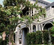
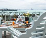
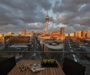
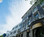
Need some hints on where to stay? We compiled a list of available hotels close to the map centre further down the page.
Being here already, you might want to pay a visit to some of the following locations: Auckland, Hamilton, Whangarei, Tauranga and Rotorua. To further explore this place, just scroll down and browse the available info.
Local weather forecast
Todays Local Weather Conditions & Forecast: 17°C / 62 °F
| Morning Temperature | 11°C / 52 °F |
| Evening Temperature | 15°C / 59 °F |
| Night Temperature | 13°C / 55 °F |
| Chance of rainfall | 0% |
| Air Humidity | 64% |
| Air Pressure | 1021 hPa |
| Wind Speed | Light breeze with 4 km/h (3 mph) from South-West |
| Cloud Conditions | Few clouds, covering 15% of sky |
| General Conditions | Few clouds |
Sunday, 5th of May 2024
17°C (63 °F)
15°C (59 °F)
Sky is clear, gentle breeze, clear sky.
Monday, 6th of May 2024
17°C (62 °F)
13°C (56 °F)
Light rain, gentle breeze, broken clouds.
Tuesday, 7th of May 2024
14°C (57 °F)
14°C (56 °F)
Moderate rain, gentle breeze, overcast clouds.
Hotels and Places to Stay
Mollies Boutique Hotel
St Marys Residence Private Luxury
City Lodge Accommodation - Hostel
Sofitel Auckland Viaduct Harbour
Swiss-Belsuites Victoria Park
The Great Ponsonby ArtHotel
The Surrey Hotel
Auckland City Hotel Hobson St
AMORA HOTEL AUCKLAND
VR AUCKLAND CITY
Videos from this area
These are videos related to the place based on their proximity to this place.
Zoo Tales - Anjalee's journey - Episode 1
Eight year old Asian elephant Anjalee has begun her journey to join Burma. Although Anjalee's final destination is Auckland Zoo, she is required to first complete a 90-day quarantine period...
Air New Zealand Skycouch - 777-300 Trip Report
Two of us booked Economy seats on Air New Zealand's new 777-300ER for a recent long haul Pacific crossing [Aircraft ZK-OKN]. We were given the option of paying extra to upgrade to the "Skycouch".
Zoo Tales - Anjalee's journey - Episode 2
Asian elephant Anjalee has begun her journey to join Auckland Zoo's elephant Burma. In Episode 2, watch Anjalee and team leader of elephants Andrew on their first morning at the elephant quarantin.
Newton Central School and Māori Education
Newton Central School in Auckland, New Zealand, undertook a contract with the Ministry of Education in 2010 to identify the strengths and successes of Māori medium education here and to enable...
Adelie Bar and Kitchen Westmere Auckland.mov
Adelie Bar and Kitchen is a Bar in Westmere, Auckland. Adelie offers food designed for sharing, cocktails and a luxury winelist.
Kayak Fishing Tours - Kayak Fishing / Kayaking and Kite Fishing Auckland NZ www.newzealandtours.travel
Kayak Fishing Tours Auckland. We show our Kayak Fishing and Kite Fishing Tours - see www.newzealandtours.travel for our Kayak Fishing Tours. We offer personal, high-quality and fully-catered...
Auckland Zoo's flamingo chick stretches its wings
Our flamingo chick is thriving and has taken its first trip to Central Lawn to get some exercise and stretch its wings!
Kea (Nestor notabilis) at the Auckland Zoo uses its problem solving abilities to get treats
A Kea (Nestor notabilis) in the High Country aviary in Te Wao Nui at the Auckland Zoo uses its impressive brainpower to get food from a puzzle box.
Feeding Pūkeko Birds
Pūkeko are known for their bold scheming and determination (http://en.wikipedia.org/wiki/Pukeko) Western Spring Park, Aukcland City, New Zealand.
Videos provided by Youtube are under the copyright of their owners.
Attractions and noteworthy things
Distances are based on the centre of the city/town and sightseeing location. This list contains brief abstracts about monuments, holiday activities, national parcs, museums, organisations and more from the area as well as interesting facts about the region itself. Where available, you'll find the corresponding homepage. Otherwise the related wikipedia article.
Herne Bay, New Zealand
Suburb:Herne Bay City:Auckland City Island:North Island Surrounded by - to the north - to the east - to the south - to the west Waitemata Harbour Saint Marys Bay Ponsonby, Grey Lynn Westmere, Coxs Bay
Waitemata Harbour
Waitemata Harbour is the main access by sea to Auckland, New Zealand. For this reason it is often referred to as Auckland Harbour, despite the fact that it is only one of two harbours surrounding the city, and is crossed by the Auckland Harbour Bridge. The Waitemata forms the north and east coasts of the Auckland isthmus. It is matched on the south by the shallower waters of Manukau Harbour.
Eden Park
Eden Park is New Zealand's largest stadium. Located in the heart of Auckland, New Zealand's largest city, it is centrally located three kilometres southwest of Auckland's CBD, straddling the boundary between the suburbs of Mount Eden and Kingsland. Eden Park's rich sporting and social history, and its international profile, is unmatched by any other stadium in the country.
Unitec Institute of Technology
Unitec Institute of Technology is the largest institute of technology in Auckland, New Zealand with over 23,800 students in 2010. The main campus is situated in Mt Albert, Auckland City, while a secondary campus is situated in Henderson, Waitakere City, and a third campus in Albany, North Shore City which opened in August 2011. Unitec offers degree programs in arts, business, and technical subjects at the bachelors, masters and doctoral level.
Grey Lynn
Grey Lynn is an inner residential suburb of Auckland City, New Zealand, located three kilometres to the west of the city centre. Originally a separate borough, Grey Lynn amalgamated with Auckland City in 1914. Grey Lynn is centred around Grey Lynn Park, which was not part of the original subdivision of 1883, since the land was too steep and too wet for house construction. In 1914 the land was drained and levelled for playing fields.
Ponsonby, New Zealand
Ponsonby is an inner-city suburb of Auckland City located 2 km west of the Auckland CBD, in the North Island of New Zealand. The suburb is oriented along a ridge running north-south, which is followed by the main street of the suburb, Ponsonby Road. A predominantly upper-middle class residential suburb, Ponsonby today is also known in Auckland for its dining and shopping establishments – many restaurants, cafes, art galleries, up-market shops and nightclubs are located along Ponsonby Road.
Point Chevalier
Point Chevalier is a suburb and peninsula in the west of the city of Auckland in the north of New Zealand. It is located five kilometres to the west of the city centre on the southern shore of the Waitemata Harbour. The suburb stretches from the town centre / shopping area along its southern edge (on Great North Road, and near the SH16 motorway) to the tip of the peninsula in the north. Its postcode is 1022.
Western Springs
Western Springs is a residential suburb and park in the west of the city of Auckland in the north of New Zealand. It is located four kilometres to the west of the city centre, situated to the north of State Highway 16. The suburb is dominated by the large park (featuring a lake with a variety of birdlife), within which are situated Auckland Zoo, Western Springs Stadium and M.O.T.A.T.. The park is the location of the annual Pasifika Festival, one of Auckland's most popular public events.
Western Springs Stadium
Western Springs Stadium is an entertainment venue in Auckland, New Zealand, that consists of a natural amphitheatre. During the winter it is used for club rugby union matches and over summer it is used for speedway. It is also occasionally used for large music concerts and festivals. Western Springs Stadium has a crowd capacity of 30,000 for sports and upwards of 50,000 for concerts. It is located four kilometres west of the city centre in the suburb of Western Springs.
Museum of Transport and Technology
The Museum of Transport and Technology (MOTAT) is a museum located in Western Springs, Auckland, New Zealand. It is located close to the Western Springs Stadium, Auckland Zoo and the Western Springs Park. The museum has large collections of civilian and military aircraft and other land transport vehicles. An ongoing programme is in place to restore and conserve items in the collections.
Kingsland Railway Station
Kingsland Railway Station is on the Western Line of the Auckland railway network. It is near Eden Park, the major rugby stadium in Auckland. The station has a side platform layout and is reached from both New North Road & Sandringham Road. During rugby games this station, 400m from Eden Park, is very busy, with thousands of supporters using it.
Baldwin Avenue Railway Station
Baldwin Avenue Railway Station, in the suburb of Mount Albert, is on the Western Line of the Auckland railway network. The station has offset side platforms connected by a level crossing.
Morningside, Auckland
Morningside is a suburb of Auckland, New Zealand. It lies four kilometres south-west of the city centre, close to Eden Park and Western Springs. The residential suburb lies between the suburbs of Grey Lynn, Kingsland, Sandringham, and Mount Albert, near the arterial North-Western Motorway and Western Railway line. The name comes from a farm estate called "Morningside" that was subdivided in 1865 for housing lots.
Westmere, New Zealand
Westmere is a residential suburb of Auckland City, New Zealand. Westmere is under the local governance of the Auckland Council. The suburb was originally a working-class area, containing some state houses; mostly private housing originating from housing development in the 1920s. It is known for its Californian style bungalow architecture. It is now a highly sought after residential location with extensive redevelopment.
Kingsland, New Zealand
Kingsland is an inner-city suburb of Auckland, the largest and most populous urban area in New Zealand. Kingsland is under the local governance of the Auckland Council. It is the home of Eden Park, New Zealand's largest stadium, which hosted the finals for the 2011 Rugby World Cup. Kingsland has a village centre that contains a series of shops, restaurants, pubs, and monthly markets.
Auckland Zoo
Auckland Zoo is a 16.35-hectare zoological garden in Auckland, New Zealand, situated next to Western Springs park not far from Auckland's central business district. It is run by the Auckland Council with the Auckland Zoological Society as a supporting organisation. Auckland Zoo opened in 1922 experiencing early difficulties mainly due to animal health issues. By 1930 a sizable collection of animals had been assembled and a zoological society formed.
MOTAT collections
This list collects the transport-related vehicles exhibited or owned by the Museum of Transport and Technology (MOTAT) in Auckland, New Zealand.
Watchman Island
Watchman Island is a small sandstone island in the Waitemata Harbour of Auckland, New Zealand. It lies approximately 600 metres north of the Herne Bay suburb. In the mid-19th century, the island was known as Sentinel Rock, which appears under this name on an 1857 British Admiralty chart of the Waitemata Harbour. On July 31st 2011 a Maori Sovereignty flag was raised at the top of the island as part of a four-man waka led Hikoi through the harbour. The flag has since been removed.
Fowlds Park
Fowlds Park is a small public reserve in the northern part of Mount Albert, in Auckland City.
Western Springs College
Western Springs College is a co-educational state secondary school in Auckland, New Zealand. It teaches students from years 9 to 13 and is located near both Western Springs Park and Auckland Zoo. The school was originally part of Seddon Memorial Technical College but was moved to the current Western Springs site in circa 1960.
Meola Reef
The Meola Reef, or Te Tokaroa Reef in Māori ('toka'='rock', 'roa'='long') is a lava flow forming a reef peninsula across part of Auckland's Waitemata Harbour, New Zealand. It was formed 20,000 years ago from the final portion of a 10 kilometer long lava flow that originated from the distant Three Kings volcano. The reef extends for over 2 kilometres across the Waitemata Harbour, to within 500 metres of Kauri Point, on the northern shore.
St Paul's College, Auckland
St Paul's College is a college for year 7 to 13 boys and offers a Catholic education to its students. It is located in the central Auckland suburb of Ponsonby. The school originates from 1903 when the Marist Brothers opened Sacred Heart College, Auckland on the site. In the early 1950s the school was split with part, taking the name of "Sacred Heart College", being relocated to Glen Innes.
Northwestern Cycleway
The Northwestern Cycleway (sometimes also referred to as the North West or Northwestern Cycle Route) is a 12 km mostly off-road cycle route connecting the Auckland CBD in Auckland City with Henderson, Waitakere City in New Zealand. For most of its length, it runs alongside the Northwestern Motorway (State Highway 16).
Hawke scout hall
The Hawke scout hall is a building located on the edge of Coxs Bay, which is between the suburbs of Herne Bay and Westmere in Auckland, New Zealand. It is primarily used by Sea Scouts.
Coxs Bay
Coxs Bay or Opoututeka is a bay located in the Waitemata harbour in the Auckland region of New Zealand. The settlements of Westmere and Herne Bay are adjacent suburbs to the south and north respectively. The first purchase of land by Europeans in Auckland was in 1840. The western boundary of this land was “the river called Opou” or Cox’s Creek. It was soon after, in the early 1840s, that John and Jane Cox started market gardening in the area. The district was then called Richmond.


