Safety Score: 3,0 of 5.0 based on data from 9 authorites. Meaning we advice caution when travelling to New Zealand.
Travel warnings are updated daily. Source: Travel Warning New Zealand. Last Update: 2024-04-26 08:02:42
Discover Te Atatu
Te Atatu in Auckland (Auckland) is a city in New Zealand about 308 mi (or 495 km) north of Wellington, the country's capital city.
Local time in Te Atatu is now 10:37 AM (Saturday). The local timezone is named Pacific / Auckland with an UTC offset of 12 hours. We know of 8 airports in the vicinity of Te Atatu, of which one is a larger airport. The closest airport in New Zealand is Auckland International Airport in a distance of 14 mi (or 23 km), South-East. Besides the airports, there are other travel options available (check left side).
We discovered 3 points of interest in the vicinity of this place. Looking for a place to stay? we compiled a list of available hotels close to the map centre further down the page.
When in this area, you might want to pay a visit to some of the following locations: Auckland, Hamilton, Whangarei, Tauranga and Rotorua. To further explore this place, just scroll down and browse the available info.
Local weather forecast
Todays Local Weather Conditions & Forecast: 16°C / 61 °F
| Morning Temperature | 14°C / 58 °F |
| Evening Temperature | 15°C / 58 °F |
| Night Temperature | 13°C / 56 °F |
| Chance of rainfall | 0% |
| Air Humidity | 50% |
| Air Pressure | 1020 hPa |
| Wind Speed | Moderate breeze with 10 km/h (6 mph) from North-East |
| Cloud Conditions | Broken clouds, covering 81% of sky |
| General Conditions | Broken clouds |
Sunday, 28th of April 2024
17°C (62 °F)
13°C (56 °F)
Overcast clouds, gentle breeze.
Monday, 29th of April 2024
18°C (64 °F)
14°C (57 °F)
Few clouds, gentle breeze.
Tuesday, 30th of April 2024
17°C (63 °F)
15°C (59 °F)
Overcast clouds, moderate breeze.
Hotels and Places to Stay
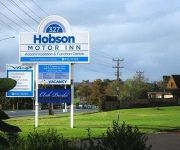
Hobson Motor Inn
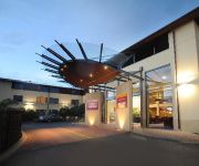
Quest Henderson
HEARTLAND HOTEL AKLD AIRPORT
Haven Bed and Breakfast
Avondale Motor Inn
Kiwi Heritage Homestay
Quality Hotel Lincoln Green
Videos from this area
These are videos related to the place based on their proximity to this place.
Te Atatu Boat Ramp Nissan Patrol Tows Range Rover Tows Boat
10 March 2012 4:47pm: Te Atatu Boating Club boat ramp Auckland New Zealand - Nissan Patrol tows Rangie struggling to get boat/trailer off the ramp that appears to have dropped it's wheels off...
SOLD 2A Porter Avenue, Te Atatu South Auckland By Justin Meldau
SOLD Property Video shoot of 2A Porter Avenue, Te Atatu South Auckland by PlatinumHD http://www.platinumhd.tv for Barfoot & Thompson Henderson.
Lebanon v NZ Maoris Tag Final Oceania Indigenous Cup 2014
Lebanon v New Zealand Maoris Clips from the Open Mens Final of the Tag Oceania Indigenous Cup 2014 in Auckland, New Zealand. A nail biter in extra time All the Lebanon teams who came to...
NZ Police Holden Commodore Responding, Moire Rd, 22 Jan 2010
Police responding through Royal Heights, a flash name for such an average part of town... New Zealand Police Holden Commodore VE Omega 22 January, 2010 Royal Road to Moire Road Royal...
A keen little Jack Russell, 30 Jul 06
Something a little more lighthearted for today... Petra, my mate's Jack Russell Terrier, is trying desperately to carry a stick, sideways, through the impenetrable mangrove swamp. A pathetic...
2/2 Forsythe Pl, Royal Heights, Auckland - Presented by Dan Manford
Surrounded by quality houses in a family-friendly neighbourhood, this delightful sunny home is the perfect entry into Royal Heights. Offering three bedrooms, open plan living and dining, and...
Te Atatu Peninsula Community Centre
Main hall.. just checking video format upload quality.. Details of Te Atatu Peninsula Community Centre here: ...
Videos provided by Youtube are under the copyright of their owners.
Attractions and noteworthy things
Distances are based on the centre of the city/town and sightseeing location. This list contains brief abstracts about monuments, holiday activities, national parcs, museums, organisations and more from the area as well as interesting facts about the region itself. Where available, you'll find the corresponding homepage. Otherwise the related wikipedia article.
Whau River
The Whau River is an estuarial arm of the southwestern Waitemata Harbour (rather than a river) within the Auckland metropolitan area in New Zealand. It flows north for 5.7 kilometres from its origin at the confluence of the Avondale Stream and Whau Stream to its mouth between the Te Atatu peninsula and the long, thin Rosebank Peninsula in Avondale. It is 800 metres at its widest and 400 metres wide at its mouth.
Te Atatu
Te Atatu (Maori for "the dawn") is the name of two suburbs in western Auckland, New Zealand: Te Atatu Peninsula and Te Atatu South. They are located next to each other some 10 kilometres to the west of the Auckland city centre. Formerly known as Te Atatu North, the suburb of Te Atatu Peninsula lies, as the name suggests, on a small peninsula.
West Harbour, Auckland
West Harbour is a suburb of Waitakere City, located in the west of Auckland. It is named for its location on the western side of the Waitemata Harbour. West Harbour is under the local governance of the Waitakere City Council. Local features include many public reserves, two local primary schools, West Harbour School and Marina View School, and farm land. West Harbour is home to Westpark Marina, a large marina catering to over 600 of private leisure boats and yachts.
Massey, New Zealand
Massey is a north-western suburb of the Auckland conurbation. It was formerly a northern suburb of Waitakere City which existed from 1989 to 2010, before being replaced by the Auckland Council. The suburb was named after former Prime Minister of New Zealand William Massey. Massey is a relatively large suburb and can be divided into three reasonably distinctive areas, Massey West, Massey East (separated by the north-western motorway) and Massey North (situated to the north of Royal Road).
Lincoln, Auckland
Lincoln is a West Auckland suburb, in Waitakere City. The Northwestern Motorway passes through the northern part of the suburb, with the "Lincoln Road" junction providing access. Lincoln North mall is a small shopping centre on the corner of Lincoln Road and Universal Drive, and across Universal Drive are a Pak'n Save supermarket and Mitre 10 megastore. The suburb is sometimes called Lincoln North or treated as part of Henderson North to avoid confusion with Lincoln in Canterbury.
Rutherford College, Auckland
Rutherford College is a co-educational state secondary school on the Te Atatu Peninsula, Auckland, New Zealand.
Trusts Stadium
Trusts Stadium is an indoor arena located in Waitakere City, Auckland, New Zealand. It is a multi-purpose stadium that primarily holds sports events and music concerts. The Stadium was opened by the Prime Minister Helen Clark on the 11th September 2004. The Stadium Arena has hosted the New Zealand Breakers in the past and has also hosted the Netball World Championships in November 2007. It holds 4,901 people and was built in 2004.
Laidlaw College
Laidlaw College, formerly known as Bible College of New Zealand (BCNZ), is an evangelical Bible college in New Zealand. The college offers tertiary courses in biblical, theological, historical and pastoral studies. It also offers teaching and counseling degrees. Some students go on to serve as pastors and missionaries, both full-time and part-time.


