Safety Score: 3,3 of 5.0 based on data from 9 authorites. Meaning please reconsider your need to travel to Netherlands.
Travel warnings are updated daily. Source: Travel Warning Netherlands. Last Update: 2024-05-09 08:23:21
Delve into Ammerstol
Ammerstol in Krimpenerwaard (South Holland) with it's 1,580 habitants is located in Netherlands about 31 mi (or 50 km) south of Amsterdam, the country's capital town.
Current time in Ammerstol is now 11:35 PM (Thursday). The local timezone is named Europe / Amsterdam with an UTC offset of 2 hours. We know of 10 airports close to Ammerstol, of which 5 are larger airports. The closest airport in Netherlands is Rotterdam Airport in a distance of 16 mi (or 26 km), West. Besides the airports, there are other travel options available (check left side).
There are several Unesco world heritage sites nearby. The closest heritage site in Netherlands is Mill Network at Kinderdijk-Elshout in a distance of 7 mi (or 12 km), South-West. We encountered 3 points of interest near this location. If you need a hotel, we compiled a list of available hotels close to the map centre further down the page.
While being here, you might want to pay a visit to some of the following locations: Utrecht, Amsterdam, Haarlem, The Hague and 's-Hertogenbosch. To further explore this place, just scroll down and browse the available info.
Local weather forecast
Todays Local Weather Conditions & Forecast: 18°C / 64 °F
| Morning Temperature | 9°C / 48 °F |
| Evening Temperature | 18°C / 64 °F |
| Night Temperature | 10°C / 51 °F |
| Chance of rainfall | 0% |
| Air Humidity | 65% |
| Air Pressure | 1026 hPa |
| Wind Speed | Light breeze with 4 km/h (2 mph) from South |
| Cloud Conditions | Broken clouds, covering 77% of sky |
| General Conditions | Broken clouds |
Friday, 10th of May 2024
18°C (65 °F)
12°C (54 °F)
Overcast clouds, light breeze.
Saturday, 11th of May 2024
20°C (67 °F)
15°C (58 °F)
Overcast clouds, gentle breeze.
Sunday, 12th of May 2024
22°C (71 °F)
16°C (61 °F)
Light rain, moderate breeze, broken clouds.
Hotels and Places to Stay
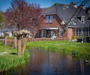
De Arendshoeve – Hotel & Restaurant
Videos from this area
These are videos related to the place based on their proximity to this place.
TimeLapse Achtkante molen Perseïden 2013
Vanwege de bewolking op 12-08-2013 zelf 3 meteoren gezien en maar een timelapse gemaakt om de tijd door te komen. Het onweerde ook nog in de verte.
airbus a320 landing (heathrow airport)
airbus a320-233 landing with some pictures (my first fs 2004 video )
Stork feeding babies
Ooievaar voert kleintjes in het Ooievaar dorp in Groot-Ammers. English: Some white storks feeding the offspring in the 'stork village' Groot-Ammers.
FPV setup (MX20-UHF-2G4). All-in-one FPV transmitter
More info: http://www.hoogtezicht.nl/gallery.html The new all-in-one FPV transmitter (version MX20-UHF-2G4).New is a built-in 2.4Ghz video receiver (VRX) in the powerbox and a charging connector...
Setup Long Range FPV ground station
The new (version 3) all-in-one Long Range (UHF) FPV transmitter. Setup FPV ground station: - Graupner MX-20 HoTT RC transmitter: - EzUHF Long Range UHF receiver - 7 inch LCD - LED Backlight...
Another GoPro POV (Point of view) from quadcopter drone
More info: http://www.hoogtezicht.nl Aerial footage with 3 another GoPro POV (Point of view) on a TBS DIscovery PRO quadcopter. With a fully stabilized gimbal with GoPro HERO 3 Black Edition...
FPV flying TBS Discovery PRO
More info: http://www.hoogtezicht.nl FPV (First person view) flight with quadcopter drone. The TBS Discovery PRO with stabilized GoPro camera gimbal gives you leveled video footage, no matter...
Videos provided by Youtube are under the copyright of their owners.
Attractions and noteworthy things
Distances are based on the centre of the city/town and sightseeing location. This list contains brief abstracts about monuments, holiday activities, national parcs, museums, organisations and more from the area as well as interesting facts about the region itself. Where available, you'll find the corresponding homepage. Otherwise the related wikipedia article.
Ammerstol
Ammerstol is a village in the municipality of Bergambacht, in the Netherlands. It is located about 12 km southeast of Gouda, on the Lek River. Between 1817 and 1985, Ammerstol was a separate municipality.
Donkse Laagten
The Donkse Laagten is a small Dutch nature reserve of roughly two square kilometres in the Alblasserwaard in the province of South Holland. It is located in the municipality of Molenwaard, between the towns Streefkerk to the northwest and Bleskensgraaf to the south. The area is governed by the organization Staatsbosbeheer. There is no public transportation to the Donkse Laagten, but it is open for recreational use.
Laagblokland
Laagblokland is a former hamlet in the Dutch province of South Holland. It was located in the former municipality of Graafstroom, between the villages of Molenaarsgraaf and Ottoland. Laagblokland was a separate municipality between 1817 and 1857, when it merged with Ottoland.


