Safety Score: 3,3 of 5.0 based on data from 9 authorites. Meaning please reconsider your need to travel to Netherlands.
Travel warnings are updated daily. Source: Travel Warning Netherlands. Last Update: 2024-05-05 08:24:42
Explore Kekerdom
Kekerdom in Gemeente Berg en Dal (Provincie Gelderland) with it's 485 inhabitants is located in Netherlands about 59 mi (or 95 km) south-east of Amsterdam, the country's capital.
Local time in Kekerdom is now 06:03 AM (Monday). The local timezone is named Europe / Amsterdam with an UTC offset of 2 hours. We know of 10 airports in the wider vicinity of Kekerdom, of which 5 are larger airports. The closest is airport we know is Niederrhein Airport in Germany in a distance of 19 mi (or 31 km). The closest airport in Netherlands is Eindhoven Airport in a distance of 39 mi (or 31 km), South. Besides the airports, there are other travel options available (check left side).
There are several Unesco world heritage sites nearby. The closest heritage site in Netherlands is Rietveld Schröderhuis (Rietveld Schröder House) in a distance of 40 mi (or 64 km), West. We found 4 points of interest in the vicinity of this place. If you need a place to sleep, we compiled a list of available hotels close to the map centre further down the page.
Depending on your travel schedule, you might want to pay a visit to some of the following locations: Kranenburg, Kleve, Arnhem, Weeze and Uedem. To further explore this place, just scroll down and browse the available info.
Local weather forecast
Todays Local Weather Conditions & Forecast: 14°C / 58 °F
| Morning Temperature | 10°C / 50 °F |
| Evening Temperature | 13°C / 56 °F |
| Night Temperature | 12°C / 53 °F |
| Chance of rainfall | 0% |
| Air Humidity | 78% |
| Air Pressure | 1008 hPa |
| Wind Speed | Gentle Breeze with 6 km/h (4 mph) from West |
| Cloud Conditions | Overcast clouds, covering 100% of sky |
| General Conditions | Light rain |
Tuesday, 7th of May 2024
14°C (56 °F)
9°C (48 °F)
Light rain, gentle breeze, overcast clouds.
Wednesday, 8th of May 2024
14°C (57 °F)
10°C (50 °F)
Light rain, light breeze, overcast clouds.
Thursday, 9th of May 2024
17°C (63 °F)
12°C (53 °F)
Light rain, light breeze, overcast clouds.
Hotels and Places to Stay
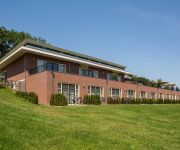
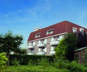
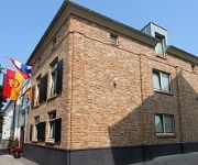
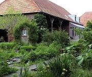
Hotel Holthurnische Hof Nijmegenl
Fletcher Gelderse Poort Hotel – Restaurant
Zur Kranengasse
Lindenhof Gästehaus
Hotel & Bungalowpark de Zeven Heuvelen Nijmegen
Campanile - Zevenaar Arnhem
Buitengoed de Panoven
Videos from this area
These are videos related to the place based on their proximity to this place.
Feestelijke opening fortseizoen bij Fort Pannerden
Fort Pannerden opende op zondag 7 april 2013 haar deuren met een feestelijk openingsprogramma. Onder begeleiding van een doedelzakspeler liepen vrijwilligers, genodigden en bezoekers vanaf...
PV kennisgeving1: positie Lingewaard inzake Fort Pannerden
In een radiointerview door Radio Gelderland met de burgemeester van de Gemeente Lingewaard afgenomen 13 augustus 2008 verduidelijkt dhr. De Vries de positie van de overheid ten opzichte van...
TVG1 De Ontruiming van Fort Pannerden 2006
Op 7 november 2006 worden leger en politie ingezet om Fort Pannerden te ontruimen. TV Gelderland doet verslag. © 2008 FP TV www.fortpannerden.nl.
Vendelrepetitie senior vendeliers 21-3-2014
Een kijkje in de keuken tijdens de vendelrepetities van de Doornenburgse schutterij Gijsbrecht van Aemstel. De vendeliers oefenen ter voorbereiding op het Gelders kampioenschap Indoorvendelen...
Kasteel Doornenburg
In de Betuwe, vlakbij de splitsing van Rijn en Waal, nabij het natuurgebied De Gelderse Poort, staat het kasteel Doornenburg. Het grote en fraaie middeleeuwse kasteel Doornenburg bestaat uit...
Verbouwing Leaneraz Veenendaal
Film gemaakt door een tevreden klant in Veenendaal. Van zolder naar bedrijfsruimte. ZOLDERTOTAALCONCEPT. Dakkapel,Velux dakramen,wanden,schuifwand kasten,elektra enz.
Videos provided by Youtube are under the copyright of their owners.
Attractions and noteworthy things
Distances are based on the centre of the city/town and sightseeing location. This list contains brief abstracts about monuments, holiday activities, national parcs, museums, organisations and more from the area as well as interesting facts about the region itself. Where available, you'll find the corresponding homepage. Otherwise the related wikipedia article.
Millingen aan de Rijn
Millingen aan de Rijn is a municipality and a town in the eastern Netherlands.
Pannerdens Kanaal
The Pannerdens Kanaal (Pannerden Canal) is a canal in the Netherlands that was dredged between 1701 and 1709 to cut off a large, shallow bend of river Rhine and so improve river traffic and water regulation. The canal, now indistinguishable from a "real" river, forks off north from river Waal a few kilometres past the point where the Bijlands Kanaal, a similar canal dug to cut off a Waal bend, ends.
Doornenburg
Doornenburg is a village south of Huissen in the municipality of Lingewaard, Gelderland, the Netherlands. It has a population of 2797 (as of 1 January 2006). Doornenburg Castle is located near the village.
Pannerden
Pannerden is a village in the Dutch province of Gelderland. It is located in the municipality of Rijnwaarden. Pannerden was a separate municipality from 1818 to 1985, when it became a part of the new municipality of Rijnwaarden.
Leuth, Netherlands
Leuth is a village in the Dutch province of Gelderland. It is located in the municipality of Ubbergen, about 10 km east of Nijmegen. Leuth was founded on a sandbank in the floodplain marshes north of the Waal (river). The earliest mention of the settlement, named Lotde, dates back to 891 and 892. The village belonged until 1815 to Prussia; Leuth was a separate municipality until about 1814.
Kapel, Gelderland
Kapel is a hamlet in the Dutch province of Gelderland. It is located in the municipality of Lingewaard, about 1 km north of the town of Gendt.
Fort Pannerden
Fort Pannerden is a disused military fort situated near the village of Pannerden in the southeast of the Netherlands. In November 2006, it became the focus of national news stories because a group of squatters were evicted in a large-scale operation by police, helped by the army. Later on in the same month, it was resquatted.
Doornenburg Castle
Castle Doornenburg is a Dutch castle from the 13th century. The castle is located in the eastern part of Gelderland, near the village of Doornenburg. It contains a front-castle and a main castle, which are connected through a small wooden bridge. It is one of the biggest and best preserved castles in the Netherlands. Originally the castle was a fortified manor built in the 9th century, under the name Villa Dorenburc. In the 13th century it was converted into a modest castle.


