Safety Score: 3,3 of 5.0 based on data from 9 authorites. Meaning please reconsider your need to travel to Netherlands.
Travel warnings are updated daily. Source: Travel Warning Netherlands. Last Update: 2024-04-28 08:22:10
Delve into Strijen
The district Strijen of Oosterhout in Gemeente Oosterhout (North Brabant) is a district located in Netherlands about 50 mi south of Amsterdam, the country's capital town.
In need of a room? We compiled a list of available hotels close to the map centre further down the page.
Since you are here already, you might want to pay a visit to some of the following locations: Turnhout, 's-Hertogenbosch, Utrecht, Laakdal and Heist-op-den-Berg. To further explore this place, just scroll down and browse the available info.
Local weather forecast
Todays Local Weather Conditions & Forecast: 15°C / 59 °F
| Morning Temperature | 12°C / 54 °F |
| Evening Temperature | 12°C / 54 °F |
| Night Temperature | 8°C / 46 °F |
| Chance of rainfall | 0% |
| Air Humidity | 61% |
| Air Pressure | 1005 hPa |
| Wind Speed | Fresh Breeze with 17 km/h (11 mph) from North |
| Cloud Conditions | Overcast clouds, covering 100% of sky |
| General Conditions | Light rain |
Monday, 29th of April 2024
16°C (61 °F)
12°C (53 °F)
Light rain, moderate breeze, overcast clouds.
Tuesday, 30th of April 2024
18°C (64 °F)
14°C (57 °F)
Light rain, gentle breeze, overcast clouds.
Wednesday, 1st of May 2024
20°C (69 °F)
15°C (59 °F)
Moderate rain, gentle breeze, scattered clouds.
Hotels and Places to Stay
Hotel Nassau Breda Autograph Collection
Hotel Oosterhout
Hotel De Korenbeurs
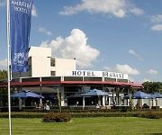
Amrath Brabant
Apollo Hotel Breda City Centre
Golden Tulip Keyser Breda
Bliss Hotel
Hotel Heere
Campanile Breda
Hotel 't Trefpunt
Videos from this area
These are videos related to the place based on their proximity to this place.
Sinterklaastintocht Oosterhout 2014
Deze video is geproduceerd door Kaj Moerenhout Media (http://www.kajmoerenhout.nl) i.o.v. OokvanWosterhout. Nadat Sinterklaas gisteren aankwam in Gouda, deed hij vandaag Oosterhout aan. Hij...
Het onderwijs in Oosterhout door de jaren heen!
Fotocollage over scholen en onderwijs in Oosterhout. Religie - schoolgebouwen - klassenfoto's - onderwijzend personeel - na school- diploma's en getuigschriften enz.
Parkfeest Oosterhout 2013
Zoals elk jaar was er ook een 2013 editie van het Parkfeest. Met ook dit jaar weer een aantal flinke namen, zo waren o.a. The Golden Earring, The BaseBalls en Jurk! te vinden op de podia in...
Mislukte ramkraak ABN Amro pinautomaat Arkendonk in Oosterhout (2013-05-26)
OOSTERHOUT - In de nacht van zaterdag op zondag, rond 04:15 uur, kwam er een melding binnen bij de meldkamer dat er mogelijk een ramkraak was gepleegd bij de geldautomaat bij het ...
Oosterhout wil antwoorden van Tennet en EZ
Oosterhout wil antwoorden van Tennet en EZ http://www.ookvanwosterhout.nl Deze video is geproduceerd door Kaj Moerenhout Media. http://www.kajmoerenhout.nl.
Auto vliegt uit de bocht op de Bovensteweg in Oosterhout (2015-02-20)
OOSTERHOUT - Bij een eenzijdig ongeval op Bovensteeg in Oosterhout is vrijdagmiddag een vrouw licht gewond geraakt. De vrouw vloog met haar auto uit de bochten belande op twee wielen iets ...
Tuincentrum AVRI in Oosterhout
Tuincentrum AVRI is gevestigd in Oosterhout, Brabant. Bekijk de 120+ positieve recensies over AVRI Tuincentrum op http://www.tuincentrumoverzicht.nl/avri-bloem-en-tuincentrum-oosterhout! ...
Vrouw zwaar gewond bij aanrijding op de Hoofseweg in Oosterhout (2015-01-31)
OOSTERHOUT - Op de Hoofseweg is zaterdagavond 31 januari 2015 een 74-jarige vrouw uit Oosterhout gewond geraakt na een aanrijding. De vrouw wilde oversteken, maar werd toen aangereden ...
Gewapende overval op parkeerplaats Arkendonk in Oosterhout (2013-10-07)
OOSTERHOUT - Ten minste vier daders beroofden maandag 7 oktober aan het einde van de middag een 37-jarige man uit Diemen. Het gebeurde op parkeerplaats Arkendonk. Het slachtoffer moest ...
Videos provided by Youtube are under the copyright of their owners.
Attractions and noteworthy things
Distances are based on the centre of the city/town and sightseeing location. This list contains brief abstracts about monuments, holiday activities, national parcs, museums, organisations and more from the area as well as interesting facts about the region itself. Where available, you'll find the corresponding homepage. Otherwise the related wikipedia article.
Drimmelen
Drimmelen is a municipality and a town in the southern Netherlands.
Oosterhout
Oosterhout (from ooster, "eastern", and hout, "woods") is a municipality and a city in the southern Netherlands. In November 2012, the city's population was 53,693.
Bergse Maas
The Bergse Maas is a canal that was constructed in 1904 to be a branch of the Maas River in the Dutch province of North Brabant. The Maas splits near Heusden into the Afgedamde Maas and the Bergse Maas. The Afgedamde Maas flows north until its confluence with the river Waal (the main distributary of the river Rhine) to form the Merwede, while the Bergse Maas continues west as the main distributary of the Maas. Part of the Merwede rejoins the Bergse Maas to from the Hollands Diep estuary.
Koninklijke Militaire Academie
The Royal Military Academy is the service academy for the Dutch Army and the Dutch Air Force. Located in Breda, the Netherlands, the KMA has trained future officers since 1828.
Zandberg, North Brabant
Zandberg is a neighbourhood and residential district to the southeast of the city centre of Breda, an extension raised in the 1920s and 1930s. It is only one of four parts of one of the seven greater quarters of that city, officially called 'Breda East' (Breda Oost).
Donge (river)
The Donge is a river in the Dutch province of Noord-Brabant. It rises near the village Dongen and flows north to the city of Geertruidenberg where it's continued by the Amer together with the Bergse Maas.
Capture of Breda (1581)
The Capture of Breda of 1581, also known as the Haultepenne Fury, occurred when Spanish troops under the command of Claude de Berlaymont, lord of Haultepenne, took Breda by surprise after a sentry was bribed by a follower of the king, Charles de Gavre, who was kept a prisoner at the castle. The corrupt sentry allowed the Spanish troops to enter the castle.
Capture of Breda (1590)
The Capture of Breda was an extremely short battle of the Eighty Years' War during which a Dutch and English army led by Maurice of Nassau and Francis Vere captured the heavily protected city of Breda by a clever tactic reminiscent of the Trojan horse. He was informed by English captain Lional Vickars and a nobleman from Cambrai, Charles de Heraugiere, that a ship carrying peat to the city was never checked by the Spanish soldiers.
Ginneken en Bavel
Ginneken en Bavel was a municipality in the Dutch province of North Brabant, located southeast of the city of Breda. It covered the villages of Ginneken (now a neighbourhood of Breda) and Bavel. Ginneken en Bavel existed until 1942, when the village of Ginneken was transferred to Breda, and the other part of the area became a new municipality called Nieuw-Ginneken.
's Gravenmoer
's Gravenmoer is a village in the Dutch province of North Brabant. It is located in the municipality of Dongen, about 3 km north of the town of Dongen. The village has a population of about 2190 inhabitants, including the farmlands to the north of the village. 's Gravenmoer was a separate municipality until 1997, when it became a part of Dongen.
Made, Netherlands
Made is a town in the Dutch province of North Brabant. It is located in the municipality of Drimmelen, about 10 km northeast of Breda. Between 1997 and 1998, "Made" was the name of a municipality, created in the merger of the former municipalities of Hooge en Lage Zwaluwe, Made en Drimmelen, and Terheijden. In 1998, the name of the municipality was changed to "Drimmelen". Made lies along the highway A59, which puts it in close range of both the A16 and the A27.
Made en Drimmelen
Made en Drimmelen was a municipality in the Dutch province of North Brabant. It included the villages Drimmelen and Made. The municipality existed until 1997, when it merged with Hooge en Lage Zwaluwe and Terheijde, to form the new municipality "Made".
Raamsdonk
Raamsdonk is a village in the Dutch province of North Brabant. It is located in the municipality of Geertruidenberg, about 15 km northeast of Breda. Raamsdonk was a separate municipality until 1997, when it became part of Geertruidenberg.
Teteringen
Teteringen is a village in the Dutch province of North Brabant. It is located in the municipality of Breda, about 4 km north of the city centre. Teteringen was a separate municipality until 1997, when it became part of Breda.
Waspik
Waspik is a village in the Dutch province of Noord-Brabant. It is located in the municipality of Waalwijk. Waspik was a separate municipality until 1997, when it became part of Waalwijk. Waspik came to national attention in 2007 when a Liberian family was forced to flee the village after repeated racist attacks. An official report into events in the village concluded that everyone involved in the affair including the town council and housing corporations had failed to protect the family.
Bavel, Netherlands
Bavel is a village in the southern Netherlands. It is located in the Dutch province of North Brabant, largely within the municipality of Breda with some rural areas in the municipality of Alphen-Chaam. Bavel has a population of around 6,500, the majority of the inhabitants live in the village itself, and some 590 in the surroundig countryside, including the hamlets of Roosberg, Eikberg, Bolberg, Tervoort, Lijndonk and Lage Aard.
Heikant, Rijen
Heikant is a former hamlet in the Dutch province of North Brabant. It was located in the municipality of Gilze en Rijen, about 1 km west of the centre of Rijen. According to the 19th century historian A.J. van der Aa, Heikant (or "De Heikant") consisted of 8 houses and had a population of 60 in the middle of the 19th century. Heikant was still named as a separate hamlet in 1997, but nowadays it no longer exists: a residaential neighbourhood of the town of Rijen now covers the area.
Heikant, Oosterhout
Heikant is a hamlet in the municipality of Oosterhout, in the Dutch province of North Brabant. It is located about 3 km southeast of the centre of Oosterhout.
Breda Castle
In the 12th century, a fortress was located at Breda. The city of Breda came into existence nearby the fortress. In 1350, the Duke of Brabant sold Breda to Jan II of Polanen (Baron of Breda). He reinforced the castle with four towers and a channel. His daughter Johanna of Polanen married in 1403 the German Duke Engelbert I of Nassau. Their son Jan IV of Nassau enlarged the castle. Henry III of Nassau-Breda changed the castle into a Renaissance palace in 1536.
Siege of Breda (1637)
The Fifth Siege of Breda (21 July – 11 October 1637) was an important siege in the Eighty Years' War in which stadtholder Frederick Henry, Prince of Orange retook the city of Breda, which had last changed hands in 1625 when the Spanish general Ambrogio Spinola conquered it for Spain. Hereafter, the city would remain in the hands of the Dutch Republic until the end of the war.
MOTI
The Museum of the Image (MOTI), previously the Graphic Design Museum in Breda, is a museum for visual culture. The museum is in the centre of Breda and exhibits the broad and dynamic world of film, design, photography, fashion, visual arts, architecture, science and gaming. MOTI places current graphic design in an historical and cultural context, open to the world and technology. It represents all forms of media, from printed material to interactive web design.
NAC Stadion t Ploegske
`t Ploegske was a football stadium in Breda, Netherlands. It was used for football matches and hosted the home matches of NAC Breda. The stadium was able to hold 3,000 people, including 150 seats. The stadium was opened in 1916 and demolished in 1931.
Terrein achter de Watertoren
Terrein achter de Watertoren was a football stadium in Breda, Netherlands. It was used for football matches and hosted the home matches of NAC Breda. The stadium was opened in 1913 and demolished in 1916.
Grote kerk (Breda)
The Grote kerk or Onze-Lieve-Vrouwekerk (Church of Our Lady) is the most important monument of Breda. The church is built in the Brabantine Gothic style. The tower of the church is 97 meter tall. The plan is in the shape of a Latin Cross.
Koepelgevangenis (Breda)
The Koepelgevangenis is a prison in Breda, Netherlands, constructed in 1886, best known as the prison where convicted World War II collaborators were held captive.


