Safety Score: 3,3 of 5.0 based on data from 9 authorites. Meaning please reconsider your need to travel to Netherlands.
Travel warnings are updated daily. Source: Travel Warning Netherlands. Last Update: 2024-05-13 08:03:22
Explore De Bergen
The district De Bergen of Raamsdonk in Gemeente Geertruidenberg (North Brabant) is located in Netherlands about 47 mi south of Amsterdam, the country's capital.
If you need a place to sleep, we compiled a list of available hotels close to the map centre further down the page.
Depending on your travel schedule, you might want to pay a visit to some of the following locations: Turnhout, 's-Hertogenbosch, Utrecht, Laakdal and Heist-op-den-Berg. To further explore this place, just scroll down and browse the available info.
Local weather forecast
Todays Local Weather Conditions & Forecast: 23°C / 73 °F
| Morning Temperature | 15°C / 59 °F |
| Evening Temperature | 20°C / 68 °F |
| Night Temperature | 14°C / 57 °F |
| Chance of rainfall | 12% |
| Air Humidity | 58% |
| Air Pressure | 1005 hPa |
| Wind Speed | Moderate breeze with 12 km/h (8 mph) from North |
| Cloud Conditions | Clear sky, covering 6% of sky |
| General Conditions | Moderate rain |
Wednesday, 15th of May 2024
15°C (59 °F)
13°C (55 °F)
Moderate rain, gentle breeze, overcast clouds.
Thursday, 16th of May 2024
13°C (56 °F)
11°C (52 °F)
Moderate rain, gentle breeze, overcast clouds.
Friday, 17th of May 2024
18°C (65 °F)
15°C (58 °F)
Moderate rain, gentle breeze, overcast clouds.
Hotels and Places to Stay
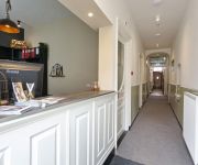
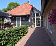
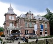
Hotel Oosterhout
Hotel Heere
Hof van 's Gravenmoer
de Villa
Videos from this area
These are videos related to the place based on their proximity to this place.
afscheid Matthieu Meijer door brandweer Geertruidenberg
De interesse en passie in de brandweer is waarschijnlijk niemand ontgaan. Daarom wordt de nieuwe brandweerkazerne vernoemd naar Matthieu Meijer. Om afscheid te nemen van de burgervader ...
Junior Kamer Bergse Maas gaat naar haar zieke Senator
Een paar weken geleden vernamen we het verschrikkelijke nieuws: Margot Segers-Rodenburg heeft kwaadaardige hersentumor. Binnen de kamer ontstond de wens om Huub en Margot een hart ...
Grote brand in boerderij Benedenkerkstraat in Waspik (2013-05-13)
WASPIK - Vanmorgen, maandag 13 mei 2013, werd omstreeks 06.40 uur een brand gemeld in een boerderij aan de Benedenkerkstraat. De brandweer schaalde op naar grote brand en rukte uit met ...
Vrachtwagen op z'n kant na ongeval op de A59 bij Raamsdonk (2014-06-11)
RAAMSDONK - Bij een verkeersongeval op de snelweg A59 is woensdagmiddag rond kwart voor drie een tankwagen gekanteld. Dat gebeurde ter hoogte van Raamsdonk. De rechterrijstrook is ...
Middelbrand in loods/bijgebouw aan de Groenendijk in Oosteind (2013-07-22)
OOSTEIND - Maandagavond is er aan de Groenendijk in Oosteind brand uitgebroken in een loods. De brandweer had moeite om de brand onder controle te krijgen omdat de loods was afgesloten. Een ...
Plofkraak bij ABN-AMRO bank aan de Wilhelminalaan in Raamsdonksveer
Bij de ABN Amro aan de Wilhelminalaan in Raamsdonksveer is in de nacht van woensdag op donderdag een plofkraak gepleegd op een geldautomaat. Daarbij werd geen geld buitgemaakt, maar wel ...
Gig at the Garage - Part 1
"Gig at the Garage" (Jansen in Raamsdonk). Juli 1989 Één van de eerste optredens van de A.S.S. band aka the Anti Society Scum. Het was in die dagen dat de noise gate nog zijn intrede...
Bas en Marc gaan paalkamperen, deel 2
Bas en Marc gaan paalkamperen bij de Donge in Brabant. In de ochtend... net wakker.
Jiki Jaarverslag / Annual report 2013
Jaarverslag van het allereerste boekjaar van Stichting Jiki :) Annual report for the first financial year of the Jiki Foundation :) (In Dutch, but English subtitles are available).
Videos provided by Youtube are under the copyright of their owners.
Attractions and noteworthy things
Distances are based on the centre of the city/town and sightseeing location. This list contains brief abstracts about monuments, holiday activities, national parcs, museums, organisations and more from the area as well as interesting facts about the region itself. Where available, you'll find the corresponding homepage. Otherwise the related wikipedia article.
North Brabant
North Brabant, since 2001 Brabant is also unofficially used, is a province of the Netherlands, located in the south of the country, bordered by Belgium's Antwerp and Limburg provinces in the south, the Meuse River (Maas) in the north, and Limburg in the east and Zeeland in the west.
Dongen
Dongen is a municipality and a village in the southern Netherlands. In the past it was home to a profitable Leather industry, to which a few old shoe factories in the town's older sections still testify. The town is formed near a small river called "Donge" (about ten feet across), the water of which was used extensively for the leather industry. The Aerts Automobile was built here in 1899.
Drimmelen
Drimmelen is a municipality and a town in the southern Netherlands.
Oosterhout
Oosterhout (from ooster, "eastern", and hout, "woods") is a municipality and a city in the southern Netherlands. In November 2012, the city's population was 53,693.
Werkendam
Werkendam is a municipality and a town in the southern Netherlands. The municipality contains a large part of the Biesbosch area.
Bergse Maas
The Bergse Maas is a canal that was constructed in 1904 to be a branch of the Maas River in the Dutch province of North Brabant. The Maas splits near Heusden into the Afgedamde Maas and the Bergse Maas. The Afgedamde Maas flows north until its confluence with the river Waal (the main distributary of the river Rhine) to form the Merwede, while the Bergse Maas continues west as the main distributary of the Maas. Part of the Merwede rejoins the Bergse Maas to from the Hollands Diep estuary.
Land van Altena
The Land of Altena (Dutch: Land van Altena) is a historical region and former fiefdom of the Lords of Altena, historically part of the County of Holland, but since 1815 located in the Dutch province of North-Brabant. The Land of Altena lies on a river island in the estuary of the rivers Rhine and Meuse. It is enclosed by the rivers Boven Merwede (north), Afgedamde Maas (east) and Oude Maasje/Bergse Maas (south) and by the regions De Biesbosch (west) and the (former) Land of Heusden (southeast).
Donge (river)
The Donge is a river in the Dutch province of Noord-Brabant. It rises near the village Dongen and flows north to the city of Geertruidenberg where it's continued by the Amer together with the Bergse Maas.
Almkerk
Almkerk is a village in the municipality of Woudrichem, in the Netherlands. It is located about 7 km south of Gorinchem. Until 1973, Almkerk was a separate municipality. Almkerk has more than 3600 people living here.
Emmikhoven
Emmikhoven is a former village in the Dutch province of North Brabant. It was located just south of Almkerk, on the other side of the small river Alm, and is now a part of that village. Emmikhoven was a separate municipality until 1879, when it was merged with Almkerk.
's Gravenmoer
's Gravenmoer is a village in the Dutch province of North Brabant. It is located in the municipality of Dongen, about 3 km north of the town of Dongen. The village has a population of about 2190 inhabitants, including the farmlands to the north of the village. 's Gravenmoer was a separate municipality until 1997, when it became a part of Dongen.
Made, Netherlands
Made is a town in the Dutch province of North Brabant. It is located in the municipality of Drimmelen, about 10 km northeast of Breda. Between 1997 and 1998, "Made" was the name of a municipality, created in the merger of the former municipalities of Hooge en Lage Zwaluwe, Made en Drimmelen, and Terheijden. In 1998, the name of the municipality was changed to "Drimmelen". Made lies along the highway A59, which puts it in close range of both the A16 and the A27.
Made en Drimmelen
Made en Drimmelen was a municipality in the Dutch province of North Brabant. It included the villages Drimmelen and Made. The municipality existed until 1997, when it merged with Hooge en Lage Zwaluwe and Terheijde, to form the new municipality "Made".
Meeuwen, Netherlands
Meeuwen is a village in the southern Netherlands. It is located in Aalburg, North Brabant, about 8 km northwest of Waalwijk. Meeuwen was a separate municipality until 1923, when it became part of Aalburg. Until 1908, the official name of the municipality was Meeuwen, Hill en Babyloniënbroek.
Raamsdonk
Raamsdonk is a village in the Dutch province of North Brabant. It is located in the municipality of Geertruidenberg, about 15 km northeast of Breda. Raamsdonk was a separate municipality until 1997, when it became part of Geertruidenberg.
Teteringen
Teteringen is a village in the Dutch province of North Brabant. It is located in the municipality of Breda, about 4 km north of the city centre. Teteringen was a separate municipality until 1997, when it became part of Breda.
Vrijhoeve-Capelle
Vrijhoeve-Capelle is a village in the Dutch province of North Brabant. It is located in the municipality of Waalwijk, about 10 km north of Tilburg. Vrijhoeve-Capelle was a separate municipality until 1923, when it became part of Sprang-Capelle.
Waspik
Waspik is a village in the Dutch province of Noord-Brabant. It is located in the municipality of Waalwijk. Waspik was a separate municipality until 1997, when it became part of Waalwijk. Waspik came to national attention in 2007 when a Liberian family was forced to flee the village after repeated racist attacks. An official report into events in the village concluded that everyone involved in the affair including the town council and housing corporations had failed to protect the family.
De Werken en Sleeuwijk
De Werken en Sleeuwijk was a municipality in the Dutch province of North Brabant. It covered the village of Sleeuwijk, and the small river De Werken. The municipality existed until 1950, when it became part of Werkendam.
Rijen
Rijen is the largest place in the Dutch municipality of Gilze en Rijen. The city hall is located here. Rijen is situated north of the A58, between Breda and Tilburg. Surrounding places are: Dorst, Dongen and Oosterhout. As of 2011 Rijen has over 16,000 inhabitants.
Babyloniënbroek
Babyloniënbroek is a village in the Dutch province of North Brabant. It is located in the municipality Aalburg, about 7 km northwest of the town of Waalwijk. Babyloniënbroek consists of a single street, and has about 400 inhabitants.
Heikant, Rijen
Heikant is a former hamlet in the Dutch province of North Brabant. It was located in the municipality of Gilze en Rijen, about 1 km west of the centre of Rijen. According to the 19th century historian A.J. van der Aa, Heikant (or "De Heikant") consisted of 8 houses and had a population of 60 in the middle of the 19th century. Heikant was still named as a separate hamlet in 1997, but nowadays it no longer exists: a residaential neighbourhood of the town of Rijen now covers the area.
Heikant, Oosterhout
Heikant is a hamlet in the municipality of Oosterhout, in the Dutch province of North Brabant. It is located about 3 km southeast of the centre of Oosterhout.
Oude Maasje
The Oude Maasje ("Little Old Meuse") is a former distributary of the river Maas, which runs parallel to the current canalised Bergse Maas.
Land van Heusden en Altena
The Land of Heusden and Altena (Dutch: Land van Heusden en Altena) is a region located in the Dutch province of North-Brabant. In 1904 it consisted of the historical regions Land of Altena and Land of Heusden (only the part above the Bergse Maas). The Land of Heusden and Altena lies on a river island in the estuary of the rivers Rhine and Meuse. It is enclosed by the rivers Boven Merwede (north), Afgedamde Maas (east) and Oude Maasje/Bergse Maas (south) and by the region of De Biesbosch (west).


