Safety Score: 3,3 of 5.0 based on data from 9 authorites. Meaning please reconsider your need to travel to Netherlands.
Travel warnings are updated daily. Source: Travel Warning Netherlands. Last Update: 2024-05-03 08:06:06
Discover Nieuw-Borgvliet
The district Nieuw-Borgvliet of Bergen op Zoom in Gemeente Bergen op Zoom (North Brabant) is a subburb in Netherlands about 66 mi south of Amsterdam, the country's capital city.
If you need a hotel, we compiled a list of available hotels close to the map centre further down the page.
While being here, you might want to pay a visit to some of the following locations: Sint-Niklaas, Dendermonde, Heist-op-den-Berg, The Hague and Brussels. To further explore this place, just scroll down and browse the available info.
Local weather forecast
Todays Local Weather Conditions & Forecast: 11°C / 52 °F
| Morning Temperature | 11°C / 51 °F |
| Evening Temperature | 13°C / 55 °F |
| Night Temperature | 11°C / 51 °F |
| Chance of rainfall | 0% |
| Air Humidity | 77% |
| Air Pressure | 1010 hPa |
| Wind Speed | Fresh Breeze with 15 km/h (10 mph) from North-East |
| Cloud Conditions | Overcast clouds, covering 100% of sky |
| General Conditions | Overcast clouds |
Saturday, 4th of May 2024
14°C (57 °F)
11°C (51 °F)
Light rain, gentle breeze, overcast clouds.
Sunday, 5th of May 2024
11°C (53 °F)
11°C (52 °F)
Light rain, gentle breeze, overcast clouds.
Monday, 6th of May 2024
11°C (52 °F)
10°C (50 °F)
Light rain, moderate breeze, overcast clouds.
Hotels and Places to Stay
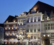
De Draak Grand Hotel en Residence
Fletcher Hotel-Restaurant Stadspark
B&B Op de Brabantse Wal
Hotel Old Dutch Bergen op Zoom
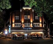
Tulip Inn
Hotel van Ee
De Volksabdij
Videos from this area
These are videos related to the place based on their proximity to this place.
JJRC H8C Winter Bergen op Zoom
Even spelen op het koeienveld langs de Markiezaatsweg. Jammer van het jello effect in het beeld...
Opendag Brandweer Bergen op Zoom (24-05-2014)
Zaterdag 24 mei 2014 heeft de brandweer van Bergen op Zoom iedereen de gelegenheid gegeven om de kazerne van binnen en buiten te bekijken. Dit hebben ze gedaan dmv een opendag.
Bedkast Poppi 90 Wit Bergen op Zoom
In deze kleine kamer hebben we een horizontale bedkast gemonteerd. Door hier een bedkast te gebruiken kan deze ruimte zo optimaal mogelijk benut worden! We hebben voor deze ruime het model...
Karate Bergen op Zoom Hikari
Karateschool Hikari, Bergen op Zoom en Hoogerheide is een vereniging waar meiden en jongens heel goed leren vechten om zich te leren verdedigen. Bevoegd en Erkende leraren met specialisaties.
Woenderbaar BOZtoberfest Bergen op Zoom 2012 - 02
Proosten met de gezellige menigte in Bergen op Zoom op het BOZtoberfest 2012 (6-10-2012). Meer informatie: www.woenderbaar.nl.
Videos provided by Youtube are under the copyright of their owners.
Attractions and noteworthy things
Distances are based on the centre of the city/town and sightseeing location. This list contains brief abstracts about monuments, holiday activities, national parcs, museums, organisations and more from the area as well as interesting facts about the region itself. Where available, you'll find the corresponding homepage. Otherwise the related wikipedia article.
Bergen op Zoom
Bergen op Zoom [ˈbɛrɣən ɔp soːm] is a municipality and a city located in the south of the Netherlands.
Steenbergen
Steenbergen is a municipality and a city in the province of North Brabant in the south of the Netherlands. The municipality has 23,202 inhabitants and covers an area of 160 km ² (of which 10 km ² water). The municipality is mainly agricultural including a strongly growing greenhouse sector, but the capital of Steenbergen and town of Dinteloord also contain some light industry.
Scheldt–Rhine Canal
The Scheldt-Rhine Canal (Schelde-Rijn Kanaal) in Belgium and the Netherlands connects Antwerp with the Volkerak, and thereby the Scheldt with the Rhine. The Scheldt-Rhine canal includes the Eendracht. It crosses the east of Zuid-Beveland, where it is crossed by a railroad bridge (between the stations Rilland-Bath on the west and Bergen op Zoom on the east) and three road bridges, and along Tholen, where it is spanned by three road bridges.
Lepelstraat
Lepelstraat [ˈleːpəɫstraːt ˈleːpəɫstraːt] is a small Dutch community six kilometres north of the city of Bergen op Zoom, and part of the municipality with that name. It has 2,342 inhabitants and 30 percent of the municipality consists of farmland. Its earliest records of history date back to 1298 where in a manuscript of landrights it was mentioned as "Den Leepel Straet. " Lepelstraat has always been important in its region's religious history.
Rilland-Bath
Rilland-Bath is a former municipality in the Dutch province of Zeeland. It was created from a merger of Rilland and Bath in 1878, and existed until it merged into the municipality Reimerswaal.
Eendracht
The Eendracht is a former tidal branch of river Scheldt that has been channelised to form the northern stretch of the Scheldt-Rhine Canal. It flows from the Markiezaatsmeer lake (formerly part of the Oosterschelde) near Bergen op Zoom past the town and eponymous island of Tholen towards the former island of Sint-Philipsland, where it used to end in the Krabbenkreek estuary.
Berendrecht
Berendrecht is a village in Antwerp province in Belgium. Its name means "dike of the bear", according to the area's dialect, or "dike of a man called Bear", or "passage by the marsh". But drecht or tricht means "ferry" or "crossing", and ber or bere in Indo-European means "dam", "defence against water": the resulting meaning is "river crossing at a dam". The Berendrecht Lock is the worlds largest lock, giving entrance to the Port of Antwerp.
Verdronken Land van Reimerswaal
The Verdronken Land van Reimerswaal is an area of flood-covered land in Zeeland in the Netherlands between Noord Beveland and Bergen op Zoom. Some of it was lost in the St. Felix's Flood in 1530, and some of it in 1532. The Oosterschelde formerly flowed along its east and north edges. It is sometimes divided into the "Verdronken Land van Zuid-Beveland" and the "Verdronken Land van de Markiezaat [= marquisate] van Bergen op Zoom". Verdronken is Dutch for "drowned".
Berendrecht-Zandvliet-Lillo
Berendrecht, Zandvliet and Lillo are three towns along the seaport docks north of the old city of Antwerp in Flanders, Belgium. The substantial 1983 merger with former municipalities, led in 2000 to the decentralisation of this enlarged municipality of Antwerp while these three towns merged into one of the city's districts, called Berendrecht-Zandvliet-Lillo or Bezali.
Putte, Netherlands
Putte is part of the Dutch municipality of Woensdrecht, and had 3751 inhabitants as of 1 January 2008. The village lies on and extends over the border between the Netherlands and Belgium, the Belgian part being Putte (Kapellen). The former municipality (which merged with several other communities to form the municipality of Woensdrecht in 1997) covered 18,56 sq. kilometres, of which much is forest and moorland.
Siege of Bergen-op-Zoom (1622)
The Siege of Bergen-op-Zoom (1622) was a battle during the Eighty Years' War. On 18 July 1622, the Spanish general Ambrosio Spinola laid siege to the Dutch city of Bergen op Zoom. The population was divided between Protestants and Catholics, who favored a Spanish conquest. Spinola tried a feigned manoeuver by sending a part of his army under Hendrik van den Bergh to Cleves, and an other part under Luis de Velasco to Steenbergen, which was consequently conquered by Velasco.
Bath, Zeeland
Bath is a small village and a former municipality in the Dutch province of Zeeland. It is now located in the municipality of Reimerswaal, about 10 km southwest of Bergen op Zoom. Bath has a population of about 80. According to the 19th century historian A.J. van der Aa, the former village of Bath was hit by floods several times in the 16th century: in 1530, 1532, 1536 and 1539. After these floods, only the church tower of the village was left, but it too had disappeared by the 19th century.
Rilland
Rilland is a village in the Dutch province of Zeeland. It is located in the municipality of Reimerswaal. Rilland was a separate municipality until 1878, when it merged with Bath to create the new municipality of Rilland-Bath. Rilland is known for its various outdoor activities surrounding the area. It is one of the few villages in Zeeland that has a shooting range, motor cross and golf terrain.
486th Air Expeditionary Wing
The 486th Air Expeditionary Wing (486 AEW) is a provisional United States Air Force unit assigned to the Air Combat Command. As a provisional unit, it may be activated or inactivated at any time. The unit was last known to be active during Operation Iraqi Freedom in 2003. During World War II, its predecessor unit, the 486th Bombardment Group (Heavy) was an Eighth Air Force heavy bombardment unit in England, stationed at RAF Sudbury.
Halsteren
Halsteren is a village in the Dutch province of North Brabant. It is located in the municipality of Bergen op Zoom, about 1 km north of that city. Halsteren has an old church from 1457 and a new church, built in 1919. A little village called Polder was located between Halsteren and Tholen in the Middle Ages. Halsteren was a separate municipality until 1997, when it became a part of Bergen op Zoom.
Huijbergen
Huijbergen is a village in the Dutch province of North Brabant. It is located in the municipality of Woensdrecht, about 9 kilometres southeast of Bergen op Zoom, close to the Belgian border.
Nieuw-Vossemeer
Nieuw-Vossemeer is a village in the Dutch province of North Brabant. It is located in the municipality of Steenbergen, about 10 km northeast of Bergen op Zoom. Nieuw-Vossemeer was a separate municipality until 1997, when it became part of Steenbergen.
Ossendrecht
Ossendrecht is a village in the Dutch province of North Brabant. It is located in the municipality of Woensdrecht, about 12 km southeast of Bergen op Zoom. Ossendrecht was a separate municipality until 1997, when it became part of Woensdrecht.
't Haantje, North Brabant
't Haantje is a hamlet in the Dutch province of North Holland. It is located in the municipality of Steenbergen, about 2 km west of Kruisland.
Heerle
Heerle is a village in the municipality of Roosendaal, in the Dutch province of North Brabant.
Gertrudiskerk
The Gertrudiskerk is a church approachable from the large market in the center of Bergen op Zoom. The towers of the church are called "pepper plant towers". An old legend says St. Gertrude, abbess of the abbey in Najvel, founded the church in 654. The older part of the church consisting of the towers, dates to around 1370. These were later incorporated in probably the fourteenth and fifteenth century when changes were made to the church.
Zandvliet
Zandvliet is a Belgian town forming part of the Antwerp district of Berendrecht-Zandvliet-Lillo. The place dates back to 1135 when it was known as Santflit, meaning "a navigable passage through sand". In 1622 the Spaniard Ambrogio Spinola constructed a fortification with seven bastions around Zandvliet, to strengthen the defenses of Antwerp against the northern Netherlands. The project lasted six years and gave the town the appearance of a citadel.
Hoogerheide
Hoogerheide is a village in the municipality of Woensdrecht, North Brabant, Netherlands. The name "Hoogerheide" means "High Heath" in English. The Grand Prix Adri van der Poel cyclo-cross race is held annually in Hoogerheide.
Fort de Roovere
Fort De Roovere is an entrenchment near Halsteren (by the Schansbaan/Ligneweg) that was part of the West Brabant Dutch Water Line. It is an earthen fort that goes through a wall (the Ligneweg) and is connected to Fort Pinssen. The fort is open from the ‘back’, and the ‘front’ consists of two bastions. The fort has a dry moat and the banks are overgrown with trees. In 1747, during the Austrian War of Succession (1740–1748) the fort was under siege by the French.
Berendrecht Lock
The Berendrecht Lock is currently the world's largest lock, giving access to the rightbank docks of the Port of Antwerp in Belgium.


