Safety Score: 3,3 of 5.0 based on data from 9 authorites. Meaning please reconsider your need to travel to Netherlands.
Travel warnings are updated daily. Source: Travel Warning Netherlands. Last Update: 2024-05-18 08:26:29
Discover Krawinkel
The district Krawinkel of Geleen in Gemeente Sittard-Geleen (Limburg) is a district in Netherlands about 105 mi south-east of Amsterdam, the country's capital city.
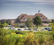
Looking for a place to stay? we compiled a list of available hotels close to the map centre further down the page.
When in this area, you might want to pay a visit to some of the following locations: Selfkant, Maastricht, Gangelt, Waldfeucht and Heinsberg. To further explore this place, just scroll down and browse the available info.
Local weather forecast
Todays Local Weather Conditions & Forecast: 19°C / 67 °F
| Morning Temperature | 12°C / 53 °F |
| Evening Temperature | 18°C / 64 °F |
| Night Temperature | 14°C / 57 °F |
| Chance of rainfall | 8% |
| Air Humidity | 62% |
| Air Pressure | 1010 hPa |
| Wind Speed | Gentle Breeze with 7 km/h (4 mph) from East |
| Cloud Conditions | Overcast clouds, covering 99% of sky |
| General Conditions | Moderate rain |
Monday, 20th of May 2024
19°C (65 °F)
14°C (56 °F)
Light rain, light breeze, overcast clouds.
Tuesday, 21st of May 2024
21°C (70 °F)
16°C (60 °F)
Moderate rain, gentle breeze, overcast clouds.
Wednesday, 22nd of May 2024
13°C (56 °F)
13°C (55 °F)
Light rain, moderate breeze, overcast clouds.
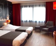
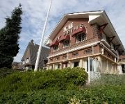
Hotels and Places to Stay
City Resort Hotel Sittard
Van der Valk Stein-Urmond
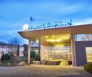
Amrâth Hotel & Thermen Born-Sittard
Bastion Geleen
Hotel De Prins
Oranje
De Limbourg
Hotel Restaurant Hof Van Hulsberg
Mulberry Cottage
Hotel de Maretak & Wellness la Myrrhe
Videos from this area
These are videos related to the place based on their proximity to this place.
Fiat 850 Spider Meeting 1994 Torino (Italy) Part 1/5
Visit to the Bertone factories, 30 years of Fiat 850 Spider. Visit to Mr. Nuccio Bertone. Travel of 12 Spiders from The Netherlands to Italy. Photo's and video. Part 1.
The Rolling Beats, Art de Bo & DJ Eric Khoe -- instrumental --
31 october 2009 "Vrienden van Ouw" (friends of Ouw) presenter DJ Eric Khoe (the Soulman) Presents at the Goodwill "Beatgala" event The Rolling Beats location "Hanenhof " Geleen in the...
Rockband The Breez -- Bad Case Of Loving You --
31 october 2009 "Vrienden van Ouw" (friends of Ouw) presenter DJ Eric Khoe (the Soulman) Presents at the Goodwill "Beatgala" event Rockband "The Breez" Special arranged in behalf of...
Ben Erkens, Harry Schmeits & Bert Kroezen, Art de Bo & The Rolling Beats --Laeve Mit Sjtress --
31 october 2009 "Vrienden van Ouw" (friends of Ouw) presenter DJ Eric Khoe (the Soulman) Presents at the Goodwill "Beatgala" event Ben Erkens, Harry Schmeits & Bert Kroezen, Art de Bo...
kirmis thing
Building.. something.. for the gelaender kirmis. My main channel: http://www.youtube.com/Benimation Facebook: http://www.facebook.com/Benimation Twitter: http://Twitter.com/Benimation.
Snow Jet Onride (Kermis Geleen) 2013
Snow Jet Onride Kermis Geleen! Skip to the fun part: 2:30 Filmed with my Samsung Galaxy S Plus ----------------------------------------------------------------- Facebook: http://www.facebook.com...
Videos provided by Youtube are under the copyright of their owners.
Attractions and noteworthy things
Distances are based on the centre of the city/town and sightseeing location. This list contains brief abstracts about monuments, holiday activities, national parcs, museums, organisations and more from the area as well as interesting facts about the region itself. Where available, you'll find the corresponding homepage. Otherwise the related wikipedia article.
Schinnen
Schinnen is a municipality and a town in the province of Limburg, the Netherlands. It is home to US Army Garrison Schinnen, a support base for US personnel assigned to nearby Allied Joint Force Command Brunssum. It is also the location of Alfa Brewery, the only brewery in the Netherlands that uses an officially certified underground spring.
Sittard
Sittard is a city in the Dutch province of Limburg, which is the southernmost province of the Netherlands. On the east Sittard borders on Germany. It has some 48,400 inhabitants (including those of neighbouring villages Munstergeleen, Limbricht, Einighausen and Guttecoven). Sittard is part of the municipality of Sittard-Geleen. The city centre is located at 45 m above sea level.
Geleen
Geleen is a city in the southern part of the province of Limburg in the Netherlands. With 33,960 inhabitants, it is part of the municipality of Sittard-Geleen. Geleen is situated along the river Geleenbeek, a right tributary to the river Meuse. The town centre is situated at about 60 m above sea level.
Elsloo, Limburg
Elsloo is a town in the Dutch province of Limburg. It is located in the municipality of Stein, about 2 km west of the town of Stein itself. Beek-Elsloo railway station serves Elsloo. Until 1982, when it was merged with Stein, Elsloo was a separate municipality.
Lutterade
Lutterade is a district of Geleen and later Sittard-Geleen (a municipality in the southeastern Netherlands, in the province of Limburg).
Maastricht Aachen Airport
Maastricht Aachen Airport is a regional airport in Beek, the Netherlands, located 5 NM northeast of Maastricht and 15 NM northwest of Aachen, Germany. It is the second-largest hub for cargo flights in the Netherlands. As of 2011, the airport had a passenger throughput of 360,000 and handled 92,500 tons of cargo. The Maastricht Upper Area Control Centre (MUAC) of the European Organisation for the Safety of Air Navigation (EUROCONTROL) is also located on the airport.
Nieuwstadt
Nieuwstadt is a city in the Dutch province of Limburg. It is a part of the municipality of Echt-Susteren, and lies about 5 km north of Sittard. In 2001, Nieuwstadt had 3088 inhabitants. The built-up area of the town was 0.74 km², and contained 1235 residences. Nieuwstadt received city rights in 1271. It was a separate municipality until 1982, when it was merged with Susteren.
Spaubeek
Spaubeek is a village in the Dutch province of Limburg. It is located in the municipality of Beek, about 3 km south of the town of Geleen. Spaubeek was a separate municipality until 1982, when it was merged with Beek.
Limbricht
Limbricht is a town in the Dutch province of Limburg. It is a part of the municipality of Sittard-Geleen, and lies about three kilometres northwest of Sittard. Limbricht was a separate municipality until 1982, when it was merged with Sittard. In 2001, Limbricht had 2787 inhabitants. The built-up area of the town was 0.62 km², and contained 1052 residences.
Berg aan de Maas
Berg, often called Berg aan de Maas, is a town in the Dutch province of Limburg. It is a part of the municipality of Stein, and lies about 6 km northwest of Geleen. In 2001, Berg had 2090 inhabitants. The built-up area of the town was 0.48 km², and contained 895 residences. Berg is situated on the right bank of the river Meuse, Maas in Dutch. The opposite, left bank of the Meuse is Belgian territory, municipality Dilsen-Stokkem. There is a ferry between Berg and Dilsen-Stokkem.
Trendwork Arena
Trendwork Arena is a multi-use stadium in Sittard, Netherlands. It is currently used mostly for football matches and is the home stadium of Fortuna Sittard. The stadium is able to hold 12,500 people and was built on the site of an industrial estate in 1999. From its inauguration until 2008, the stadium was known as Wagner & Partners Stadion. It replaced Fortuna Sittard's old stadium De Baandert.
Born, Netherlands
Born is a town of approximately 6,000 inhabitants in the Dutch municipality of Sittard-Geleen. It has a port on the Julianakanaal (Juliana canal). Born is also the site of the car factory Nedcar. It has a zoo. Until 2001, Born was a separate municipality (population about 15,000), that included the villages Born, Buchten, Holtum, Grevenbicht, Papenhoven and Obbicht.
Juliana Canal
The Juliana Canal, named after Queen Juliana of the Netherlands, is a 36 km long canal in the southern Netherlands, providing a bypass of an unnavigable section of the river Meuse between Maastricht and Maasbracht. It is an important transport connection between the ports of the Rhine delta and the industrial areas of southern Limburg and southern Belgium. The Juliana Canal was constructed in the 1920s and 1930s, and opened in 1935.
De Baandert
De Baandert was a multi-use stadium in Sittard-Geleen, Netherlands. It was used mostly for football matches and hosted the home matches of Fortuna Sittard. The stadium was able to hold 22,000 people. It was closed in 1999 when Wagner & Partners Stadion opened. The stadium hosted one international match of the Dutch national football team: a friendly played on May 27, 1992 against Austria (3-2).
Munstergeleen
Munstergeleen is a village in the Dutch province of Limburg. It is located in the municipality of Sittard-Geleen, and it lies in the Western Mine Region (Westelijke Mijnstreek in Dutch).
Obbicht en Papenhoven
Obbicht en Papenhoven is a former municipality in the Dutch province of Limburg. It consisted of the villages Obbicht and Papenhoven, located on the River Meuse about 8 km northwest of Sittard. Obbicht en Papenhoven merged with the municipality of Born in 1982.
Schimmert
Schimmert is a village in the Dutch province of Limburg. It is located in the municipality of Nuth. Schimmert was a separate municipality until 1982, when it was merged with Nuth. Schimmert is after Ubachsberg the highest church village from the Netherlands. Schimmert is known for its water tower (1926) And for the Church in the center of the village.
Urmond
Urmond is a village in the Dutch province of Limburg. It is located in the municipality of Stein. Urmond was a separate municipality until 1982, when it was merged with Stein.
Jansgeleen Castle
Jansgeleen Castle, now erroneously called Sint-Jansgeleen or Sint Jansgeleen, was a medieval castle in the little village of Spaubeek, in the Dutch province of Limburg. Spaubeek is located in the municipality of Beek, about 3 km south of the town of Geleen. Spaubeek was a separate municipality until 1982, when it was merged with Beek. The history of Spaubeek was closely connected to that of Jansgeleen Castle.
Tervoorst
Tervoorst, known as Tervoeësj in Limburgish, is a hamlet in the municipality of Nuth in the province of Limburg, the Netherlands. The hamlet contains approximately sixty houses, located in a linear pattern along the Voorsterstraat and the Horenweg, which run from the village of Nuth until the hamlet Brand. The Platsbeek river flows to the north of the settlement. In the south there is a hill supporting the nearby Hunnecum hamlet's windmill as well as houses situated on its slopes.
Terstraten
Terstraten, known as Tersjtraote in Limburgish, is a hamlet in the municipality of Nuth in the province of Limburg, the Netherlands. It is one of the so called Bovengehuchten, or Upper Hamlets, of Nuth. All the houses are situated along the street Terstraten, which runs from the neighboring hamlet Brand via a hollow way towards the Maastrichterweg. In between the houses is a little square with a Christian cross underneath a tree. The houses in Terstraten are officially preserved heritage.
Brand, Nuth
Brand is a hamlet in the municipality of Nuth in the province of Limburg, the Netherlands. It is one of the so called Bovengehuchten, or Upper Hamlets, of Nuth. Brand is located south of the stream Platsbeek. The hamlet consists of five houses along the Branterweg. This road connects the hamlets Tervoorst and Helle. Some houses, including a farm named Op genne Brant, are constructed with timber framing. Brand is often mistakenly regarded as part of the nearby hamlet Terstraten.
Helle, Nuth
Helle, known as G'n Hèl in Limburgish, is a hamlet in the municipality of Nuth in the province of Limburg, the Netherlands. It is one of the so called Bovengehuchten, or Upper Hamlets, of Nuth. It is located between the village of Schimmert and the hamlet Terstraten. The name Helle probably originates from helde, or hill. This could be a reference to the many hills and hollow ways near the hamlet.
Grijzegrubben
Grijzegrubben, known as Griëzegröbbe in Limburgish, is a hamlet in the municipality of Nuth in the province of Limburg, the Netherlands. The name Grijzegrubben contains the toponym Grubbe, which in Limburg often refers to a hollow way. The name was already in use in the year 1637, when Aleidis of Grijzegrubben leased some land to the nobleman Bartholomeus van Reymersbeeck.
La Diligence (restaurant)
Restaurant La Diligence is a former restaurant located in Beek, in the Netherlands. It was a fine dining restaurant that was awarded one Michelin star in the periods 1974-1975 and 1979-1985. In 1985, Bèr Smeets was head chef. The restaurant was located in a villa on the Maastrichterlaan, which was demolished in 1992.


