Safety Score: 3,6 of 5.0 based on data from 9 authorites. Meaning please reconsider your need to travel to Mexico.
Travel warnings are updated daily. Source: Travel Warning Mexico. Last Update: 2024-04-30 08:30:35
Delve into Tlaxpana
The district Tlaxpana of in Ciudad de México is a subburb in Mexico a little west of Mexico City, the country's capital town.
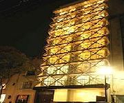
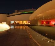
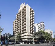
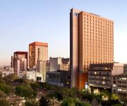
If you need a hotel, we compiled a list of available hotels close to the map centre further down the page.
While being here, you might want to pay a visit to some of the following locations: Mexico City, Nezahualcoyotl, Huixquilucan de Degollado, Los Reyes Acaquilpan and Santa Ana Jilotzingo. To further explore this place, just scroll down and browse the available info.
Local weather forecast
Todays Local Weather Conditions & Forecast: 26°C / 80 °F
| Morning Temperature | 19°C / 66 °F |
| Evening Temperature | 26°C / 80 °F |
| Night Temperature | 24°C / 75 °F |
| Chance of rainfall | 0% |
| Air Humidity | 22% |
| Air Pressure | 1012 hPa |
| Wind Speed | Gentle Breeze with 6 km/h (4 mph) from South-West |
| Cloud Conditions | Scattered clouds, covering 26% of sky |
| General Conditions | Scattered clouds |
Wednesday, 1st of May 2024
27°C (80 °F)
23°C (73 °F)
Overcast clouds, gentle breeze.
Thursday, 2nd of May 2024
28°C (83 °F)
25°C (76 °F)
Light rain, gentle breeze, few clouds.
Friday, 3rd of May 2024
28°C (82 °F)
25°C (78 °F)
Sky is clear, moderate breeze, clear sky.
Hotels and Places to Stay
Eurostars Suites Reforma
Camino Real Polanco México
San Marino Suites
Holiday Inn MEXICO BUENAVISTA
City Express EBC Reforma
Hilton Mexico City Reforma
City Express Plus Ref El Angel
DEL PRADO HOTEL
Carlota
Mexico City Marriott Reforma Hotel
Videos from this area
These are videos related to the place based on their proximity to this place.
Ministración en Peña de Horeb, México 14-Abril-2011 - 2 / 2
El Dr. Martin Scott ministrando al final del culto, en la Iglesia de Cristo PEÑA DE HOREB. Vísitanos en Marina Nacional #200 Colonia Anahuac, Delegación Miguel Hidalgo, México D.F. -- Recorded...
Dr. Victor E. Pera Gálvez - Tratamiento de Arrugas Faciales sin Cirugía
Tratamiento de arrugas faciales sin cirugía. Permite rejuvenecer y embellecer el rostro, darle una apariencia más juvenil, descansada y saludable. Disimular o eliminar las líneas de expresión...
Dr. Victor E. Pera Gálvez - Mamoplastía de Aumento - Cambio de Implantes Mamarios
La Mamoplastía de aumento o aumento de busto se utiliza para mejorar el atractivo y contorno corporal cuando los senos son pequeños, para recuperar la pérdida de volumen de los senos después...
La Taberna de MIguel una delicia a descubrir
Con el sabor REAL de España, la Taberna de Miguel te sorprenderá por su cocina, su vino y su ambiente.. es como estar en Asturias ! Visitala en Mazaryk 17 - B muy cerca de Mariano Escobedo....
Mexico City Gay Parade 2012. Stripper @ Lollipop Club
Stripper @ Lollipop Club, Zona Rosa He's very hot!
Reopening of Museo Tamayo, Mexico City
The Museo Tamayo in Mexico City reopened on August 26, 2012 after a major renovation and expansion of the museum. The expansion project was designed by Teodoro Gonzalez de Leon, one of the.
Hotel Geneve, Mexico City
Elegancia, vanguardia y buen servicio son atributos que el Hotel Geneve ha conservado en sus más de 100 años. Su arquitectura y decoración evocan el estilo clásico europeo, los visitantes...
Travel Bed and play mat
Practical travel bed and play mat by bbconsentido.com For more info of our products, visit: www.bbconsentido.com or email us: ventas@bbconsentido.com.
Videos provided by Youtube are under the copyright of their owners.
Attractions and noteworthy things
Distances are based on the centre of the city/town and sightseeing location. This list contains brief abstracts about monuments, holiday activities, national parcs, museums, organisations and more from the area as well as interesting facts about the region itself. Where available, you'll find the corresponding homepage. Otherwise the related wikipedia article.
Metro Buenavista
Metro Buenavista is a station on the Mexico City Metro, in the Colonia Buenavista neighborhood of the Cuauhtémoc borough. It is the southwestern terminal station of Line B (the green-on-silver line, Buenavista-Ciudad Azteca). It also offers connections to the Insurgentes Metrobús bus rapid transit line. The station logo represents the front of an ALCO type diesel locomotive.
Metro Popotla
Metro Popotla is a station on Line 2 of the Mexico City Metro system. It is located in the Colonia Popotla district of the Miguel Hidalgo borough of Mexico City, northwest of the city centre, near the Calzada México-Tacuba. The name of the station comes from a town that once existed in the zone.
Metro Colegio Militar
Metro Colegio Militar is a station on Line 2 of the Mexico City Metro system. It is located in the Miguel Hidalgo borough of Mexico City, northwest of the city centre, on Calzada México-Tacuba. The station logo shows the stylised coat of arms of the Heroic Military College. This is in reference to the military academy that existed in the nearby Popotla neighbourhood from 1920 until 1976, when it was moved to its current location in the south of Mexico City.
Metro Normal
Metro Normal is a station on Line 2 of the Mexico City Metro system. It is located in the Miguel Hidalgo borough of Mexico City, northwest of the city centre, near the Calzada México-Tacuba. The station logo depicts the tower of the nearby main building of the Escuela Normal de Maestros, an academy for elementary school teachers, inaugurated in 1947 by Jaime Torres Bodet, then Secretary of Education of Mexico. The station opened on 14 September 1970.
Metro San Cosme
San Cosme is a station on Line 2 of the Mexico City Metro system. It is located in the Cuauhtémoc borough of Mexico City, northwest of the city centre, on Avenue Ribera de San Cosme a few blocks before it becomes Calzada México-Tacuba. The southern exit leads to Colonia San Rafael while the Northern one leads to Colonia Santa María la Ribera. It is two blocks from the Mercado de San Cosme. The station logo depicts a balcony from the nearby colonial building known as La Casa de los Mascarones.
Metro Revolución
Metro Revolución is a station on Line 2 of the Mexico City Metro system. It is located in the Colonia Tabacalera and Colonia Buenavista districts in the Cuauhtémoc borough of Mexico City, northwest of the city centre, on Avenida Puente de Alvarado. It was first opened to the public on 14 September 1970. The station logo and name come from the nearby Monumento a la Revolución, which opened in 1938.
Torre Ejecutiva Pemex
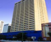
The Pemex Executive Tower (Spanish: Torre Ejecutiva Pemex) is a skyscraper in Mexico City. The 214 meter (211 meters to top floor) international style tower was built between 1979 and 1983. Since the building's opening, it has been occupied by state-owned Pemex, one of the largest petroleum companies in the world.
Zona Rosa
This article is about Mexico City, for other uses read Zona Rosa (disambiguation) Zona Rosa is a neighborhood in Mexico City which is known for its shopping, nightlife, gay community, and its recently established Korean community. The neighborhood is officially part of the Colonia Juárez colonia or official neighborhood, located just west of the historic center of Mexico City.
Torre Bicentenario
The Torre Bicentenario (Bicentennial Tower) was a skyscraper project planned for construction in Mexico City. If built, at 300 meters (984 ft) tall, it would surpass the Torre Mayor as the holder of the title of Tallest Building in Mexico and same height as the highest building in Latin America. However, such title is uncertain, as Costanera Center's main tower in Santiago, Chile, is reaching the same height and is already in advanced construction.
Colonia Santa María la Ribera
Colonia Santa María la Ribera is a colonia located in the Cuauhtémoc borough of Mexico City, just west of the historic center. It was created in the late 19th century for the affluent who wanted homes outside of the city limits. The colonia reached its height between 1910 and 1930. In the 1930s, the middle class moved in and a new era of construction began. The colonia began to deteriorate in the 1950s, as the city grew around it and apartment buildings were constructed.
Academia de Artes
The Academia de Artes (AA) is the Mexican Academy of Arts founded 1967/1968 by CONACULTA for the promotion of Mexican art. Seat of the institution is the Museo Nacional de San Carlos in Mexico City. The Slogan of the Acadademy is elevación por el arte (elevation/refinement through art).
Mexico City National Cemetery
The Mexico City National Cemetery is a cemetery in Mexico City. It was established in 1851 by the United States Congress to gather the American dead of the Mexican-American War that lay in the nearby fields and to provide burial space for Americans who died in the vicinity. A small monument marks the common grave of 750 unidentified American dead of the War of 1847.
Colonia Juárez (Mexico City)
Colonia Juarez is one of the better–known neighborhoods or colonias in the Cuauhtémoc borough of Mexico City. Its boundaries are: the corner of Paseo de la Reforma and Eje Bucareli to the north, Avenida Chapultepec to the south, Eje 1 Poniente to the east and Circuito Interior José Vasconcelos to the west.
Chapultepec aqueduct
The Chapultepec aqueduct (in Spanish: el acueducto de Chapultepec) is an aqueduct originally built at Chapultepec by the Aztecs during the Tenochtitlan era; its original name was simply the “Great Aqueduct. ” What remains of the aqueduct today is located in Mexico City near Metro Sevilla. The project was started under the tlatoani Chimalpopoca and modified by Moctezuma I.
Monumento a la Revolución
The Monument to the Revolution (Spanish: Monumento a la Revolución) is a landmark and monument commemorating the Mexican Revolution. It is located in Republic Square (Spanish: Plaza de la República) which divides Revolution Avenue between the avenues Paseo de la Reforma and Avenida de los Insurgentes in downtown Mexico City.
Edificio Miguel E. Abed
Edificio Miguel E Abed, located on Eje Central Lázaro Cárdenas # 13 in Cuauhtemoc, the Historic Center of Mexico City, opposite the Torre Latinoamericana. It was built by Mexican-Lebanese businessman Miguel E. Abed who was also one of the founders of the Centro Libanes in Mexico City along with former president Miguel Avila Camacho. The building is equipped with three high-speed elevators (lifts) which move at 6.0 meters per second.
Colonia Cuauhtémoc, Mexico City
Colonia Cuauhtémoc is a colonia or official neighborhood located just north of Paseo de la Reforma, west of the historic center of Mexico City. The colonia was created in the late 19th century after some false starts and is named after a statue of Cuauhtémoc which features on Paseo de la Reforma. Actions taken by residents have ensured that the area remains mostly residential, with commercial development limited to the strip along Paseo de la Reforma.
Colonia San Rafael
Colonia San Rafael is a colonia of the Cuauhtémoc borough of Mexico City, just west of the historic city center. It was established in the late 19th century as one of the first formal neighborhoods outside of the city center and initially catered to the wealthy of the Porfirio Díaz era. These early residents built large mansions, many with French influence, and many still remain.
Colonia Tabacalera
Colonia Tabacalera is a colonia or neighborhood in the Cuauhtémoc borough of Mexico City, on the western border of the city's historic center. It was created in the late 19th century along with other nearby colonias such as Colonia San Rafael and Colonia Santa María la Ribera. From the early 20th century, it became a mixture of mansions and apartment buildings, with major constructions such as the now Monument to the Revolution and the El Moro skyscraper built in the first half of the century.
Corpus Christi massacre
The Corpus Christi Massacre, Corpus Christi Thursday Massacre, or El Halconazo (The hawk strike— because of the participation of a group of elite Mexican army soldiers known as Los Halcones) was a massacre of student demonstrators in Mexico City on June 10, 1971, the day of the Corpus Christi festival.
Jardín del Arte Sullivan
The Jardín del Arte Sullivan (literally Sullivan Garden of Art) is an outdoor art market which takes place every Sunday near the historic center of Mexico City in a neighborhood called Colonia San Rafael. This market began in the 1950s, when young artists who could not show their works in traditional galleries and shows decided to set up in front of their studios and in local parks to exhibit and sell their work.
Museo Nacional de San Carlos
The Museo Nacional de San Carlos (English: National Museum of San Carlos) is a Mexican national art museum devoted to European art, located in the Cuauhtémoc borough in Mexico City. The museum is housed in the Palacio del Conde de Buenavista, a neoclassical building at Puente de Alvarado No. 50, Colonia Tabacalera, Mexico City.
The Anglo Mexican Foundation
The Anglo Mexican Foundation is a not for profit educational organization located in Mexico with its main offices in Colonia San Rafael in Mexico City. Its main activities are associated with English language teaching, examination preparation, teacher training, scholarships for teachers and cultural activities. The Foundation began as the Instituto Anglo Mexicano de Cultura A.C. in 1943 with the aim of strengthening ties between Mexico and Great Britain through cultural exchange.
Embassy of Colombia, Mexico City
The Embassy of Colombia in Mexico City is the diplomatic mission of the Republic of Colombia to the United Mexican States; it is headed by the Ambassador of Colombia to Mexico. It is located in the Cuauhtémoc borough and neighbourhood of Mexico City, near El Ángel, the Chapultepec aqueduct, and the Modern Art Museum, precisely at Paseo de La Reforma 375 between the Río Guadalquivir and Río Nilo avenues, and it is serviced by the Insurgentes and Sevilla stations.
Torre Ejecutiva Pemex explosion
On 31 January 2013 in Mexico City, an explosion caused by a gas leak occurred beneath Building B-2 at the Torre Ejecutiva Pemex (Pemex Executive Tower), a skyscraper complex that is the headquarters of Pemex, the Mexican state oil company. At least 37 people died and another 126 were injured when an explosion occurred in a building adjacent to the main tower.


