Safety Score: 3,6 of 5.0 based on data from 9 authorites. Meaning please reconsider your need to travel to Mexico.
Travel warnings are updated daily. Source: Travel Warning Mexico. Last Update: 2024-05-04 08:22:41
Discover Santa Barbara
The district Santa Barbara of in Ciudad de México is a district in Mexico a little north-west of Mexico City, the country's capital city.
Looking for a place to stay? we compiled a list of available hotels close to the map centre further down the page.
When in this area, you might want to pay a visit to some of the following locations: Mexico City, Nezahualcoyotl, Santa Ana Jilotzingo, Huixquilucan de Degollado and Tlazala de Fabela. To further explore this place, just scroll down and browse the available info.
Local weather forecast
Todays Local Weather Conditions & Forecast: 28°C / 83 °F
| Morning Temperature | 21°C / 70 °F |
| Evening Temperature | 25°C / 76 °F |
| Night Temperature | 25°C / 77 °F |
| Chance of rainfall | 0% |
| Air Humidity | 13% |
| Air Pressure | 1011 hPa |
| Wind Speed | Moderate breeze with 13 km/h (8 mph) from East |
| Cloud Conditions | Clear sky, covering 7% of sky |
| General Conditions | Light rain |
Sunday, 5th of May 2024
28°C (83 °F)
22°C (71 °F)
Light rain, gentle breeze, clear sky.
Monday, 6th of May 2024
29°C (84 °F)
25°C (77 °F)
Light rain, gentle breeze, scattered clouds.
Tuesday, 7th of May 2024
29°C (84 °F)
25°C (77 °F)
Light rain, moderate breeze, scattered clouds.
Hotels and Places to Stay
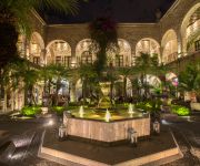
Hotel de la Soledad
Courtyard Mexico City Vallejo
City Express Buenavista
City Express Plus Satelite
Holiday Inn MEXICO BUENAVISTA
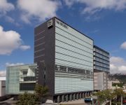
NH Mexico City Valle Dorado
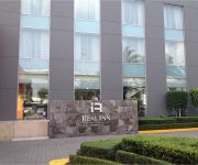
Real Inn Perinorte
DEL PRADO HOTEL
Courtyard Mexico City Toreo
RAMADA MEXICO ZONA NORTE
Videos from this area
These are videos related to the place based on their proximity to this place.
UFO Flying humanoid over Tlalnepantla, Mexico City, Dec 27th 2008
Updated (february 19th 2009), I solved the mistery, it's just a balloon like this one: http://www.youtube.com/watch?v=Kd65FnUAhgQ WATCH the complete video, slow-motion and frame stills...
LPAIC ESIME Azcapotzalco
Sistema Flexible de Manufactura, solo un poco de lo que se puede hacer en el laboratorio (LPAIC O CIM2) de ESIME Azcapotzalco.
Quiero Casa Real de San Martín (Azcapotzalco)
Proyecto de Departamentos con ubicación inmejorable, a dos calles de la Arena Ciudad de México, del metro Ferrería y suburbano Fortuna, cuenta con macro plaza, salón de usos múltiples,...
Lesni zver Simplicity UAM azcapotzalco
El grupo de Jazz Checo Lesní zvěř tocando en la UAM azcapotzalco. Eurojazz en la UAM. Texto por Julio C. Hernández. En el pequeño; casi tan pequeño como un salón de clases; auditorio...
Azcapotzalco Departamento en Venta
Inmueble: Departamento Informes : 41 51 37 66 Precio: $ 700000 http://www.inmobiliariang.esy.es Superficie: 60 m2 Nivel: 4o Piso Recamaras: 2 Habitaciones: Sala, Comedor, 2 Recamaras, Baño...
Libertango A. Piazzolla Ensamble de Guitarras de la UAM Azcapotzalco
Libertango de Astor Piazzolla. Interpretada por el Ensamble de Guitarras de la UAM Azcapotzalco. Todos alumnos de esta Universidad. Eduardo Rodríguez: Diseño Industrial Ernesto García:...
Händel Messiah Overture Ensamble de Guitarras UAM Azcapotzalco
Interpretación de la Obertura del Mesías de Händel por el Ensamble de Guitarras de la UAM Azcapotzalco. Este ensamble está conformado por estudiantes de Diseño Industrial, Derecho, Ingeniería...
Gema - Rondalla ESIME Azcapotzalco (Engranes de Amor)
una excelente canción interpretada por alumnos de Esime Azcapotzalco que cantan el genero Rondalla, espero les guste.
Videos provided by Youtube are under the copyright of their owners.
Attractions and noteworthy things
Distances are based on the centre of the city/town and sightseeing location. This list contains brief abstracts about monuments, holiday activities, national parcs, museums, organisations and more from the area as well as interesting facts about the region itself. Where available, you'll find the corresponding homepage. Otherwise the related wikipedia article.
Metro Ferrería
Metro Ferrería/Arena Ciudad de México is a station along Line 6 of the Mexico City Metro. It is located in the Azcapotzalco borough, in the north of Mexico City. The logo depicts a perspective view of the Arena Ciudad de México building, located near the station. It was changed in november 29 2012. The previous station logo depicted the head of a cow. This was a reference to a cattle ranch that existed nearby, known as Ferrería; there was also a train station that serviced this ranch.
Metro Camarones
Camarones is a station along Line 7 of the Mexico City Metro. It is located in Colonia Barrio Santa Cruz Acayucan district in the Azcapotzalco borough, north of Mexico City, Mexico. The station was opened with the others along the northern portion of Line 7 on 29 November 1988. Its name and logo come from a town that once existed nearby, the town of Camarones.
Metro Panteones
Panteones is a station serving Line 2 of the Mexico City Metro. It is located in the Colonia Argentina district of the Miguel Hidalgo borough of the Mexican Federal District. Panteón means "cemetery" in Spanish; the station's name and logo come from the nearby graveyards. The station was opened as part of a westward extension of Line 2 on 22 August 1984. \t\t \t\t\tMetro Panteones. jpg \t\t\t Metro Station Panteones, 9 April 2009 \t\t\t \t\t \t\t \t\t\tMetro Panteones Entrance.
Metro Autobuses del Norte
Autobuses del Norte is a station on Line 5 of the Mexico City Metro. It is located in the north of Mexico City, in Gustavo A. Madero borough. The station's logo is a front view of an intercity bus, and the station's name means "northern buses". The name and the logo come from the fact that the Northern intercity bus station is located in front of this metro station. The metro station has an information desk and office with pamphlets about the metro.
Metro El Rosario
Metro El Rosario (Spanish: Estación El Rosario) is a surface station on the Mexico City Metro. It is located in Azcapotzalco borough, in the northern reaches of Mexico City. It serves as the terminal for both Lines 6 and 7. The station logo depicts a set of rosary beads. The platforms for lines 6 and 7 are at the same level, separated only by a bridge. This terminal, like many others, is multimodal, connecting to other kinds of transport.
Metro Tacuba
Metro Tacuba is a station of the Mexico City Metro. It is located in the Tacuba district of the Miguel Hidalgo borough, to the west of downtown Mexico City. It lies along Lines 2 and 7. The station logo depicts three flowers, as its name comes from the Nahuatl language word tlacopan, that which means "land of flowers". It refers to the ancient Tepanec kingdom of Tlacopan that existed in the area in pre-Columbian times.
Metro Cuitláhuac
Metro Cuitláhuac is a station on the Mexico City Metro. It is located in the Colonia Popotla and Colonia San Álvaro districts in the Miguel Hidalgo borough of Mexico City, to the northwest of the city centre. It lies along Line 2. The station logo depicts an Aztec battle shield. However, the name comes from nearby Avenida Cuitláhuac, an avenue named in honour of Cultlahuanctzin (whose name was later changed into Spanish language as "Cuitláhuac").
Metro Politécnico
Metro Politécnico is a station on the Mexico City Metro. It is located in the north of Mexico City, in the Gustavo A. Madero borough. It is the northern terminus for Line 5. The station's logo is the emblem of the Instituto Politécnico Nacional, a university in Mexico City. It is represented by a half cogwheel, the stylised form of a building and the acronym IPN. This station is located under 100 Metros Avenue.
Metro Instituto del Petróleo
Metro Instituto del Petróleo is a station along Line 5 and Line 6 of the metro of Mexico City serving the Colonia Valle del Tepeyac, Colonia San Bartolo Atepehuapan, and Colonia Nueva Industrial districts of the Gustavo A. Madero delegation of Mexico City. The connection between platforms of Line 5 and Line 6 is made via a long passage decorated with sculptures made of oil barrels. The station logo represents an oil derrick. The station was named after the nearby Mexican Institute of Petroleum.
Estadio Wilfrido Massieu
Estadio Wilfrido Massieu is a outdoor stadium on the campus Zacatenco of the National Polytechnic Institute (IPN), located north of Mexico City. It was opened in 1959 and has a capacity of 15,000 spectators. The venue is named for Wilfrido Massieu Pérez, a former Director-general of the IPN.
Metro Vallejo
Metro Vallejo is a station along Line 6 of the Mexico City Metro. It is located in the Colonia Vallejo neighborhood of the Azcapotzalco borough of northwestern Mexico City. Its logo represents a silhouette of a factory. The station opened on 21 December 1983.
Metro Norte 45
Norte 45 (Spanish: Estación Norte 45) is a station on Line 6 of the Mexico City Metro. It is located in the Colonia Pueblo Salinas neighborhood. The logo for this station is a compass rose and the station takes its name from a nearby street that runs from northeast to southwest (somewhat unusual for streets in Mexico City that typically run either north-south or east-west). The station opened on 21 December 1983.
Metro Azcapotzalco
Metro Azcapotzalco is a metro station in northern Mexico City. It travels through Line 6. Its Logo is that of an ant (Azcapotzalco means "Ant's place")
Metro Tezozómoc
Metro Tezozómoc is a metro station on Mexico's Line 6. Its logo is a profile of King Tezozómoc, who ruled the Aztec for 80 years. The station can be accessed through Ahuehuetes and Avenida Sauces Colonia Pasteros, in the Azcapotzalco borough. It has no underground direct connections, which means that, in order to exchange platforms, one has to exit the station and cross the street, thus making it necessary to pay the fare again, a feature only shared with Metro Allende in Line 2.
Metro Aquiles Serdán
Metro Aquiles Serdán (Spanish: Estación Aquiles Serdán) is a station along Line 7 of the Mexico City Metro. It is located in the Colonia La Preciosa neighborhood of the Azcapotzalco borough of northwestern Mexico City. Its logo represents the bust of Aquiles Serdán, a martyr in the Mexican Revolution. The station opened on 29 November 1988.
ESCOM
The Superior School of Computer Sciences is a superior school of the National Polytechnic Institute located in Mexico City, Mexico. Its students pursue the bachelor's degree in computer engineering with one major: computer systems. The curriculum is designed to last for four years. The school has a faculty mostly with postgraduate studies, and there is a growing number of teachers with doctoral studies.
Mexican Institute of Petroleum
The Mexican Institute of Petroleum is a public research organization dedicated to develop technical solutions, conduct basic and applied research and provide specialized training to Pemex, the state-owned government-granted monopoly in Mexico's petroleum industry. The Institute was founded on 23 August 1965 by federal decree and is based in Mexico City.
Tenayuca
Tenayuca is a pre-Columbian Mesoamerican archaeological site in the Valley of Mexico. In the Postclassic period of Mesoamerican chronology Tenayuca was a settlement on the former shoreline of the western arm of Lake Texcoco, located approximately 10km to the northwest of Tenochtitlan (the heart of present-day Mexico City). Tenayuca is considered the earliest capital city of the Chichimecs, nomadic tribes that migrated and settled in the Valley of Mexico, forming their own kingdoms.
Mexico City Arena
Mexico City Arena (Spanish: Arena Ciudad de México), is an indoor arena in Azcapotzalco, Mexico City, Mexico. It is used to host events such as concerts, sports events, and more. It was officially opened on February 25, 2012 The total cost of the arena was $300 million. The arena has a maximum capacity of 22,300 spectators. It is operated by Zignia Live.
Planetario Luis Enrique Erro
Planetario Luis Enrique Erro is a planetarium located in Mexico City, owned and operated by the National Polytechnic Institute. It was the first planetarium in Mexico open to the public and is one of the oldest in Latin America. It was opened in 1967 and operated for over 39 years with a planetarium projector model Mark 4. It was reopened to the public on 15 January 2007 after renovation and modernization costing about 43 million pesos.
Parque Tezozómoc
Parque Tezozómoc is a large park in Mexico City. It is located in the Azcapotzalco borough, in the northwestern section of Mexico City (México, D. F. ), Mexico. It is 28 hectares in size. The park was designed by Mario Schjetnan, and opened in 1982. It is near the El Rosario residential neighborhood, and was built on the land of the former Hacienda del Rosario. It an important public open space, sports and recreational area, and a point of reference landmark for northwestern Mexico City.
National Polytechnic Institute
The Instituto Politécnico Nacional (Spanish for National Polytechnic Institute), colloquially known as el Politécnico (the Polytechnic) or el Poli (the Poli) is one of the largest public universities in Mexico with 153.027 students at the high school, undergraduate and postgraduate levels.
Benemerito De Las Americas
Benemérito de las Américas is a town and one of the 119 Municipalities of Chiapas, in southern Mexico. As of 2005, the municipality had a total population of 14,446. It covers an area of 979.2 km² and borders Guatemala.
UAM Azcapotzalco
UAM Azcapotzalco is one of the five campuses of Universidad Autónoma Metropolitana system, one of the top three Mexican public universities. This campus is located in the northern area of Mexico City, in the borough of Azcapotzalco. It is one of the three campuses built short after Mexican President Luis Echeverría decreed the foundation of UAM in 1974.
El Bajío (restaurant)
El Bajío is a group of ten restaurants in Mexico City which are run by Carmen Ramírez Degollado, noted for their colorful decoration and traditional cuisine from central Mexico which has received awards and praise from notable food experts. The restaurant business began in 1972 when Carmen’s husband Raúl Ramírez Degollado bought a restaurant selling carnitas in the northwestern borough of Azcapotzalco.


