Safety Score: 3,6 of 5.0 based on data from 9 authorites. Meaning please reconsider your need to travel to Mexico.
Travel warnings are updated daily. Source: Travel Warning Mexico. Last Update: 2024-05-04 08:22:41
Delve into San Francisco Tetecala
The district San Francisco Tetecala of in Ciudad de México is a district located in Mexico a little north-west of Mexico City, the country's capital town.
In need of a room? We compiled a list of available hotels close to the map centre further down the page.
Since you are here already, you might want to pay a visit to some of the following locations: Mexico City, Huixquilucan de Degollado, Santa Ana Jilotzingo, Nezahualcoyotl and Tlazala de Fabela. To further explore this place, just scroll down and browse the available info.
Local weather forecast
Todays Local Weather Conditions & Forecast: 26°C / 79 °F
| Morning Temperature | 19°C / 66 °F |
| Evening Temperature | 23°C / 74 °F |
| Night Temperature | 23°C / 74 °F |
| Chance of rainfall | 0% |
| Air Humidity | 23% |
| Air Pressure | 1014 hPa |
| Wind Speed | Moderate breeze with 10 km/h (6 mph) from North-East |
| Cloud Conditions | Clear sky, covering 3% of sky |
| General Conditions | Light rain |
Sunday, 5th of May 2024
28°C (83 °F)
21°C (70 °F)
Light rain, moderate breeze, clear sky.
Monday, 6th of May 2024
29°C (83 °F)
24°C (75 °F)
Light rain, gentle breeze, scattered clouds.
Tuesday, 7th of May 2024
29°C (84 °F)
23°C (74 °F)
Light rain, moderate breeze, scattered clouds.
Hotels and Places to Stay
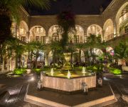
Hotel de la Soledad
Hotel & Villas Panamá
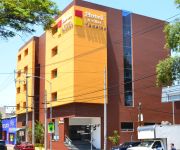
Holiday Inn MEXICO BUENAVISTA
Santa Fe
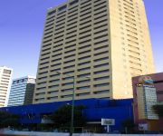
Courtyard Mexico City Vallejo
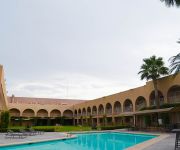
RAMADA MEXICO ZONA NORTE
Alteza Polanco
DEL PRADO HOTEL
Courtyard Mexico City Toreo
El Senador
Videos from this area
These are videos related to the place based on their proximity to this place.
LPAIC ESIME Azcapotzalco
Sistema Flexible de Manufactura, solo un poco de lo que se puede hacer en el laboratorio (LPAIC O CIM2) de ESIME Azcapotzalco.
QUIERO CASA SAN SEBASTIAN (AZCAPOTZALCO)
Departamentos en Azcapotzalco a unos min de la Arena Ciudad de México, metro Ferrería y camarones, 1 y 2 recámaras, estancia - comedor, cuarto de lavado, estacionamiento, elevador, area...
Mexicana 849 landing in Mexico City, Sept. 1, 2009
Mexicana flight 849 (DFW to Mexico City) landing at Benito Juarez Int. Airport on a partly hazy morning, September 1, 2009. Video Shot from seat 14A. The Plane is an Airbus 319.
Quiero Casa Castilla / Azcapotzalco
Departamentos de 1 y 2 recámaras, baño completo, elevador, roof garden, gimnasio, salón de usos múltiples, área de juegos, estacionamiento (opcional), estamos en Aquiles Serdán 671, a...
Mariachis df Azcapotzalco urgentes 47551610 -EL GUSTITO MARIACHI-
DF mariachis en Azcapotzalco mariachis urgentes en df Azcapotzalco mariachis de prestigio con amplio repertorio para todo evento servicio de mariachis df Azcapotzalco las 24hrs www.mariachirealdepu...
Mud Cars, Azcapotzalco
Video about one of the weirdest but funiest parades... this one is just a pre-parade roll arround the streets, october 31. Long time ago, a pair of borthers started a weird (at first) tradition...
BAILE CELEX AZCAPOTZALCO
POR ESO NO PROGRESA MEXICO, VEAN LO QUE SE HACE EN HORAS DE CLASE EN EL CELEX AZCAPOTZALCO JAJA. NO, FUE UNA DESPEDIDA DEL CURSO.
Videos provided by Youtube are under the copyright of their owners.
Attractions and noteworthy things
Distances are based on the centre of the city/town and sightseeing location. This list contains brief abstracts about monuments, holiday activities, national parcs, museums, organisations and more from the area as well as interesting facts about the region itself. Where available, you'll find the corresponding homepage. Otherwise the related wikipedia article.
Metro Cuatro Caminos
Metro Cuatro Caminos (translated from Spanish the name literally means "Four Roads") is a station of the Mexico City metro network. It is the current north terminus of Line 2 and serves as a hub for regional transport from and into the State of México. As of 14 September 1970 Line 2 originally terminated at Metro Tacuba, but on 22 August 1984 the line was extended an additional two stations to reach the municipality of Naucalpan.
Metro Ferrería
Metro Ferrería/Arena Ciudad de México is a station along Line 6 of the Mexico City Metro. It is located in the Azcapotzalco borough, in the north of Mexico City. The logo depicts a perspective view of the Arena Ciudad de México building, located near the station. It was changed in november 29 2012. The previous station logo depicted the head of a cow. This was a reference to a cattle ranch that existed nearby, known as Ferrería; there was also a train station that serviced this ranch.
Metro Camarones
Camarones is a station along Line 7 of the Mexico City Metro. It is located in Colonia Barrio Santa Cruz Acayucan district in the Azcapotzalco borough, north of Mexico City, Mexico. The station was opened with the others along the northern portion of Line 7 on 29 November 1988. Its name and logo come from a town that once existed nearby, the town of Camarones.
Metro Panteones
Panteones is a station serving Line 2 of the Mexico City Metro. It is located in the Colonia Argentina district of the Miguel Hidalgo borough of the Mexican Federal District. Panteón means "cemetery" in Spanish; the station's name and logo come from the nearby graveyards. The station was opened as part of a westward extension of Line 2 on 22 August 1984. \t\t \t\t\tMetro Panteones. jpg \t\t\t Metro Station Panteones, 9 April 2009 \t\t\t \t\t \t\t \t\t\tMetro Panteones Entrance.
Metro El Rosario
Metro El Rosario (Spanish: Estación El Rosario) is a surface station on the Mexico City Metro. It is located in Azcapotzalco borough, in the northern reaches of Mexico City. It serves as the terminal for both Lines 6 and 7. The station logo depicts a set of rosary beads. The platforms for lines 6 and 7 are at the same level, separated only by a bridge. This terminal, like many others, is multimodal, connecting to other kinds of transport.
Metro Tacuba
Metro Tacuba is a station of the Mexico City Metro. It is located in the Tacuba district of the Miguel Hidalgo borough, to the west of downtown Mexico City. It lies along Lines 2 and 7. The station logo depicts three flowers, as its name comes from the Nahuatl language word tlacopan, that which means "land of flowers". It refers to the ancient Tepanec kingdom of Tlacopan that existed in the area in pre-Columbian times.
Metro Cuitláhuac
Metro Cuitláhuac is a station on the Mexico City Metro. It is located in the Colonia Popotla and Colonia San Álvaro districts in the Miguel Hidalgo borough of Mexico City, to the northwest of the city centre. It lies along Line 2. The station logo depicts an Aztec battle shield. However, the name comes from nearby Avenida Cuitláhuac, an avenue named in honour of Cultlahuanctzin (whose name was later changed into Spanish language as "Cuitláhuac").
Metro Popotla
Metro Popotla is a station on Line 2 of the Mexico City Metro system. It is located in the Colonia Popotla district of the Miguel Hidalgo borough of Mexico City, northwest of the city centre, near the Calzada México-Tacuba. The name of the station comes from a town that once existed in the zone.
Metro Colegio Militar
Metro Colegio Militar is a station on Line 2 of the Mexico City Metro system. It is located in the Miguel Hidalgo borough of Mexico City, northwest of the city centre, on Calzada México-Tacuba. The station logo shows the stylised coat of arms of the Heroic Military College. This is in reference to the military academy that existed in the nearby Popotla neighbourhood from 1920 until 1976, when it was moved to its current location in the south of Mexico City.
Lomas Verdes
Lomas Verdes is a middle-class neighborhood located in the county of Naucalpan de Juárez, in the state of Mexico. The community was developed in the late 1960s and is near Ciudad Satélite (which was founded in 1957. ) Lomas Verdes means "Green Hills" in Spanish, as the terrain had a set of smooth hills covered with green grass and other wild vegetation.
Metro Normal
Metro Normal is a station on Line 2 of the Mexico City Metro system. It is located in the Miguel Hidalgo borough of Mexico City, northwest of the city centre, near the Calzada México-Tacuba. The station logo depicts the tower of the nearby main building of the Escuela Normal de Maestros, an academy for elementary school teachers, inaugurated in 1947 by Jaime Torres Bodet, then Secretary of Education of Mexico. The station opened on 14 September 1970.
Metro Vallejo
Metro Vallejo is a station along Line 6 of the Mexico City Metro. It is located in the Colonia Vallejo neighborhood of the Azcapotzalco borough of northwestern Mexico City. Its logo represents a silhouette of a factory. The station opened on 21 December 1983.
Metro Norte 45
Norte 45 (Spanish: Estación Norte 45) is a station on Line 6 of the Mexico City Metro. It is located in the Colonia Pueblo Salinas neighborhood. The logo for this station is a compass rose and the station takes its name from a nearby street that runs from northeast to southwest (somewhat unusual for streets in Mexico City that typically run either north-south or east-west). The station opened on 21 December 1983.
Metro Azcapotzalco
Metro Azcapotzalco is a metro station in northern Mexico City. It travels through Line 6. Its Logo is that of an ant (Azcapotzalco means "Ant's place")
Metro Tezozómoc
Metro Tezozómoc is a metro station on Mexico's Line 6. Its logo is a profile of King Tezozómoc, who ruled the Aztec for 80 years. The station can be accessed through Ahuehuetes and Avenida Sauces Colonia Pasteros, in the Azcapotzalco borough. It has no underground direct connections, which means that, in order to exchange platforms, one has to exit the station and cross the street, thus making it necessary to pay the fare again, a feature only shared with Metro Allende in Line 2.
Metro Aquiles Serdán
Metro Aquiles Serdán (Spanish: Estación Aquiles Serdán) is a station along Line 7 of the Mexico City Metro. It is located in the Colonia La Preciosa neighborhood of the Azcapotzalco borough of northwestern Mexico City. Its logo represents the bust of Aquiles Serdán, a martyr in the Mexican Revolution. The station opened on 29 November 1988.
Metro San Joaquín
Metro San Joaquín (Spanish: Estación San Joaquín) is a station along Line 7 of the metro of Mexico City. Its logo represents the silhouette of a bridge of the radial Viaducto Río San Joaquín. It was opened on 20 December 1984. It is located in the Colonia Pencil Sur neighnorhood and nearby points of interest include the Panteón Francés. \t\t \t\t\tMetroSanJoaquinEntrance. JPG \t\t\t Lago de Terminos Street entrance to Metro station San Joaquín \t\t\t \t\t \t\t \t\t\tMetroSanJoaquinPlatform.
Tacuba (Mexico City)
Tacuba is a section of northwest Mexico City. Tacuba was an autonomous municipality until 1928, when it was incorporated into the Central Department along with the municipalities of Mexico, Tacubaya and Mixcoac. The Central Department was later split up into boroughs (delegaciones); historical Tacuba is now in the borough of Miguel Hidalgo. Tacuba is home to a Child Jesus image called the “Niño Futbolista” (Child Football/Soccer player).
Mexico City Arena
Mexico City Arena (Spanish: Arena Ciudad de México), is an indoor arena in Azcapotzalco, Mexico City, Mexico. It is used to host events such as concerts, sports events, and more. It was officially opened on February 25, 2012 The total cost of the arena was $300 million. The arena has a maximum capacity of 22,300 spectators. It is operated by Zignia Live.
Colonia Atlampa
Colonia Atlampa is a colonia or neighborhood located in the Cuauhtémoc borough, northwest of the historic center of Mexico City. The boundaries of the area are marked by the following streets: Calzada de Nonoalco or Ricardo Flores Magón Street to the south, Circuito Interior Paseo de las Jacarandas to the north, Avenida Insurgentes Norte to the east and Circuito Interior Instituto Politécnico Industrial to the west. The neighborhood is considered lower class and working class.
Parque Tezozómoc
Parque Tezozómoc is a large park in Mexico City. It is located in the Azcapotzalco borough, in the northwestern section of Mexico City (México, D. F. ), Mexico. It is 28 hectares in size. The park was designed by Mario Schjetnan, and opened in 1982. It is near the El Rosario residential neighborhood, and was built on the land of the former Hacienda del Rosario. It an important public open space, sports and recreational area, and a point of reference landmark for northwestern Mexico City.
Museo Soumaya
The Museo Soumaya is a private museum in Mexico City with free admission. It is owned by the Carlos Slim Foundation and contains the extensive art, religious relics, historical documents, and coin collection of Carlos Slim and his late wife Soumaya, after whom the museum was named. The museum holds works by many of the best known European artists from the 15th to the 20th century. It contains a large collection of casts of sculptures by Auguste Rodin. The museum was founded in 1994.
Corpus Christi massacre
The Corpus Christi Massacre, Corpus Christi Thursday Massacre, or El Halconazo (The hawk strike— because of the participation of a group of elite Mexican army soldiers known as Los Halcones) was a massacre of student demonstrators in Mexico City on June 10, 1971, the day of the Corpus Christi festival.
UAM Azcapotzalco
UAM Azcapotzalco is one of the five campuses of Universidad Autónoma Metropolitana system, one of the top three Mexican public universities. This campus is located in the northern area of Mexico City, in the borough of Azcapotzalco. It is one of the three campuses built short after Mexican President Luis Echeverría decreed the foundation of UAM in 1974.
El Bajío (restaurant)
El Bajío is a group of ten restaurants in Mexico City which are run by Carmen Ramírez Degollado, noted for their colorful decoration and traditional cuisine from central Mexico which has received awards and praise from notable food experts. The restaurant business began in 1972 when Carmen’s husband Raúl Ramírez Degollado bought a restaurant selling carnitas in the northwestern borough of Azcapotzalco.


