Safety Score: 3,4 of 5.0 based on data from 9 authorites. Meaning please reconsider your need to travel to India.
Travel warnings are updated daily. Source: Travel Warning India. Last Update: 2024-04-25 08:17:04
Discover Dam Dam
Dam Dam in North 24 Parganas (West Bengal) with it's 122,719 citizens is a town in India about 811 mi (or 1,305 km) south-east of New Delhi, the country's capital city.
Current time in Dam Dam is now 08:38 AM (Friday). The local timezone is named Asia / Kolkata with an UTC offset of 5.5 hours. We know of 8 airports near Dam Dam, of which one is a larger airport. The closest airport in India is Netaji Subhash Chandra Bose International Airport in a distance of 2 mi (or 3 km), North-East. Besides the airports, there are other travel options available (check left side).
There are several Unesco world heritage sites nearby. The closest heritage site in India is Sundarbans National Park in a distance of 56 mi (or 91 km), South-East. Looking for a place to stay? we compiled a list of available hotels close to the map centre further down the page.
When in this area, you might want to pay a visit to some of the following locations: Kolkata, Khulna, Magura, Bagerhat and Rajshahi. To further explore this place, just scroll down and browse the available info.
Local weather forecast
Todays Local Weather Conditions & Forecast: 42°C / 107 °F
| Morning Temperature | 29°C / 84 °F |
| Evening Temperature | 38°C / 101 °F |
| Night Temperature | 30°C / 86 °F |
| Chance of rainfall | 0% |
| Air Humidity | 20% |
| Air Pressure | 1004 hPa |
| Wind Speed | Fresh Breeze with 16 km/h (10 mph) from North |
| Cloud Conditions | Clear sky, covering 0% of sky |
| General Conditions | Sky is clear |
Saturday, 27th of April 2024
42°C (107 °F)
30°C (86 °F)
Sky is clear, fresh breeze, clear sky.
Sunday, 28th of April 2024
43°C (109 °F)
30°C (86 °F)
Broken clouds, fresh breeze.
Monday, 29th of April 2024
45°C (113 °F)
30°C (85 °F)
Sky is clear, fresh breeze, clear sky.
Hotels and Places to Stay
Swissotel Kolkata
Simi International The Imperial
The Fern Residency Kolkata
Howard Johnson
Viceroy Kolkata (Boutique Hotel)
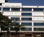
Hotel Raj Palace
Kingston Boutique Hotel
AIRPORT CITY HOTEL
Ethnotel
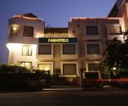
FabHotel Club Royale Airport
Videos from this area
These are videos related to the place based on their proximity to this place.
GTA IV Seculauncher: Failed to start application [2000] fix
Download link for visual credist 2005 : http://www.mediafire.com/download/6sn6e3cpazbhpyc/vcredist_x86_2005.exe.
Eye 'n' face practical. At Kolkata. India.
Eye and face muscle control & practical. At Kolkata. India.
Mithi's Durga Puja Talent Hunt Dance Performance ( প্রথম পুরষ্কার )
অসংখ্য ধন্যবাদ আমাদের রাজীবদা কে ( Rajib Chatterjee) , for capturing the performance.
Videos provided by Youtube are under the copyright of their owners.
Attractions and noteworthy things
Distances are based on the centre of the city/town and sightseeing location. This list contains brief abstracts about monuments, holiday activities, national parcs, museums, organisations and more from the area as well as interesting facts about the region itself. Where available, you'll find the corresponding homepage. Otherwise the related wikipedia article.
Dum Dum
Dum Dum is a city and a municipality in North 24 Parganas district in the state of West Bengal, India. It is a neighborhood in North-west Kolkata and the location of Netaji Subhas Chandra Bose International Airport, formerly Dum Dum Airport. It also has the Ordnance Factory Dumdum (OFDC) of the Ordnance Factories Board which manufactures armaments and other equipment for the Indian Armed Forces. Dum Dum provides a number of transport facilities in the city.
Netaji Subhas Chandra Bose International Airport
Netaji Subhas Chandra Bose International Airport is an airport located in Kolkata, West Bengal, India, serving the greater Kolkata metropolitan area. It is located approximately 17 km from Kolkata's city centre. The airport was known as Dum Dum Airport before being renamed in the honor of Netaji Subhas Chandra Bose, one of the most prominent Indian nationalist leaders of Indian independence movement.
West Bengal University of Technology
The West Bengal University of Technology (WBUT) is a public state university located in Kolkata, West Bengal, India. Funded initially by the Government of West Bengal. It provides facilities for the pursuit of degree and advanced-level courses in engineering, management and other professional areas through its affiliated institutions. The university has been accorded affiliating university status with its jurisdiction encompassing the entire state of West Bengal.
South Dumdum
South Dumdum is a city and a municipality in North 24 Parganas district in the Indian state of West Bengal. South Dum Dum consists of localities like, Nagerbazar, Bangur Avenue, Dum Dum Park, Lake Town, Paikpara.
Bidhannagar Government High School
Bidhannagar Govt. High School, or BNGHS, is an educational institution in West Bengal, India. It is situated in BD block in Salt lake and hence also popularly referred as BD School. It is the first government co-educational senior secondary school established in West Bengal. The medium of teaching is Bengali and English. The school is affiliated to West Bengal Board of Secondary Education and West Bengal Council of Higher Secondary Education.
Dum Dum (Lok Sabha constituency)
Dum Dum (Lok Sabha constituency) is one of the 543 parliamentary constituencies in India. The constituency centres on Dum Dum in West Bengal. All the seven assembly segments of No. 16 Dum Dum (Lok Sabha constituency) are in North 24 Parganas district.
Dum Dum metro station
Dum Dum is a station of the of Kolkata Metro. The metro station adjoins the platforms of the railway station where connections can be made with Indian Railways services.
Sinthee
Sinthee or Sinthi is a neighbourhood in north Kolkata. It is surrounded by Dum Dum in the west and South, Baranagar in the north and east, Cossipore/ Shyambazar in the South. The Barrackpore Trunk Road passes through here.


!['GTA IV Seculauncher: Failed to start application [2000] fix' preview picture of video 'GTA IV Seculauncher: Failed to start application [2000] fix'](https://img.youtube.com/vi/OdbckDJEUzI/mqdefault.jpg)


