Safety Score: 3,4 of 5.0 based on data from 9 authorites. Meaning please reconsider your need to travel to India.
Travel warnings are updated daily. Source: Travel Warning India. Last Update: 2024-05-07 07:59:51
Delve into Liluāh
The district Liluāh of Chakapara in Hāora (West Bengal) is a district located in India about 806 mi south-east of New Delhi, the country's capital town.
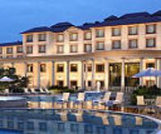
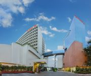
In need of a room? We compiled a list of available hotels close to the map centre further down the page.
Since you are here already, you might want to pay a visit to some of the following locations: Kolkata, Khulna, Magura, Bagerhat and Rajshahi. To further explore this place, just scroll down and browse the available info.
Local weather forecast
Todays Local Weather Conditions & Forecast: 34°C / 94 °F
| Morning Temperature | 27°C / 80 °F |
| Evening Temperature | 35°C / 94 °F |
| Night Temperature | 29°C / 84 °F |
| Chance of rainfall | 0% |
| Air Humidity | 41% |
| Air Pressure | 1009 hPa |
| Wind Speed | Moderate breeze with 11 km/h (7 mph) from North |
| Cloud Conditions | Scattered clouds, covering 25% of sky |
| General Conditions | Light rain |
Thursday, 9th of May 2024
35°C (95 °F)
26°C (79 °F)
Heavy intensity rain, fresh breeze, few clouds.
Friday, 10th of May 2024
33°C (92 °F)
28°C (83 °F)
Moderate rain, moderate breeze, overcast clouds.
Saturday, 11th of May 2024
35°C (94 °F)
27°C (80 °F)
Light rain, moderate breeze, few clouds.
Hotels and Places to Stay
The Oberoi Grand
The Lalit Great Eastern Kolkata
Fortune Park Panchwati
Sapphire Suites
The Peerless Inn
N S International
Metropole
Lytton
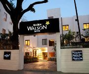
Hotel Walson
The Lindsay
Videos from this area
These are videos related to the place based on their proximity to this place.
NEWLY STARTED HOWRAH PURI SHATABDI RATTLES THROUGH DASNAGAR ON ITS INAUGRAL DAY
NEWLY STARTED HOWRAH PURI SHATABDI EXPRESS WITH OLD DURONTO RAKES RATTLES THROUGH DASNAGAR ON ITS INAUGRAL DAY.
DWEB Training Solutions in Salkia, Howrah
Website Designing, PHP development, ASP.Net Development, Java Development, SEO, Graphics Editing, Video Editing, Ethical Hacking Workshop and many other courses are conducted. To know ...
Meckel's 68th Saraswati Puja
From #Wikipedia: Famous Meckel's Saraswati puja is an attraction of this area. This is the Video of the 68th (Year:2014) Swaraswati Pujo P.S: #ChootaBheem.
The Meltdown -Bishakh Datta and Rajdeep Deb(a.k.a Chris Benneto)
This was a casual recording...which turned out great!
Electronic components
http://www.electronicsandyou.com Electronic Components - Capacitors, Resistors, transistors, Inductors, Thermistors, Diodes, Crystal Components smd components, Surface Mount Components...
Calcutta, India
We have made our way to Calcutta, the center of all that is chaotic and crazy in the world. Every second is pure insanity, my eyes can't keep up with the movement. A wild mixture of modern...
Inde 2013 : Train de banlieue à Kolkata
Train de banlieue à Kolkata dans le Bengal Occidental (West Bengal) en Inde.
Videos provided by Youtube are under the copyright of their owners.
Attractions and noteworthy things
Distances are based on the centre of the city/town and sightseeing location. This list contains brief abstracts about monuments, holiday activities, national parcs, museums, organisations and more from the area as well as interesting facts about the region itself. Where available, you'll find the corresponding homepage. Otherwise the related wikipedia article.
Howrah
Howrah or Haora is an industrial city, a municipal corporation in the Howrah district, West Bengal, India. It is the headquarters of the district, and also the headquarters of the Howrah Sadar subdivision of the district. Located on the west bank of the Hoogli River, it is a twin city to Kolkata. Howrah is the second smallest district after Kolkata.
Howrah Bridge
The Howrah Bridge is a suspension type balanced cantilever bridge that spans the Hooghly River in West Bengal, India. Commissioned in 1943, the bridge was originally named the New Howrah Bridge, because it links the city of Howrah to its twin city, Kolkata (Calcutta). On 14 June 1965 it was renamed Rabindra Setu, after the great Bengali poet Rabindranath Tagore who was the first Indian and Asian Nobel laureate. However it is still popularly known as the Howrah Bridge.
Howrah railway station
Howrah Station is the largest and second busiest station in India. It is one of the four intercity railway stations serving Kolkata, the others are Sealdah Station, Shalimar Station and Kolkata railway station in Kolkata. Howrah is situated on the West bank of the Hooghly River, linked to Kolkata by the magnificent Howrah Bridge which is an icon of Kolkata. It is the oldest station and the largest railway complex in India.
Vivekananda Setu
Vivekananda Setu (Bengali: বিবেকানন্দ সেতু also called Willingdon Bridge and Bally Bridge) is a bridge over the Hooghly River in West Bengal, India. It links the city of Howrah, at Bally, to its twin city of Kolkata, at Dakshineswar. Built in December 1932, it is a multispan steel bridge and was built to provide road cum rail link between the Calcutta Port and its hinterland. It is 2,887 feet long.
Bankra
Bankra is a census town under Domjur police station in Sadar subdivision of Howrah district in the Indian state of West Bengal.
Chakapara
Chakapara is a census town under Liluah police station in Sadar subdivision of Howrah district in the Indian state of West Bengal.
Chamrail
Chamrail is a census town under Liluah police station in Sadar subdivision of Howrah district in the Indian state of West Bengal.
Eksara
Eksara is a census town under Liluah police station in Sadar subdivision of Howrah district in the Indian state of West Bengal.
Khalia
Khalia is a census town under Liluah police station in Sadar subdivision of Howrah district in the Indian state of West Bengal.
Don Bosco High & Technical School, Liluah
Don Bosco School Liluah, or DBL, is an all-boys, English medium school covering lower kindergarten through grade twelve. Located in Liluah, near the city of Kolkata, India, the school was established in 1937, and is run by the Salesians of Don Bosco S.D.B. which is a minority institution within the Catholic Church. The patron saint of the school is St. John Bosco, popularly known as Don Bosco. The motto of the school is "Virtus et Labor".
Ghoshpara Bally
Ghoshpara is a neighbourhood of Bally, in Howrah district in the Indian state of West Bengal. Some of the reputed families in this area are the Neogy family and Ghosh family. There is a road in memory of Late D.C. Neogy. It stretches from Bally Station to Bankpukur. There is a lake of size 8 bigha. Ghoshpara is located at
Bally, Howrah
Bally is a city, municipality in Howrah District, West Bengal, India. It is a part of the area covered by Kolkata Metropolitan Development Authority. It is a town of historical importance. Located at the north-eastern tip of the Howrah district, on the banks of the River Hooghly, it is just across the river from the Dakshineswar Kali Temple and near the Belur Math.
Uttarpara Govt. High School
Uttarpara Government High School (also known as Uttarpara Rastriya Uchcha Vidyalaya) is a school situated in Uttarpara, a town of Hooghly District, West Bengal, India. The school is directly under the Government of West Bengal. The present Headmaster is Mr. Pradip Kumar Basu.
Minerva Theatre, Kolkata
The Minerva Theatre is a theatre in Calcutta, built in 1893. It was erected at the site on Beadon Street where the Great National Theatre stood before. The maiden play held on this stage was 'Macbeth'. It was initially owned by Nagendra Bhusan Mukhopaddhaya. In course of time, it witnessed several transfers of ownership. Sri Girish Chandra Ghosh is noted for having given the last spectacular performance of his life in this theatre. "Minerva" was burnt down in a fire in 1922.
Bagbazar
Bagbazar (also spelt Baghbazar) is a neighbourhood in north Kolkata, in the Indian state of West Bengal. The area, under Shyampukur police station of Kolkata Police, has been, along with neighbouring Shyambazar, the citadel of the Bengali aristocracy. Bagbazar has played an active role in growth and development of Kolkata.
Jorabagan
Jorabagan is a neighbourhood in north Kolkata, earlier known as Calcutta, in the Indian state of West Bengal. As a neighbourhood, it covers a small area but its importance is primarily because of the police stationand the assembly constituency.
Burrabazar
Burrabazar (also spelt Bara Bazar) is a neighbourhood in central Kolkata, earlier known as Calcutta, in the Indian state of West Bengal. It is an assembly constituency. Burrabazar expanded from a yarn and textile market into the commercial nucleus of Kolkata and one of the largest wholesale markets in India.
Sunrise English Medium School
Ramakrishna Mission Vidyamandira
Ramakrishna Mission Vidyamandira is an autonomous degree college affiliated with the University of Calcutta, India.
Nivedita Setu
Nivedita Setu (also called Second Vivekananda Setu) is a cable-stayed bridge over Hooghly River in Kolkata, West Bengal. It runs parallel to and around 50 m downstream of the old Vivekananda Setu opened in 1932. The bridge is named after Sister Nivedita, the social worker-disciple of Swami Vivekananda. Belghoria Expressway that connects the meeting point of NH 2 with NH 6 at Dankuni to NH 34, NH 35, Dum Dum Airport and northern parts of Kolkata passes over the bridge.
Howrah (Lok Sabha constituency)
Howrah (Lok Sabha constituency) is one of the 543 parliamentary constituencies in India. The constituency centres on Howrah in West Bengal. All the seven assembly segments of No. 25 Howrah (Lok Sabha constituency) are in Howrah district.
Raja Peary Mohan College
Raja Peary Mohan College is a general purpose college in Hooghly District of West Bengal, India under University of Calcutta. It offers intermediate and undergraduate courses in various arts, science and commerce subjects. The college is one of the most popular instituttion for higher study in the neighbourhood of Kolkata.
Salkhia
Salkhia is a slum in Howrah, West Bengal, India. It is on the Hooghly River, near Kolkata municipality. It is between Mali Panchghara and Ghusuri. It existed in the 19th century already. Tikia Para and Pilkhana, Kolkata are among the other slums in Howrah.
Jorabagan (Vidhan Sabha constituency)
Jorabagan (Vidhan Sabha constituency) (Bengali: জোড়াবাগান বিধানসভা কেন্দ্র) was an assembly constituency in Kolkata in the Indian state of West Bengal. As a consequence of the orders of the Delimitation Commission, Jorabagan (Vidhan Sabha constituency) ceases to exist from 2011. It was part of Calcutta North West (Lok Sabha constituency).
Bally Jagachha (community development block)
Bally Jagachha (community development block) is an administrative division in Howrah Sadar subdivision of Howrah district in the Indian state of West Bengal. Liluah and Bally police stations serve this block. Headquarters of this block is at Ghoshpara. Bally, Chakapara, Chamrail, Eksara, Khalia and Jagadishpur are urban areas in this block.


