Safety Score: 2,8 of 5.0 based on data from 9 authorites. Meaning we advice caution when travelling to Hungary.
Travel warnings are updated daily. Source: Travel Warning Hungary. Last Update: 2024-05-07 07:59:51
Delve into Frankhegy
The district Frankhegy of Budaörs in Pest megye is a district located in Hungary a little south-west of Budapest, the country's capital town.
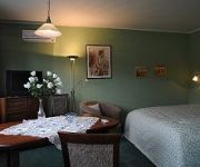
In need of a room? We compiled a list of available hotels close to the map centre further down the page.
Since you are here already, you might want to pay a visit to some of the following locations: Budakeszi, Budapest, Erd, Szigetszentmiklos and Martonvasar. To further explore this place, just scroll down and browse the available info.
Local weather forecast
Todays Local Weather Conditions & Forecast: 16°C / 60 °F
| Morning Temperature | 13°C / 55 °F |
| Evening Temperature | 19°C / 66 °F |
| Night Temperature | 15°C / 59 °F |
| Chance of rainfall | 0% |
| Air Humidity | 68% |
| Air Pressure | 1012 hPa |
| Wind Speed | Moderate breeze with 11 km/h (7 mph) from East |
| Cloud Conditions | Overcast clouds, covering 100% of sky |
| General Conditions | Overcast clouds |
Wednesday, 8th of May 2024
13°C (55 °F)
13°C (55 °F)
Moderate rain, light breeze, overcast clouds.
Thursday, 9th of May 2024
14°C (58 °F)
13°C (55 °F)
Light rain, gentle breeze, overcast clouds.
Friday, 10th of May 2024
17°C (63 °F)
13°C (56 °F)
Light rain, gentle breeze, scattered clouds.
Hotels and Places to Stay
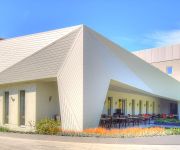
Holiday Inn BUDAPEST - BUDAÖRS
Anna Hotel Budapest
Carolina Apartman
FIFTEEN Boutique Rooms Budapest
Belvedere
Hillside Premium Apartments
Mediterran
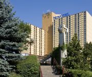
Novotel Budapest City
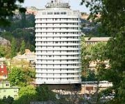
Danubius Budapest
Belle Fleur
Videos from this area
These are videos related to the place based on their proximity to this place.
Car Wash (Budapest) Hungary
Inside a car wash in Budapest Thank you for watching! Please subscribe to my channel... http://www.youtube.com/skyjay01.
VFR Club Hungary szezonnyitó gurulás, 2013.04.14..movie
Útvonal: Budaörs - Bős-nagymarosi vízlépcső Kamera: GoPro HD Hero2.
Budaörs, Pest, Hungary Time Lapse
Time lapse video showing 24 hours from a webcam at Budaörs, Pest, Hungary. More information about this webcam can be found at ...
2012 amateur poledance championship - Julia Boiko - 1st place
Winner of the hungarian amateur poledance championship 1st place Julia Boiko.
Shunting Madness :) Tili-toli Csillebérc állomáson
The Budapest Children's Railway SHUNTING MADNESS On the day of the railway, there were a number of heritage trains and also a very long special train (as seen in one of my other videos)...
[HQ] OpenBVE: Mercedes-Benz Citaro C2 on bus line 1 2015.01.13
Mercedes-Benz Citaro C2G articulated low-floor city bus in Budapest, Mézeskalács utca - Szentpéter tér, fictional bus line 1, in OpenBVE 1.4.3 train simulator game. This route is available...
Videos provided by Youtube are under the copyright of their owners.
Attractions and noteworthy things
Distances are based on the centre of the city/town and sightseeing location. This list contains brief abstracts about monuments, holiday activities, national parcs, museums, organisations and more from the area as well as interesting facts about the region itself. Where available, you'll find the corresponding homepage. Otherwise the related wikipedia article.
Hegyvidék
Hegyvidék (German: Bergland, literally "Mountain-land" or "Mountain-range") is the official name of the XII district of Budapest, capital of Hungary. It is a region of Buda, on the west bank of river Danube.
Hungarian Soviet Republic
The Hungarian Soviet Republic or Hungarian Republic of Councils (Hungarian: Magyarországi Tanácsköztársaság or Magyarországi Szocialista Szövetséges Tanácsköztársaság) was a short-lived independent Communist state established in Hungary in the aftermath of World War I. It was the successor of the Hungarian Democratic Republic and lasted only from 21 March until 1 August 1919. The state was led by Béla Kun and was not recognized by France, the U.K. or the U.S.
Thomas Mann Gymnasium
Thomas Mann Gymnasium Director OStD Klaus Eberl, Interim Commissioner Established 1908 School type Public / Independent Location Budapest, Hungary Pupils 578 School colours Red, yellow, black, green Ribbon colour Bright blue Jersey colours Yellow-black Motto "Children must be given two things: roots and wings. " Affiliations UNESCO Associated Schools
Széll Kálmán tér
Széll Kálmán tér (Széll Kálmán Square, formerly Moszkva tér, Moscow Square) is a square in Budapest. It is one of the city's busiest transport interchanges (comparable to Móricz Zsigmond körtér farther south), which is served by a station on Metro line 2, tram lines 4, 6, 18, 59, 59A, 61 and bus lines 5, 16, 16A, 22, 22E, 39, 90, 90A, 91, 102, 116, 128, 149, 155, 156, 190, 222.
Budapest-Déli Railway Terminal
Budapest-Déli pályaudvar is one of the three main railway terminals of Budapest, Hungary. Located in the 1st District (Várkerület) of Budapest, the station is located in Buda, and primarily serves towns and cities in Transdanubia. The station was first opened in 1861 on the line towards Fiume on the Adriatic Sea (then part of the Austro-Hungarian Empire).
Konkoly Observatory
Konkoly Obszervatórium (Konkoly Observatory) is an astronomical observatory owned and operated by Hungarian Academy of Sciences. It is located in Budapest, Hungary. It was founded in 1871 by Miklos Konkoly-Thege as his private observatory.
Pasarét
Pasarét is a neighbourhood on the Buda side of Budapest. On the maps edited around the beginning of the nineteenth century it was called Sauwiesen (Pig-meadow) and also as Schmalzbergel (Fat-hill). (In city people spoke German as well, it was the countryside that preserved the Hungarian language). On earlier army maps simply as Ried (meadow). The Serbs (rácok) living under the castle-district also called this place pasa.
Farkasréti Cemetery
Farkasréti Cemetery or Farkasrét Cemetery is one of the most famous cemeteries in Budapest. It opened in 1894 and is noted for its spectacular sight towards the city (several people wanted it more to be a resort area than a cemetery). It comprises tombs of numerous Hungarian notables and it is the most preferred place for actors and actresses and other artists (opera singers, musicians, painters, sculptors, architects, writers, poets).
Moholy-Nagy University of Art and Design
The Moholy-Nagy University of Art and Design, former Hungarian University of Arts and Design, is located in Budapest, Hungary. The university is committed to training traditional artist-craftsmen, as well as architects, designers and visual communication designers. This University is named for László Moholy-Nagy.
Budapest Cog-wheel Railway
The Budapest Cog-wheel Railway, officially called Tram line number 60, is a rack railway running in Budapest, Hungary.
Sashegy
Sashegy is a hill and neighbourhood in Budapest, Hungary. It is a green, upper middle class area in Buda with expensive family homes. Administratively Sashegy is divided between the 11th and the 12th districts of Budapest.
Diósd
Diósd, Hungary is a small town located between the larger cities of Budapest and Érd in the Budapest metropolitan area, Pest County. It best found by travelling on the road 7 (also known as Balatoni út), which crosses the commune. The motorway M0 runs at the very edge of Diósd. Though many residents commute to work in the capital city of Budapest, the largest employers in the town are a manufacturing plant, named New MGM Zrt.
Hungarian Democratic Republic
The Hungarian People's Republic and Hungarian Republic were short-lived republics that existed, apart from a 133-day interruption, from late 1918 to early 1920. They were established in the wake of the dissolution of the Austro-Hungarian Empire following World War I. During this period, Hungary was forced to cede lands for the formation of nations based on majority-ethnic groups, who formed Czechoslovakia, Romania, and Yugoslavia, made up of Serbians, Croatians and Slovenes.
Krisztina Téri Iskola
Krisztina Téri Iskola (Krisztina Square School) a 220 years old historic school in the I. district of Budapest, Krisztinaváros, Hungary (in 2007). "The school started after vintage in 1787".
Kingdom of Hungary (1920–1946)
The Kingdom of Hungary, also known as the Regency, existed from 1920 to 1946 as a de facto country under Regent Miklós Horthy. Horthy officially represented the Hungarian monarchy of Charles IV, Apostolic King of Hungary. Attempts by Charles IV to return to the throne were prevented by threats of war from neighbouring countries and by the lack of support from Horthy. The Kingdom of Hungary under Horthy was an Axis Power during most of World War II.
International Christian School of Budapest
The International Christian School of Budapest (ICSB) is an international school located in Diosd, Hungary. It was started in 1994 as a missionary school.
Déli pályaudvar (Budapest Metro)
Déli pályaudvar (Southern Railway Station) is the western terminus of the M2 (East-West) line of the Budapest Metro. It serves the Déli Railway Station and its vicinity.
Széll Kálmán tér (Budapest Metro)
Széll Kálmán tér (Széll Kálmán Square) is a station on the M2 (East-West) line of the Budapest Metro. It is located under Széll Kálmán Square in Buda. At 38.4m below ground level, it is the deepest station of the Budapest Metro. Near the station, numerous bus and tram routes pass or converge, making it one of the city's major transport interchanges. From its opening in 1973 until 2011, the station (and square) was known as Moszkva tér.
Normafa
A spot frequented by denizens of Budapest in the Buda hills, Normafa is known for its panoramic scenery and fresh air. It is located on Svábhegy and is in close proximity to Jánoshegy, the highest point in Budapest. The name is derived from the name of a tree, the "Norma tree. " Traditionally the beech tree was planted by King Matthias Corvinus in the 15th century. The name stuck when performers from the Hungarian National Theater visited it, where they performed Vincenzo Bellini's Norma.
Jánoshegy
Jánoshegy The tallest of the Buda hills, it rises to 528m. From the tower on top of the hill, known as Erzsébet kilátó, one can get an imposing panoramic view of Budapest. The hill is in close proximity to Normafa and can also be accessed by the Libegő, a chairlift which connects it with Zugliget.
Belvedere Tower in the Buda Hills
Belvedere Tower in the Buda Hills, also called the Elisabeth Tower, stands on John's Hill above Budapest. Built in 1911, the tower was named after Empress Elisabeth, wife of Emperor Franz Joseph I. Frigyes Schulek was the architect. The tower is near Budapest's District XII, and may be reached from the Széll Kálmán tér of Budapest.
Memento Park
Memento Park is an open air museum in Budapest, dedicated to monumental statues from Hungary's Communist period (1949–1989). There are statues of Lenin, Marx, and Engels, and several Hungarian Communist leaders. The park was designed by Hungarian architect, Ákos Eleőd, who won the competition announced by the Budapest General Assembly (Fővárosi Közgyűlés) in 1991. Thus the architect: "This park is about dictatorship.
Kelenföld railway station
Kelenföld railway station, known as Budapest Kelenföld until 2011, is Budapest's fourth busiest railway station. Opened in 1861, it is situated south-west of the city centre, in Újbuda or District XI in the suburb Kelenföld. Today, Kelenföld is an extremely busy station, with almost all passenger and freight services operated by Hungarian Railways towards Transdanubia passing through.
International Business School, Budapest
International Business School (Hungarian: IBS Nemzetközi Üzleti Főiskola) is an accredited private college in Budapest, Hungary. It was founded in 1991 by Prof. István Tamás, a Hungarian businessman. Nemzetközi Üzleti Főiskola {{#invoke:InfoboxImage|InfoboxImage|image=|size=|sizedefault=frameless|alt=}}Established 1991Type Private collegeChancellor Prof. István TamásLocation Budapest, HungaryCampus UrbanWebsite http://www. ibs-b.
Gazdagrét
Gazdagrét is a neighbourhood of Budapest, the capital of Hungary. It is located in the western part of the 11th district. It is a residential area consisting of prefabricated buildings with a population of 11,929 (2001 census). The neighbourhood was built between 1983 and 1989, during the last of the Communist-era construction booms, and kept the name the area earned for its rich harvests when it consisted mainly of orchards (Gazdagrét literally means "rich meadow").






!['[HQ] OpenBVE: Mercedes-Benz Citaro C2 on bus line 1 2015.01.13' preview picture of video '[HQ] OpenBVE: Mercedes-Benz Citaro C2 on bus line 1 2015.01.13'](https://img.youtube.com/vi/AGFGM6q-sX0/mqdefault.jpg)


![Webcam: Csikidűlő: M1 − 13 km] Törökbálint térsége [országhatár felé capture of the webcam Csikidűlő: M1 − 13 km] Törökbálint térsége [országhatár felé](https://images.webcams.travel/daylight/preview/1334076256.jpg)
![Webcam: Máriavölgy: M7 − 7,9 km] M1-M7 Budapest térsége [Budapest felé capture of the webcam Máriavölgy: M7 − 7,9 km] M1-M7 Budapest térsége [Budapest felé](https://images.webcams.travel/daylight/preview/1334078359.jpg)
![Webcam: Máriavölgy: M7 − 7,9 km] M1-M7 Budapest [országhatár felé capture of the webcam Máriavölgy: M7 − 7,9 km] M1-M7 Budapest [országhatár felé](https://images.webcams.travel/daylight/preview/1334078424.jpg)
![Webcam: Franktanya: M7 − 9,6 km] M1-M7 Budaőrsi pihenő [Budapest felé capture of the webcam Franktanya: M7 − 9,6 km] M1-M7 Budaőrsi pihenő [Budapest felé](https://images.webcams.travel/daylight/preview/1334078683.jpg)
![Webcam: Idamajor: M7 − 11 km] Sport. u. csp. (Budaörs) [Budapest felé capture of the webcam Idamajor: M7 − 11 km] Sport. u. csp. (Budaörs) [Budapest felé](https://images.webcams.travel/daylight/preview/1334078904.jpg)