Safety Score: 3,0 of 5.0 based on data from 9 authorites. Meaning we advice caution when travelling to France.
Travel warnings are updated daily. Source: Travel Warning France. Last Update: 2024-04-28 08:22:10
Delve into Bas Brec
Bas Brec in Alpes-de-Haute-Provence (Provence-Alpes-Côte d'Azur Region) is a town located in France about 378 mi (or 609 km) south-east of Paris, the country's capital town.
Time in Bas Brec is now 06:24 AM (Monday). The local timezone is named Europe / Paris with an UTC offset of 2 hours. We know of 12 airports closer to Bas Brec, of which 5 are larger airports. The closest airport in France is Barcelonnette - Saint-Pons Airport in a distance of 10 mi (or 16 km), North. Besides the airports, there are other travel options available (check left side).
There are two Unesco world heritage sites nearby. The closest heritage site is Vineyard Landscape of Piedmont: Langhe-Roero and Monferrato in Italy at a distance of 69 mi (or 110 km). In need of a room? We compiled a list of available hotels close to the map centre further down the page.
Since you are here already, you might want to pay a visit to some of the following locations: Barcelonnette, Bersezio, Pietraporzio, Acceglio and Sambuco. To further explore this place, just scroll down and browse the available info.
Local weather forecast
Todays Local Weather Conditions & Forecast: 9°C / 48 °F
| Morning Temperature | 6°C / 43 °F |
| Evening Temperature | 8°C / 46 °F |
| Night Temperature | 7°C / 44 °F |
| Chance of rainfall | 1% |
| Air Humidity | 94% |
| Air Pressure | 1020 hPa |
| Wind Speed | Gentle Breeze with 7 km/h (4 mph) from West |
| Cloud Conditions | Overcast clouds, covering 100% of sky |
| General Conditions | Light rain |
Tuesday, 30th of April 2024
9°C (48 °F)
7°C (45 °F)
Moderate rain, gentle breeze, overcast clouds.
Wednesday, 1st of May 2024
9°C (49 °F)
7°C (45 °F)
Light rain, gentle breeze, overcast clouds.
Thursday, 2nd of May 2024
8°C (46 °F)
5°C (40 °F)
Rain and snow, gentle breeze, overcast clouds.
Hotels and Places to Stay
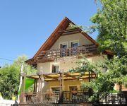
Le Martagon SARL LE NOUVEAU MARTAGON
Videos from this area
These are videos related to the place based on their proximity to this place.
Colmars Les Alpes 2014
Quelques images de Colmars village et ses environs en passant par la Cascade de la Lance, le Pont de Misson, et autres chemins forestiers. Musique de Fable "Bowerstone" Filming et montage...
Trans-Provence Cow Chasing
Day 2 of the 2014 Trans Provence from Prads to Villars-Colmars. Stage 4 Video shortened to 2:36 - my total stage time was 5:44. Unfortuntely ran in a couple of cows chilling on the course....
Rando AMSL Fréjus VTT groupe Loisir lacs de Lignin juin 7 8 9, 2014
Rando AMSL Fréjus VTT groupe Loisir lacs de Lignin juin 7 8 9, 2014.
Aujourd'hui on a testé le SNOW SCOOT
Voici le résumé de notre sympathique journée au seignus du val d'allos, durant laquelle nous avons testé le snowscoot.
Stage AMSL Fréjus école VTT La Foux d'Allos juillet 2013
Stage AMSL Fréjus école VTT La Foux d'Allos juillet 2013.
Val d Allos Urge Ski Enduro 2013
Voici le résumé de la course de ski enduro qui a eu lieu au Val d Allos.
GoPro | STAPS TOULOUSE au ski au Val d'Allos
Semaine de ski avec les étudiants STAPS de Toulouse au Val D'allos dans les Alpes du Sud. Ski, snow, luge, piscine, soirées ... ambiance et bonne humeur étaient au rendez-vous!!!
Videos provided by Youtube are under the copyright of their owners.
Attractions and noteworthy things
Distances are based on the centre of the city/town and sightseeing location. This list contains brief abstracts about monuments, holiday activities, national parcs, museums, organisations and more from the area as well as interesting facts about the region itself. Where available, you'll find the corresponding homepage. Otherwise the related wikipedia article.
Bléone
The Bléone is a 67.5 km long river in the Alpes-de-Haute-Provence département, southeastern France. Its source is several small streams converging near the refuge de l'Estrop, a mountain shelter in Prads-Haute-Bléone. It flows generally southwest. It is a left tributary of the Durance into which it flows between L'Escale and Les Mées.


